


Prospector - Church Rocks Loop
Hurricane, Utah
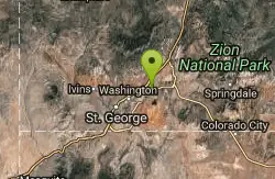
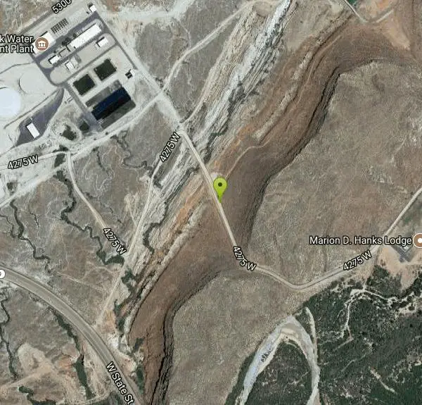
| Address: | ~324 4275 W, Hurricane, UT 84737, USA |
| GPS: |
37°10'11.2"N 113°23'41.7"W Maps | Directions |
| State: | Utah |
| Trail Length: | 11.00 miles |
| MTB Difficulty: | Intermediate |
| Trail Type: | Lariat |
| MTB Trail Type: | Singletrack |
Mountain Bike
The trail leaving the parking area is a wide track for about the first quarter mile until a signed intersection where you will turn left (south) onto singletrack and start your ride parallel to some red rock ledges. The trail is fairly smooth and has nice flow as it crosses up and over small ridges and down through gullies. A couple spots have been rerouted for vegetation rehabilitation but these are clearly marked. At about 1.7 miles you will run into a very sandy hill, this sand section will last just about 100 yards and then is done, in the middle of it is an intersection with the Spanish Wash trail, any equestrian traffic that has been on the trail will more than likely exit here. Continuing on stay right on the main trail when you encounter a small singletrack that takes off to the left. The intersection with the Church Rocks trail will be an obvious T, although ride-able either direction I recommend taking a right and doing the loop counter-clockwise. You will ride back towards the north for about a mile but higher up on the hillside so there are more slickrock sections mixed in. You will come to a large U turn and the trail goes up a short but steep rock section and then takes off south up the ledge. Once on top you have over a mile of slick rock ledges and bowls to play in all the while making your way south down the ridge. Upon reaching the end you will all of a sudden notice large black volcanic rocks strewn about, these are very evident because all you have seen for the last hour or so has been red. Its advisable to go down the wash to get off of the ridge and start heading back north. Once at the bottom you will notice a couple other trails, these are the other access trails mentioned in the directions. There will be a couple different routes up the slick rock, just follow the tire tracks in the sand or make your own fun route, they all end up towards the top at the same place. Just look for the main trail at the top of the hill marked by large carins and all the other tire tracks, follow it north back to the Prospector trail. Courtesy of Singletracks.com
More Information
Prospector - Church Rocks Loop
Prospector - Church Rocks Loop is a singletrack mountain bike trail in St. George, Utah. View maps, videos, photos, and reviews of Prospector - Church Rocks Loop bike trail in St. George.
http://www.singletracks.com/bike-trails/prospector-church-rocks-loop/Never modify trail features. Ride trails when they're dry enough that you won't leave ruts. Speak up when you see others on the trail and always yield to hikers, horses, and others coming uphill. Always ride on the established trail.
Read More
- Plan Ahead and Prepare
- Travel & camp on durable surfaces
- Dispose of waste properly
- Leave what you find
- Minimize campfire impacts
- Respect wildlife
- Be considerate of other visitors
Directions
From Hurricane, Utah
- Head north on S 100 W toward State St (456 ft)
- Turn left at the 1st cross street onto State St (6.9 mi)
- Turn right onto 5300 W/SR-318 (0.3 mi)
- Turn right onto 4275 W (0.9 mi)
Other Mountain Bike Trails Nearby
Hurricane Rim trail
Hurricane, Utah
4.7 miles EA rocky singletrack rim trail above the Virgin River with slab sections, several hundred feet of exposure, and spectacular views — rideable out and back or as part of the Hurricane Loop.
Mountain Bike 
Gould's Rim trail
Hurricane, Utah
4.9 miles EA rim trail along the edge of a canyon near Hurricane, Utah — starts smooth and grows rocky, with stunning views as it winds between a doubletrack climb and the Goulds trail junction.
Mountain Bike 9.4 mi
Church Rocks
Washington, Utah
5.3 miles WA nearly 6-mile red rock ride near St. George winding through sandy desert washes and smooth slick rock — a great practice run before tackling Moab's Slick Rock Trail.
Hike, Mountain Bike 11.3 mi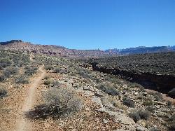
Grapevine Trail
Washington, Utah
5.5 miles WA 5-mile out-and-back trail connecting southern Utah desert, paved paths, and rocky terrain before ending at Grapevine Spring — a small waterfall cascading down red rock.
Hike, Mountain Bike 5.1 mi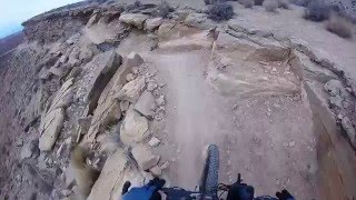
Dead Ringer
Virgin, Utah
8.7 miles EA 5-mile desert singletrack starting from the JEM trailhead near Virgin, winding through ups and downs and bottoming out in the bumpy, hoof-print-marked Goosebumps area.
Hike, Mountain Bike 3.4 mi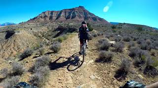
More Cowbell
Virgin, Utah
8.7 miles EA smooth 2.7-mile beginner mountain bike loop through red Utah desert bluffs — mostly flat singletrack that's also great for hikers and connects to more challenging trails.
Hike, Mountain Bike 
Ice House Loop
St. George, Utah
9.5 miles WA thrilling nearly all-downhill mountain bike descent of 6.8 miles dropping 2,000 feet — part of the larger Broken Mesa Loop near St. George, Utah.
Mountain Bike 
Crypto-Goosebumps
La Verkin, Utah
10.0 miles EA flowing, narrow, and at times exposed mountain bike ride linking JEM, Hurricane Rim, Cryptobionic, and Goosebumps trails through the La Verkin area of southern Utah.
Mountain Bike 7.0 mi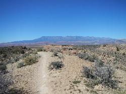
J.E.M. Trail
La Verkin, Utah
10.1 miles EA 13.27-mile round-trip mountain bike trail near Hurricane, Utah with jarring terrain and sharp turns near sheer cliffs — beautiful red rock and desert views reward the effort.
Hike, Mountain Bike 
Broken Mesa Rim
St. George, Utah
10.3 miles WA climb from the Red Cliffs Desert Reserve through basalt boulders and juniper to a 5-mile twisting mesa-top descent — including a straightforward 20% grade through broken lava at the edge.
Mountain Bike 
Pioneer Park
St. George, Utah
10.5 miles SWIntermediate-to-advanced technical singletrack looping near Pioneer Park with great views and some fun doubletrack — follow the turtle fence as a landmark.
Mountain Bike 
Paradise Rim/turtle Wall
St. George, Utah
11.8 miles WA fun town-accessible ride past the Turtle Wall's slickrock and along the Paradise Rim, with technical descents and optional singletrack loops on the way back.
Mountain Bike 13.1 mi
Little Creek Mesa
Hurricane, Utah
12.1 miles SETwenty miles of interconnected red-rock singletrack across Little Creek Mesa, Gooseberry Mesa, and West Mesa, with sheer cliffs, slickrock descents, and big scenery near Hurricane.
Mountain Bike 11.6 mi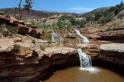
Toquerville Falls
La Verkin, Utah
12.1 miles NELedges, falls, a ladder to the best jumping spots, and a 7-foot-deep pool at the end of a 5.5-mile sandy desert drive — but stay away from the brittle, injury-prone cliff edges.
Dive, Hike, Mountain Bike, Swim 
Gooseberry Mesa
Hurricane, Utah
12.5 miles EGooseberry Mesa's 13.4-mile mountain bike loop near Zion National Park features mesas, desert scenery, challenging climbs, steep descents, and cliff-edge trail sections — best ridden April through November.
Mountain Bike 
Snake Hollow Bike Park
St. George, Utah
13.4 miles WAn 80-acre bike park in St. George with four skills zones — a dirt jump area, pump track and skills loop, gravity drops, and a slopestyle course — spread across Snake Hollow's west and east sides.
Mountain Bike 0.2-0.4 mi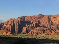
Snow Canyon State Park
St. George, Utah
13.7 miles WA smaller, quieter cousin to Zion, Snow Canyon offers mountain biking, rock climbing, caving, and desert exploration near the Tuacahn amphitheater outside St. George.
Cave, Hike, Mountain Bike, Rock Climb 0.5-15.1 mi
Green Valley Trail System
St. George, Utah
15.1 miles SWAn interconnected Southern Utah trail system with everything from the sandy Bearclaw Poppy and slickrock Zen Trail to technical Snake Pit and Rattlesnake routes — endless combinations for all mountain bike skill levels.
Hike, Mountain Bike 0.9-7.8 mi
Santa Clara River Reserve
Ivins, Utah
15.8 miles WA sprawling beginner-to-moderate trail system on the bluffs of Southern Utah near Snow Canyon, with a connector to Green Valley — short loops or all-day rides available.
Mountain Bike 3.3 mi
Guacamole Mesa
Virgin, Utah
15.9 miles EAn 11-mile advanced desert loop on Guacamole Mesa outside Zion NP — a steep, narrow climb with gorgeous red rock views gives way to a flat desert finish; avoid in rain.
Hike, Mountain BikeNearby Campsites

Sand Hollow State Park
Hurricane, Utah
3.5 miles SA desert reservoir near Hurricane with a cliff-jumping area, a sandy beach for swimming and paddleboarding, and vast sand dunes for ATVs — southern Utah's desert playground.
Camp, Canoe, Dive, Kayak, Swim 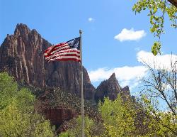
Zion National Park
Hurricane, Utah
22.8 miles EWind, water, and ice sculpted Zion's iconic red sandstone buttes, bends, and mounts into one of the most breathtaking and irreplaceable landscapes on Earth.
Camp, Hike, Mountain Bike, Swim


