


Santa Clara River Reserve
Ivins, Utah

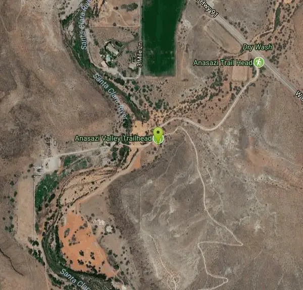
| Address: | ~Anasazi Trail, Ivins, UT 84738, USA |
| GPS: |
37°7'15.8"N 113°40'30.4"W Maps | Directions |
| State: | Utah |
| Trail Length: | 6.00 miles |
| MTB Difficulty: | Intermediate |
| Trail Type: | Loop |
| MTB Trail Type: | Singletrack |
| Trails/Routes: | 0.9-7.8 mi |
Mountain Bike
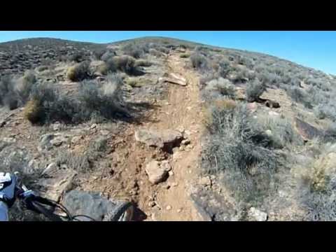
The Santa Clara River Reserve, located near Santa Clara, Utah and Snow Canyon State Park, is a trail system close to the Green Valley trail system that has similar trails and a connecter trail between the two systems for the hard core riders that want get as much mountain biking in as possible. With many trails rated from beginner to moderate, the Santa Clara River Reserve trails have a little something for all riders. If you are looking for an all day riding experience, there are plenty of trails to do so, or if you are looking to have a short bike ride in between other activities in the busy St. George area, there are plenty of shorter options as well. Be sure to follow all trail etiquette with other bike riders and hikers along these trails and watch for the weather to make sure you are not riding after a rainstorm when the trails are muddy. All trails in the reserve are best from April to September. Santa Clara River Reserve will wow you with the variety of trails you can both hike and bike along the beautiful bluffs of Southern Utah!
Barrel Roll is a short but difficult trail and many bikers from out of town assume that they can bike it fairly easily. Make no mistake, the Barrel Roll trail packs quite a punch in its 6 mile round trip with rocky slides and a trail that is mostly uphill, although riders get to enjoy the beautiful view of the City of St. George, Snow Canyon, and the red rock bluffs surrounding the area.
Black Brush is a 4 mile trail that takes riders up and down the red rock bluffs just outside of Snow Canyon. It is moderately trafficked and mostly used by hikers, so if you are riding your bike along this trail be sure to be courteous to the hikers in the area. The loop takes riders and hikers along the rim of one of the bluffs where wildflowers, views of St. George and Snow Canyon, and desert wildlife can be seen.
Cove Wash Access Trail is a short but steep trail that gives riders access to the entire Cove Wash trail. It is often viewed as a "warm-up" for the entirety of the Cove Wash trail and gives beginner riders a taste of what the entire trail is like. The trail itself is only a mile long and could be a great place for a short hike if you are pressed for time.
Cove Wash (East & West) trail is a heavily trafficked 10 mile trail that mountain bikers share with ATV riders. Be aware of all riders along the trail and do not attempt to pass ATV riders or mountain bikers. This trail is mostly an uphill ride until riders can coast down to the wash to end the out and back style trail. It is not one of the more popular trails in the system, but is a great option for any biker that wants to challenge themselves while riding in the trail system.
Gates Lane is one of the unique trails along the Santa Clara River Reserve. The trail head is located along a residential street and continues 1.6 miles until bikers meet up with the rest of the trail system. The trail is gradually up hill until bikers get to the large incline at the end where the trail meets up with the trail system. Gates Lane is mostly used as a connecter trail that can be great for a quick ride.
The Precipice Trail is a less than one mile trail that is most used as a connecter trail between the Sidewinder trail and Barrel Roll. but it is a challenge to all those that dare to ride it. With a steep incline and a narrow trail about half way through because of a small rock slide that happened recently because of construction in the area.
The Rim Runner loop bike trail offers a unique ride along the tabletop mesas of southern Utah. As you ride along this one of a kind trail, bikers overlook the vast desert landscape complete with rolling hills, switchbacks and lots of sand. Riders of an intermediate to beginner level would be fine on this trail to gain more experience with biking around and over large rocks, experience rough terrain, bike through sand, and through smooth washes that allow for faster biking.
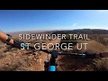
The Sidewinder Trail is a 1.7 mile alternative trail to Barrel Roll that is a great shortcut, but it is not the easy trail riders are looking for. With hills, sand, and narrow trails, Sidewinder trail will keep you on your toes as you ride through this short but challenging trail.
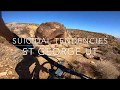
Suicidal Tendencies is one of the more advanced trails in the Santa Clara River Reserve system as a Black Diamond level trail. This trail is 4 miles with sharp twists and turns, steep hills, narrow trails with sheer cliffs off the edge, and fast down hill areas, this trail is sure to get your blood pumping as you cruise through this trail. Suicidal Tendencies is one of the more popular trails in the system amongst the more advanced bikers. While it is fun to ride this trail quickly, be sure to be mindful of other bikers that may not be going as fast.
More Information
Barrel Roll
Barrel Roll is a singletrack mountain bike trail in Santa Clara, Utah. View maps, videos, photos, and reviews of Barrel Roll bike trail in Santa Clara.
http://www.singletracks.com/bike-trails/barrel-roll/Barrel Roll Trail - Ultimate Guide to Mountain Biking in Utah
Barrel Roll. Popular Hit! 6-mile loop within the Santa Clara River Preserve. Moderate total climbing but gentle and steady. Views of area. Intermediate technical. Season year-round.
https://utahmountainbiking.com/trails/barrelroll/Rim Runner Loop
Rim Runner Loop is a singletrack mountain bike trail in Santa Clara, Utah. View maps, videos, photos, and reviews of Rim Runner Loop bike trail in Santa Clara.
https://www.singletracks.com/bike-trails/rim-runner-loop/Rim Runner Loop Mountain Bike Trail, Santa Clara, Utah
This is yet another great loop out of the Sand Cove Trailhead. Near Santa Clara, Utah.
https://www.mtbproject.com/trail/4532342/rim-runner-loopSuicidal Tendencies
Suicidal Tendencies is a singletrack mountain bike trail in Santa Clara, Utah. View maps, videos, photos, and reviews of Suicidal Tendencies bike trail in Santa Clara.
http://www.singletracks.com/bike-trails/precipice-sidewinder-suicidal-tendencies/Never modify trail features. Ride trails when they're dry enough that you won't leave ruts. Speak up when you see others on the trail and always yield to hikers, horses, and others coming uphill. Always ride on the established trail.
Read More
- Plan Ahead and Prepare
- Travel & camp on durable surfaces
- Dispose of waste properly
- Leave what you find
- Minimize campfire impacts
- Respect wildlife
- Be considerate of other visitors
Directions
From Ivins, Utah
- Head south on Main St toward E Center St (1.2 mi)
- Turn left onto E Old US Hwy 91 (1.2 mi)
- Continue onto Santa Clara Dr/
W Sunset Blvd (0.6 mi) - Turn right onto Gates Ln (0.3 mi)
- Gates Ln turns right and becomes Clary Hills Dr (0.6 mi)
- At the traffic circle, take the 2nd exit onto Colbey Loop (361 ft)




Other Mountain Bike Trails Nearby

Snake Hollow Bike Park
St. George, Utah
2.4 miles EAn 80-acre bike park in St. George with four skills zones — a dirt jump area, pump track and skills loop, gravity drops, and a slopestyle course — spread across Snake Hollow's west and east sides.
Mountain Bike 
Paradise Rim/turtle Wall
St. George, Utah
4.0 miles EA fun town-accessible ride past the Turtle Wall's slickrock and along the Paradise Rim, with technical descents and optional singletrack loops on the way back.
Mountain Bike 0.5-15.1 mi
Green Valley Trail System
St. George, Utah
5.4 miles SEAn interconnected Southern Utah trail system with everything from the sandy Bearclaw Poppy and slickrock Zen Trail to technical Snake Pit and Rattlesnake routes — endless combinations for all mountain bike skill levels.
Hike, Mountain Bike 
Pioneer Park
St. George, Utah
5.8 miles EIntermediate-to-advanced technical singletrack looping near Pioneer Park with great views and some fun doubletrack — follow the turtle fence as a landmark.
Mountain Bike 0.2-0.4 mi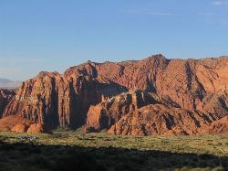
Snow Canyon State Park
St. George, Utah
6.0 miles NA smaller, quieter cousin to Zion, Snow Canyon offers mountain biking, rock climbing, caving, and desert exploration near the Tuacahn amphitheater outside St. George.
Cave, Hike, Mountain Bike, Rock Climb 
Ice House Loop
St. George, Utah
7.1 miles NEA thrilling nearly all-downhill mountain bike descent of 6.8 miles dropping 2,000 feet — part of the larger Broken Mesa Loop near St. George, Utah.
Mountain Bike 
Broken Mesa Rim
St. George, Utah
9.1 miles NEA climb from the Red Cliffs Desert Reserve through basalt boulders and juniper to a 5-mile twisting mesa-top descent — including a straightforward 20% grade through broken lava at the edge.
Mountain Bike 11.3 mi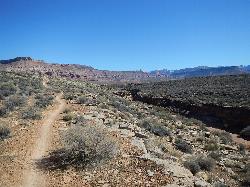
Grapevine Trail
Washington, Utah
10.4 miles EA 5-mile out-and-back trail connecting southern Utah desert, paved paths, and rocky terrain before ending at Grapevine Spring — a small waterfall cascading down red rock.
Hike, Mountain Bike 9.4 mi
Church Rocks
Washington, Utah
10.6 miles EA nearly 6-mile red rock ride near St. George winding through sandy desert washes and smooth slick rock — a great practice run before tackling Moab's Slick Rock Trail.
Hike, Mountain Bike 
Prospector - Church Rocks Loop
Hurricane, Utah
15.8 miles EA flowing singletrack loop through red rock ledges, slickrock bowls, and sandy stretches, finishing with over a mile of slickrock riding and a dramatic encounter with large black volcanic rocks.
Mountain Bike 
Hurricane Rim trail
Hurricane, Utah
19.9 miles EA rocky singletrack rim trail above the Virgin River with slab sections, several hundred feet of exposure, and spectacular views — rideable out and back or as part of the Hurricane Loop.
Mountain Bike 
Gould's Rim trail
Hurricane, Utah
20.3 miles EA rim trail along the edge of a canyon near Hurricane, Utah — starts smooth and grows rocky, with stunning views as it winds between a doubletrack climb and the Goulds trail junction.
Mountain Bike 3.4 mi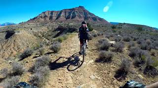
More Cowbell
Virgin, Utah
23.9 miles EA smooth 2.7-mile beginner mountain bike loop through red Utah desert bluffs — mostly flat singletrack that's also great for hikers and connects to more challenging trails.
Hike, Mountain Bike 5.1 mi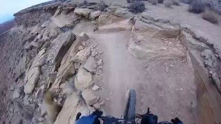
Dead Ringer
Virgin, Utah
23.9 miles EA 5-mile desert singletrack starting from the JEM trailhead near Virgin, winding through ups and downs and bottoming out in the bumpy, hoof-print-marked Goosebumps area.
Hike, Mountain Bike 13.1 mi
Little Creek Mesa
Hurricane, Utah
25.2 miles ETwenty miles of interconnected red-rock singletrack across Little Creek Mesa, Gooseberry Mesa, and West Mesa, with sheer cliffs, slickrock descents, and big scenery near Hurricane.
Mountain Bike 
Crypto-Goosebumps
La Verkin, Utah
25.7 miles EA flowing, narrow, and at times exposed mountain bike ride linking JEM, Hurricane Rim, Cryptobionic, and Goosebumps trails through the La Verkin area of southern Utah.
Mountain Bike 7.0 mi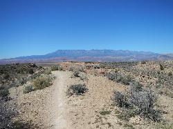
J.E.M. Trail
La Verkin, Utah
25.9 miles EA 13.27-mile round-trip mountain bike trail near Hurricane, Utah with jarring terrain and sharp turns near sheer cliffs — beautiful red rock and desert views reward the effort.
Hike, Mountain Bike 11.6 mi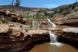
Toquerville Falls
La Verkin, Utah
26.5 miles NELedges, falls, a ladder to the best jumping spots, and a 7-foot-deep pool at the end of a 5.5-mile sandy desert drive — but stay away from the brittle, injury-prone cliff edges.
Dive, Hike, Mountain Bike, Swim 
Gooseberry Mesa
Hurricane, Utah
27.8 miles EGooseberry Mesa's 13.4-mile mountain bike loop near Zion National Park features mesas, desert scenery, challenging climbs, steep descents, and cliff-edge trail sections — best ridden April through November.
Mountain Bike 3.3 mi
Guacamole Mesa
Virgin, Utah
31.7 miles EAn 11-mile advanced desert loop on Guacamole Mesa outside Zion NP — a steep, narrow climb with gorgeous red rock views gives way to a flat desert finish; avoid in rain.
Hike, Mountain BikeNearby Campsites

Sand Hollow State Park
Hurricane, Utah
16.1 miles EA desert reservoir near Hurricane with a cliff-jumping area, a sandy beach for swimming and paddleboarding, and vast sand dunes for ATVs — southern Utah's desert playground.
Camp, Canoe, Dive, Kayak, Swim 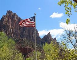
Zion National Park
Hurricane, Utah
38.5 miles EWind, water, and ice sculpted Zion's iconic red sandstone buttes, bends, and mounts into one of the most breathtaking and irreplaceable landscapes on Earth.
Camp, Hike, Mountain Bike, Swim


