


28 Hiking Trails near Big Laurel Creek Area
first prev 1 2 next lastShowing Hiking Trails within 50 miles Distance miles of Laurel Creek Trail, Marshall, NC 28753, USA City, Zip, or Address
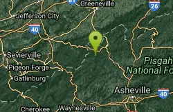
Rocky Bluff
Hot Springs, North Carolina
5.1 miles SWRocky Bluff is a tranquil mountain getaway in the Pisgah National Forest near Hot Springs, North Carolina, where a wooded campground sits beside the lovely Spring Creek just a few miles south of...
Camp, Hike, Swim

Old Forge Campground
Bethany, Tennessee
14.1 miles NPrimitive walk-in camping on scenic Jennings Creek in the Cherokee National Forest, with small waterfalls, swimming holes, and hiking trails right from camp — bring your own water.
Camp, Hike, Swim 3.4 mi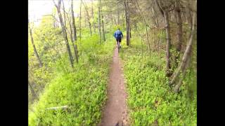
Alexander Mountain Bike Park
Alexander, North Carolina
14.8 miles SEChallenging singletrack near Alexander with nice climbs, flowing sections, and a French Broad River view — trail can get overgrown from light use.
Hike, Horseback, Mountain Bike 2.2-2.3 mi
Richmond Hill
Asheville, North Carolina
22.0 miles SEAn 18-hole wooded disc golf course at Richmond Hill Park in Asheville spanning 6,093 feet — hilly, challenging, and set in a 183-acre park with mountain biking, hiking, and birding.
Disc Golf, Hike, Mountain Bike
Hardtimes Connector / 661
Asheville, North Carolina
29.4 miles SA flat singletrack connector at the base of the mountain near Asheville, linking the Hardtimes Trailhead to the main trail system and the big climbs up above.
Hike, Horseback, Mountain Bike
Little Hickory Top
Asheville, North Carolina
29.4 miles SLittle Hickory Top is a flowy, moderate singletrack in Asheville's Bent Creek network, a favorite leg for building Pisgah mountain-bike loops.
Hike, Horseback, Mountain Bike
Bent Creek
Asheville, North Carolina
29.5 miles SAsheville's go-to trail system offers everything from flat beginner loops near Lake Powhatan to the legendary Green's Lick descent with massive berms, wallrides, and jump lines.
Hike, Mountain Bike 3.8 mi
Ramsey Cascades
Gatlinburg, Tennessee
35.7 miles SWRamsey Cascades is the tallest waterfall in Great Smoky Mountains National Park — a thundering 100-foot, multi-tiered cascade hidden deep in the old-growth forest of the Greenbrier area near...
Hike, Kayak, Swim, Whitewater
South Mills River Trail
Canton, North Carolina
35.9 miles SAn easy out-and-back following the South Fork Mills River with several swinging bridge crossings leading to the historic Cantrell Lodge site — with a steep, technical river-access option.
Hike, Mountain Bike
Big East Fork
Canton, North Carolina
37.2 miles SHeavy forest, multiple waterfalls, and a river that shifts from white rapids to calm swimming holes along Big East Fork in Pisgah National Forest — great for kayaking, camping, and swimming year-round.
Backpack, Hike, Kayak, Swim
Pilot Cove Loop Trail
Pisgah Forest, North Carolina
37.9 miles SA short 1.8-mile singletrack loop in Pisgah Forest with steep, tight turns and one of the best ridge views in Pisgah National Forest.
Hike, Mountain Bike
Skinny Dip Falls
Brevard, North Carolina
40.1 miles SA cascading waterfall with multiple clear pools for wading and swimming, a 6-foot jumping spot, and an easy 3/4-mile forested walk from the Blue Ridge Parkway — swimmers should mind fast water and slippery rocks.
Hike, Swim 0.2-2.8 mi
Graveyard Fields
Brevard, North Carolina
40.4 miles STwo cascading waterfalls — a swimmable Lower Falls just 1/3 mile from the road, and a more challenging Upper Falls on a 3.5-mile wildflower loop — make this a must-see hike.
Hike, Swim 1.8 mi
Flat Laurel Creek
40.4 miles S
A 3.18-mile multi-use trail following Flat Laurel Creek through colorful rock formations and forest, with distant views of Sam Knob and a small waterfall — open year round.
Hike, Horseback, Mountain Bike, Swim
Looking Glass Falls
Brevard, North Carolina
41.8 miles SA cascading 60-foot waterfall over mossy stone with a wading pool below — just a short, beautiful walk from Pisgah Highway in Brevard, stunning in any season.
Hike, Swim
Coontree Recreation Area
Brevard, North Carolina
42.3 miles SA scenic picnic area on the Davidson River with direct access to calm, deep water for swimming and fishing — plus the 3.7-mile Coontree Loop Trail through Pisgah National Forest.
Hike, Mountain Bike, Swim
Butter Gap / Trail #123
Brevard, North Carolina
42.6 miles SButter Gap Trail in Pisgah Forest climbs about 1,000 feet and connects to FS 471D — the western fork is open to mountain bikes, with seasonal bike access on part of the route.
Hike, Mountain Bike 0.8 mi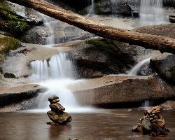
Daniel Ridge Falls
Brevard, North Carolina
42.7 miles SAn easy half-mile hike in Pisgah National Forest near Brevard to a 150-foot waterfall known by three names — most impressive after rain, modest in dry spells, with an optional 4-mile loop to the top.
Hike, Mountain Bike, Swim 7.1 mi
Daniel Ridge Loop
Canton, North Carolina
42.7 miles SA classic short Pisgah loop with moderate technical riding, a rocky downhill roller coaster, two waterfalls, and multiple route options to tailor the adventure.
Hike, Mountain Bike 3.1-4.3 mi
Farlow Gap
Canton, North Carolina
42.7 miles SOne of Pisgah's most technical downhills — a minefield of boulders dropping 2,000 feet in 3 miles, best ridden as part of the Fish Hatchery loop.
Hike, Mountain Bike


