


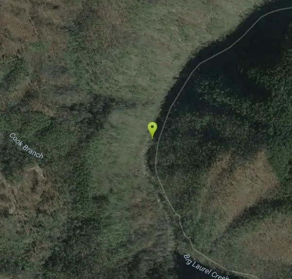
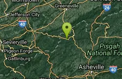
Big Laurel Creek Area
Marshall, North Carolina

| GPS: |
35°54'4.0"N 82°46'13.1"W Maps | Directions |
| State: | North Carolina |
Fishing
Hike, Kayak, Swim, and Whitewater
An easy, family-type, hike to several swimming holes of various degrees of challenge in Big Laurel Creek on its way to join the French Broad River. For details...Courtesy of swimmingholes.org
Bathing suits: May be optional at more remote places
Big Laurel ranks as one of the classic Western North Carolina whitewater runs thanks to its great moderate Class III/IV rapids, nice scenery, and frequent runnable flows. At low flows and medium flows Big Laurel is a great training ground for paddlers making the transition from river running to creek boating. At higher flows it is a booming river in its own right. Paddlers should be aware of an easily avoided sieve partway down on the left side of Stairstep Rapid, as well as a stout easily avoided hole on the right side of Suddy Hole. Hiking and swimming has picked up dramatically along Big Laurel in recent years so expect company in the summer. The trail borders the entire run and offers easy scouting and portaging. Courtesy of americanwhitewater.org
More Information
Be courteous, informed, and prepared. Read trailhead guidelines, stay on the trail, and don't feed the wildlife.
Read More- Plan Ahead and Prepare
- Travel & camp on durable surfaces
- Dispose of waste properly
- Leave what you find
- Minimize campfire impacts
- Respect wildlife
- Be considerate of other visitors
Directions
From Marshall, North Carolina
- Head north on Baileys Branch Rd toward N Main St (26 ft)
- Turn left onto US-70 BUS W/N Main St (1.6 mi)
- Turn left onto US-25 N/US-70 W (9.0 mi)
- Turn left toward Hwy 208 (0.2 mi)
- Continue onto Hwy 208 (0.4 mi)
From Asheville, go north on US 19 (freeway) to Weaverville then take RT 25 north about 20 miles. As you approach the intersection of RT 25 and RT 208, you will see on the right a gravel road signed for a recycling facility and then also on the right a 25 MPH curve speed sign. On the left hand side of the road, right across from this curve sign, is an unsigned non-descript gravel road that looks like a driveway - turn left into this road and park where it says "foot traffic only". (It also says that this is a private road, but it is not, although there is some private land along side of it in the beginning before you get into the National Forest land - so keep off the private land.)
Walk down this road and keep left at the intersection. You will then be walking downstream along Big Laurel Creek on an old, abandoned road, that gets narrower as you go down the gentle grade. There are swimming places in this pretty creek at about 1 mile, 1.5 miles and 2.5 miles (and maybe others) from where you parked. CAUTIONOne or more of these swimming places are unsafe at higher water levels - study each one carefully for currents before swimming.Courtesy of swimmingholes.org

Other Swimming Holes, Hiking Trails, Kayaking Areas, and Whitewater Rapids Nearby
Hot Springs Resort
Hot Springs, North Carolina
3.3 miles WPrivately owned resort has camping, lodging and natural hot mineral water in fiberglass hot tubs. Fees charged. This from a visitor in 2010:"I went with my friends for the first...
Swim
Sliding Rock
Hot Springs, North Carolina
4.9 miles SWSliding Rock is a well loved destination in the Pisgah National Forest. This 60 foot natural rock waterslide descends into an 8 foot deep pool, creating a unique adventure. The water is between 50...
Swim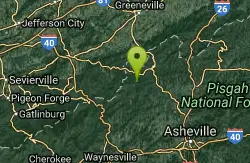
Sapphire Area
Hot Springs, North Carolina
4.9 miles SWThere are several falls with swimming within walking range on the Horsepasture River here...
Swim
Rocky Bluff
Hot Springs, North Carolina
5.1 miles SWPlay in water in creek, shallow at times.
Camp, Hike, Swim
Old Forge Campground
Bethany, Tennessee
14.1 miles NOld Forge Campground and Recreation Area is a small campsite perfect for campers looking for a primitive experience. Old Forge is located on the beautiful Jennings Creek in the Cherokee National...
Camp, Hike, Swim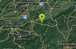
French Broad
Del Rio, Tennessee
14.2 miles WSwim near Del Rio, Tennessee
Swim 3.4 mi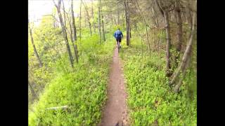
Alexander Mountain Bike Park
Alexander, North Carolina
14.8 miles SENice, challenging singletrack. Not overly technical, with some nice climbs and nice flowing sections, and a nice view of the French Broad river. However, this trail does get overgrown sometimes from...
Hike, Horseback, Mountain Bike
Horse Creek Campground
Chuckey, Tennessee
15.6 miles NEHorse Creek Campground is a popular day use and camping location in the Horse Creek Recreation Area. This beautiful spot in the Cherokee National Forest is a great location to connect with nature...
Camp, Swim 0.2-2.3 mi
Richmond Hill
Asheville, North Carolina
22.0 miles SEHilly, wooded course. Handmade signs and Astro Turf tees. Alt. pins on 14 holes. Long pants smart (poison ivy). Parking lot OB. Public (No Fee) Richmond Hill Park is Asheville's largest wooded...
Disc Golf, Hike, Mountain Bike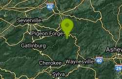
Mouse Creek Falls
Waynesville, North Carolina
23.4 miles SWSwim near Waynesville, North Carolina
Swim
Cosby Campground
Cosby, Tennessee
26.5 miles WCamp and Swim near Cosby, Tennessee
Camp, Swim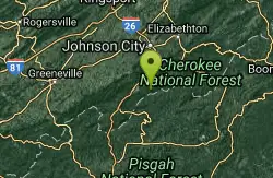
Rock Creek
Unicoi, Tennessee
28.4 miles NECreek is fed into man-made concrete-bottom stream-fed pool. This from a visitor in 2010:"There is a sandy beach with stone and concrete stairs down to the pool. There is a short...
Swim
Hardtimes Connector / 661
Asheville, North Carolina
29.4 miles SThis trail connects to the main trail system and the big climbs to the top from the Hardtimes Trailhead. This section of singletrack lies in the flatter terrain but leads to the big climbs up the...
Hike, Horseback, Mountain Bike
Little Hickory Top
Asheville, North Carolina
29.4 miles SDogs: Leashed
Hike, Horseback, Mountain Bike
Bent Creek
Asheville, North Carolina
29.5 miles SBent Creek is the go-to trail system for the greater Asheville area, and with the deeply-ingrained mountain bike culture in the Asheville/Brevard area, and Western North Carolina in general, Bent...
Hike, Mountain Bike
Mount Mitchell Area
Trinity, North Carolina
32.4 miles ENice family swimming place right by N. F. campgrounds in the South Toe River (cold) in the Pisgah N. F... Fees: Yes This site is closed seasonally.
Camp, Swim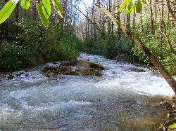
North Mills River
Mills River, North Carolina
34.7 miles SThe forest is known for its hiking and mountain biking trails, several of which are near the campground. Mills River offers excellent trout fishing, as well as tubing and swimming, which are...
Swim 3.8 mi
Ramsey Cascades
Gatlinburg, Tennessee
35.7 miles SWHike, Kayak, Swim, and Whitewater near Gatlinburg, Tennessee
Hike, Kayak, Swim, Whitewater
South Mills River Trail
Canton, North Carolina
35.9 miles SThis is an easy out-and-back trail that follows the South Fork Mills River with several swinging bridge crossings that leads to the site of the old Cantrell Lodge. From the trail head, the left side...
Hike, Mountain Bike
Big East Fork
Canton, North Carolina
37.2 miles SBig East Fork is a trail along Pigeon River with a variety of activities available. This trail travels through heavy forest along the river with beautiful, clear water. There are several waterfalls...
Backpack, Hike, Kayak, SwimNearby Campsites
Rocky Bluff
Hot Springs, North Carolina
5.1 miles SWPlay in water in creek, shallow at times.
Camp, Hike, Swim
Old Forge Campground
Bethany, Tennessee
14.1 miles NOld Forge Campground and Recreation Area is a small campsite perfect for campers looking for a primitive experience. Old Forge is located on the beautiful Jennings Creek in the Cherokee National...
Camp, Hike, Swim
Horse Creek Campground
Chuckey, Tennessee
15.6 miles NEHorse Creek Campground is a popular day use and camping location in the Horse Creek Recreation Area. This beautiful spot in the Cherokee National Forest is a great location to connect with nature...
Camp, Swim
Cosby Campground
Cosby, Tennessee
26.5 miles WCamp and Swim near Cosby, Tennessee
Camp, Swim
Mount Mitchell Area
Trinity, North Carolina
32.4 miles ENice family swimming place right by N. F. campgrounds in the South Toe River (cold) in the Pisgah N. F... Fees: Yes This site is closed seasonally.
Camp, Swim
Davidson River Campground
Pisgah Forest, North Carolina
42.9 miles SDavidson River Recreation Area offers camping and outdoor activities for the whole family. The campground boasts several loops of shaded campsites, as well as access to hiking trails, fishing spots,...
Camp, Hike, Swim
Mt. LeConte Lodge
Sylva, North Carolina
44.8 miles SWHigh atop Mt. LeConte in the Great Smoky Mountains National Park, LeConte Lodge® is the highest guest lodge in the eastern United States. It is situated on an open glade just below the summit of...
Camp, Hike, Horseback, Rock Climb


