


54 Hiking Trails near Sheep Creek Trail
first prev 1 2 3 next lastShowing Hiking Trails within 50 miles Distance miles of Forest Road 260, Irwin, ID 83428, USA City, Zip, or Address
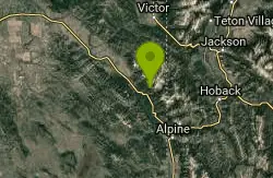
Little Elk Creek Trail
Irwin, Idaho
2.3 miles SEBackpack, Hike, Horseback, and Mountain Bike near Irwin, Idaho
Backpack, Hike, Horseback, Mountain Bike 5.6-8.3 mi
Palisades Creek Trail / Lakes and Waterfall Canyon
Irwin, Idaho
3.0 miles NWSpectacular mountain views, two landslide-formed alpine lakes, and mountain goat sightings — all within a 4-to-6-mile hike in the Swan Valley wilderness.
Backpack, Camp, Hike, Horseback, Mountain Bike
Calamity Campground
Irwin, Idaho
3.0 miles SWA wooded Palisades Reservoir campground 55 miles east of Idaho Falls with clean blue water for swimming, boating, water skiing, and fishing — plus miles of ATV routes.
Camp, Canoe, Hike, Kayak, Mountain Bike, Swim 13.8 mi
Big Elk Creek
Irwin, Idaho
4.2 miles SEA versatile campground on a small dammed lake with fishing, kayaking, hiking and backpacking into the Caribou-Targhee National Forest, and stunning fall Aspen and Douglas-Fir colors on the Big Elk Creek Trail.
Backpack, Camp, Canoe, Hike, Horseback, Kayak 13.2-13.5 mi

Bear Creek Hot Springs
Irwin, Idaho
6.6 miles SWTrek ~13 miles up a creek canyon near Palisades Reservoir to a secluded natural hot spring — gentle most of the way, with one rewarding final climb.
Backpack, Camp, Hike, Horseback, Hot Springs, Mountain Bike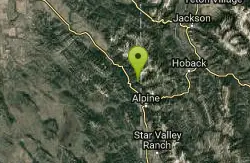
Indian Creek Campground (Palisades)
Irwin, Idaho
9.1 miles SEA picturesque reservoir nestled between the Snake River and Caribou ranges, just 25 miles from Jackson Hole — a beautiful drive and a wildlife-rich fishing base.
Camp, Hike, Horseback, Swim
Fall Creek Falls
Swan Valley, Idaho
11.4 miles NWA shaded Snake River campground near Swan Valley with abundant wildlife, great trout fishing, and Fall Creek Falls a quarter-mile away.
Camp, Cave, Hike, Kayak, Swim 4.6 mi
Coal Creek Trail
Alta, Wyoming
14.0 miles NEA hike beyond Coal Creek Meadows to a mountain divide with dramatic views of the Mesquite Creek Valley and the peaks to the north, including Grand Teton on the horizon.
Hike, Mountain Bike
Burns Canyon
Ririe, Idaho
22.2 miles NWHike and Mountain Bike near Ririe, Idaho
Hike, Mountain Bike 6.2 mi
Darby Wind Cave
Driggs, Idaho
24.6 miles NEWaterfalls, wildflowers, creek crossings, and a wind cave high on the canyon wall — Darby's switchback trail rewards hikers with views found nowhere else in the Tetons.
Backpack, Cave, Hike, Rock Climb 4.5 mi
Aspen Trail
Alta, Wyoming
25.7 miles NFlowing singletrack along a 6,800-ft ridgeline contour connects to Darby Canyon on a mix of smooth and rocky terrain — a satisfying intermediate out-and-back or loop.
Hike, Mountain Bike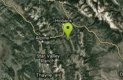
Bailey Lake
Jackson, Wyoming
25.8 miles SENamed by Congressional action in 1967 for prominent jurist Robert D. Bailey Sr., this reservoir on the Guyandotte River in West Virginia was dedicated in August 1980.
Camp, Hike, Horseback, Mountain Bike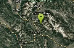
Cache Creek Trial
Jackson, Wyoming
26.1 miles EA groomed cross-country ski trail with an 850-foot elevation gain and loss near Jackson, Wyoming — snowmobiles are allowed and grooming runs Monday, Wednesday, and Friday mornings out 4.6 miles.
Hike
Murphy Lakes
Bedford, Wyoming
26.5 miles SECanoe, Hike, and Swim near Bedford, Wyoming
Canoe, Hike, Swim
Jumping Rock at Phelp's Lake
Jackson, Wyoming
27.2 miles NEA solo 20-foot boulder perched above deep water at Phelps Lake, with Death Canyon looming overhead — one of the most dramatic jump spots in all of Wyoming.
Dive, Hike, Swim 1.3-4.3 mi
Phelps Lake
Jackson, Wyoming
27.2 miles NEA 5.5-mile loop around beautiful Phelps Lake with mountain scenery, majestic blue water, several Teton waterfalls, and lakeside campsites — plus a popular cliff jumping rock along the trail.
Backpack, Camp, Dive, Hike, Swim
Poison Flats
Ririe, Idaho
28.1 miles NWHike near Ririe, Idaho
Hike 0.6-2.2 mi
Fish Creek Area
Ririe, Idaho
28.3 miles NWCLOSED. This land is owned and managed by the US Forest Service and is not designated for use. As of July 2024, being caught mountain biking on this trail could recieve up to a $5000 fine and a misdemeanor. Learn more. The Big Hole Mountains' Fish Creek trail network serves up singletrack climbs, floater jumps, rock gardens, and fast Fishbone descents accessed from Ririe or Rexburg.
Hike, Mountain Bike 1.1 mi
Hidden Vista / Pine Loop
Ririe, Idaho
28.5 miles NWCLOSED. This land is owned and managed by the US Forest Service and is not designated for use. As of July 2024, being caught mountain biking on this trail could recieve up to a $5000 fine and a misdemeanor. Learn more. A short singletrack trail to a canyon overlook with Snake River views — then a detour east for fun climbs, turns, rocks, and jumps on the way back to the Buckskin Morgan parking lot.
Hike, Mountain Bike 1.7 mi
Buckskin Morgan Ridge
Ririe, Idaho
28.5 miles NWCLOSED. This land is owned and managed by the US Forest Service and is not designated for use. As of July 2024, being caught mountain biking on this trail could recieve up to a $5000 fine and a misdemeanor. Learn more. A punchy climb to Buckskin Morgan Ridge pays off with twisty singletrack descents through roots, loose rock, and rolling hills above the Snake River Plain.
Hike, Mountain Bike


