


18 Hiking Trails near Stoddard Creek
first prev 1 next lastShowing Hiking Trails within 50 miles Distance miles of Forest Rd 003, Spencer, ID 83446, USA City, Zip, or Address

Aldous Lake and Hancock Lake
Kilgore, Idaho
19.5 miles ETwin alpine lakes — Aldous and Hancock — on a scenic 1.5-to-2.5-mile hike near Kilgore, with beautiful mountain scenery and heavier weekend crowds.
Backpack, Camp, Hike, Horseback, Swim
Pine Butte / The Caldera
St. Anthony, Idaho
22.2 miles SEAn old volcano in the Idaho desert that feels like stepping into a mountain forest — pine-covered hillsides, a meadow ringed by aspen and boulders, and a quarter-mile easy trail to the caldera floor.
Camp, Hike, Horseback
Webber Creek
Dubois, Idaho
23.6 miles WA dispersed recreation area at 7,000 feet elevation with a trailhead, vault toilet, and the Webber Creek Trail heading west toward Scott Peak — great for hiking, fishing, horseback riding, and mountain biking.
Backpack, Camp, Hike, Horseback, Hot Springs, Mountain Bike 0.6-4.7 mi

Harriman State Park
Island Park, Idaho
38.0 miles EAn 11,000-acre wildlife refuge 38 miles from Yellowstone along Henry's Fork — world-class fly-fishing, hiking among wildflowers and wildlife, plus 24 miles of Nordic ski trails in winter.
Cross-country Ski, Hike, Horseback, Mountain Bike, Snowshoe 4.2 mi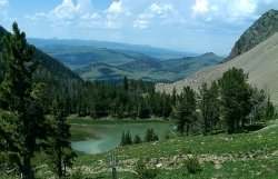
Lake Marie
Island Park, Idaho
39.2 miles EA high Continental Divide hike across the Idaho-Montana border to a cold, snowmelt-fed lake in a wildflower meadow — water level shifts dramatically from spring to fall.
Backpack, Hike 7.6 mi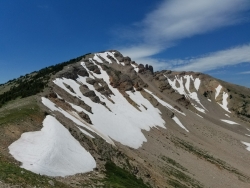
Mount Jefferson
Island Park, Idaho
39.2 miles EIdaho's highest point in the Centennial Mountains crowns a remote 10,203-ft Continental Divide summit on the Idaho-Montana border west of Yellowstone.
Hike 2.9 mi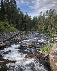
Box Canyon Trail
Island Park, Idaho
40.7 miles EA scenic 3-mile riverside singletrack along Henry's Fork in Box Canyon — open to OHVs under 50 inches wide, with river views most of the trail and great trout fishing.
Hike, Mountain Bike
Henry's Fork Green Way (St. Anthony Green Belt)
Saint Anthony, Idaho
40.9 miles SEAn easy paved 2-mile round-trip riverside walk along Henry's Fork in Saint Anthony — a statue of fur trader Andrew Henry at the halfway loop, and a pet-friendly, beginner-friendly path.
Hike
Sheep Falls on Henry's Fork
Island Park, Idaho
43.2 miles EA 25-foot waterfall cascading through a narrow basalt chute on the North Fork of the Snake River — a pleasant, rarely crowded hike compared to nearby Mesa Falls.
Hike 2.1-2.3 mi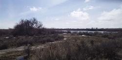
Market Lake Wildlife Management Area
Roberts, Idaho
44.7 miles SA wildlife management area teeming with waterfowl — ibis colonies, ducks, geese, herons, eagles, hawks, and owls — plus mule deer, white-tailed deer, and a small moose population near Roberts, Idaho.
Hike, Horseback 0.6-2.0 mi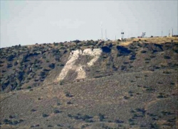
North Menan Butte ('R' Mountain)
Menan, Idaho
45.1 miles SA volcanic butte locals call R Mountain, with a paved trailhead, chain handrails near the top, informational signs at the rim, and views of Rexburg and the Snake River.
Camp, Cave, Hike 0.2-0.5 mi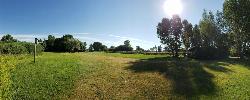
Eagle Park
Rexburg, Idaho
45.3 miles SEA cottonwood forest park inside Rexburg city limits with campsites, fishing, a dog park, mountain biking on easy and moderate loops, and rock-throwing by the river.
Camp, Hike, Mountain Bike, Sled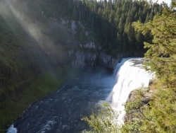
Mesa Falls
Ashton, Idaho
46.8 miles EUpper Mesa Falls drops 114 feet and spans 300 feet across the Henrys Fork — just 0.2 miles of paved walkway from the parking lot, with platforms, handrails, and morning rainbow mist.
Cross-country Ski, Hike, Kayak 0.1-1.3 mi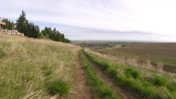
Hidden Valley Trails
Rexburg, Idaho
46.9 miles SEA well-signed network of downhill singletrack flows around the edges of Rexburg, with trails like Flow State, Drop Zone, and Lil' Sendy for every ability level.
Hike, Mountain Bike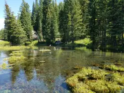
Big Springs
Island Park, Idaho
47.7 miles EA Big Springs campground shaded by Lodgepole Pines on Henry's Fork — with a 1-mile interpretive trail, fish feeding under the bridge, the historic Johnny Sack Cabin, and access to the Mesa Falls Scenic Byway.
Camp, Hike 0.3 mi
Birch Creek Charcoal Kilns
Leadore, Idaho
48.2 miles WSixteen remarkably intact 20-foot beehive brick kilns stand in remote Idaho as relics of an 1880s silver-mining operation that employed 200 workers for barely three years.
Hike 3.2-47.0 mi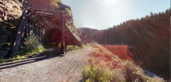
Yellowstone Branch Line Trail
Ashton, Idaho
49.4 miles SEA 39-mile trail from Warm River to the Montana border — open to backpackers, hikers, mountain bikers, horseback riders, and ATVs through the Targhee National Forest.
Backpack, Cross-country Ski, Hike, Horseback, Mountain Bike 0.3-0.6 mi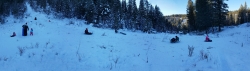
Bear Gulch
Ashton, Idaho
49.7 miles EAn abandoned ski hill from 1969 with overgrown runs that still deliver great sledding — the lower run is fast and winding all the way down to the old ski lift.
Camp, Cross-country Ski, Hike, Sled


