


14 Hiking Trails near Topton, NC 28901
first prev 1 next lastShowing Hiking Trails within 50 miles Distance miles of Topton, NC 28901, USA City, Zip, or Address
Davis Branch
Tellico Plains, Tennessee
22.3 miles WDavis Branch is a beautiful campground located in Tennesse by the beautiful Tellico River. Here you can camp, hike, and explore the river. The campground has six different campsites all offering...
Camp, Hike, Swim
Mt. LeConte Lodge
Sylva, North Carolina
26.8 miles EHigh atop Mt. LeConte in the Great Smoky Mountains National Park, LeConte Lodge® is the highest guest lodge in the eastern United States. It is situated on an open glade just below the summit of...
Camp, Hike, Horseback, Rock Climb
Baby Falls
Tellico Plains, Tennessee
27.3 miles WThe Tellico River is the home of the Baby Falls waterfall/swimming hole. Although it is beautiful at all times of the year, fall has been said to be one of the most beautiful and favorite times for...
Hike, Kayak, Swim, Whitewater
War Woman Dell Wildlife Management Area
Clayton, Georgia
32.2 miles SEWarwoman Dell Nature Trail and Becky Branch Falls Trail is a 0.8 mile out and back trail located near Clayton, Georgia that features a waterfall and is good for all skill levels. The trail is...
Camp, Hike, Horseback 3.8 mi
Ramsey Cascades
Gatlinburg, Tennessee
37.0 miles NEHike, Kayak, Swim, and Whitewater near Gatlinburg, Tennessee
Hike, Kayak, Swim, Whitewater 1.4 mi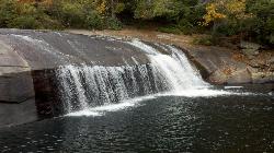
Turtleback Falls
Lake Toxaway, North Carolina
43.0 miles ETurtleback Falls was named for its domed shape, similar to the back of a turtle. It's also called "umbrella falls" for the same reason. Visitors slide down Turtleback as the...
Backpack, Hike, Swim 1.0 mi
Hidden Falls
Lake Toxaway, North Carolina
43.3 miles EHidden Falls is a serene family-friendly swimming hole in Pisgah National Forest just down river from the towering Rainbow Falls. It's on the Horsepasture River "hidden" just a few...
Hike, Swim 1.3 mi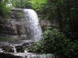
Rainbow Falls
Lake Toxaway, North Carolina
43.6 miles ERainbow Falls is one of the most spectacular waterfall settings in the Blue Ridge Mountains of North Carolina. This 150-ft. tall waterfall is impressive, especially after rainy weather that swells...
Hike, Swim 1.7 mi
Flat Laurel Creek
45.1 miles E
Flat Laurel Creek is a 3.18 mile multi-use trail that is perfect for exploring on foot, horse and bike. This trail can be accessed from a parking lot on either end, making it easy to begin...
Hike, Horseback, Mountain Bike, Swim
Courthouse Falls
45.7 miles E
Courthouse Falls is a beautiful 45 foot waterfall that is popular to visit. This waterfall is an easy 3/4 mile hike from the parking lot on Courthouse Creek Road (FSR 140) or can be accessed from the...
Hike, Swim 0.2-2.8 mi
Graveyard Fields
Brevard, North Carolina
48.5 miles EGraveyard Fields is a beautiful hike known for it's forests, wild flowers and two beautiful waterfalls. The Blue Ridge Mountains surround this area creating stunning views throughout the...
Hike, Swim
Skinny Dip Falls
Brevard, North Carolina
49.3 miles ESkinny Dip Falls is a beautiful and family friendly waterfall. Despite the misleading name, bathing suits are not optional at Skinny Dip Falls. Skinny Dip Falls is a long, thin cascading waterfall...
Hike, Swim 7.1 mi
Daniel Ridge Loop
Canton, North Carolina
49.4 miles EThis is a classic, short Pisgah loop. It's moderately technical most of the way with a couple of trickier sections. Most people prefer to approach it counter-clockwise, but it can be ridden...
Hike, Mountain Bike 3.1-4.3 mi
Farlow Gap
Canton, North Carolina
49.4 miles EThis is one of the most technical downhills in Pisgah: very steep and rocky! The trail drops about 2000 ft in 3 miles then connects with the Daniel Ridge trail. The climb to the gap is long (9 miles)...
Hike, Mountain Bike


