


11 Kayaking Areas near Upper Lake Clementine
first prev 1 next lastShowing Kayaking Areas within 50 miles Distance miles of Upper Lake Clementine near Auburn City, Zip, or Address

Lake Clementine Trail Loop
Auburn, California
4.8 miles SWFour connected trails loop around Lake Clementine on the North Fork American River — wheelchair accessible, pet friendly, and great for fishing, camping, and family summer outings.
Camp, Canoe, Hike, Kayak, Mountain Bike, Swim
American River Confluence
Auburn, California
4.9 miles SWThe Confluence — where the North and Middle Forks of the American River meet below Foresthill Bridge — is Auburn's favorite swimming and rafting hub.
Hike, Horseback, Kayak, Rock Climb, Swim, Whitewater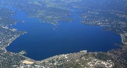
Granite Bay Main Beach
Granite Bay, California
17.2 miles SWThe largest sand beach on Folsom Lake, guarded in summer, twenty five minutes from downtown Sacramento at the end of Douglas Boulevard.
Canoe, Hike, Kayak, Swim
Hell Hole Reservoir
Georgetown
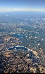
30.8 miles EA 4,630 foot Rubicon River reservoir in the Eldorado National Forest, 51 miles and two hours east of Georgetown, where the boat ramp cove is the only drivable shoreline and the lake drops over 100 feet by September.
Camp, Canoe, Hike, Kayak, Swim
William Kent Beach
Tahoe City
45.6 miles EA free Forest Service swim beach on Lake Tahoe's West Shore, two miles south of Tahoe City on Highway 89, with a pebbly shore, cold clear water and picnic tables across from William Kent Campground.
Kayak, Swim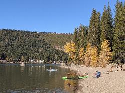
China Cove Beach
Truckee
45.7 miles NEChina Cove Beach is the sandy, shallow corner at the west end of Donner Memorial State Park, on the south shore of Donner Lake outside Truckee. California State Parks runs it, access is open to anyone paying the 10 dollar day use parking fee, and there is
Camp, Canoe, Hike, Kayak, Swim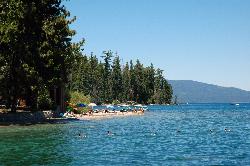
Sugar Pine Point Beach
Tahoma
46.6 miles EA quarter-mile walk from the parking lot puts you on a sand beach at the foot of Ed Z'berg Sugar Pine Point State Park, where General Creek meets Lake Tahoe and the water runs clear enough to read the bottom. It is also genuinely cold, even in August.
Camp, Hike, Kayak, Swim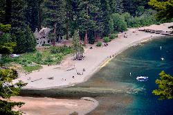
Vikingsholm Beach
South Lake Tahoe
46.7 miles ESandy beach at the head of Emerald Bay in Emerald Bay State Park, below the 1929 Vikingsholm mansion, reached by a steep one-mile trail. Free to walk in; parking is $10 a day.
Hike, Kayak, Swim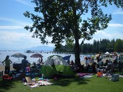
Commons Beach
Tahoe City
46.8 miles EFree public beach and lakefront park in downtown Tahoe City on Lake Tahoe, run by the Tahoe City PUD, with cold clear water, a sand and cobble shore, kayak rentals and free summer concerts.
Kayak, Swim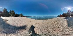
Lester Beach
South Lake Tahoe
47.0 miles ELester Beach is the sandy main swim beach at D. L. Bliss State Park on Lake Tahoe's west shore, with clear, cold, shallow water and a $10 per vehicle day-use fee in season.
Camp, Canoe, Hike, Kayak, Swim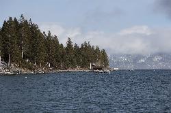
Lake Forest Beach
Tahoe City
48.4 miles EA free public beach at the end of Bristlecone Street, owned by Placer County and run by the Tahoe City Public Utility District. Sandy, pine shaded and genuinely quiet, with the one real constraint being how few cars fit at the end of the road.
Camp, Canoe, Kayak, Swim


