


98 Mountain Bike Trails near Porcupine Creek
first prev 1 2 3 4 5 next lastShowing Mountain Bike Trails within 50 miles Distance miles of Forest Road 582, Ashton, ID 83420, USA City, Zip, or Address

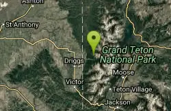
Yellowstone Branch Line Trail
Ashton, Idaho
5.1 miles NWYellowstone branch line trail runs from Warm River to the Montana border totaling 39 miles. There are a few places to jump on and off the trail as well as a few smaller trails that branch off of this...
Backpack, Cross-country Ski, Hike, Horseback, Mountain Bike 17.5 mi

Tear Drop Lake
Ashton, Idaho
10.5 miles NENestled in the Targhee National Forest just off of Ashton's Fish Creek Road, this tear drop shaped lake is a family adventure waiting to happen. The lake isn't very big but it is teeming with...
Camp, Canoe, Hike, Kayak, Mountain Bike, Swim 29.6 mi
Ashton to Tetonia Trail
Ashton, Idaho
10.8 miles WThe Idaho Department of Parks and Recreation undertook the project to transform the old Teton Valley Branch of the Union Pacific Railroad from Ashton to Tetonia into a trail for bikes, ATVs, and...
Mountain Bike
Flat Canyon Trail
Island Park, Idaho
11.5 miles NNon-motorized use. souce: fs.usda.gov
Mountain Bike
Badger Creek
Tetonia, Idaho
16.0 miles SBadger Creek is a stream located just 13.6 miles from Ashton, in Teton County, in the state of Idaho, United States, near France, ID. Whether you’re spinning, baitcasting or fly fishing your...
Camp, Cross-country Ski, Hike, Mountain Bike, Rock Climb
Big Bend Ridge Trail
Ashton, Idaho
17.8 miles NWTrail is open to OHVs. source: fs.usda.gov
Mountain Bike 0.6-4.7 mi
Harriman State Park
Island Park, Idaho
20.1 miles NWHarriman State Park is found 38 miles from Yellowstone along Henry's Fork. This 11,000-acre wildlife refuge is open year round for most activities. In addition to having beautiful scenery and...
Cross-country Ski, Hike, Horseback, Mountain Bike, Snowshoe
Wright Creek Trail
Tetonia, Idaho
22.4 miles SOpen to MTB, horseback riding, snowshoeing, and hiking. source: fs.usda.gov
Mountain Bike 0.6 mi
Packsaddle Lake
Tetonia, Idaho
22.5 miles SPacksaddle is one of the less well known lakes/trails in the area. If you've got a good offroad vehicle, you can probably make it all the way to the end of the road, otherwise, it's just an...
Dive, Hike, Mountain Bike, Snowshoe, Swim 1.7 mi
Rick's Basin
Driggs, Idaho
24.0 miles SEMountain Bike near Driggs, Idaho
Mountain Bike 5.8 mi
Box Canyon Trail
Island Park, Idaho
24.1 miles NVarious species of tress and wildflowers can be seen on the trail, as well as songbirds, waterfowl and occasional wildlife. The trail is open for the following uses: Motorcycle Trail Riding, Off...
Hike, Mountain Bike
Probation And Burg Bumper
Tetonia, Idaho
24.3 miles SThe Probation part of the trail is the steepest downhill in the area. Has multiple bridges and log jumps in the short mile down. The Burg portion of the trail is uphill with some...
Mountain Bike 0.6-4.0 mi
Grand Targhee XC Park
Moose, Wyoming
24.4 miles SEMountain Bike 1.1 mi
More Cowbell
Moose, Wyoming
24.4 miles SEThis singletrack trail winds through aspens, high alpine meadows and old growth conifers.
Mountain Bike 1.9 mi
Perm-a-grin
Moose, Wyoming
24.4 miles SEPerma Grin is guaranteed to fix a smile on your face indefinitely! This swooping, flowing, smooth singletrack descends the hillside above Rick's Basin.
Mountain Bike 2.1 mi
Buffalo Soldier
Moose, Wyoming
24.5 miles SETrail is a nice loop, all singletrack, with about 300' of elevation gain. Trail is about 1.8 miles one way. You can also use it as a connector to Mill Creek or lightning loop. Buffalo...
Mountain Bike 4.0 mi
Quakie Ridge
Moose, Wyoming
24.5 miles SETrail starts at the base ski area on a service road then heads out on nice single track. Trail winds through meadows of wildflowers. Some minor altitude gain along the trail. The...
Mountain Bike
Cold Springs
Moose, Wyoming
24.9 miles SETrail is easiet down as a loop but can be done as a shuttle as well. Take a right into Teton Canyon and park at the first big parking lot on the left. About 50 yards from Ski Hill rd....
Mountain Bike
Sharks Belly
Driggs, Idaho
25.1 miles STrail system can start from Channel lock or Bovine. Channel Lock is an easier climb than Bovine. This description and mileage starts at the Channel Lock trail, forest service boundary marker. Take...
Mountain Bike
Southbound
Driggs, Idaho
25.1 miles STrail starts by going up the Channel lock trail. At the top of Channel Lock go right onto the Southbound trail. Trail will loop back to Channel lock which you take back to your car. Trail is...
Mountain Bike


