


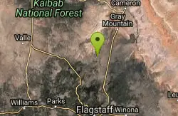
Pumpkin Trail to Bulls Basin Trail Loop
Flagstaff, Arizona

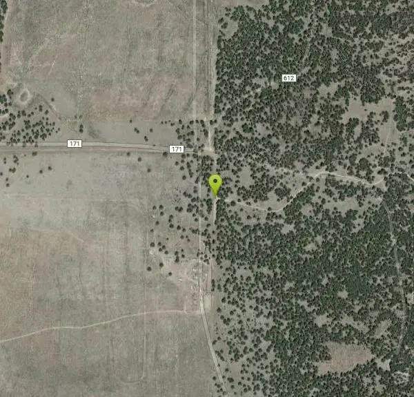
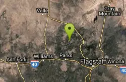
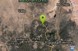
| Address: | ~Co Rd 171, Flagstaff, AZ 86001, USA |
| GPS: |
35°25'21.9"N 111°54'41.1"W Maps | Directions |
| State: | Arizona |
| Trail Length: | 11.30 miles |
| Elevation Gain: | 3297.00 feet |
| Hike Difficulty: | Intermediate |
| Trail Type: | Loop |
Hike
Courtesy of AllTrails.com
More Information
Add ResourceBe courteous, informed, and prepared. Read trailhead guidelines, stay on the trail, and don't feed the wildlife.
Read More- Plan Ahead and Prepare
- Travel & camp on durable surfaces
- Dispose of waste properly
- Leave what you find
- Minimize campfire impacts
- Respect wildlife
- Be considerate of other visitors
Directions
From Flagstaff, Arizona
- Head west on Historic Rte 66 toward N Humphreys St (20 ft)
- Turn right onto N Humphreys St (0.6 mi)
- Turn left onto W Columbus Ave (292 ft)
- Continue onto US-180 W/N Fort Valley Rd (16.5 mi)
- Turn left (1.1 mi)
- Continue straight (2.1 mi)
- Turn right toward Forest Service Rd 171 (476 ft)
- Turn right toward Forest Service Rd 171 (0.1 mi)
- Continue onto Forest Service Rd 171 (1.8 mi)
- Turn right onto Forest Service Rd 100 (26 ft)
- Turn left onto Forest Service Rd 171Destination will be on the right(4.1 mi)
Other Hiking Trails Nearby
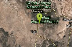
Kendrick Peak Trail
Flagstaff, Arizona
0.0 miles NWHike
Slate Mountain Trail
Flagstaff, Arizona
6.1 miles NEDirections from Flagstaff: Drive 35 miles north on US 180 to FR 191. Turn west 2 miles to the trailhead on the right side of the road. US 180 is paved. FR 191 is graveled and suitable...
Hike
Red Mountain Trail
Flagstaff, Arizona
8.5 miles NHike
SP Crater
Flagstaff, Arizona
18.8 miles NEHike
Red Butte Trail
Williams, Arizona
29.3 miles NDirections from Highway 64/180: Turn onto Forest Road (FR) 320. Travel east for 1.5 miles and turn left (north) onto FR 340. After traveling .75 mile on this road turn right (east) onto...
Hike 1.0 mi
Harding Springs Trail
Sedona, Arizona
30.8 miles SHarding Springs Trail is a beautiful hiking trail in Sedona, Arizona. This trail was originally one of several that provided a way for cattlemen to drive their stock in and out of Oak Creek...
Hike 0.1-0.7 mi
Cave Springs
Sedona, Arizona
31.0 miles SCave Springs Campground is a scenic campground that sits in Oak Creek Canyon. Cave Springs is nestled perfectly in the town of Sedona, giving the campground the notorious Sedona red views. Uniquely,...
Camp, Hike, Swim
East Horseshoe Mesa Trail
Williams, Arizona
34.3 miles NDirections from East Entrance: Drive west on East Rim Drive to Grandview Point access road. Turn right and follow the access road to the trailhead. Descend two miles on the Grandview...
Hike 0.3 mi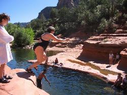
Slide Rock
Sedona, Arizona
34.3 miles SSlide Rock is one of the most popular locations in the Sedona area. Slide Rock is natures most thrilling water slides. Slide Rock is a gargantuan 80 feet long, and 2-4 feet wide. This slippery slope...
Hike, Swim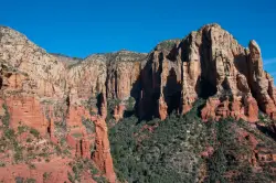
Brins Mesa Trail
Sedona, Arizona
35.4 miles SBrins Mesa Trail is located in the Coconino National Forest just at the edge of the town of Sedona. This trail will provide picturesque views of the gorgeous, geological landscape. Brins...
Hike
Devil's Bridge
Sedona, Arizona
36.4 miles SWe loved the red rock views on this hike! It's a 3.6 mile round-trip trail, on rocky/sandy ground, and is fairly easy, until the last mile, which is steep. Dozens of jeeps and ATVs passed us -...
Hike
Arizona Trail
Grand Canyon Village, Arizona
37.0 miles NThe Arizona Trail, located near the Grand Canyon, is great from January through November. At 16.8 miles (one way) in distance, the trail is out and back and rated with high difficulty.
Hike, Horseback
Wilson Mountain Trail
Sedona, Arizona
38.3 miles SHike near Sedona, Arizona
Hike 3.4 mi
Grasshopper Point
Sedona, Arizona
38.3 miles SGrasshopper Point is a beautiful swimming hole located in Sedona, Arizona. Grasshopper Point is the perfect place to cool off in the summer after a nice hike, or a hot summer day. This swimming...
Dive, Hike, Swim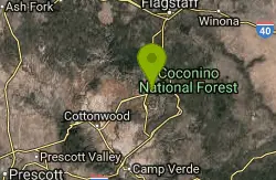
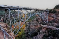
Midgley Bridge Trail
Sedona, Arizona
38.3 miles SHike near Sedona, Arizona
Hike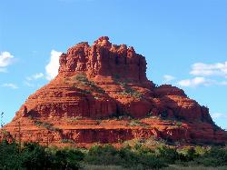
Schnebly Hill Vista Overlook
Sedona, Arizona
38.7 miles SThe Schnebly Hill Formation is a beautiful red rock gem in Sedona, Arizona. This rock formation is considerably big, which is why it is divided into four different sections that are called...
Hike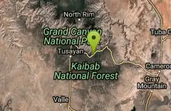
Tonto Trail: New Hance Trail to Grandview Point
Grand Canyon Village, Arizona
38.8 miles NBackpack, Camp, Hike 6.0 mi
Huckaby Trail
Sedona, Arizona
39.5 miles SOn the hunt for adventure? Established in 1998, Huckaby Trail is just the adventuresome route for both avid hikers and mountain bikers. It offers up forestry of Arizona Sycamores and picturesque...
Canoe, Hike, Mountain Bike 8.5 mi
Munds Wagon Trail
Sedona, Arizona
39.6 miles SMunds Wagon Trail is different from many of the other more “classic†rides around Sedona. If you come from somewhere else and are missing the feel of loose rocks...
Hike, Mountain Bike
Grandview Lookout
Grand Canyon Village, Arizona
39.6 miles NHike
Nearby Campsites
Cave Springs
Sedona, Arizona
31.0 miles SCave Springs Campground is a scenic campground that sits in Oak Creek Canyon. Cave Springs is nestled perfectly in the town of Sedona, giving the campground the notorious Sedona red views. Uniquely,...
Camp, Hike, Swim
Tonto Trail: New Hance Trail to Grandview Point
Grand Canyon Village, Arizona
38.8 miles NBackpack, Camp, Hike
Grand Canyon South Rim Area Campgrounds
Grand Canyon Village, Arizona
39.6 miles NCamp
Tonto Trail from Grandview Point to South Kaibab Trailhead
Grand Canyon Village, Arizona
40.0 miles NA rigorous point-to-point backpack of four to five days; recommended for experienced Grand Canyon backpackers only. Long stretches of this scenic, lonely segment of the Tonto Trail are...
Backpack, Camp, Hike
Grandview Trail Loop
Grand Canyon Village, Arizona
40.0 miles NThis is definitely not a mountain biking trail! I am a resident of Grand Canyon and know for sure. Also use of Mtn bikes on canyon trails is illegal in the Park....
Backpack, Camp, Cross-country Ski, Hike 9.1 mi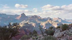
New Hance Trail
Grand Canyon Village, Arizona
40.2 miles NNew Hance Trail is a colorful hike through Red Canyon to the Colorado River. This trail is considered one of the more difficult trails in the Grand Canyon and is a challenge only prepared hikers...
Backpack, Camp, Hike
Chavez Crossing
Sedona, Arizona
40.8 miles SChavez Crossing is a campground in Sedona, Arizona. It sits perfectly nestled in Arizona's most beautiful red rock attractions along with the grand summer sunsets. If that didn't sound...
Camp, Hike, Swim
Tanner Trail
Grand Canyon Village, Arizona
42.3 miles NA rigorous rim-to-river backpack of three or more days, following one of the South Rim's more difficult trails. The unmaintained trail, recommended only for seasoned hikers, is...
Backpack, Camp, Hike
South Kaibab to North Kaibab to Bright Angel Trail
Grand Canyon Village, Arizona
44.6 miles NGenerally an early morning start and a late finish with an amazing sunrise on the way down the South Kaibab and depending on your speed, a beautiful sunset as you hike back toward (or up) Bright...
Backpack, Camp, Hike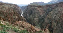
Clear Creek Trail
Grand Canyon Village, Arizona
44.6 miles NAn extended backpack trip of four to six days deep within the Grand Canyon. NOTE: The starting point for Clear Creek Trail, Bright Angel Campground, is in a remote location away from a trailhead. The...
Backpack, Camp, Hike 13.6 mi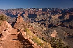
South Kaibab Trails
Grand Canyon Village, Arizona
44.6 miles NSouth Kaibab Trail is a 7 mile point-to-point trail located near Grand Canyon, Arizona that features a river and is rated as difficult. The trail is primarily used for hiking & walking and is...
Camp, Hike, Horseback
South Kaibab to Phantom Ranch to Bright Angel Trail
Grand Canyon Village, Arizona
44.6 miles NOne of the most popular hikes in Grand Canyon National Park is the South Kaibab to Phantom Ranch to Bright Angel Trail. Marked as difficult, the trail is well maintained and labeled. This Grand...
Backpack, Camp, Hike
The Grand Canyon: Kaibab to Bright Angel Trail
Grand Canyon Village, Arizona
44.6 miles NExperience the Grand Canyon like few others with this unforgettable 2-3 day trip down into the canyon. If you are looking for the perfect hike in the Grand Canyon, this is it. The 2 (or 3) day hike...
Backpack, Camp, Hike 0.6 mi
Mather Campground Trail
Grand Canyon Village, Arizona
44.7 miles NLocated on the South Rim of the Grand Canyon, Mather Campground Trail is a brief one mile out and back connector trail which is great for hiking, mountain biking, walking, and trail running. The...
Camp, Hike, Mountain Bike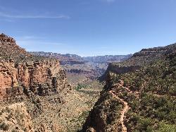
Bright Angel Trail to Three-Mile Rest house
Grand Canyon Village, Arizona
45.7 miles NThe popular out-and-back Bright Angel Trail to Three-Mile Resthouse is 5.4 miles out in distance. The trail includes many steep switchbacks and 360 degrees of absolutely stunning views of the inside...
Backpack, Camp, Hike 4.9 mi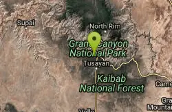
Bright Angel Trail to Tonto Trail
Grand Canyon Village, Arizona
45.7 miles N"[T]he Tonto Trail offers a degree of civility not found elsewhere along the trail, and it is here that most hikers get their first exposure to the unique nature of this singular transcanyon...
Backpack, Camp, Hike 4.5 mi
Bright Angel Trail to Bright Angel Campground and River Trail
Grand Canyon Village, Arizona
45.7 miles NBright Angel Trail to Bright Angel Campground and River dirt trail is one of the most famous trails near Grand Canyon, Arizona. The well-maintained trail encompasses incredible views and has an...
Backpack, Camp, Hike, Rock Climb 1.4-9.8 mi
The Bright Angel Trails
Grand Canyon Village, Arizona
45.7 miles NPrepare yourself for switchbacks as part of a tough elevation gain on the Bright Angel trail to Plateau Point trail. This trail features spectacular views as you hike along the edge of...
Backpack, Camp, Hike, Horseback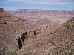
Boucher Trail to Hermit Trail Loop
Grand Canyon Village, Arizona
47.2 miles NA demanding loop trip of three to four days, tracing one of the most difficult South Rim trails. Even seasoned Grand Canyon backpackers consider the Boucher Trail to be the most difficult, hazardous,...
Backpack, Camp, Hike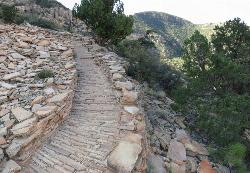
Hermit's Rest Viewpoint to Tonto Trail to Bright Angel Trail
Grand Canyon Village, Arizona
47.2 miles NHermit’s Rest Viewpoint to Tonto Trail to Bright Angel Trailhead is perfect for hiking, backpacking, walking, and trail running. The Trail takes you across a well-established portion of the...
Backpack, Camp, Hike


