


Quigley Canyon
Hailey

Cross Country Ski, Hike, and Mountain Bike
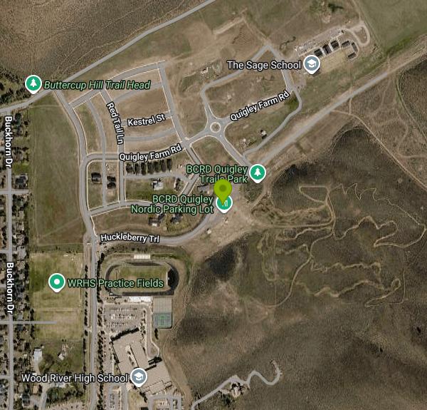
Quigley Canyon runs east from Hailey into the foothills of the Pioneer Mountains. Its lower end holds BCRD Quigley Trails Park, a year-round trail area run by the Blaine County Recreation District (BCRD), on the hills and canyon floor behind Wood River High School on Fox Acres Road, a few minutes from downtown Hailey. In summer it has a paved pump track, flow trails, jump lines and a loop trail up the canyon. In winter BCRD grooms more than 20 km of Nordic trail there.
The land comes from a mix of owners. When the City of Hailey annexed Quigley Canyon in June 2017, the annexation agreement required open land, including a parcel behind the high school that went to BCRD. The rest of the trail system crosses private ground owned by Quigley Farm. The landowner allows public use there, and a Wood River Land Trust conservation easement protects that land permanently. BCRD built the trails with Quigley Farm, the Wood River Land Trust, the City of Hailey and the Sun Valley Ski Education Foundation as partners. Work started in 2018, and Hailey's planning and zoning commission approved the first phase that fall. Since much of the canyon is private, stay on the designated trails.
The Quigley Loop Trail is a roughly 4.2-mile loop for bikes, hikers and horseback riders, reached from Quigley Canyon Road. MTB Project rates it easy to intermediate, with only about 240 feet of climbing and no technical sections, so it works as a family ride or an easy run. Closer to the high school, Quigley Trails Park has an asphalt pump track, a skills area, a climbing trail, and beginner, intermediate and advanced flow trails and jump lines. The flow trails and jump lines drop from the top of the climbing trail back to the pump track area. If you are new to jumps, start on the beginner line and work up.
Park off Fox Acres Road next to Wood River High School and the pump track. A second lot near the end of the pavement on Quigley Road serves the Quigley Loop. BCRD sometimes closes parts of Quigley Road or specific trailheads for construction or other work, so check BCRD's summer TraiLink page before you go.
In winter Quigley is BCRD's Nordic area closest to Hailey. It has over 20 km of groomed trails spread across about 15 mostly beginner and intermediate trails. The Sun Valley Ski Education Foundation's Hailey development team trains here, so expect to share the trails with young racers. You need a BCRD Nordic pass. Quigley has its own day pass that costs less than the North Valley day pass, and the BCRD season pass works here too. Three sections allow dogs and fat bikes, and fat bikers need a Nordic pass at Quigley as well. Kids 17 and under ski free. BCRD's winter etiquette rules ask that dogs stay under voice and sight control or on a leash, and that owners pack out dog waste. Snow in the lower valley comes and goes, so check the grooming report before you head out.
More Information
Advanced Flow Trail Mountain Bike Trail, Hailey, Idaho
Put your big bike pants on and let 'er rip. Near Hailey, Idaho.
https://www.mtbproject.com/trail/7060874/advanced-flow-trailBCRD plans new trails east of Hailey | Hailey | mtexpress.com
After five years of work in Croy Canyon, the Blaine County Recreation District expects to start work cutting a new network of trails in Quigley Canyon this week, breaking ground
https://www.mtexpress.com/news/hailey/bcrd-plans-new-trails-east-of-hailey/article_082ec2ce-5319-11e8-a2a3-379e68a58dfb.htmlComplete Guide to Cross-Country Skiing Sun Valley - Sun Valley Idaho
We give you the complete break down of everything you need to know, from where to ski to who can help you get the right gear.
https://visitsunvalley.com/complete-guide-to-cross-country-skiing-sun-valleyHailey P&Z approves permit for BCRD trails | Environment | mtexpress.com
The Hailey Planning and Zoning Commission approved on Monday a plan to build a 2.37-mile trail system on the hills east of Wood River High School for hiking, Nordic skiing
https://www.mtexpress.com/news/environment/hailey-p-z-approves-permit-for-bcrd-trails/article_a22ec28a-ed14-11e8-8b5e-2f3c6f7d82ff.htmlOut on the trails | Special Sections | mtexpress.com
Operating one of the largest and most dog-friendly Nordic trails systems in North America, the Blaine County Recreation District’s winter trail system offers more than 200 kilometers (124.3 miles) of
https://www.mtexpress.com/wood_river_journal/special_sections/out-on-the-trails/article_6ed161a6-a792-11ef-844c-b339fd830eb4.htmlQuigley Loop Mountain Bike Trail, Hailey, Idaho
Non-technical, fast loop close to town. Near Hailey, Idaho.
https://www.mtbproject.com/trail/7047977/quigley-loopQuigley Trails Park - BCRD
Quigley Trails Park Quigley Canyon's proximity to schools and neighborhoods in the southern Wood River Valley make it a popular outdoor recreation spot for youth, adults, seniors, and families. Summer Trailink Construction Information Quigley Trails Park Quigley Trail Park features a pump track, jump lines, flow lines, and a skills…
https://bcrd.org/summer-trails/our-summer-trails/quigley-trails-park/Quigley Trails Park - BCRD
News: Quigley Trails Park is closed for Paving August 8-14. Dismiss this alert. Quigley Nordic is located just minutes from downtown Hailey and has over 20 kilometers of groomed ski trails in Quigley Canyon. Trail Passes Winter Trailink Quigley Nordic Trails Download Map BCRD has worked with community partners Quigley…
https://bcrd.org/winter-trails/our-winter-trails/quigley-trails-park/Trail Passes & Pins - BCRD
2026-2027 Nordic Season Passes Preseason Sale October 12 - November 22 BCRD operates more than 160 kilometers of Nordic skiing and 36 kilometers of snowshoe trails throughout the Wood River Valley.A BCRD day pass or season pass is required for skiing or snowshoeing on BCRD trails, with the exception of…
https://bcrd.org/winter-trails/trail-passes-pins/Never modify trail features. Ride trails when they're dry enough that you won't leave ruts. Speak up when you see others on the trail and always yield to hikers, horses, and others coming uphill. Always ride on the established trail.
Read MoreBe courteous, informed, and prepared. Read trailhead guidelines, stay on the trail, and don't feed the wildlife.
Read More
- Plan Ahead and Prepare
- Travel & camp on durable surfaces
- Dispose of waste properly
- Leave what you find
- Minimize campfire impacts
- Respect wildlife
- Be considerate of other visitors
Directions
From Hailey
- Head southeast on S Main St toward E Croy St (0.9 mi)
- Turn left onto Fox Acres Rd (0.2 mi)
- At the traffic circle, continue straight onto Fox Acres Dr (0.6 mi)
- Turn right onto Huckleberry Trl (0.2 mi)
- Turn rightDestination will be on the left(240 ft)


Other Mountain Bike Trails, Hiking Trails, and Cross Country Ski Trails Nearby
Wood River Trail
Hailey
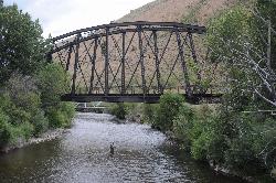
0.9 miles WA free paved path of 20-plus miles on the old Union Pacific rail bed, linking Bellevue, Hailey, Ketchum and Sun Valley. It is groomed for Nordic skiing in winter.
Cross-country Ski, Cycle, Hike
Carbonate Mountain
Hailey, Idaho
1.6 miles WSteep trail up the 6,714-foot hill directly west of downtown Hailey, with a 3.7-mile hiking loop, a six-mile advanced bike loop and wide views of the Wood River Valley.
Hike, Mountain Bike
Lambs Gulch
Hailey, Idaho
3.5 miles WCLOSED. Closed due to wildfire as well as expressed concerns from the property owner. Four miles of buffed-out singletrack with bridges and berms — part of a large and growing trail system near Hailey, Idaho that rewards riders looking for flow.
Mountain Bike
Hidden Valley
Hailey, Idaho
4.1 miles SWA connector trail in Bullion Gulch best ridden counterclockwise, passing through open sagebrush, an aspen grove, and about 13 bermed turns through rolling hills.
Mountain Bike
Bullion Connector Trail
Hailey, Idaho
4.4 miles SWA multi-use connector climbing through bermed turns and switchbacks to Bullion Gulch — fun in both directions and a great option when snow is still deep up high.
Mountain Bike
Bulldog
Hailey, Idaho
4.5 miles SWA cross-country singletrack in Hailey accessible via other trails — a satisfying climb leads to an amazing downhill run that rewards those who seek it out.
Mountain Bike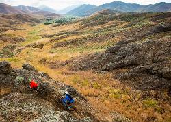
Croy Creek Trail System
Hailey, Idaho
4.5 miles SWAbout 18.5 miles of BLM and Blaine County singletrack in the sage foothills west of Hailey, rebuilt by IMBA after the 2013 Beaver Creek Fire and open early May to mid-November.
Atv/motorcycle, Hike, Mountain Bike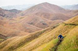
Two Dog
Hailey, Idaho
5.5 miles WThe longest trail in the Croy Creek system, about 7.4 miles of non-motorized singletrack from Bullion Gulch Road over a sage saddle and down into the Croy Creek valley.
Hike, Mountain Bike
Imperial Gulch Trail
Hailey, Idaho
8.1 miles NWA steady climb through wildflowers, aspen groves, and meadows near Hailey with stunning Pioneer Mountain views — best ridden counter-clockwise beginning with Greenhorn Gulch.
Mountain Bike
River Run
Ketchum, Idaho
11.0 miles NA great descending trail in the Bald Mountain area near Ketchum with plenty of switchbacks, wooded shade, and connections to Bald Mountain Trail and Warm Spring Trail — watch for hikers on the way down.
Mountain Bike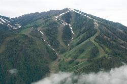
Bald Mountain Trail
Ketchum, Idaho
11.1 miles NThe main hiking and uphill-only biking route up Bald Mountain, climbing about 5.2 miles and 3,200 feet from River Run Plaza in Ketchum. Many hikers stop at the Roundhouse about 4 miles up.
Hike, Mountain Bike
Bald Mountain Bike Park
Ketchum, Idaho
11.1 miles NA lift-accessed summer mountain biking experience at Bald Mountain — 3,000 feet of uphill elevation included, followed by miles of advanced downhill trails back to the base.
Mountain Bike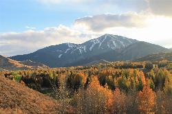
White Cloud Loop
Sun Valley, Idaho
12.5 miles NA 4.2-mile dirt loop around the White Clouds golf course in Sun Valley, maintained by Sun Valley Company and open to hikers, runners, riders and leashed dogs. It dries out early in spring and looks across at Bald Mountain and the Boulder Mountains.
Hike, Mountain Bike
Adams Gulch Loop
Ketchum, Idaho
13.6 miles NKetchum's busiest trail network, with easy loops on Shadyside and Sunnyside, the Griffin Butte intermediate loop and the one-way, bike-only Forbidden Fruit flow trail. The trailhead is less than two miles north of town.
Hike, Mountain Bike
Corral Creek
Hailey, Idaho
14.7 miles NFun and fast singletrack along Trail Creek on the lower end and Corral Creek Road at the top — nothing too technical, great for beginners, and busy with other trail users.
Mountain Bike
Greenhorn Gulch
Ketchum, Idaho
15.1 miles NWA scenic multi-use singletrack in Ketchum with good downhill flow, a moderate climb, and a grind up to the Imperial Gulch junction.
Mountain Bike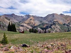
Pioneer Cabin Trail
Sun Valley
15.4 miles NA steep, switchbacking trail from the Corral Creek trailhead east of Sun Valley to Pioneer Cabin, a 1937 Union Pacific ski hut with close views of the Pioneer Mountains.
Hike, Mountain Bike
Chocolate Gulch / Trail #312
Ketchum, Idaho
17.2 miles NChocolate Gulch (Trail #312) is a mellow, scenic mountain-bike ride north of Ketchum with wildflowers and Boulder Mountain views.
Mountain Bike
Fox Creek Loop
Ketchum, Idaho
17.2 miles NA 6-mile singletrack loop north of Ketchum that climbs through the 2007 Castle Rock burn, drops through aspen and finishes along the Big Wood River. Bikes ride it one way, counter-clockwise.
Hike, Mountain Bike
Fox Peak / Trail #938
Ketchum, Idaho
17.6 miles NWA connector singletrack through a castle-rock fire recovery area and a beautiful aspen grove, linking Osberg Ridgeline to East Fork Road #168.
Mountain BikeNearby Campsites
Magic Reservoir
Bellevue
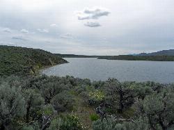
14.7 miles SWMagic Reservoir is a big irrigation lake on the Big Wood River surrounded by BLM sagebrush land, with free ramps and primitive camps. It is known for trout, perch and ice fishing, but water levels swing hard with irrigation demand.
Camp, Canoe, Kayak
Worswick Hot Springs
Fairfield, Idaho
25.6 miles WFree hillside hot spring pools on Worswick Creek in the Sawtooth National Forest, about 20 miles north of Fairfield. The lower pools run about 90 to 105 degrees, and the source water is hot enough to scald.
Camp, Hot Springs
Preis Hot Spring
Fairfield, Idaho
27.3 miles WA small sunken wooden box beside Forest Road 227 north of Fairfield that fits two people in clear, roughly 102 degree water. Pair it with Worswick Hot Springs a couple of miles away.
Camp, Hot Springs 3.4 mi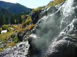
Skillern Hot Springs
Fairfield, Idaho
27.6 miles WA stunning six-mile trail along crystal-clear Big Smoky Creek to a hot spring — spectacular in fall, with two trail options and a sign marking the final three miles.
Camp, Hike, Hot Springs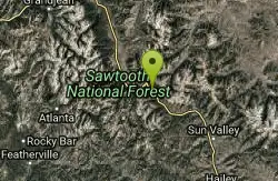
Galena Lodge
Ketchum, Idaho
30.3 miles NWA community-owned historic lodge 23 miles north of Sun Valley, open summer and winter as a hub for hikers, bikers, Nordic skiers, and snowshoers with rentals and great food.
Camp, Cross-country Ski, Snowshoe
Mormon Reservoir
Fairfield
30.6 miles SWIrrigation reservoir on McKinney Creek about five miles south of Fairfield, with a free Idaho Fish and Game boat ramp, docks, toilets and primitive camping. It is stocked with rainbow trout, but the water drops hard by late summer and in dry years.
Camp, Canoe, Kayak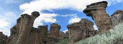
Little City of Rocks
Gooding, Idaho
34.1 miles SWA volcanic hoodoo landscape of natural arches, towers, and mushroom-cap formations near Gooding, Idaho — best visited in spring when desert wildflowers bloom and the main loop trail is scenic.
Camp, Hike
Lava Flow Campground
Arco, Idaho
37.0 miles EA campground surrounded by a young lava flow near the Craters of the Moon visitor center and popular trails — 42 first-come sites at $15/night during main season.
Camp
McKinney Butte Lava Tubes
Gooding, Idaho
44.3 miles SWTwo forking lava tubes near Bliss — one open to anyone, the other gated (BLM permit required) — that survived the Bonneville Flood and a 1993 landslide.
Camp, Cave


