


Wood River Trail
Hailey
Cross Country Ski, Cycle, and Hike
The Wood River Trail is the paved path that runs the length of the Wood River Valley, linking Bellevue, Hailey, Ketchum and Sun Valley. Locals just call it the bike path. The Blaine County Recreation District (BCRD) built and maintains it and describes it as a 20-plus mile paved, multi-use, year-round path. More paved branches reach into Sun Valley and the Elkhorn neighborhood, which brings the whole system to around 30 miles. From the Sun Valley end, the Hemingway Memorial is just off Trail Creek Road about a mile northeast of the Sun Valley Lodge. It is a bronze bust of the writer beside Trail Creek, dedicated in 1966, and makes an easy stop on a ride out that way. It is free to use in every season, and it is closed to motor vehicles.
Most of the route follows the old Sun Valley branch of the Union Pacific Railroad. BCRD built the trail on the abandoned rail bed in sections between 1984 and 1991. Voters approved a two-year levy in 2013 to rebuild and resurface it, and that work was finished over the summers of 2014 and 2015. Because it sits on a rail bed, the grade is gentle the whole way. The valley drops slowly from north to south, so riding from Ketchum toward Hailey and Bellevue is a long, easy descent, and the ride back north is a slow climb. Wind funnels up and down the valley and often matters more than the grade, so check it before committing to a long out-and-back.
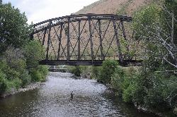
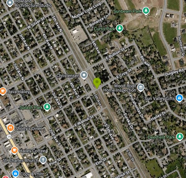
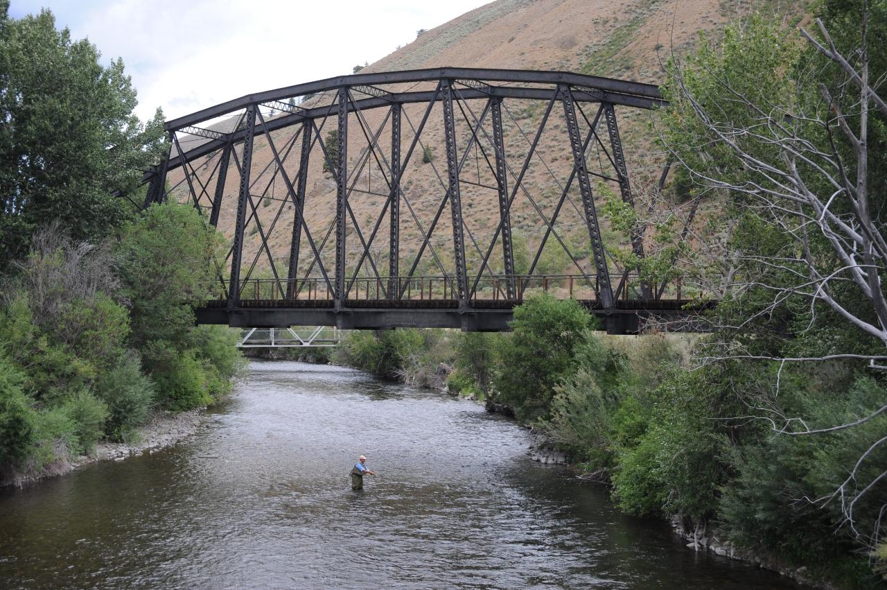
This listing is pinned where the trail crosses East Croy Street on the east side of Hailey, a few blocks from Main Street. From here you can head north toward Ketchum or south past the airport toward Bellevue. The southern section runs close to Highway 75 through farmland. North of Hailey the path follows Buttercup Road past hay fields and the Valley Club golf course, and one stretch has a scale model of the solar system painted on the pavement. About 6 miles south of Ketchum it crosses the Big Wood River on the Gimlet Bridge, an 1894 steel truss railroad bridge that was moved here in 1914, carried Union Pacific trains to Sun Valley until 1981, and was converted for foot and bike traffic in 1984. It went on the National Register of Historic Places in 1997. Interpretive signs at the bridges and at Boxcar Bend cover the railroad history. Near Ketchum the path passes through two short tunnels, and its north end is at Hulen Meadows near the river.
The surface is asphalt, wide enough for two-way traffic, with wooden signposts at junctions and a lot of road crossings in town. Benches, water fountains, restrooms and emergency phones are spaced along the route. It gets used by commuters, road and mountain bikers, runners, walkers, parents with strollers, skateboarders and horseback riders. BCRD asks everyone to keep right except to pass and to give slower users the right-of-way, and it recommends helmets.
Dogs are welcome. BCRD asks owners to keep them under voice control or on a leash and to pick up after them, and there are bag dispensers and trash cans along the path.
E-bike rules come from the cities and the county, and BCRD does not set or enforce them. BCRD's board did pass a resolution in 2018 supporting e-bikes of 750 watts or less that top out at 20 mph on the county's multi-use pathways. Report unsafe riding to Blaine County Dispatch at (208) 578-3831.
In winter the path is not plowed. BCRD grooms it for Nordic skiing instead, about 32 kilometers from Hulen Meadows in Ketchum south to Gannett Road in Bellevue, and skiing it costs nothing. Walkers, snowshoers and fat bikers use it too.
If you only want to ride one direction, Mountain Rides runs free electric buses between Bellevue, Hailey, Ketchum and Sun Valley every day of the year. The buses have bike and ski racks on the front, first come first served, with a 55 pound limit per bike. E-bikes, tandems and bikes with child carriers are not allowed on the racks, so plan on riding both ways if you are on one of those.
More Information
Bikes & Skis – Mountain Rides
Bikes, Scooters, Skis, and Snowboards Bikes, Scooters, Skis, and
https://mountainrides.org/bikes-skis/Mountain Rides – Wood River Valley Public Transportation
Blaine County, Idaho - Zero Emissions Fleet Your ride through the mountains
https://mountainrides.org/The Wood River Trail | Sun Valley Magazine
The Wood River Trail, or the "bike path," provides an abundance of recreational purposes to community members.
https://sunvalleymag.com/articles/the-wood-river-trail/Trail Etiquette - BCRD
The Sun Valley Region is fortunate for its many mixed use trails. Using proper trail etiquette ensures an enjoyable experience for all. Please abide by the following rules while out on the trails. Explore Share the Trail Please be respectful of other users, regardless of their mode, speed or skill…
https://bcrd.org/summer-trails/trail-etiquette/Wood River Paved Path Mountain Bike Trail, Sun Valley, Idaho
A favorite paved path linking Ketchum, Hailey and Bellvue. Near Sun Valley, Idaho.
https://www.mtbproject.com/trail/5892938/wood-river-paved-pathWood River Trail - BCRD
Earth Day Cleanup Join BCRD on Wednesday, April 22 to clean up the path! The Wood River Trail is a 20+ mile paved, multi-use, year-round path that provides a non-motorized connection between the Wood River Valley communities of Bellevue, Hailey, Ketchum and Sun Valley. Earth day Registration Summer Trailink Please…
https://bcrd.org/summer-trails/our-summer-trails/wood-river-trail/Wood River Trail - BCRD
News: Quigley Trails Park is closed for Paving August 8-14. The Wood River Trail is a 32-kilometer groomed path that connects the Wood River Valley communities of Bellevue, Hailey, Ketchum, and Sun Valley. Trail Passes Winter Trailink The Wood River Trail Download Map The Wood River Trail, known to locals…
https://bcrd.org/winter-trails/our-winter-trails/wood-river-trail/Wood River Trail Ebike Ordinances - BCRD
E-Bike Regulations The regulations governing e-bike usage on the Wood River Trail (WRT) are established by ordinances at both city and county levels. The cities of Hailey, Ketchum, and Sun Valley, along with Blaine County, have all passed ordinances related to e-bikes.As for e-bike regulations on public lands trails, they…
https://bcrd.org/summer-trails/our-summer-trails/wood-river-trail-ebike/Be courteous, informed, and prepared. Read trailhead guidelines, stay on the trail, and don't feed the wildlife.
Read More
- Plan Ahead and Prepare
- Travel & camp on durable surfaces
- Dispose of waste properly
- Leave what you find
- Minimize campfire impacts
- Respect wildlife
- Be considerate of other visitors
Directions
From Hailey
- Head northeast on E Bullion St toward N 1st Ave/
Picabo St (0.3 mi) - Turn right onto 4th Ave S (404 ft)
- Turn left onto E Croy StDestination will be on the left(374 ft)


Other Hiking Trails, Cross Country Ski Trails, and s Nearby
Carbonate Mountain
Hailey, Idaho
0.7 miles SWSteep trail up the 6,714-foot hill directly west of downtown Hailey, with a 3.7-mile hiking loop, a six-mile advanced bike loop and wide views of the Wood River Valley.
Hike, Mountain Bike
Quigley Canyon
Hailey
0.9 miles EA year-round BCRD trail area in Quigley Canyon east of Hailey. Summer brings a pump track, flow trails, jump lines and a 4-mile loop, and winter brings over 20 km of groomed Nordic trails.
Cross-country Ski, Hike, Mountain Bike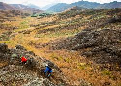
Croy Creek Trail System
Hailey, Idaho
3.8 miles SWAbout 18.5 miles of BLM and Blaine County singletrack in the sage foothills west of Hailey, rebuilt by IMBA after the 2013 Beaver Creek Fire and open early May to mid-November.
Atv/motorcycle, Hike, Mountain Bike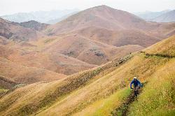
Two Dog
Hailey, Idaho
4.7 miles SWThe longest trail in the Croy Creek system, about 7.4 miles of non-motorized singletrack from Bullion Gulch Road over a sage saddle and down into the Croy Creek valley.
Hike, Mountain Bike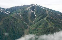
Bald Mountain Trail
Ketchum, Idaho
10.8 miles NThe main hiking and uphill-only biking route up Bald Mountain, climbing about 5.2 miles and 3,200 feet from River Run Plaza in Ketchum. Many hikers stop at the Roundhouse about 4 miles up.
Hike, Mountain Bike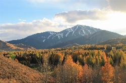
White Cloud Loop
Sun Valley, Idaho
12.3 miles NA 4.2-mile dirt loop around the White Clouds golf course in Sun Valley, maintained by Sun Valley Company and open to hikers, runners, riders and leashed dogs. It dries out early in spring and looks across at Bald Mountain and the Boulder Mountains.
Hike, Mountain Bike
Adams Gulch Loop
Ketchum, Idaho
13.3 miles NKetchum's busiest trail network, with easy loops on Shadyside and Sunnyside, the Griffin Butte intermediate loop and the one-way, bike-only Forbidden Fruit flow trail. The trailhead is less than two miles north of town.
Hike, Mountain Bike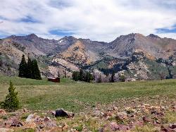
Pioneer Cabin Trail
Sun Valley
15.5 miles NA steep, switchbacking trail from the Corral Creek trailhead east of Sun Valley to Pioneer Cabin, a 1937 Union Pacific ski hut with close views of the Pioneer Mountains.
Hike, Mountain Bike
Fox Creek Loop
Ketchum, Idaho
17.0 miles NA 6-mile singletrack loop north of Ketchum that climbs through the 2007 Castle Rock burn, drops through aspen and finishes along the Big Wood River. Bikes ride it one way, counter-clockwise.
Hike, Mountain Bike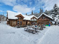
Harriman Trail
Ketchum
19.4 miles NAn 18-mile gravel path from the Sawtooth National Recreation Area headquarters north of Ketchum to Galena Lodge. It is open to bikes, hikers and horses in summer and groomed by BCRD for Nordic skiing in winter.
Cross-country Ski, Cycle, Hike, Mountain Bike 3.4 mi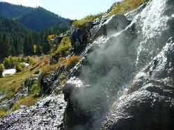
Skillern Hot Springs
Fairfield, Idaho
26.8 miles WA stunning six-mile trail along crystal-clear Big Smoky Creek to a hot spring — spectacular in fall, with two trail options and a sign marking the final three miles.
Camp, Hike, Hot Springs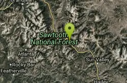
Galena Lodge
Ketchum, Idaho
29.8 miles NWA community-owned historic lodge 23 miles north of Sun Valley, open summer and winter as a hub for hikers, bikers, Nordic skiers, and snowshoers with rentals and great food.
Camp, Cross-country Ski, Snowshoe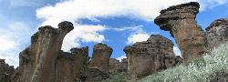
Little City of Rocks
Gooding, Idaho
33.6 miles SWA volcanic hoodoo landscape of natural arches, towers, and mushroom-cap formations near Gooding, Idaho — best visited in spring when desert wildflowers bloom and the main loop trail is scenic.
Camp, Hike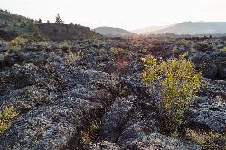
North Crater Flow
Arco, Idaho
37.9 miles EThe North Crater Flow Trail is one of the best first stops at Craters of the Moon National Monument, a short, paved, accessible loop that carries visitors out across a genuine river of hardened lava...
Hike 1.8 mi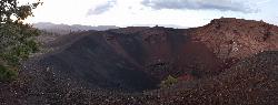
North Crater Trail
Visitors Center, Craters of the Moon National Monument
38.1 miles EA one-way trail through North Crater and Big Craters at Craters of the Moon — dropping into a volcanic crater mouth and ending at Spatter Cones, with fragile lava formations off-limits to protect.
Hike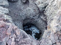
Snow Cone
Visitors Center, Craters of the Moon National Monument
38.1 miles EThe Snow Cone is one of the more surprising little features at Craters of the Moon National Monument, a small, narrow, deep spatter cone on the volcanic Snake River Plain of central Idaho that holds...
Hike 0.1 mi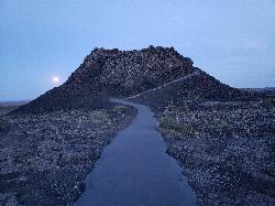
Spatter Cones
Visitors Center, Craters of the Moon National Monument
38.1 miles EMiniature volcanoes formed by lobbed molten lava blobs at Craters of the Moon — a must-see feature that symbolizes this unique national monument; stay on trails to protect the delicate spatter cones.
Hike 0.4 mi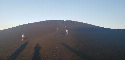
Inferno Cone
Visitors Center, Craters of the Moon National Monument
38.3 miles EA steep climb up Inferno Cone at Craters of the Moon, rewarded with panoramic views of the Great Rift, Snake River Plain, and Pioneer Mountains — and on clear days, the Tetons 100 miles away.
Hike 1.9 mi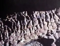
Tree Molds Trail
Visitors Center, Craters of the Moon National Monument
38.7 miles EA paved trail winding through Craters of the Moon Wilderness to a lava flow that captured the shapes of fallen and standing trees in cooling rock — look for wooden posts marking the molds.
Hike 1.7 mi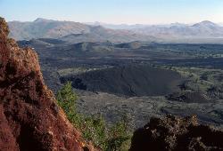
Broken Top Loop Trail
Visitors Center, Craters of the Moon National Monument
38.7 miles EA hike over, under, and around a 2,000-year-old cinder cone and lava flows in Craters of the Moon, with access to Buffalo Cave — bring a flashlight and free permit.
Cave, HikeNearby Campsites
Magic Reservoir
Bellevue
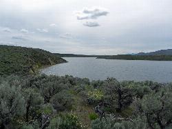
14.3 miles SWMagic Reservoir is a big irrigation lake on the Big Wood River surrounded by BLM sagebrush land, with free ramps and primitive camps. It is known for trout, perch and ice fishing, but water levels swing hard with irrigation demand.
Camp, Canoe, Kayak
Worswick Hot Springs
Fairfield, Idaho
24.7 miles WFree hillside hot spring pools on Worswick Creek in the Sawtooth National Forest, about 20 miles north of Fairfield. The lower pools run about 90 to 105 degrees, and the source water is hot enough to scald.
Camp, Hot Springs
Preis Hot Spring
Fairfield, Idaho
26.4 miles WA small sunken wooden box beside Forest Road 227 north of Fairfield that fits two people in clear, roughly 102 degree water. Pair it with Worswick Hot Springs a couple of miles away.
Camp, Hot Springs 3.4 mi
Skillern Hot Springs
Fairfield, Idaho
26.8 miles WA stunning six-mile trail along crystal-clear Big Smoky Creek to a hot spring — spectacular in fall, with two trail options and a sign marking the final three miles.
Camp, Hike, Hot Springs
Galena Lodge
Ketchum, Idaho
29.8 miles NWA community-owned historic lodge 23 miles north of Sun Valley, open summer and winter as a hub for hikers, bikers, Nordic skiers, and snowshoers with rentals and great food.
Camp, Cross-country Ski, Snowshoe
Mormon Reservoir
Fairfield
29.9 miles SWIrrigation reservoir on McKinney Creek about five miles south of Fairfield, with a free Idaho Fish and Game boat ramp, docks, toilets and primitive camping. It is stocked with rainbow trout, but the water drops hard by late summer and in dry years.
Camp, Canoe, Kayak
Little City of Rocks
Gooding, Idaho
33.6 miles SWA volcanic hoodoo landscape of natural arches, towers, and mushroom-cap formations near Gooding, Idaho — best visited in spring when desert wildflowers bloom and the main loop trail is scenic.
Camp, Hike
Lava Flow Campground
Arco, Idaho
37.9 miles EA campground surrounded by a young lava flow near the Craters of the Moon visitor center and popular trails — 42 first-come sites at $15/night during main season.
Camp
McKinney Butte Lava Tubes
Gooding, Idaho
43.8 miles SWTwo forking lava tubes near Bliss — one open to anyone, the other gated (BLM permit required) — that survived the Bonneville Flood and a 1993 landslide.
Camp, Cave


