


Riddle Lake Hike
Grant Village, Yellowstone National Park
| Address: | Yellowstone National Park, Yellowstone National Park, WY 82190, USA |
| GPS: |
44°21'30.6"N 110°34'54.3"W Maps | Directions |
| State: | Wyoming |
| Trails/Routes: | 4.9 mi |
National Park
Hike
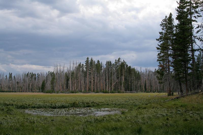
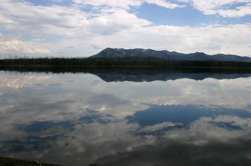
Riddle Lake hike is a 5 mile roundtrip hike. Riddle Lake is an alluring body of water with a sandy beach. The hiker gets the best of both worlds on this hike. Impressive pine and mountain views, meadows, and a lake with a mini beach area.The trail is an easy hike because elevation is hardly detectable, and allows the hiker to focus on the scenery.This hike takes you through a blanket of forest, then a dirt trail. You will pass several tree trunks covered in scratch marks, offering fresh evidence that bears frequent this area*. This hike is closed for a majority of the hiking season due to swans nesting in that area. To know if it is available to hike, contact a park ranger.
The history of Riddle lake dates back a few centuries. It was named by early explorers in the 1800's who were uncertain about which ocean the lake drained toward because it sits so close to the Continental Divide- it was believed flow toward both the east and west oceans and then later discovered that it actually flowed into Yellowstone Lake.
This area does attract a lot of wildlife such as Elk, Moose and Grizzly bears. Upon reaching the lake you can see the Red Mountains to the south. The trail then follows the shore and eventually ends at a black sand beach on the northeast side. Many people stop their hike when they approach the lake, but you can continue around the lake to enjoy the scenery.
This is considered an easy hike with little elevation difference.
*WARNING: To stay extra safe, it is smart to have bear spray with you on your hike and also to make noise while you are on your hike to keep wildlife away. When it comes to wildlife, if you see them on your hike, do not approach them, for your own safety. You can take pictures of wild life but do not approach to pet.
More Information
Yellowstone National Park Itinerary
This Yellowstone National Park Itinerary will help you get started as you plan your vacation to Yellowstone National Park.
https://www.justgotravelstudios.com/collections/national-park-itineraries/products/yellowstone-national-park-itinerary?ref=9zpxis0diinBackcountry Conditions - Yellowstone National Park (U.S. National Park Service)
This page provides a map and details conditions of trail status, closures, and known hazards.
https://www.nps.gov/yell/planyourvisit/situationreport.htmOops! We ran into some problems. | Backcountry Post
Forums New posts Search forums What's new Featured content New posts New resources Latest activity Resources Latest reviews Search resources Store Log in Register What's new Search Search Search titles only Note By: Search Advanced search… Latest activity Register Menu Log in Register Navigation Install the app Install How to install the app on iOS Follow along with the video below to see how to install our site as a web app on your home screen.
https://backcountrypost.com/trail-guides/riddle-lake.56/Yellowstone National Park: Riddle Lake
This easy-going hike winds past lodgepole forest and grassy stream beds to the black sand beaches of a backcountry lake in Yellowstone National Park.
https://www.backpacker.com/trips/yellowstone-national-park-riddle-lake/Be courteous, informed, and prepared. Read trailhead guidelines, stay on the trail, and don't feed the wildlife.
Read More
- Plan Ahead and Prepare
- Travel & camp on durable surfaces
- Dispose of waste properly
- Leave what you find
- Minimize campfire impacts
- Respect wildlife
- Be considerate of other visitors
Directions
From Grant Village, Yellowstone National Park
- Head north toward Rainbow Loop (105 ft)
- Turn left onto Rainbow Loop (315 ft)
- Turn left onto Grant Village Rd (1.0 mi)
- Turn left onto US-191 S/
US-287 S/ US-89 S Toll roadParts of this road may be closed at certain times or daysDestination will be on the left(2.3 mi)
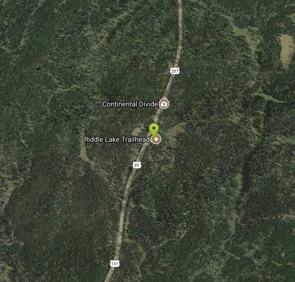
To get to the trailhead: From Grant Village at the bottom of the West Thumb of Yellowstone Lake, Drive 2.3 miles south on South Entrance Road (Routes 191 and 89) to the trailhead on the east side of the road. From the other direction, the trailhead is 17.2 miles north of the south entrance of Yellowstone National Park.
Trailhead address: South Entrance Road (Route 191 & 89), Yellowstone National Park, WY 82190
Trailhead coordinates: 44.358408, -110.582163 (44° 21′ 30.26″N 110° 34′ 55.78″W)


Other Hiking Trails Nearby

Lewis River Channel / Dogshead Loop
Grant Village, Yellowstone National Park
2.8 miles SA serene hike along Lewis Channel to Shoshone Lake — the largest lake in the continental US without a road to it — with Teton views, driftwood shores, osprey, bald eagles, and ravens.
Canoe, Hike, Kayak 6.9 mi
Heart Lake Trail
Grant Village, Yellowstone National Park
3.0 miles SAn 8-mile moderate hike to a remote backcountry lake with blue thermal pools, fumaroles, Rustic Geyser, and remarkable fishing for native cutthroat, mountain whitefish, and Arctic grayling.
Backpack, Camp, Hike, Hot Springs 1.4 mi
Yellowstone Lake Overlook Trail
Grant Village, Yellowstone National Park
3.9 miles NAn easy 1.7-mile loop from the West Thumb Geyser Basin parking lot with a rewarding overlook of Yellowstone Lake — a great beginner hike open in summer and fall.
Hike
Lake Overlook
Grant Village, Yellowstone National Park
4.0 miles NA 1.7-mile escape from the West Thumb crowds, leading through forest to a mountain-top meadow overlook of West Geyser and Yellowstone Lake.
Hike 0.4 mi
West Thumb Geyser Basin
Grant Visitor's Center, Yellowstone National Park
4.0 miles NBoardwalks trace the edge of Yellowstone Lake at the scenic West Thumb Geyser Basin — hot springs, mud pots, fumaroles, lake shore geysers, and underwater vents in one compact visit.
Hike 0.5 mi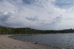
Duck Lake
Grant Village, Yellowstone National Park
4.0 miles NA short 0.8-mile hike through lodgepole pine in Yellowstone near West Thumb, revealing the fire history of 1988 and a quiet, calm lake with a sandy beach feel.
Hike 6.1 mi
Shoshone Lake (via DeLacy Creek)
Old Faithful, Yellowstone National Park
8.5 miles NWA 6.1-mile forest and grassy hike from Old Faithful to the shore of Shoshone Lake — a perfect crowd-escape option with fishing permitted (permit required) and backcountry hot spring access.
Hike 2.6 mi
Lone Star Geyser Trail
Old Faithful, Yellowstone National Park
11.9 miles WA 4.8-mile round-trip trail through forest to a colorful geyser that erupts 30–45 feet into the air about every 3 hours — bikeable the entire way.
Hike, Mountain Bike 3.1 mi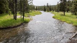
Mallard Lake
Old Faithful, Yellowstone National Park
13.7 miles NWA 10-mile roundtrip Yellowstone hike through changing scenery — pine forest, rocky terrain, and grassy meadows — arriving at a calm, wildflower-ringed lake with a bird's-eye view of Old Faithful.
Hike 2.3 mi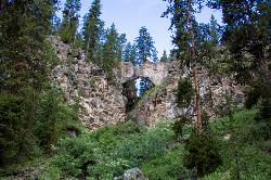
Natural Bridge Trail
Lake Village, Yellowstone National Park
13.9 miles NEAn easy 2-mile trail through forests and meadows to a bridge carved by a creek wearing through rhyolite — best views come from hiking around to the back of the arch.
Hike, Mountain Bike 6.2 mi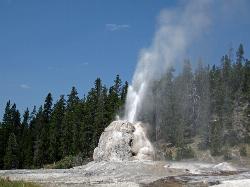
Howard Eaton Trail
Old Faithful, Yellowstone National Park
13.9 miles NWA moderately difficult 6.5-mile there-and-back trail from Old Faithful through spruce-fir forest, past geysers and springs, culminating at the impressive Lonestar Geyser which erupts every three hours.
Hike 1.5 mi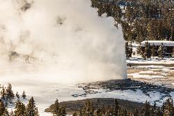
Observation Point Trail
Old Faithful, Yellowstone National Park
14.0 miles NWA lightly trafficked 2-mile loop that offers an elevated aerial view of Old Faithful and passes close-up geysers on the way to Solitary Geyser — the quieter way to see the iconic geyser.
Hike
Old Faithful Geyser
Old Faithful, Yellowstone National Park
14.0 miles NWOld Faithful has erupted every 44 to 125 minutes since 2000, making it one of the world's most predictable geysers — a must-see centerpiece of Yellowstone National Park.
Hike 0.3-0.5 mi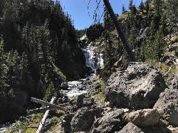
Mystic Falls
Old Faithful, Yellowstone National Park
16.0 miles NWA lesser-known Yellowstone gem — a 70-foot cascading waterfall on Little Firehole River surrounded by quiet forest, with short and long viewing trails both described as easy.
Hike 2.8 mi
Elephant Back Mountain Trail
Lake Village, Yellowstone National Park
16.4 miles NEA 3-mile loop trail climbing 800 feet to a stunning overlook of Yellowstone Lake near Lake Village — a moderate hike open in summer and fall.
Hike 2.0 mi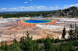
Grand Prismatic Spring Overlook Trail
Old Faithful, Yellowstone National Park
16.4 miles NWA 1.2-mile forested round-trip trail climbing to a sweeping overlook of the Grand Prismatic Spring and entire Midway Geyser Basin — the rainbow colors are best seen from above.
Hike 1.5-5.0 mi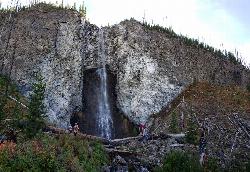
Fairy Falls
Old Faithful, Yellowstone National Park
16.4 miles NWA 197-foot wispy waterfall deep in Yellowstone, along a mostly flat trail past Grand Prismatic Spring — at its most magical in spring snowmelt, quieter than the crowded geyser basin stretches.
Hike 0.7 mi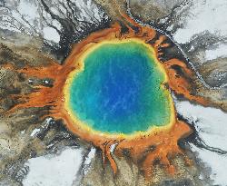
Grand Prismatic Spring
Old Faithful, Yellowstone National Park
17.2 miles NWThe largest hot spring in the United States sits in Yellowstone's Midway Geyser Basin — a vivid rainbow of thermophilic colors that makes Grand Prismatic Spring a must-see.
Hike 0.6 mi
Pelican Creek Nature Trail
Lake Village, Yellowstone National Park
17.6 miles NEA short 0.6-mile loop past streams, forest, and the vast expanse of Yellowstone Lake — spot pelicans, grebes, and teals on this family-friendly walk.
Hike 7.4 mi
Pelican Valley Trail
Lake Village, Yellowstone National Park
18.7 miles NEA flat, easy 6.2-mile hike through forest, over bridges, and into Pelican Valley's marshy winding creek — some of the best grizzly bear country in Yellowstone, open July 4 through fall, daylight hours only.
HikeNearby Campsites

Grant Village
Grant Village, Yellowstone National Park
2.6 miles NNamed for President Grant near Yellowstone Lake's West Thumb, this village has lakeside dining, a geyser basin next door, campfire ranger programs, and tree-lined campsites steps from the water.
Camp, Canoe, Kayak 6.9 mi
Heart Lake Trail
Grant Village, Yellowstone National Park
3.0 miles SAn 8-mile moderate hike to a remote backcountry lake with blue thermal pools, fumaroles, Rustic Geyser, and remarkable fishing for native cutthroat, mountain whitefish, and Arctic grayling.
Backpack, Camp, Hike, Hot Springs 0.1 mi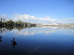
Lewis Lake Campground
Grant Village, Yellowstone National Park
5.7 miles SWYellowstone's third-largest lake draws canoeists, kayakers, and serious anglers, with a quiet campground open mid-June through early November on a first-come basis.
Camp, Canoe, Kayak
Bridge Bay
Lake Village, Yellowstone National Park
14.1 miles NEA scenic campground on the western shore of Yellowstone Lake at 7,800 feet — wooded upper loops, open meadows, and a nearby marina store, though far from the park's main dining hubs.
Camp
Fishing Bridge RV Campground
Lake Village, Yellowstone National Park
17.6 miles NEAn RV campground near the mouth of the Yellowstone River where visitors can watch White Pelicans, waterfowl, and trout from the historic Fishing Bridge — fishing from the bridge is no longer permitted.
Camp 14.8 mi
Biscuit Basin to Fairy Falls and Firehole Meadows
Old Faithful, Yellowstone National Park
19.2 miles NWA nearly 15-mile backcountry hike starting at Biscuit Basin passes turquoise pools, a 70-foot waterfall, Firehole Meadows, Imperial Geyser, and three stunning blue lakes with rust-red shores.
Backpack, Camp, Hike
Madison Campground
Madison, Yellowstone National Park
24.2 miles NWA partly wooded riverside campground at 6,800 feet in Yellowstone, close to Old Faithful and the geyser basins, with great fishing on the Madison River and 270-plus individual sites.
Camp 0.8-3.8 mi
Little Gibbon Falls
Norris, Yellowstone National Park
24.6 miles NA family-friendly 4.5-mile Yellowstone loop reaches fishing and swimming spots along Gibbon Creek, with kid-safe trail, canoeing options, and bearspray-worthy backcountry feel.
Camp, Canoe, Hike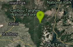
Loon Lake
Ashton, Idaho
24.9 miles SWLoon Lake is a small, lively mountain lake tucked into the Caribou-Targhee National Forest just off Ashton's Fish Creek Road, in the timbered high country of eastern Idaho near the gateway to...
Camp, Kayak, Swim
Cave Falls of Yellowstone
Ashton, Idaho
25.5 miles SWA campground right on the Fall River along Yellowstone's south boundary puts you steps from legendary fishing, with fire rings and bear-proof boxes at each site.
Camp, Hike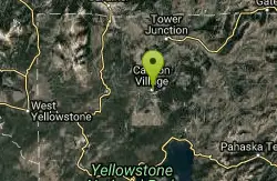
Canyon Campground
Canyon Junction, Yellowstone National Park
26.4 miles NA popular Yellowstone campground of 300-plus sites just minutes from the Grand Canyon of the Yellowstone and the Upper and Lower Falls, with hiking trails and North Rim Drive access right from camp.
Camp
Norris Campground
Norris, Yellowstone National Park
26.8 miles NCentrally located in Yellowstone NP, this campground puts you within a short drive of Grand Canyon of the Yellowstone, Hayden Valley, Old Faithful, and Yellowstone Lake.
Camp 17.5 mi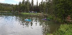
Tear Drop Lake
Ashton, Idaho
28.6 miles WA small, lively lake in the Targhee forest for kayaking, swimming, and an easy loop trail — family fun with primitive lakeside camping.
Camp, Canoe, Hike, Kayak, Mountain Bike, Swim
Horseshoe Lake
Ashton, Idaho
29.1 miles SWA lily-pad-dotted lake hidden in the Targhee National Forest with a gradual beach entry perfect for wading, a floating dock for jumping, and no motorized boats.
Camp, Canoe, Dive, Swim
Sheep Falls on Fall River
Ashton, Idaho
31.8 miles SWA local gem off Cave Falls Road where the river splits into multiple falls tumbling over each other — primitive campsites and beautiful views make it a great picnic stop.
Camp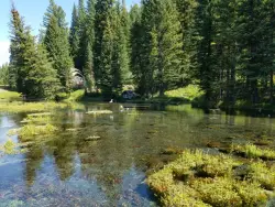
Big Springs
Island Park, Idaho
34.6 miles WA Big Springs campground shaded by Lodgepole Pines on Henry's Fork — with a 1-mile interpretive trail, fish feeding under the bridge, the historic Johnny Sack Cabin, and access to the Mesa Falls Scenic Byway.
Camp, Hike
Porcupine Creek
Ashton, Idaho
36.8 miles SWA backcountry hunting, fishing, camping, and swimming spot in Targhee National Forest, surrounded by forests, meadows, a creek, and unmarked trails — bear country, so pack and store food carefully.
Camp, Swim
Indian Creek Campground Yellowstone
Mammoth Hot Springs, Yellowstone National Park
36.9 miles NIndian Creek Campground is a quiet, wooded, tent-friendly Yellowstone campground near Mammoth Hot Springs, big on wildlife and peace.
Camp 0.3-0.6 mi
Bear Gulch
Ashton, Idaho
37.8 miles WAn abandoned ski hill from 1969 with overgrown runs that still deliver great sledding — the lower run is fast and winding all the way down to the old ski lift.
Camp, Cross-country Ski, Hike, Sled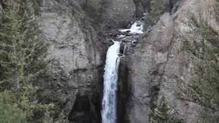
Tower Falls
Tower Junction, Yellowstone National Park
38.0 miles NTower Fall plunges 132 feet off Tower Creek in Yellowstone, framed by dramatic rock pinnacles — located about 3 miles south of Roosevelt Junction.
Camp, Hike


