


255 Things to do near Conant Creek Pegram Truss Railroad Bridge
first prev 1 2 3 4 5 6 7 8 9 10 next lastShowing results within 50 miles Distance miles of 3968 E 1000 N, Ashton, ID 83420, USA City, Zip, or Address

Sheep Bridge Trail
Driggs, Idaho
26.5 miles SEThis is a great easy trail for beginner hikers or mountain bikers. In the early summer, you'll find many beautiful wildflowers and large kaleidoscopes of butterflies to go with them. You...
Hike, Mountain Bike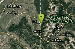
Spring Creek Trail
Alta, Wyoming
26.7 miles SEThis trail starts at the remains of the historic Rapid Creek Ranger Station. The trail heads east following an old road. After crossing Rapid Creek, the trail climbs up to a ridge...
Mountain Bike 1.9 mi
Terraced Falls
Grant Village, Yellowstone National Park
26.8 miles E3.6 mile easy out and back trail. 430 ft Elevation gain. The trailhead is off Ashton-Flagg Ranch Road along Yellowstone's South border. Ashton-Flagg Ranch Road is closed during the winter.
Hike 5.8 mi
Box Canyon Trail
Island Park, Idaho
26.8 miles NVarious species of tress and wildflowers can be seen on the trail, as well as songbirds, waterfowl and occasional wildlife. The trail is open for the following uses: Motorcycle Trail Riding, Off...
Hike, Mountain Bike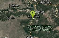
Box Canyon Island Park
Island Park, Idaho
26.9 miles NThe Box Canyon Campground is situated on the canyon rim above the Henry's Fork of the Snake River. There are 16 single and 2 double units, each having tent and camper pads, fire rings, grills...
Canoe 4.5 mi
Aspen Trail
Alta, Wyoming
26.9 miles SEAspen Trail (tr 034) is single track trail for 4.35 miles along 6,800 ft contour to Darby Canyon (tr 012). Spring Creek Trail (tr 032) is double track trail for 3.68 miles to end. The trail starts...
Hike, Mountain Bike 0.8-1.3 mi
Warm Slough Campground
Rexburg, Idaho
27.1 miles SWThis is a pretty popular campsite that fills up pretty quick on busy weekends. Campsites are fairly spread out and there is no official donation box (as of July 2015). A couple of the campsites...
Airsoft, Camp, Canoe 13.3 mi
Cranky Buckskin Randy
Herbert, Idaho
27.1 miles SWThanks to the Snake River Trail Alliance, this route connects 3 great trails between the Buckskin Morgan parking area at the top and the Luthy's Corral parking at the bottom (new in...
Mountain Bike
Cranky Cowboy
Herbert, Idaho
27.1 miles SWMountain Bike near Herbert, Idaho
Mountain Bike 0.6-2.2 mi
Fish Creek Area
Ririe, Idaho
27.1 miles SFish Creek is a network of mountain bike trails up in the Big Hole Mountains. The trails are easily accessed from either the Ririe or Rexburg side of the range. The trail system is set up much...
Hike, Mountain Bike
Big Hole Dispersed Campsites
Ririe, Idaho
27.2 miles SWA dispersed campsite is simply an unestablished and unmaintained area where people camp. Often, this means that there is a campfire or other basic campsite feature to identify the site and that's...
Camp
Bighole Mountains / Moody
Ririe, Idaho
27.4 miles SWThis is a little unofficial campground with a plenty of shade for your basecamp and a wooded field with great boundaries. There's 2 roads that split and merge giving you very simple...
Airsoft, Paintball

Kelly Canyon Loops
Ririe, Idaho
27.6 miles SWThis mountain bike trail near Kelly Canyon Ski Area has several options available. Highlights are the views in all directions from the top of the mountain. Trails: Waterfall...
Mountain Bike 0.9 mi
Buffalo River Campground
Island Park, Idaho
27.7 miles NThe float here is nice and easy. It's a great early season float. Later in the season the shallow spots will force you to walk a good chunk of the float. The water is super clear and often pretty...
Camp, Canoe, Kayak, Swim
Pine Butte / The Caldera
St. Anthony, Idaho
27.8 miles NWThis is about as close to an oasis as you can get in the deserts of Idaho. It's an old volcano in the middle of the sagebrush desert. As soon as you start down the path, you can feel the air...
Camp, Hike, Horseback
Henderson Canyon
Victor, Idaho
27.8 miles STrail begins as dirt road/double track with numerous "cow" trails breaking off of road. Some of these trails see more tire tracks than others.
Mountain Bike
Reunion Flat Campground
Alta, Wyoming
27.9 miles SECamp near Alta, Wyoming
Camp 11.9 mi
Waterfall Loop
Ririe, Idaho
28.2 miles SWTrail is a mixture of single track, forest road and double track. Provides a variety of scenery. About 1400 feet of elevation change throughout the trail.GPS is a must unless you are going with...
Mountain Bike 2.1 mi
Batman
Ririe, Idaho
28.7 miles SWThis trail features rolling terrain, and multiple short, steep downhill sections followed by short steep uphill sections. This trail follows the fence line. Watch out for cows (and cow droppings)...
Mountain Bike 5.7-8.1 mi
Space Cruz
Ririe, Idaho
28.8 miles SWThe trail starts out with a really flowy singletrack then connects up to some ATV trails. On the single track, just stay on the main trail. There are several little splits several you can take...
Cross-country Ski, Mountain Bike


