


194 Things to do near Grand Teton
first prev 1 2 3 4 5 6 7 8 9 10 next lastShowing results within 50 miles Distance miles of 672 Lupine Meadows Rd, Alta, WY 83414, USA City, Zip, or Address

Webster's Dam
Ririe, Idaho
42.9 miles WAlso known as Manmade Falls or the Woodmansee Dam, Webster Dam is an abandoned dam located deep in Moody Creek canyon, the dam was abandoned when sediment built up behind the dam which then...
Camp, Hike, Mountain Bike
Lower Hawley Gulch Trail
Ririe, Idaho
43.0 miles WThis is a singletrack biking trail in Ririe, Idaho. The trail is mainly flat with a few gradual slopes. You may have to carry your bike over obstacles such as fallen trees, logs, and small ponds....
Mountain Bike
Table Rock Campground
Ririe, Idaho
43.0 miles WTable Rock / Poison Flat Campground is located at the Caribou-Targhee National Forest which occupies over 3 million acres and stretches across southeastern Idaho, from the Montana, Utah, and Wyoming...
Camp
Kelly Canyon/Table Rock
Ririe, Idaho
43.1 miles WThe initial climb is soft, so you might wash out a little. There are enough roots and rocks to add some challenge to the climb and some air to the descent. The trail forks at one point,...
Mountain Bike 1.1 mi
Hidden Vista / Pine Loop
Ririe, Idaho
43.1 miles WYou'll find the Hidden Vista trailhead on the South End of the Buckskin Morgan parking lot about a mile past Y Junction. This is a short trail with a little up and a little down for just under a...
Hike, Mountain Bike 5.7-8.1 mi
Space Cruz
Ririe, Idaho
43.2 miles WThe trail starts out with a really flowy singletrack then connects up to some ATV trails. On the single track, just stay on the main trail. There are several little splits several you can take...
Cross-country Ski, Mountain Bike
Bighole Mountains / Moody
Ririe, Idaho
43.2 miles WThis is a little unofficial campground with a plenty of shade for your basecamp and a wooded field with great boundaries. There's 2 roads that split and merge giving you very simple...
Airsoft, Paintball 1.7 mi
Buckskin Morgan Ridge
Ririe, Idaho
43.2 miles WGoing up is a little tough because of the rocks, but once you clear the top it is a twisty down hill portion [until] you get to a fenced road. From there you can turn around or keep going strait...
Hike, Mountain Bike

Poison Flats
Ririe, Idaho
43.3 miles WHike near Ririe, Idaho
Hike
Big Hole Dispersed Campsites
Ririe, Idaho
43.4 miles WA dispersed campsite is simply an unestablished and unmaintained area where people camp. Often, this means that there is a campfire or other basic campsite feature to identify the site and that's...
Camp
Flat Canyon Trail
Island Park, Idaho
43.4 miles NWNon-motorized use. souce: fs.usda.gov
Mountain Bike 4.8 mi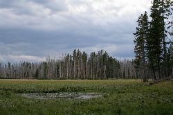
Riddle Lake Hike
Grant Village, Yellowstone National Park
43.8 miles NRiddle Lake hike is a 5 mile roundtrip hike. Riddle Lake is an alluring body of water with a sandy beach. The hiker gets the best of both worlds on this hike. Impressive pine and mountain views,...
Hike 3.8 mi
Kelly Mountain Trail
Ririe, Idaho
43.9 miles WKelly Canyon Trail is a moderate, uphill trail that can be used by hikers, mountain bikers, and ATV riders. The trail features views of hills, mountains, trees, wildflowers, and some wildlife. Dogs...
Cross-country Ski, Hike, Mountain Bike, Snowshoe 1.8 mi
Crystal Cruise
Ririe, Idaho
44.1 miles WThis trail uses the Crystal Cruise Nordic Trail along the Kelly Canyon ski resort boundary, taking you up to Kelly Canyon proper. It's a good climb, and a quick downhill back to the parking...
Mountain Bike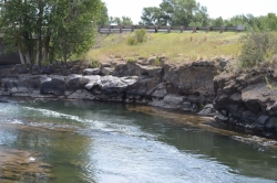
Fall River Bridge
Ashton, Idaho
44.2 miles NWRight off Highway 20, there's a great spot to swim, swing, and dive. There's pullouts for parking right next to the bridge. There's a rope swing under the railroad bridge and a little...
Dive, Swim
Wolf Flats Recreation Area
Ririe, Idaho
44.5 miles WWolf Flats is a completely free, dispersed, undeveloped camping area with 25 locations to camp. Some areas are large enough to accommodate groups of 50 people.
Camp 2.1 mi
Batman
Ririe, Idaho
44.6 miles WThis trail features rolling terrain, and multiple short, steep downhill sections followed by short steep uphill sections. This trail follows the fence line. Watch out for cows (and cow droppings)...
Mountain Bike 1.7 mi
Randy's Cow Trail / Ken's Corner
Ririe, Idaho
44.6 miles WThis trail descends from the fence corner at the West end of Batman and continues down to Lyon's Creek Parking just off Lyon's road. The top of this trail is only a couple hundred yards from...
Mountain Bike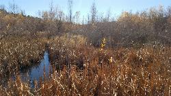
River Rush
Ashton, Idaho
44.6 miles NWPaintball near Ashton, Idaho
Paintball
Kelly Canyon
Ririe, Idaho
44.9 miles WThe trail switchbacks up Kelly Mountain, hitting two brief red-line climbs before you get up on the top. The famed "Shale Chute" is back there somewhere (so this is part of the route for...
Mountain Bike


