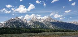
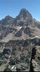
Grand Teton
Jackson Hole, Wyoming
| Address: | 672 Lupine Meadows Rd, Alta, WY 83414, USA |
| GPS: |
43°44'4.8"N 110°44'29.5"W Maps | Directions |
| State: | Wyoming |
| Trails/Routes: | 3.9-14.4 mi |
Restrooms Waterfalls Streams Glaciers Trails Rocks Wildflowers National Park
Backpack, Hike, and Rock Climb
At 13,770 feet above sea level, the Grand Teton towers majestic over Southeastern Idaho and Western Wyoming, making it a life goal of many amateur climbers and outdoor enthusiasts.
The more popular routes all begin at the Lupine Meadows Trailhead and continue up through Garnet Canyon and The Meadows before splitting North. Most routes require rock climbing equipment and are only for skilled climbers. A guide is highly encouraged on any route. With 3k feet of exposure, falling from multiple segments of the trail would mean certain death.
Trailhead altitude: 6,732 ft
Summit altitude: 13,770 ft
Mapped Route/Trail Distances
| Grand Teton via Owen-Spaulding | 14.2 miles Round Trip |
| Grand Teton via Upper Exum | 14.4 miles Round Trip |
| Ford-Stettner Couloir from Meadows | 3.9 miles Round Trip |
More Information
Be courteous, informed, and prepared. Read trailhead guidelines, stay on the trail, and don't feed the wildlife.
Read MoreDirections
From Jackson Hole, Wyoming
- Head north on US-191 N/US-26 E/US-89 N/N Cache St toward E Deloney AveContinue to follow US-191 N/US-26 E/US-89 N(6.8 mi)
- At the traffic circle, take the 2nd exit and stay on US-191 N/US-26 E/US-89 N (5.5 mi)
- Turn left onto Teton Park Rd (1.0 mi)
- Keep right to stay on Teton Park RdParts of this road may be closed at certain times or days(6.2 mi)
- Turn left onto Lupine Meadows Rd (0.3 mi)
- Turn right to stay on Lupine Meadows Rd (1.3 mi)
Trails
Distance ?
14.2 miles Round TripElevation Gain ?
7,015 feetReal Ascent ?
7,638 feetReal Descent ?
623 feetAvg Grade (11°)
20%Grade (-43° to 61°)
-94% to 180%Distance ?
14.4 miles Round TripElevation Gain ?
7,014 feetReal Ascent ?
7,696 feetReal Descent ?
682 feetAvg Grade (11°)
19%Grade (-43° to 67°)
-94% to 230%Distance ?
3.9 miles Round TripElevation Gain ?
4,552 feetReal Ascent ?
4,714 feetReal Descent ?
162 feetAvg Grade (27°)
51%Grade (-48° to 61°)
-112% to 180%Elevation differences are scaled for emphasis. While the numbers are accurate, the cut-away shown here is not to scale.
Other Rock Climbing Walls, Hiking Trails, and Backpacking Trails Nearby

Middle Teton
Jackson Hole, Wyoming
0.0 miles NEAt 12,804 ft above sea level, the Middle Teton is a challenging and beautiful hike from the trailhead all the way to the peak. The first part of the trail is dirt trails through the trees. That...
Backpack, Hike, Rock Climb
Mount Owen
Jackson, Wyoming
0.0 miles NHike near Jackson, Wyoming
Hike
Teewinot Mountain
Jackson Hole, Wyoming
0.1 miles NBackpack and Hike near Jackson Hole, Wyoming
Backpack, Hike 24.3 mi
Cascade Canyon Trail
Jackson Hole, Wyoming
1.5 miles NEThis hike starts the same as the Jenny Lake trail, then after you pass the boat dock, it takes off up Cascade Canyon just to the north of Teewinot, Mount Owen, and the Grand Teton along Cascade...
Backpack, Hike 4.9 mi
Amphitheater Lake
Alta, Wyoming
2.0 miles WBackpack and Hike near Alta, Wyoming
Backpack, Hike 0.3-5.1 mi
Jenny Lake Trail
Jackson Hole, Wyoming
2.2 miles NOne of the most popular trails to visit in Grand Teton is the Jenny Lake Trail. The Jenny Lake Trail, located near Moose, Wyoming, is an easy trail that loops around the lake. Along with the sheer...
Hike 10.5-16.2 mi
Paintbrush Canyon
Alta, Wyoming
3.5 miles NBeautiful trail along String Lake, Leigh Lake, and Lake Solitude. For even more solitude, scramble up the rocks to Micah Lake for a beautiful view and even fewer people. You won't find...
Backpack, Hike 3.6 mi
String Lake
Alta, Wyoming
3.5 miles NString Lake is a shallow lake that connects Leigh Lake and Jenny Lake at the base of Mount St. John and Rockchuck Peak. From the lakeshore, you can also take in beautiful views of Teewinot and Mt....
Canoe, Hike, Kayak, Swim 0.1-7.3 mi
Leigh Lake
Alta, Wyoming
3.8 miles NEnjoy the grandeur of Grand Teton National Park just a little ways off the beaten path. Leigh Lake rests underneath the majestic Mount Moran. The waters of Leigh Lake flow almost directly into String...
Backpack, Canoe, Hike, Kayak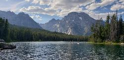
Mt. Moran
Alta, Wyoming
7.2 miles NMount Moran (12,610 feet (3,840 m)) is a mountain in Grand Teton National Park of western Wyoming, USA. The mountain is named for Thomas Moran, an American western frontier landscape artist....
Hike 1.3-4.3 mi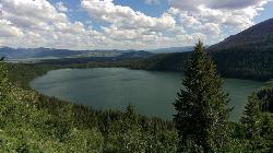
Phelps Lake
Jackson, Wyoming
7.6 miles SThe Phelps Lake trail, located in Teton National Park, Wyoming, is in one of the most scenic locations of the park. Usually overshadowed by nearby Jenny Lake, it can often be missed by visitors of...
Backpack, Camp, Dive, Hike, Swim
Jumping Rock at Phelp's Lake
Jackson, Wyoming
7.6 miles SJust below Teton's Death Canyon, on the eastern shore of Phelp's Lake is a 20 foot boulder sitting all by itself above deep water. It's almost if God said, "Those hikers will need a...
Dive, Hike, Swim 7.9 mi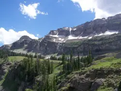
Devil's Stairs
Driggs, Idaho
8.8 miles WJust to the West of Table Rock is this often overlooked trail less traveled by, full of beautiful meadows and beautiful views all its own. The trail begins from the same campsite as the Table Rock...
Backpack, Hike 15.0-18.4 mi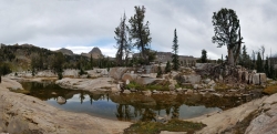
Alaska Basin
Driggs, Idaho
8.8 miles WThe Alaska Basin Trail is a stunning trail through the Jedediah Wilderness near Driggs, Idaho and goes East into Wyoming, just outside of Grand Teton National Park. The trail is wide...
Backpack, Hike, Horseback 3.8-6.4 mi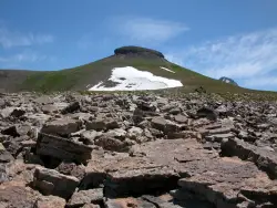
Table Rock / Table Mountain
Driggs, Idaho
8.9 miles WAt 11,300 feet, Table Mountain is possibly the most beautiful climb this side of the Tetons and offers what may well be the very best view of the Grand Tetons. It's just far enough away...
Camp, Hike 0.1-6.2 mi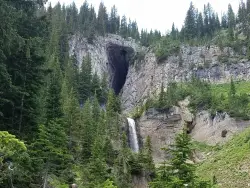
Darby Wind Cave
Driggs, Idaho
11.8 miles WDarby Wind Cave is a beautiful hike full of waterfalls, wildflowers, streams, and mountainous views. The sites you see will depend on the time of year you visit but it will always be beautiful and...
Backpack, Cave, Hike, Rock Climb 4.5 mi
Sheep Bridge Trail
Driggs, Idaho
12.4 miles WThis is a great easy trail for beginner hikers or mountain bikers. In the early summer, you'll find many beautiful wildflowers and large kaleidoscopes of butterflies to go with them. You...
Hike, Mountain Bike
Darby Canyon Cliffs
Alta, Wyoming
14.6 miles WAn interesting cave by Darby Canyon is the major draw to this popular west slope hike, closely followed by intermittent waterfalls splashing down the canyon rim along with impressive displays of...
Rock Climb 4.5 mi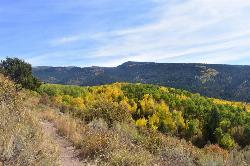
Aspen Trail
Alta, Wyoming
14.7 miles WAspen Trail (tr 034) is single track trail for 4.35 miles along 6,800 ft contour to Darby Canyon (tr 012). Spring Creek Trail (tr 032) is double track trail for 3.68 miles to end. The trail starts...
Hike, Mountain Bike
Blue Miner Lake
Jackson, Wyoming
16.5 miles SEBackpack and Hike near Jackson, Wyoming
Backpack, HikeNearby Campsites

Jenny Lake Campground
Jackson Hole, WY
1.5 miles NEJenny Lake campground is a scenic beauty in the heart of Grand Teton National Park. It's understandable why it often fills before 8 AM during peak summer periods. It's nestled right at the...
Camp 1.3-4.3 mi
Phelps Lake
Jackson, Wyoming
7.6 miles SThe Phelps Lake trail, located in Teton National Park, Wyoming, is in one of the most scenic locations of the park. Usually overshadowed by nearby Jenny Lake, it can often be missed by visitors of...
Backpack, Camp, Dive, Hike, Swim 3.8-6.4 mi
Table Rock / Table Mountain
Driggs, Idaho
8.9 miles WAt 11,300 feet, Table Mountain is possibly the most beautiful climb this side of the Tetons and offers what may well be the very best view of the Grand Tetons. It's just far enough away...
Camp, Hike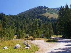
Teton Canyon Campground
Alta, Wyoming
9.0 miles WTeton Canyon is the start of several great adventures, including the Alaska Basin Trail, Table Rock, Devil's Stairs, and the Teton Crest. The campground offers a perfect basecamp to get an...
Camp
Reunion Flat Campground
Alta, Wyoming
10.6 miles WCamp near Alta, Wyoming
Camp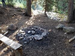
Darby Canyon Camping
Alta, Wyoming
14.6 miles WThere's no official campgrounds up the canyon but there are several dispersed campsites with existing fire lays. Please adhere to principles of Leave No Trace. Use existing fire lays and leave...
Camp
Crystal Creek Campground
Jackson, Wyoming
17.7 miles SECrystal Creek Campground is located along the Gros Ventre River and Crystal Creek, both designated Wild and Scenic Rivers for the spectacular surrounding scenery and excellent fishing opportunities....
Camp
Mike Harris Campground
Victor, Idaho
20.5 miles SWMike Harris Campground is located along scenic Teton Pass, just 5 miles from Victor, Idaho at an elevation of 6,200 feet. Visitors enjoy fishing, exploring local trails and sightseeing in this...
Camp
Badger Creek
Tetonia, Idaho
22.1 miles NWBadger Creek is a stream located just 13.6 miles from Ashton, in Teton County, in the state of Idaho, United States, near France, ID. Whether you’re spinning, baitcasting or fly fishing your...
Camp, Cross-country Ski, Hike, Mountain Bike, Rock Climb
Pine Creek Campground
Victor, Idaho
25.8 miles SWThe Pine Creek Campground has 10 single units and has restrooms.
Camp
Loon Lake
Ashton, Idaho
28.1 miles NCamp, Kayak, and Swim near Ashton, Idaho
Camp, Kayak, Swim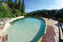
Granite Hot Springs
Jackson, Wyoming
29.3 miles SEThis from a report: Civilian Conservation Corps (CCC) constructed Granite Hot Springs Pool. While the hot springs have attracted visitors for thousands of years, it wasn't until the mid-1930s...
Camp, Hot Springs, Swim
Sheep Falls on Fall River
Ashton, Idaho
29.5 miles NWThe lesser known Sheep Falls on Fall River is a local treasure off of Cave Falls road. There are primitive campsites and beautiful views for a great picnic spot. The water splits and comes down in...
Camp
Cave Falls of Yellowstone
Ashton, Idaho
31.0 miles NWThis campgrond is situated on the banks of Fall River in Wyoming along the south border of Yellowstone National Park. Cave Falls Campground has 23 single site units and a terrific area for...
Camp, Hike 5.6-8.3 mi
Palisades Creek Trail / Lakes and Waterfall Canyon
Irwin, Idaho
33.2 miles SWPalisades Creek Trail is located about 50 miles southeast of Idaho Falls and about 60 miles west of Jackson Hole WY in Swan Valley Idaho. The four mile hike up to lower Palisades Lake or the 6.2 mile...
Backpack, Camp, Hike, Horseback, Mountain Bike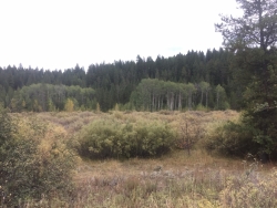
Porcupine Creek
Ashton, Idaho
34.0 miles NWPorcupine Creek is a hunting, fishing, camping, and swimming spot near Ashton, Idaho in Fremont County within Targhee National Forest. It's surrounded by forests, meadows, and a creek...
Camp, Swim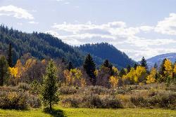
Big Elk Campground
Irwin, Idaho
34.1 miles SWBig Elk Creek Campground is a very versitile campground with plenty of activities to keep busy. Campgrounds are available, with three group sites that include picnic tables and campfire rings. There...
Camp 13.8 mi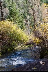
Big Elk Creek
Irwin, Idaho
34.2 miles SWBig Elk Creak Campground is a very versitile campground with plenty of activities to keep busy. Campgrounds are available, with three group sites that include picnic tables and campfire rings. There...
Backpack, Camp, Canoe, Hike, Horseback, Kayak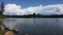
Horseshoe Lake
Ashton, Idaho
34.5 miles NWHorseshoe Lake is hidden back in the Targhee National Forest. It's a beautiful lake with plenty of lily pads. The road to get there is well maintained and there are many options for pull-outs...
Camp, Canoe, Dive, Swim
Moody Meadows
Driggs, Idaho
36.3 miles WGood place for kids, they can ride bikes in the meadow, play in the stream, and camping is off of the road. Hiking, motorbiking, and horseback riding trails are abundant in the area.
Camp


