


146 Things to do near Rexburg Area Ice Caves
first prev 1 2 3 4 5 6 7 8 next lastShowing results within 50 miles Distance miles of Rexburg Area Ice Caves near Rexburg, Idaho City, Zip, or Address

Pine Butte / The Caldera
St. Anthony, Idaho
1.5 miles NWAn old volcano in the Idaho desert that feels like stepping into a mountain forest — pine-covered hillsides, a meadow ringed by aspen and boulders, and a quarter-mile easy trail to the caldera floor.
Camp, Hike, Horseback 
Civil Defense Caves
Rexburg, Idaho
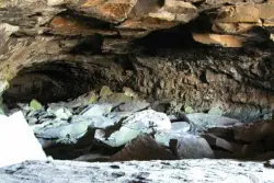
6.3 miles STwo large lava tubes with an arched ceiling, gravel floor, bats in the left branch, and a cavern section at the end — open May through September to protect the bat habitat.
Cave 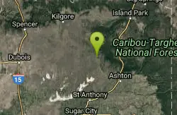
Sand Creek Frenzy
Ashton, Idaho
9.2 miles EThere are some woods back there and it is secluded. There are many places you can play just watch out for campers.
Paintball 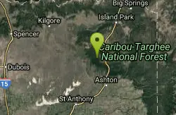
Big Bend Ridge Trail
Ashton, Idaho
14.3 miles EA smooth, swooping singletrack network near Driggs, Idaho with low elevation change, multiple route options, and a long riding season — one of the first trails to dry out each spring.
Mountain Bike 
St. Anthony Sand Dunes
Saint Anthony, Idaho
16.1 miles SWinter transforms the St. Anthony Sand Dunes into the smoothest sledding surface around — hills in every direction, bowl features, and halfpipe-like terrain on mountains of snow-covered sand.
Sled 0.6-4.7 mi
Harriman State Park
Island Park, Idaho
18.0 miles EAn 11,000-acre wildlife refuge 38 miles from Yellowstone along Henry's Fork — world-class fly-fishing, hiking among wildflowers and wildlife, plus 24 miles of Nordic ski trails in winter.
Cross-country Ski, Hike, Horseback, Mountain Bike, Snowshoe 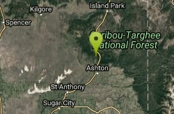
Ashton Hill
Ashton, Idaho
18.0 miles EFairly thick forest. Considerable underbrush. Lots of places in the area to play.
Airsoft, Paintball 4.8 mi
Aldous Lake and Hancock Lake
Kilgore, Idaho
18.3 miles NTwin alpine lakes — Aldous and Hancock — on a scenic 1.5-to-2.5-mile hike near Kilgore, with beautiful mountain scenery and heavier weekend crowds.
Backpack, Camp, Hike, Horseback, Swim 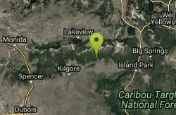
Howard Creek Trail
Island Park, Idaho
18.5 miles NA very primitive trail following Howard Creek upstream through a low canyon near Island Park — remote, quiet, and best used as a connector to the Continental Divide Trail.
Mountain Bike 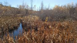
River Rush
Ashton, Idaho
19.1 miles SEPaintball near Ashton, Idaho
Paintball 
Egin Lakes
Saint Anthony, Idaho
19.5 miles SUnusually shallow, sandy lakes on the gateway to the St. Anthony Sand Dunes — great for water games in 2-to-3-foot-deep water, the closest thing to a real beach in SE Idaho.
Sled, Swim 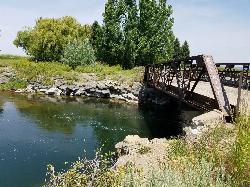
Twin Bridges
St. Anthony, Idaho
19.6 miles SEAn old abandoned bridge with two jump levels, a rope swing, and a little sandbar upstream — rarely crowded and great for families on warm days.
Dive, Swim 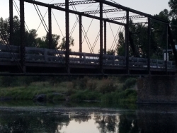
Fun Farm Bridge
Saint Anthony, Idaho
20.2 miles SEJump from road level, the bridge top, or the bars below at the Funny Farm Bridge — still an active road, so stay alert for vehicles, especially large trucks.
Dive, Swim 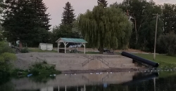
St. Anthony Sandbar
Saint Anthony, Idaho
20.3 miles SCLOSED. //// Sand Bar Update //// ***As of 27 June 2019 *** The Sand Bar is still closed to ALL swimming, please do not cross the boundary line. We are closely monitoring the river flows (currently at 2100 CFS) we typically like to see the levels at approximately 1200 CFS before swimmers are allowed in the water. We are anticipating opening the Sand Bar to swimmers very soon, we ask that you be patient and respect the closure until then. SAPD. A community river park with 60-plus years of history — water slide, diving board, floating platform, sandboxes, playground, and roped shallow and deep swimming areas on Henry's Fork.
Dive, Swim 
Henry's Fork Green Way (St. Anthony Green Belt)
Saint Anthony, Idaho
20.4 miles SAn easy paved 2-mile round-trip riverside walk along Henry's Fork in Saint Anthony — a statue of fur trader Andrew Henry at the halfway loop, and a pet-friendly, beginner-friendly path.
Hike 
Sheep Falls on Henry's Fork
Island Park, Idaho
20.4 miles EA 25-foot waterfall cascading through a narrow basalt chute on the North Fork of the Snake River — a pleasant, rarely crowded hike compared to nearby Mesa Falls.
Hike 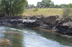
Fall River Bridge
Ashton, Idaho
20.9 miles SEA rope swing under a railroad bridge and a swimming hole just north — pull off Highway 20, check the mid-river rocks for water level, and enjoy a quick summer splash.
Dive, Swim 29.6 mi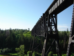
Ashton to Tetonia Trail
Ashton, Idaho
21.8 miles SEA 29.6-mile multi-use trail along a converted Union Pacific Railroad right-of-way from Ashton to Tetonia — open to bikes, ATVs, snowmobiles, runners, skiers, and horses with 787 ft of elevation gain southbound.
Mountain Bike 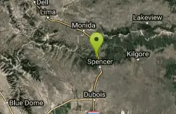
Stoddard Creek
Spencer, Idaho
23.5 miles NWA campground just 1 mile off I-15 and 17 miles north of Dubois, surrounded by trails and wildlife in scenic high desert — an easy-access base for exploring northern Idaho's backcountry.
Camp 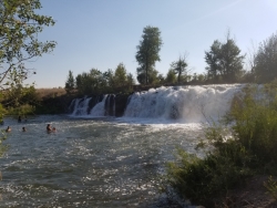
Monkey Rock
Saint Anthony, Idaho
23.5 miles SECLOSED. PSA: Monkey Rock is no longer open to the public. The owner has posted "No Trespassing" signs and is asking the Fremont County Sheriff's Office to assist with keeping people out of their private property. We would like to remind those who may choose to ignore the "No Trespassing" signs that trespassing is a misdemeanor and will not be tolerated. A summer waterfall you can wade right up to, with shallow swimming for small children, a popular engagement photo backdrop, and a deeper jump pool down the road at Hog Hollow Bridge.
Swim


