


105 Things to do near Rumsey Park
first prev 1 2 3 4 5 6 next lastShowing results within 50 miles Distance miles of 276 N Mc Lane Rd, Payson, AZ 85541, USA City, Zip, or Address

Woods Canyon Lake
Payson, Arizona
23.0 miles EWoods Canyon Lake is a fishing lake near Payson, Arizona located near the Mogollon Rim. The lake has a hike that loops around it, and several other hikes nearby to look at the particularly scenic...
Camp, Hike, Swim 3.3 mi
Meadow Trail #505
Payson, Arizona
23.1 miles EMeadow Trail #505 is a paved path that leads from the edge of Woods Canyon Lake to the scenic edge of the Woods Canyon vista. This hike is smooth enough to allow for easy access by wheelchairs,...
HikeEast Clear Creek
Happy Jack, Arizona
23.2 miles NEEast Clear Creek is a river that stretches through the Mogollon Rim area of Arizona. It provides water to the surrounding desert landscape, fishing opportunities, and various areas to hike,...
Canyoneer, Hike, Swim 1.6-3.6 mi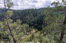
Kinder Crossing Trail #19
Happy Jack, Arizona
24.8 miles NEKinder Crossing Trail #19 travels down to the beauty of East Clear Creek, and then extends up until reaching FR 137; but many people use the trail to reach the creek waters and play in the water. The...
Hike, Swim
Sinkhole Campground
Payson, Arizona
25.8 miles ESinkhole Campground is a camping area near Willow Springs Lake. There are also hikes, mountain biking trails, and fishing opportunities nearby. There are 26 campsites in total at this...
Camp, Hike, Mountain Bike
Park Trail #66
Tonto Basin, Arizona
26.0 miles SFrom the Park Creek Trailhead, the trail crosses Park Creek and climbs gradually through lower Sonoran Desert and riparian vegetation for ½ mile. The trail then ascends steeply...
Mountain Bike 3.0 miBlodgett Basin Trail No. 31
Camp Verde, Arizona
29.4 miles NWBlodgett Basin Trail is one of a select few trails that shows off the riparian desert beauty unique to West Clear Creek Wilderness. The trail stretches from Bull Pen Trailhead through the canyon and...
Backpack, Hike, Swim 16.9 mi
West Clear Creek Trail No. 17
Camp Verde, Arizona
29.5 miles NWWest Clear Creek Trail No. 17 is a great way to reach the running waters of West Clear Creek. By far the most accessible and popular, it starts from the Bull Pen Ranch parking lot and winds down the...
Backpack, Hike, Swim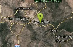
Bullpen Day Use Area
Camp Verde, Arizona
29.5 miles NWBullpen has something for everyone. Whether you park here and use the trail head to start on one of several hikes that lead down West Clear Creek, or stay nearby to use the picnic areas and...
Backpack, Dive, Hike, Swim 0.4 mi
Clear Creek Campground
Camp Verde, Arizona
31.0 miles NWWest Clear Creek flows along the boundary of this desert canyon country camp and is a popular place for hiking, swimming, wading and fishing. Cool water species such as smallmouth bass and green...
Camp, Hike, Swim
Sycamore Trail #68
Tonto Basin, Arizona
31.0 miles SFrom FR 421, the trail climbs steadily through lower Sonoran Desert and riparian vegetation up the arroyo formed by Sycamore Creek. It turns northward and continues to climb along a...
Mountain Bike 5.4 mi
Denton Trail #69
Tonto Basin, Arizona
31.1 miles SFrom FR 421, the trail climbs steadily up the east face of the mountain. Some sections are quite steep. The trail eventually tops out at 5,760 feet elevation and then descends to Big Pine Flat for...
Hike, Mountain Bike 1.4 mi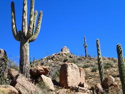
Ballantine Trail
Rio Verde, Arizona
34.4 miles Sthis trail looks a lot better once it moves away from the highway. A somewhat strenuous climb reveals a landscape of knuckle-and-joint, mica-imbedded boulders, deep gorges and a battalion of regal...
Hike 3.9 mi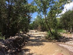
Cave Creek Swimming Hole
Cave Creek, Arizona
35.9 miles SWHidden along Cave Creek Trail #4 is a swimming hole deep enough to refresh from the summer heat. It takes almost four miles of hiking in Arizona desert to reach the swimming hole, but the water is...
Hike, Swim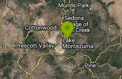
Beaver Creek Campground
Camp Verde, Arizona
36.5 miles NWCamp, Canoe, Kayak, and Swim near Camp Verde, Arizona
Camp, Canoe, Kayak, Swim
Three Bar Route
Tonto Basin, Arizona
36.6 miles SThe Three Bar Wildlife Enclosure is a fenced wildlife study area operated by Arizona Game and Fish. The proximity of two recreation sites provides ample parking should you want to cool...
Mountain Bike 7.1 mi
The Crack at Wet Beaver Creek
Rimrock, Arizona
36.7 miles NWThe Crack is a popular swimming hole found by hiking the Bell Trail down to Wet Beaver Creek. After following the trail for about 3.5 miles away from the parking lot, take a detour to the left just...
Dive, Hike, Horseback, Swim
Beaver Creek Dispersed Camping
37.2 miles NW
Free dispersed camping on the cliffs above Beaver Creek.
Camp
Vineyard Trail #131
Tonto Basin, Arizona
38.7 miles STrail passes through a variety of Lower Sonoran Desert vegetation plant communities. Spectacular views of Roosevelt Lake, Apache Lake, Roosevelt Dam and Four Peaks. Historic Camp...
Mountain Bike
Arizona Trail: Gooseberry Springs to Blueridge
Happy Jack, Arizona
40.4 miles NFollow single track south. Trail made up of single track, old 2-tracks, and dirt roads. Make sure to be on the look out for AZ Trail markers. Can take trail to Highway 87 at Blue...
Mountain Bike


