


58 Things to do near Hailey, Idaho
first prev 1 2 3 next lastShowing results within 50 miles Distance miles of Hailey, ID 83333, USA City, Zip, or Address
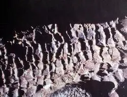
Tree Molds Trail
Visitors Center, Craters of the Moon National Monument
39.0 miles EWhen molten lava advanced through this area it flowed through a grove of living trees. As the trees burned, moisture was released as steam, cooling the hot lava just enough to leave an impression of...
Hike 1.7 mi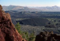
Broken Top Loop Trail
Visitors Center, Craters of the Moon National Monument
39.0 miles EThe Broken Top Loop Trail provides an opportunity to hike over, under and around the youngest volcano on the Snake River Plain. The event that created this cinder cone and associated lava flows...
Cave, Hike 8.8 mi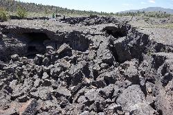
Wilderness Trail
Visitors Center, Craters of the Moon National Monument
39.0 miles EYou will have a sense of solitude as you travel into the Craters of the Moon Wilderness. Begin the trail on the sidewalk that parallels the roadway and turn right to follow the direct route across a...
Cave, Hike 0.5 mi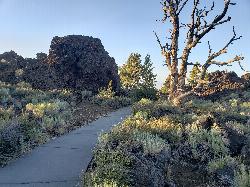
Devil's Orchard Trail
Visitors Center, Craters of the Moon National Monument
39.3 miles EThis paved trail explores an area of cinder beds scattered with pieces of the North Crater wall. Exhibits along the trail challenge you to consider the difficulties of protecting this fragile...
Hike 1.0-1.3 mi
Caves Trail
Visitors Center, Craters of the Moon National Monument
39.5 miles ECave and Hike near Visitors Center, Craters of the Moon National Monument
Cave, Hike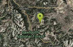
Fourth Of July Lake / Ants Basin / Robinson Bar
Stanley, Idaho
39.7 miles NWThis is an epic ride in the Boulder-White Clouds that connects Fourth of July Lakes, into Ants Basin, down Warm Springs Creek Trail, through Warm Springs Meadow, and out Warm Springs...
Mountain Bike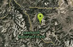
Fisher Creek Loop
Stanley, Idaho
40.2 miles NWXCOn a lucky day I caught the trail empty, however often there are several 12-30 vehicles parked at the trailhead. Ride counter-clockwise, starting with Fisher Creek Road. It begins...
Mountain Bike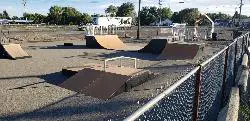
Shoshone Skate Park
Shoshone, Idaho
40.6 miles SSkateboard near Shoshone, Idaho
Skateboard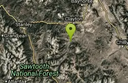
Frog Lake Loop
Clayton, Idaho
41.5 miles NRide this loop either direction. Either way there will be amazing scenery, either direction there will be long singletrack climbs and awesome descending. The write up below describes a...
Mountain Bike

McKinney Butte Lava Tubes
Gooding, Idaho
43.5 miles SWAlso known to the locals as the Spider Caves, the McKinney Butte Lava Tubes is a tunnel formed by lava flows from long ago. Similar to many lava tubes with an entrance broken from the side of...
Camp, Cave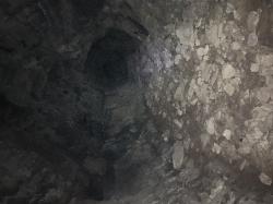
Owl Cave
Fuller, Idaho
43.6 miles SWOwl Cave is located out by the Dead Horse Cave and Spider Caves (Mckinley Butte Lava Tubes). Owl Cave is about 100 yards from Spider Cave and is also closed Seasonally from Nov-May but...
Cave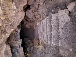
Dead Horse Cave
Gooding, Idaho
43.8 miles SWCave near Gooding, Idaho
Cave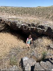
Dynamite Cave
Shoshone, Idaho
44.3 miles Sa very unquie cave South of shoshone ID. cave has a old dynamite container as you enter into the cave also a free standing bridge outside the entrance of the cave
Cave
Pigtail Trail
Stanley, Idaho
44.4 miles NWPigtail Trail is the first portion of the singletrack part of the Fisher Creek Loop. It's a great little descent down to the junction with Williams Creek, with some excellent...
Mountain Bike
Fisher Creek Road
Stanley, Idaho
45.0 miles NWThis trail has one of the best descents in the area, and is coupled with some amazing views of the Sawtooth Mountains. There is a mix of both paved road and dirt track on this trail, and it can be...
Mountain Bike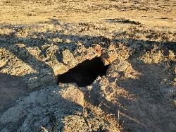
Tea Kettle Cave
Bliss, Idaho
45.4 miles SWCave near Bliss, Idaho
Cave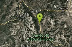
Williams Creek
Stanley, Idaho
47.1 miles NWThe Williams Creek Trail forms the majority of the singletrack of the popular "Fisher Creek Loop" ride. It's flowy, fast, with great corners, and awesome views!
Mountain Bike 7.9 mi
Borah Peak
Mackay, Idaho
48.6 miles NEThis is the highest peak in all of Idaho, standing 12,662 ft along the Lost River Range. There are several routes that can be taken in order to reach the summit with different levels of difficulty...
Hike


