


Trestle Trail
Park City, Utah
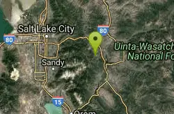
| Address: | ~46 Silver Star Ct, Park City, UT 84060, USA |
| GPS: |
40°38'22.1"N 111°30'23.0"W Maps | Directions |
| State: | Utah |
| Trail Length: | 1.00 miles |
| MTB Difficulty: | Advanced |
| Trail Type: | Network |
| MTB Trail Type: | Singletrack |
Mountain Bike
Trestle Trail is an advanced .66-mile descent that drops straight down below the Town Lift chairlift. Courtesy of Singletracks.com
More Information
Trestle Trail
Trestle Trail is a singletrack mountain bike trail in Park City, Utah. View maps, videos, photos, and reviews of Trestle Trail bike trail in Park City.
http://www.singletracks.com/bike-trails/trestle-trail/Never modify trail features. Ride trails when they're dry enough that you won't leave ruts. Speak up when you see others on the trail and always yield to hikers, horses, and others coming uphill. Always ride on the established trail.
Read More
- Plan Ahead and Prepare
- Travel & camp on durable surfaces
- Dispose of waste properly
- Leave what you find
- Minimize campfire impacts
- Respect wildlife
- Be considerate of other visitors
Directions
From Park City, Utah
- Head northwest on Park Ave toward Heber Ave (299 ft)
- Turn left onto Woodside Ave (0.6 mi)
- Turn right onto King Rd (0.2 mi)
- Sharp right to stay on King Rd (1.6 mi)
- Turn right (0.1 mi)
- Turn leftDestination will be on the left(0.6 mi)

Other Mountain Bike Trails Nearby

John's 99
Park City, Utah
0.5 miles SWA 1.8-mile mostly downhill singletrack in Park City connecting to the 'Little Chief' trail at the bottom — easy-to-intermediate with a few sharp turns that catch newer riders off guard.
Mountain Bike 
John's Trail
Park City, Utah
0.6 miles NEA twisting aspen trail at Park City Mountain Resort accessible by lift on PayDay — full of roots and tight squeezes for a fun, lively mountain bike challenge.
Mountain Bike 
Moosehouse
Park City, Utah
0.6 miles SEA .6-mile oldschool freeride descent in Park City with steep loamy terrain, sharp berms, and drops — connecting John's 99 to Gravedigger.
Mountain Bike 
Gina's Daly Bypass
Park City, Utah
0.6 miles SEA half-singletrack, half-gravel connector trail in Park City linking Gravedigger and Daly Grind down to Sweeney's and town.
Mountain Bike 
Poison Creek
Park City, Utah
0.7 miles NEA paved greenway running through the heart of Park City, Utah, connecting to multiple other trails so you can get around town by bike without touching busy roads.
Mountain Bike 
Park City Mountain Resort (PCMR)
Park City, Utah
0.8 miles NA dense Park City singletrack network above Old Town with chunky gnar, buff trails, berms, aspen groves, switchbacks, and fantastic views — enough variety to keep you busy for a week.
Mountain Bike 
Billy's Bypass
Park City, Utah
0.8 miles SWA short 0.21-mile connector trail in Park City linking Sweeney's, Crescent Mine Grade, Jenni's, and Moose — a quick link for building longer mountain bike routes.
Mountain Bike 
Gravedigger
Park City, Utah
0.9 miles SAn advanced 20.6-mile singletrack through roots, rocks, and tight aspens in Park City, connecting Moosehouse to Speedbag with fast cruising sections and a flying dirt-road finish.
Mountain Bike 
Masonic
Park City, Utah
0.9 miles NEA twisty, old-school descent off the knob down to Lost Prospector — narrow tread, sharp turns, and technical rocks reminiscent of legacy trails.
Mountain Bike 
Steps
Park City, Utah
1.0 miles SWA quick 1-mile advanced descent through aspen groves and small meadows on Park City's ski runs, connecting Viking Yurt to the Home Run dirt road at the bottom.
Mountain Bike 
Mojave
Park City, Utah
1.0 miles SWA twisty singletrack through high aspens starting off the Crescent quad lift, winding down to the Mid Mountain trail at Park City Mountain Resort.
Mountain Bike 
Sweeney Switchbacks
Park City, Utah
1.0 miles NTight, extremely technical switchbacks wrapped in aspens — some so sharp you'll need to swing your back wheel around to make them.
Mountain Bike 
Crescent Mine Grade
Park City, Utah
1.0 miles NBuilt on an old mining train-grade, this nearly 4-mile descent from Thayne's Road into Park City is super fast, straight, and smooth — a rip-roaring singletrack run.
Mountain Bike 
Prospector Area
Park City, Utah
1.0 miles NEA 0.75-mile uphill connector to the top of Masonic Hill, where multiple downhill options including Solamere and Masonic await, all within the Prospector trail network.
Mountain Bike 
Jenni's
Park City, Utah
1.0 miles NA 5-mile intermediate singletrack traversing PCMR's ski slopes and ducking into tight trees, descending to Park City — connects to John's, Moose, Loose, and more.
Mountain Bike 
Eagle Trail
Park City, Utah
1.1 miles NWA fast, smooth .63-mile descent linking Crescent Mine Grade to Spiro, where you'll pick up speed through tall grass, shrubbery, and trees with minimal technical challenge.
Mountain Bike 
Webster
Park City, Utah
1.2 miles SWAbout 1.5 miles of alternating singletrack and doubletrack connecting Keystone, Meadow Road, Pioneer, McConkey's, Flat Iron, Minor's Mile, Link, and more.
Mountain Bike 
Daly Grind
Park City, Utah
1.2 miles SA doubletrack connector that drops down the mountain, linking Empire Link, Prospect Ridge, and a multitude of other Park City trails.
Mountain Bike 
Spiro
Park City, Utah
1.3 miles NOne of the longer individually named trails in Park City, Spiro runs about 3 miles from town up to Thaynes Canyon Road — an entertaining ride whether you go up or come down.
Mountain Bike 
Keystone
Park City, Utah
1.3 miles SWA 1.5-mile intermediate singletrack trail at Park City running from the Jupiter access road past the Apex junction to Meadow Road — a smooth mountain connector at the resort.
Mountain BikeNearby Campsites

Spruces Campground
Salt Lake City, Utah
6.9 miles WA fee campground in Big Cottonwood Canyon near Salt Lake City — check USDA.gov for current rates and seasonal availability.
Camp, Sled 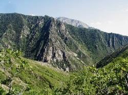
Mill Creek Canyon
Salt Lake City, Utah
11.6 miles WAn out-and-back canyon trail with over 1,000 feet of elevation gain — the lower ski trail sees heavy traffic while the upper section above Elbow Fork stays quiet, with a reservable Yurt at the top December through April.
Camp, Cross-country Ski, Snowshoe 1.6-14.1 mi
Mount Timpanogas
Provo, Utah
16.0 miles SWUtah's most-climbed mountain towers 7,000 feet above the Provo valley, stretching seven miles north to south with multiple peaks over 11,000 feet — a Wasatch landmark.
Camp, Hike, Horseback, Swim 
Holbrook Trailhead
Bountiful, Utah
24.3 miles NWThe Holbrook Trailhead is a popular access point for the Bonneville Shoreline Trail and Holbrook Canyon above Bountiful, Utah, on the western face of the Wasatch. Perched on the bench right at the...
Airsoft, Backpack, Camp, Paintball, Snowshoe 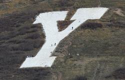
Y-Mountain Summit Trail
Provo, Utah
27.7 miles SA 1.2-mile climb east of BYU leads to a massive block Y on the hillside and sweeping panoramas over Provo, Orem, Utah Valley, and Utah Lake below.
Camp, Hike 
Hell Hole Lake
Evanston, Utah
36.2 miles EA challenging wash hike in Evanston's Dry Wash, navigating sand and boulders for 1.8 miles to Hellhole Canyon at the edge of the Red Mountain Wilderness.
Camp, Hike, Horseback 4.7 mi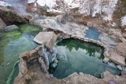
Fifth Water Hot Springs
Provo, Utah
39.2 miles SA scenic 2.5-mile riverside hike to the famous Diamond Fork rock pools and waterfall, with soaks up to 108°.
Backpack, Camp, Hike, Hot Springs, Mountain Bike, Swim 5.6 mi
Antelope Island Lakeside Trail
Syracuse, Utah
46.4 miles NWAn easy 2-hour loop on Antelope Island around the Great Salt Lake, with rock formations, views of the Sierra Nevadas, and the GSL — kid-friendly and good for bug fans.
Camp, Hike, Horseback 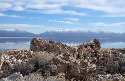
Antelope Island State Park
Syracuse, Utah
46.7 miles NWTwenty miles of trails cross Utah's Great Salt Lake island alongside free-roaming bison, antelope, and bobcats — best visited in early spring or late fall to beat the bugs.
Backpack, Camp, Hike, Horseback, Mountain Bike 2.9 mi
Pineview Reservoir
Eden, Utah
48.3 miles NA stunning Wasatch reservoir with three sandy beaches, boating, kayaking, paddleboarding, water skiing, and 18 miles of paved trail — the ultimate summer base behind the Ogden front.
Camp, Canoe, Hike, Kayak, Mountain Bike, Swim


