


Sliding Rock
Hot Springs, North Carolina

| GPS: |
35°51'41.0"N 82°50'37.0"W Maps | Directions |
| State: | North Carolina |
Swim
Sliding Rock is a well loved destination in the Pisgah National Forest. This 60 foot natural rock waterslide descends into an 8 foot deep pool, creating a unique adventure. The water is between 50 and 60 degrees in the summer making this the perfect place to cool off.
Sliding Rock has its on season from Memorial Day to Labor Day. During on season there is a lifeguard on duty and restrooms available for visitors. A $5 entry fee per visitor is charged during the on season. Sliding rock is open seven days a weeks but may close due to dangerous weather or water levels. Sliding rock is a popular destination, especially in the afternoons, sometimes filling up the parking lot and causing long lines to use the slide.
Sliding rock may be used, without entry fee, during the off season but it is use at your own risk, as no life guards are on duty and no one is available to check for weather and water safety.
More Information
Outdoor Adventures - Outdoor Activities in North Carolina
North Carolina's outdoor activities are as rich and varied as its landscapes. Plan a waterfall hike in the Smokies. Go camping in the Uwharries. Or try hang gliding on the Outer Banks. Browse things to do like camping, hiking, fishing and more.
https://www.visitnc.com/things-to-do/outdoor-adventuresSliding Rock, NC
See our insiders' photo guide to Sliding Rock in Pisgah National Forest near Asheville and Brevard, NC, a natural water slide and mountain swimming hole.
https://www.romanticasheville.com/sliding_rock_north_carolina.htm
- Plan Ahead and Prepare
- Travel & camp on durable surfaces
- Dispose of waste properly
- Leave what you find
- Minimize campfire impacts
- Respect wildlife
- Be considerate of other visitors
Directions
From Hot Springs, North Carolina
- Head southwest on Bridge St (144 ft)
- Continue straight onto NC-209 S/
Lance Ave Continue to follow NC-209 S(3.2 mi) - Turn left (0.2 mi)
From Asheville, take I-26 south then (at Hendersonville) take RT 64 west to Brevard. When entering Brevard area, take RT 276 north (right turn) into the Pisgah N.F.. Then:
ROUTE 276: The following are back on RT 276:
SLIDING ROCK [SLID]: A long, gradual slide on smooth rock in Looking Glass Creek into very cold water pool at bottom. Very safe, lifeguards, well developed area, crowded sometimes. Changing rooms and bathrooms. PHOTO . Continue west on RT 276 and see sign for Sliding Rock. Fee here. No picnicking. No phone. Fee charged. Verified. LAT, LON lat=35.29039, lon=-82.76425(source: DeLorme) (accuracy:approximate) LINK TO GOOGLE MAP
BIG EAST FORK [BIGE]: Continue west on RT 276 past the Blue Ridge Parkway, (towards Cruso, Waynesville, and Canton) through a bunch of curves, at just under 3 miles from the Parkway (approx) you will come to a really serious (180 degree) right hand curve (about 20 minutes BEFORE you get to Cruso). Watch here for the Big East Fork trail sign on the left. Take the trail on the left side of the creek, an easy 15-minute hike till you see a small waterfall and swimming hole on the right. LAT, LON lat=35.36131, lon=-82.81444(source: DeLorme) (accuracy:approximate) LINK TO GOOGLE MAP. Pretty certain. Not verified. Updated 1/3/2007.
Courtesy of swimmingholes.org


Other Swimming Holes Nearby
Rocky Bluff
Hot Springs, North Carolina
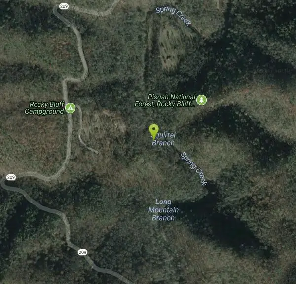
0.2 miles NWRocky Bluff is a tranquil mountain getaway in the Pisgah National Forest near Hot Springs, North Carolina, where a wooded campground sits beside the lovely Spring Creek just a few miles south of...
Camp, Hike, Swim 
Hot Springs Resort
Hot Springs, North Carolina
2.4 miles NA privately operated outdoor resort with natural hot mineral water in private hot tubs — popular with visitors who split the cost, with mineral-rich water that relaxes and rejuvenates.
Swim 
French Broad
Del Rio, Tennessee
11.0 miles NWSwim near Del Rio, Tennessee
Swim 
Old Forge Campground
Bethany, Tennessee
18.3 miles NEPrimitive walk-in camping on scenic Jennings Creek in the Cherokee National Forest, with small waterfalls, swimming holes, and hiking trails right from camp — bring your own water.
Camp, Hike, Swim 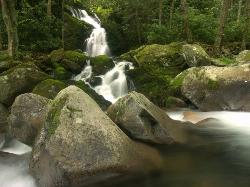
Mouse Creek Falls
Waynesville, North Carolina
18.5 miles SWMouse Creek Falls is one of the finest waterfall hikes in Great Smoky Mountains National Park, a two-tiered 45-foot cascade where Mouse Creek spills down a mossy rock face and empties straight into...
Swim 
Horse Creek Campground
Chuckey, Tennessee
20.0 miles NEA Cherokee National Forest campground beside Horse Creek with fifteen sites, picnic tables, fishing for rainbow and brook trout, creek swimming, and 31 day-use picnic tables — $10/night camping fee.
Camp, Swim 
Cosby Campground
Cosby, Tennessee
21.7 miles WCamp and Swim near Cosby, Tennessee
Camp, Swim 3.8 mi
Ramsey Cascades
Gatlinburg, Tennessee
30.9 miles WRamsey Cascades is the tallest waterfall in Great Smoky Mountains National Park — a thundering 100-foot, multi-tiered cascade hidden deep in the old-growth forest of the Greenbrier area near...
Hike, Kayak, Swim, Whitewater 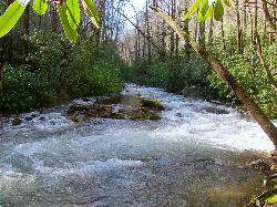
North Mills River
Mills River, North Carolina
33.2 miles SA campground in the Cherokee National Forest with creek swimming, fishing for rainbow and brook trout, and kid-favorite tubing — plus 31 picnic tables and educational summer programs nearby.
Swim 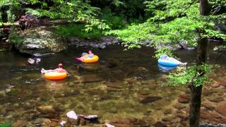
Little Pigeon River
Gatlinburg, Tennessee
33.2 miles WSeven accessible swimming holes and tubing spots on the Little Pigeon River, surrounded by beautiful Smoky Mountain scenery near Gatlinburg's attractions.
Swim 
Rock Creek
Unicoi, Tennessee
33.4 miles NEA man-made concrete-bottom stream-fed pool with a sandy beach and short waterfall makes Rock Creek a refreshing — if chilly in June — summer splash near Unicoi.
Swim 
Big East Fork
Canton, North Carolina
34.4 miles SHeavy forest, multiple waterfalls, and a river that shifts from white rapids to calm swimming holes along Big East Fork in Pisgah National Forest — great for kayaking, camping, and swimming year-round.
Backpack, Hike, Kayak, Swim 
Sunburst
Canton, North Carolina
34.4 miles SSunburst is a refreshing mountain getaway along the West Fork of the Pigeon River in North Carolina's Pisgah National Forest, tucked into the high, forested country south of Canton and...
Swim 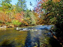
Carolina Hemlock
Burnsville, North Carolina
36.0 miles EA family swimming area on the South Toe River near Mount Mitchell in the Pisgah National Forest campgrounds — note that the site is closed seasonally and fees apply.
Camp, Swim 1.8 mi
Flat Laurel Creek
37.1 miles S
A 3.18-mile multi-use trail following Flat Laurel Creek through colorful rock formations and forest, with distant views of Sam Knob and a small waterfall — open year round.
Hike, Horseback, Mountain Bike, Swim 
Skinny Dip Falls
Brevard, North Carolina
37.2 miles SA cascading waterfall with multiple clear pools for wading and swimming, a 6-foot jumping spot, and an easy 3/4-mile forested walk from the Blue Ridge Parkway — swimmers should mind fast water and slippery rocks.
Hike, Swim 0.2-2.8 mi
Graveyard Fields
Brevard, North Carolina
37.4 miles STwo cascading waterfalls — a swimmable Lower Falls just 1/3 mile from the road, and a more challenging Upper Falls on a 3.5-mile wildflower loop — make this a must-see hike.
Hike, Swim 
Looking Glass Falls
Brevard, North Carolina
39.3 miles SA cascading 60-foot waterfall over mossy stone with a wading pool below — just a short, beautiful walk from Pisgah Highway in Brevard, stunning in any season.
Hike, Swim 0.1 mi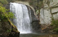
Looking Glass Falls
Brevard, North Carolina
39.3 miles SOne of North Carolina's most popular and accessible waterfalls — the 60-foot Looking Glass Falls drops roadside along the Forest Heritage Scenic Byway in Pisgah National Forest, with easy viewing from the parking area or a short walk.
Swim 
Coontree Recreation Area
Brevard, North Carolina
39.8 miles SA scenic picnic area on the Davidson River with direct access to calm, deep water for swimming and fishing — plus the 3.7-mile Coontree Loop Trail through Pisgah National Forest.
Hike, Mountain Bike, SwimNearby Campsites
Rocky Bluff
Hot Springs, North Carolina
0.2 miles NWRocky Bluff is a tranquil mountain getaway in the Pisgah National Forest near Hot Springs, North Carolina, where a wooded campground sits beside the lovely Spring Creek just a few miles south of...
Camp, Hike, Swim
Old Forge Campground
Bethany, Tennessee
18.3 miles NEPrimitive walk-in camping on scenic Jennings Creek in the Cherokee National Forest, with small waterfalls, swimming holes, and hiking trails right from camp — bring your own water.
Camp, Hike, Swim
Horse Creek Campground
Chuckey, Tennessee
20.0 miles NEA Cherokee National Forest campground beside Horse Creek with fifteen sites, picnic tables, fishing for rainbow and brook trout, creek swimming, and 31 day-use picnic tables — $10/night camping fee.
Camp, Swim
Cosby Campground
Cosby, Tennessee
21.7 miles WCamp and Swim near Cosby, Tennessee
Camp, Swim
Carolina Hemlock
Burnsville, North Carolina
36.0 miles EA family swimming area on the South Toe River near Mount Mitchell in the Pisgah National Forest campgrounds — note that the site is closed seasonally and fees apply.
Camp, Swim 
Mt. LeConte Lodge
Sylva, North Carolina
40.1 miles SWThe highest guest lodge in the eastern United States at 6,400 feet, with spectacular Smokies views from an open glade just below the Mt. LeConte summit in Great Smoky Mountains NP.
Camp, Hike, Horseback, Rock Climb 
Davidson River Campground
Pisgah Forest, North Carolina
40.7 miles SA year-round campground in Pisgah National Forest just four miles from Brevard and less than an hour from Asheville, with shaded loops, hiking trails, waterfalls, and fishing spots nearby.
Camp, Hike, Swim


