


Chilhowee Recreation Area
Benton
Camp, Canoe, Hike, Kayak, and Swim
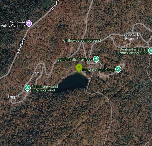
Chilhowee Recreation Area is a U.S. Forest Service campground and day-use area on top of Chilhowee Mountain in the Ocoee Ranger District of the Cherokee National Forest, in Polk County east of Benton. The swimming spot is McKamy Lake (spelled McCamy on some federal maps), a seven-acre impoundment the Civilian Conservation Corps built in the late 1930s and early 1940s. A designated swim area with a sand beach sits on the northeast shore of the lake, next to the main day-use picnic grounds, at roughly 2,000 feet of elevation.
From the US 64 and US 411 intersection near Ocoee, drive east on US 64 for about 7 miles, then turn onto Forest Service Road 77 (Oswald Dome Road) at the Chilhowee Recreation Area sign. The road climbs about 7.5 miles of narrow, winding pavement past several overlooks before the right turn into the recreation area. The Forest Service specifically warns against following phone GPS, which tends to route drivers up Benton Springs Road instead; stay on Road 77. The day-use parking lots are about 100 yards east of the beach, a short walk from the sand.
The swim area is the designated part of a small, calm mountain lake with no current, entered from the sand beach. The Forest Service does not list lifeguards, so plan on swimming unsupervised and keep a close eye on children. Because the lake sits high on the mountain, expect the water to run cooler than the big reservoirs in the valley below; it is most comfortable from mid-June through August. Gasoline motors are not allowed on the lake (anything over 5 horsepower or with an internal combustion engine is prohibited), so canoes, kayaks and float tubes share the water with swimmers and bank anglers.
Swimming is not free. The Forest Service charges a day-use fee of $3 per vehicle per day, paid at the site, and the campground map notes that federal pass holders pay half. Campers registered at Chilhowee Campground are covered by their camping receipt. The day-use area is open year-round, while the campground itself usually runs from early April to late October. The flush bathhouses are closed in winter.
McKamy Lake has been drained in the past for spillway work and has since refilled, and road and facility projects have closed the entrance gate for stretches. Check the Cherokee National Forest alerts page or call the Ocoee Ranger District at 423-338-3300 before driving up, especially after heavy rain.
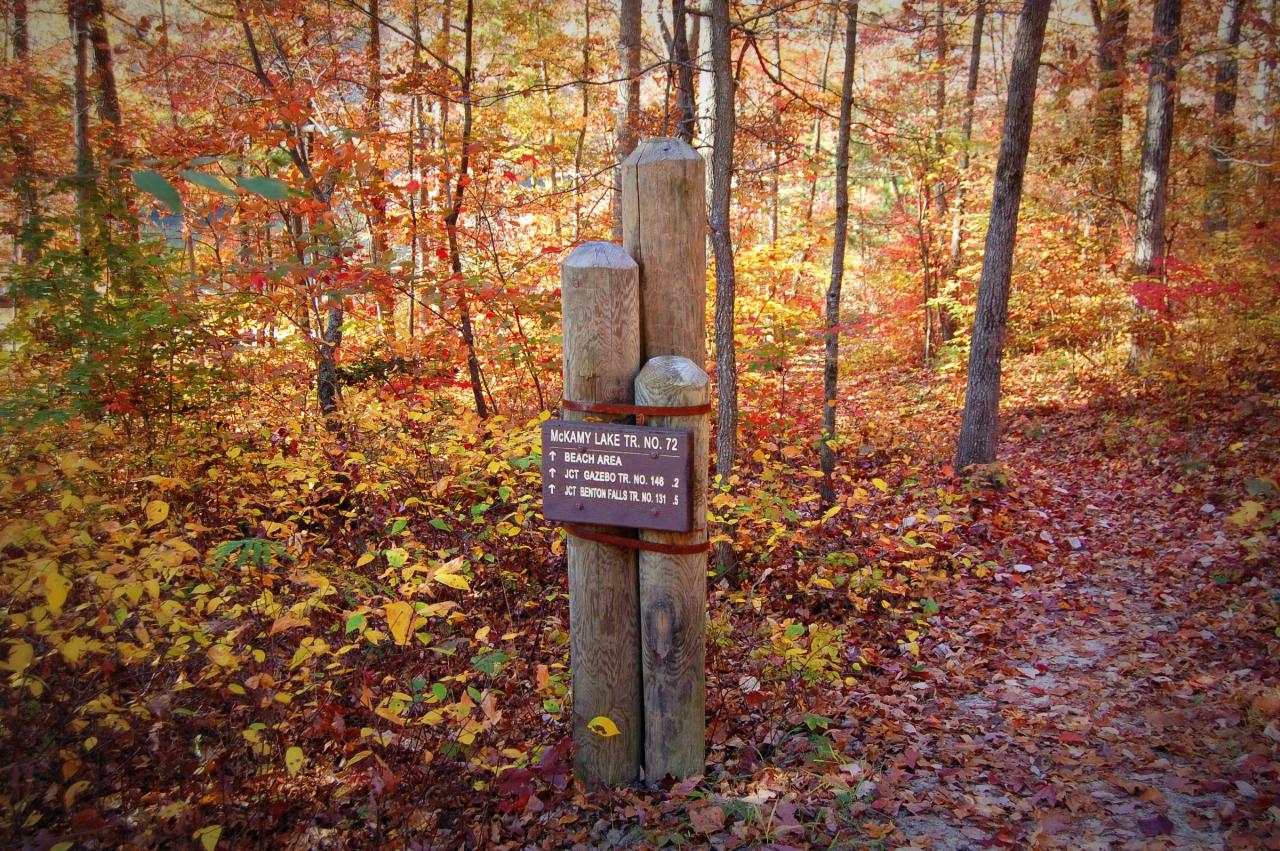
The McKamy Lake Trail circles the shoreline in about 0.6 miles, and the Benton Falls Trail starts near the swim area and runs 1.5 miles each way to a 65-foot waterfall. The wider Chilhowee Trail System adds more than 20 miles of hiking and mountain bike routes that drop down the mountain to Parksville Campground. Picnic sites, a group picnic area and a bathhouse are close to the beach, and the campground has about 79 sites, many with electric hookups.
More Information
Cherokee National Forest | Alerts | Forest Service
Review the Alerts below to be aware of any fire restrictions, safety notices, and forest regulations that may impact your visit to Cherokee National Forest.&...
https://www.fs.usda.gov/r08/cherokee/alertsCherokee National Forest | Benton Falls Hike | Forest Service
The Benton Falls Trail is an easy 1.5 mile (each way) hike to the 65 foot high waterfall.
https://www.fs.usda.gov/r08/cherokee/recreation/benton-falls-hikeCherokee National Forest | Chilhowee Recreation Area | Forest Service
Located in the Chilhowee Recreation Area, Chilhowee Campground offers more than 70 campsites, electric hookups, RV sites, tent-only sites and multiple bathhouses. The campground is usually open from early April to late October, with an overflow area and day use area open year-round. 7-acre McKamy Lake offers a swim area with a sand beach, and fishing from the bank. Boats are allowed, but gasoline motors are not. Also, within the recreation area are approximately 25 miles of hiking and biking trails, and a scenic waterfall. On the drive up to the campground, stop at one of the overlooks to see beautiful mountain settings. Wildlife is abundant in this area, so have your camera ready and tread lightly.Chilhowee Recreation Area Map and Guide
https://www.fs.usda.gov/r08/cherokee/recreation/chilhowee-recreation-areaCherokee National Forest | Chilhowee Trail System | Forest Service
An official website of the United States government
https://www.fs.usda.gov/r08/cherokee/recreation/trails/chilhowee-trail-systemCherokee National Forest | McKamy Lake | Forest Service
Visitors to Chilhowee Recreation Area are drawn to McKamy Lake for swimming, fishing picnicking, sunbathing and canoeing. The seven-acre lake was built in the late 1930s to early 1940s by the Civilian Conservation Corps. Chilhowee Lake Trail skirts the banks of the lake and connects to picnic, bathhouse and campground facilities.
https://www.fs.usda.gov/r08/cherokee/recreation/mckamy-lakeChilhowee Campground, Cherokee National Forest - Recreation.gov
Explore Chilhowee Campground in Cherokee National Forest, Tennessee with Recreation.gov. Located in the Chilhowee Recreation Area, Chilhowee Campground offers a multitude of camping opportunities for both RV and tent sites, many with electric hookup
https://www.recreation.gov/camping/campgrounds/251723Chilhowee Group Camp, Cherokee National Forest - Recreation.gov
Explore Chilhowee Group Camp in Cherokee National Forest, Tennessee with Recreation.gov. Located in the Chilhowee Recreation Area, Chilhowee Group Camp offers camping for up to 75 individuals. Nearby McKamy Lake offers a swim area with a sandy beach
https://www.recreation.gov/camping/campgrounds/250024hilhowee
U.S. Department of Agriculture Forest Service Southern Region Forest Road 77. Travel approximately 7.3 miles to the campground entrance sign and turn right. with electric hookups. Loops A & B also offer walk in tent sites with electricity.
https://www.fs.usda.gov/sites/nfs/files/r08/cherokee/publication/Chilhowee%20Recreation%20Area%20Campground%20Map.pdfBe courteous, informed, and prepared. Read trailhead guidelines, stay on the trail, and don't feed the wildlife.
Read More
- Plan Ahead and Prepare
- Travel & camp on durable surfaces
- Dispose of waste properly
- Leave what you find
- Minimize campfire impacts
- Respect wildlife
- Be considerate of other visitors
Directions
From Benton
- Head southwest on Blakesley Creek Rd toward Johnstone Dr (1.7 mi)
- Turn right onto Cardwell Hill Dr (1.1 mi)
- Turn left onto OR-223 S (1.0 mi)
- Turn left onto US-20 EPass by Burger King (on the right in 8.2 mi)(10.2 mi)
- Keep left to continue on OR-34 (1.0 mi)
- Turn right onto OR-34 E/
Corvallis-Lebanon Hwy 210 (15.0 mi) - Take the Denny Sch. Rd exit toward Armory/
Airport (0.3 mi) - Merge onto Denny School Rd (1.2 mi)
- Continue straight onto Airport Dr (2.0 mi)
- Turn right onto S Second St (0.2 mi)
- Continue straight onto S Main Rd (0.1 mi)
- Turn left onto S Main (154 ft)
- Turn right onto US-20 EPass by NAPA Auto Parts - Wilson's Auto Parts (on the right in 12.7 mi)(85.3 mi)
- At the traffic circle, take the 2nd exit and stay on US-20 E (1.0 mi)
- At the traffic circle, take the 2nd exit onto US-20 (15.0 mi)
- At the traffic circle, take the 2nd exit onto US-20 E (2.0 mi)
- At the traffic circle, take the 2nd exit and stay on US-20 E (0.8 mi)
- At the traffic circle, take the 2nd exit and stay on US-20 E (0.4 mi)
- At the traffic circle, take the 1st exit and stay on US-20 E (0.9 mi)
- Turn left onto NE Empire Ave (1.2 mi)
- At the traffic circle, take the 2nd exit and stay on NE Empire Ave (0.4 mi)
- At the traffic circle, take the 2nd exit (213 ft)
- Continue onto NE Empire Ave (0.5 mi)
- Keep right (0.1 mi)
- At the traffic circle, take the 3rd exit onto NE Butler Market Rd (0.3 mi)
- At the traffic circle, take the 1st exit and stay on NE Butler Market Rd (0.2 mi)
- At the traffic circle, continue straight to stay on NE Butler Market Rd (0.5 mi)
- Turn right onto Hamby Rd (2.2 mi)
- At the traffic circle, take the 3rd exit onto US-20 EPass by Dairy Queen Grill & Chill (on the left in 126 mi)(127 mi)
- Turn left onto US-20 E/
US-395 N/ N Broadway Ave (signs for John Day Vale/ Ontario) Continue to follow US-20 EPass by NAPA Auto Parts - Dyna Parts LLC (on the right in 113 mi)(125 mi) - At the traffic circle, take the 3rd exit onto OR-201 N/
State Hwy 201 (4.8 mi) - Turn right to merge onto I-84 E/
US-30 E toward Boise Continue to follow I-84 EEntering Idaho(225 mi) - Keep right to stay on I-84 E, follow signs for Ogden/
Salt Lake Entering Utah(135 mi) - Take exit 340 for I-84 E toward I-80 E/
Cheyenne (1.0 mi) - Continue onto I-84 E (9.3 mi)
- Slight right (0.4 mi)
- Merge onto I-84 E (28.3 mi)
- Take exit 120A on the left to merge onto I-80 E toward CheyennePassing through WyomingEntering Nebraska(827 mi)
- Take exit 397 to merge onto US-77 S/
Homestead Expy toward NE-2/ Beatrice/ Nebraska City (9.3 mi) - Slight left onto NE-2Entering Iowa(48.9 mi)
- Continue onto IA-2 E (2.9 mi)
- Turn right to merge onto I-29 S toward Kansas CityEntering Missouri(88.3 mi)
- Keep left to stay on I-29 S (46.1 mi)
- Merge onto I-29 S/
I-35 S (4.4 mi) - Continue onto US-71 (0.2 mi)
- Merge onto I-70 E/
US-71 S (0.3 mi) - Slight left onto I-70 E/
US-24 E/ US-40 E (signs for St Louis) Continue to follow I-70 E(124 mi) - Slight right (0.5 mi)
- Merge onto I-70 E (2.5 mi)
- Slight right toward Interstate 70 Dr SE (0.1 mi)
- Merge onto Interstate 70 Dr SE (0.1 mi)
- Keep left (0.1 mi)
- Merge onto I-70 E (119 mi)
- Take the exit toward I-55 N/
I-64 E/ Illinois (0.2 mi) - Continue onto I-70 EEntering Illinois(2.6 mi)
- Take exit 3 for I-64 E toward Louisville (0.1 mi)
- Take the ramp onto I-64 E (71.1 mi)
- Merge onto I-57 S/
I-64 E (3.9 mi) - Slight right onto I-57 S (signs for Memphis) (47.3 mi)
- Take exit 44 for I-24 E toward Nashville (1.3 mi)
- Continue onto I-24 E (37.4 mi)
- Keep right to stay on I-24 EPassing through KentuckyEntering Tennessee(138 mi)
- Take exit 44A to merge onto I-24 E/
I-65 S toward Nashville (2.3 mi) - Keep left to continue on I-24 E, follow signs for I-40 E/
Chattanooga/ Knoxville (2.8 mi) - Take exit 50A for I-24 E toward I-40 E/
Knoxville/ Chattanooga (0.3 mi) - Continue onto I-24 E/
I-40 E (1.7 mi) - Take exit 213A for I-24 E toward Chattanooga (0.4 mi)
- Continue onto Exit 53 (signs for I-440/
Memphis) (0.4 mi) - Keep left to continue on I-24 E, follow signs for Chattanooga (57.9 mi)
- Take exit 110 for TN-53 toward Manchester/
Woodbury (0.2 mi) - Turn right onto TN-53 S/
Woodbury Hwy (0.7 mi) - Turn left onto N Woodland St (0.5 mi)
- Turn left onto E Fort St (0.2 mi)
- Turn left onto N Waite St (0.4 mi)
- Turn left onto TN-55 E (0.3 mi)
- Turn right to merge onto I-24 EPassing through GeorgiaEntering Tennessee(73.8 mi)
- Take exit 185B to merge onto I-75 N toward Knoxville (19.3 mi)
- Take exit 20 toward US-64BYP E/
Cleveland (0.3 mi) - Merge onto US-74 E (6.2 mi)
- Merge onto US-64 E/
US-74 E via the ramp to Ocoee (15.1 mi) - Turn left onto Oswald Rd (7.4 mi)
- Turn right (0.4 mi)
- Turn leftDestination will be on the right(0.1 mi)


Other Swimming Holes, Hiking Trails, Canoeing Areas, and Kayaking Areas Nearby
Mac Point Beach
Reliance
2.9 miles SEForest Service swim beach on a small point in Parksville Lake (Lake Ocoee) along US 64 in the Cherokee National Forest. Designated swim area, no lifeguard, $3 per vehicle per day.
Swim
Hiwassee
Benton, Tennessee
6.7 miles NESwim near Benton, Tennessee
Swim
Blue Hole Ocoee
Turtletown, Tennessee
10.1 miles SENumerous swimming holes 10-to-15 feet deep with tunnels to swim through, cliff jumping, and snorkeling in crystal-clear water — a great family adventure on the Ocoee.
Swim
Conasauga Area
Soddy-Daisy, Tennessee
10.9 miles SSwim near Soddy-Daisy, Tennessee
Swim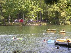
Lake Conasauga Picnic and Swim Site
Chatsworth
20.2 miles SThe highest lake in Georgia, a 19 acre CCC-built lake at 3,150 feet on Grassy Mountain, with a designated swim area and dock on the shore opposite the campground. The campground is closed until further notice after a September 2026 water main break.
Camp, Canoe, Hike, Kayak, Swim 0.8 mi
Holly Creek Picnic Area
Chatsworth, Georgia
23.4 miles SA scenic North Georgia picnic and swimming spot with a shallow creek hole, easy rock jumps, and kayaking nearby.
Canoe, Kayak, Swim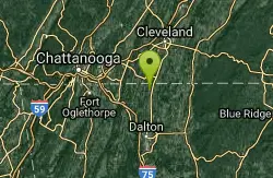
Farmers Lake
Cohutta, Georgia
23.4 miles SWSwim near Cohutta, Georgia
Swim 5.6 mi
Emery Creek Trail
Chatsworth, Georgia
23.5 miles STwo beautiful waterfalls and a small swimming hole shine on this 5.9-mile Northern Georgia trail, but plan for multiple creek crossings — water shoes are a must.
Hike
Baby Falls
Tellico Plains, Tennessee
27.3 miles NEA Tellico River waterfall and swimming hole that's beginner-friendly for kayakers, beautiful for hikers, and especially stunning in fall for picnics and photography.
Hike, Kayak, Swim, Whitewater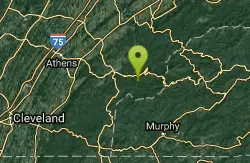
Baby Falls Area
Tellico Plains, Tennessee
27.3 miles NESwim near Tellico Plains, Tennessee
Swim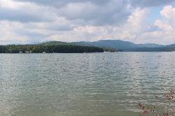
Morganton Point Recreation Area
Morganton, Georgia
28.0 miles SEForest Service swim beach, campground and boat ramp on a wooded point jutting into Lake Blue Ridge, two miles from the town of Morganton.
Camp, Canoe, Hike, Kayak, Swim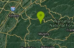
Davis Branch
Tellico Plains, Tennessee
30.2 miles EA riverside campground on the Tellico River with six campsites, each with a picnic table — a peaceful Tennessee base camp for hiking, fishing, and campfire nights.
Camp, Hike, Swim
Richland Creek
Dayton, Tennessee
35.0 miles NWSwim near Dayton, Tennessee
Swim
Chickamauga Creek
Soddy-Daisy, Tennessee
35.8 miles WMultiple swimming holes along a state natural area trail near Soddy-Daisy — including the local favorite 'Blue Hole' with cliffs, a rope swing, and 12-to-14-foot depths. The area closes at 7 p.m. and sees litter; pack a bag and carry some out.
Swim
Chattahoochee National Park
Cave Spring, Georgia
39.0 miles SESwim near Cave Spring, Georgia
Swim
Piney River Area
Rockwood, Tennessee
41.8 miles NTen miles of remote backcountry trail link several swimming holes along the wild Piney River — a true through-hike with very likely optional swimwear in the wilderness.
Swim
Fires Creek Area
Wake Forest, North Carolina
42.5 miles ESwim near Wake Forest, North Carolina
Swim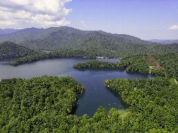
Cheoah Point Beach
Robbinsville
44.4 miles EForest Service swim beach with a roped swim area on Santeetlah Lake, 6 miles north of Robbinsville, NC. Open April 15 to October 31 with a $5 per vehicle day-use fee.
Camp, Canoe, Hike, Kayak, Swim
Vogle State Park
Blairsville, Georgia
47.2 miles SEA 233-acre park at the base of Blood Mountain in the Chattahoochee National Forest — one of Georgia's first state parks, founded in 1931.
Camp, Canoe, SwimNearby Campsites
Lake Conasauga Picnic and Swim Site
Chatsworth
20.2 miles SThe highest lake in Georgia, a 19 acre CCC-built lake at 3,150 feet on Grassy Mountain, with a designated swim area and dock on the shore opposite the campground. The campground is closed until further notice after a September 2026 water main break.
Camp, Canoe, Hike, Kayak, Swim
Morganton Point Recreation Area
Morganton, Georgia
28.0 miles SEForest Service swim beach, campground and boat ramp on a wooded point jutting into Lake Blue Ridge, two miles from the town of Morganton.
Camp, Canoe, Hike, Kayak, Swim
Davis Branch
Tellico Plains, Tennessee
30.2 miles EA riverside campground on the Tellico River with six campsites, each with a picnic table — a peaceful Tennessee base camp for hiking, fishing, and campfire nights.
Camp, Hike, Swim
Cheoah Point Beach
Robbinsville
44.4 miles EForest Service swim beach with a roped swim area on Santeetlah Lake, 6 miles north of Robbinsville, NC. Open April 15 to October 31 with a $5 per vehicle day-use fee.
Camp, Canoe, Hike, Kayak, Swim
Vogle State Park
Blairsville, Georgia
47.2 miles SEA 233-acre park at the base of Blood Mountain in the Chattahoochee National Forest — one of Georgia's first state parks, founded in 1931.
Camp, Canoe, Swim


