


Gooseberry Mesa
Hurricane, Utah

| Address: | ~Unnamed Road, Hurricane, UT 84737, USA |
| GPS: |
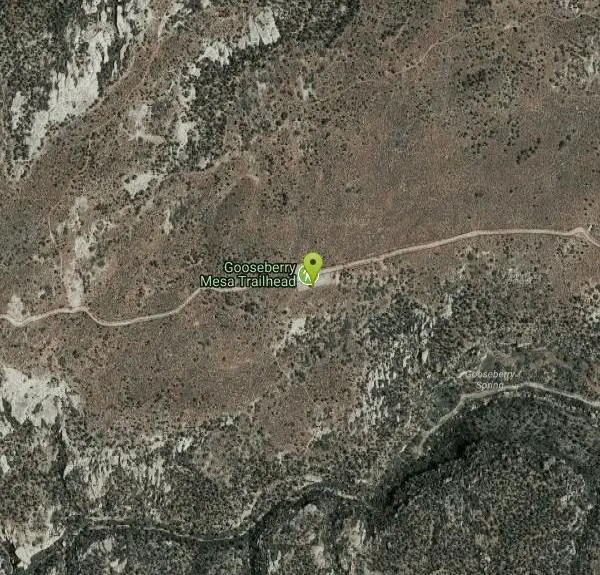
37°8'29.7"N 113°10'17.5"W Maps | Directions |
| State: | Utah |
| Trail Length: | 30.00 miles |
| MTB Difficulty: | Advanced |
| Trail Type: | Other |
| MTB Trail Type: | Singletrack |
Mountain Bike
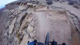
The Gooseberry Mesa trail, located near Hurricane, Utah, is one of the most scenic mountain biking trails in southern Utah. Located near the Little Creek Mesa trail, it features beautiful mesas, desert scenery, and a challenging loop for all riders. Riders can see beautiful Zion National Park from the trail and will be awestruck as they ride through this beautiful trail. The trail itself is shorter than the Little Creek Mesa trail at about 13.4 miles long, but it could be considered more difficult than the Little Creek Mesa trail because of challenging climbs, steep descents, and cliffs close to the trail.
No need to fret over the safety of the trail, it is very safe as long as riders take precautions as they ride and do not attempt to ride the trail too quickly or in inclement weather. Do not attempt to ride this trail during a rain storm or just after a rain storm to both protect riders and the trail. Rider safety can become compromised if riding during the rain with the slick rock becoming slippery creating slip and fall hazards for riders. The trail may also become damaged and harder to ride for future riders if the trail is attempted to be ridden during or just after a rain storm.
The best time to ride this trail is from April to November as the weather in the area is much better during these times and there are prime trail conditions. This trail was created just over 20 years ago by local riders who maintain the trail frequently. Mountain bikers from all over the world enjoy the Gooseberry Mesa trail because of its beauty, the untamed nature of the trail, and the challenge it presents. You will not want to miss out on the Gooseberry Mesa trail if you are in southern Utah.
More Information
Gooseberry Mesa
Gooseberry Mesa is a singletrack mountain bike trail in Hurricane, Utah. View maps, videos, photos, and reviews of Gooseberry Mesa bike trail in Hurricane.
http://www.singletracks.com/bike-trails/gooseberry-mesa/Never modify trail features. Ride trails when they're dry enough that you won't leave ruts. Speak up when you see others on the trail and always yield to hikers, horses, and others coming uphill. Always ride on the established trail.
Read More
- Plan Ahead and Prepare
- Travel & camp on durable surfaces
- Dispose of waste properly
- Leave what you find
- Minimize campfire impacts
- Respect wildlife
- Be considerate of other visitors
Directions
From Hurricane, Utah
- Head south on S 100 W (46 ft)
- Turn left at the 1st cross street onto W 100 S (0.4 mi)
- Continue onto UT-59 S (13.7 mi)
- Sharp left onto Main St (2.9 mi)
- Turn left (0.6 mi)
- Slight right (3.0 mi)
- Slight leftDestination will be on the left(1.1 mi)


Other Mountain Bike Trails Nearby
Dead Ringer
Virgin, Utah
3.9 miles WA 5-mile desert singletrack starting from the JEM trailhead near Virgin, winding through ups and downs and bottoming out in the bumpy, hoof-print-marked Goosebumps area.
Hike, Mountain Bike 3.4 mi
More Cowbell
Virgin, Utah
3.9 miles WA smooth 2.7-mile beginner mountain bike loop through red Utah desert bluffs — mostly flat singletrack that's also great for hikers and connects to more challenging trails.
Hike, Mountain Bike 7.0 mi
J.E.M. Trail
La Verkin, Utah
4.6 miles NWA 13.27-mile round-trip mountain bike trail near Hurricane, Utah with jarring terrain and sharp turns near sheer cliffs — beautiful red rock and desert views reward the effort.
Hike, Mountain Bike 
Crypto-Goosebumps
La Verkin, Utah
4.8 miles NWA flowing, narrow, and at times exposed mountain bike ride linking JEM, Hurricane Rim, Cryptobionic, and Goosebumps trails through the La Verkin area of southern Utah.
Mountain Bike 8.4 mi
Grafton Mesa
Springdale, Utah
5.2 miles EA short but adrenaline-pumping 4.6-mile experienced-only trail through red rock with views of Zion's peaks — best ridden top-down via the Springdale shuttle, and skip it when wet.
Mountain Bike 7.2 mi
Wire Mesa
Hurricane, Utah
5.6 miles EA 7.4-mile out-and-back through rolling desert mesas with options for all skill levels, beautiful southern Utah views, and a scenic overlook of Zion National Park at the end.
Mountain Bike 13.1 mi
Little Creek Mesa
Hurricane, Utah
6.4 miles SWTwenty miles of interconnected red-rock singletrack across Little Creek Mesa, Gooseberry Mesa, and West Mesa, with sheer cliffs, slickrock descents, and big scenery near Hurricane.
Mountain Bike 3.3 mi
Guacamole Mesa
Virgin, Utah
6.7 miles NEAn 11-mile advanced desert loop on Guacamole Mesa outside Zion NP — a steep, narrow climb with gorgeous red rock views gives way to a flat desert finish; avoid in rain.
Hike, Mountain Bike 
Gould's Rim trail
Hurricane, Utah
7.6 miles WA rim trail along the edge of a canyon near Hurricane, Utah — starts smooth and grows rocky, with stunning views as it winds between a doubletrack climb and the Goulds trail junction.
Mountain Bike 
Hurricane Rim trail
Hurricane, Utah
7.9 miles WA rocky singletrack rim trail above the Virgin River with slab sections, several hundred feet of exposure, and spectacular views — rideable out and back or as part of the Hurricane Loop.
Mountain Bike 
Springdale Town Loop
Hurricane, Utah
10.1 miles EA fun, tight, twisty mountain bike trail near Hurricane that can be enjoyed year-round — quick turns and flow keep it entertaining on every lap.
Mountain Bike 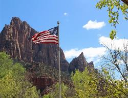
Zion National Park
Hurricane, Utah
11.3 miles NEWind, water, and ice sculpted Zion's iconic red sandstone buttes, bends, and mounts into one of the most breathtaking and irreplaceable landscapes on Earth.
Camp, Hike, Mountain Bike, Swim 11.6 mi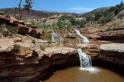
Toquerville Falls
La Verkin, Utah
11.6 miles NLedges, falls, a ladder to the best jumping spots, and a 7-foot-deep pool at the end of a 5.5-mile sandy desert drive — but stay away from the brittle, injury-prone cliff edges.
Dive, Hike, Mountain Bike, Swim 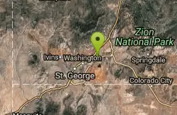
Prospector - Church Rocks Loop
Hurricane, Utah
12.5 miles WA flowing singletrack loop through red rock ledges, slickrock bowls, and sandy stretches, finishing with over a mile of slickrock riding and a dramatic encounter with large black volcanic rocks.
Mountain Bike 9.4 mi
Church Rocks
Washington, Utah
17.3 miles WA nearly 6-mile red rock ride near St. George winding through sandy desert washes and smooth slick rock — a great practice run before tackling Moab's Slick Rock Trail.
Hike, Mountain Bike 11.3 mi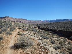
Grapevine Trail
Washington, Utah
17.6 miles WA 5-mile out-and-back trail connecting southern Utah desert, paved paths, and rocky terrain before ending at Grapevine Spring — a small waterfall cascading down red rock.
Hike, Mountain Bike 
Ice House Loop
St. George, Utah
21.9 miles WA thrilling nearly all-downhill mountain bike descent of 6.8 miles dropping 2,000 feet — part of the larger Broken Mesa Loop near St. George, Utah.
Mountain Bike 
Pioneer Park
St. George, Utah
22.1 miles WIntermediate-to-advanced technical singletrack looping near Pioneer Park with great views and some fun doubletrack — follow the turtle fence as a landmark.
Mountain Bike 
Broken Mesa Rim
St. George, Utah
22.6 miles WA climb from the Red Cliffs Desert Reserve through basalt boulders and juniper to a 5-mile twisting mesa-top descent — including a straightforward 20% grade through broken lava at the edge.
Mountain Bike 
Paradise Rim/turtle Wall
St. George, Utah
23.9 miles WA fun town-accessible ride past the Turtle Wall's slickrock and along the Paradise Rim, with technical descents and optional singletrack loops on the way back.
Mountain BikeNearby Campsites
Zion National Park
Hurricane, Utah
11.3 miles NEWind, water, and ice sculpted Zion's iconic red sandstone buttes, bends, and mounts into one of the most breathtaking and irreplaceable landscapes on Earth.
Camp, Hike, Mountain Bike, Swim 
Sand Hollow State Park
Hurricane, Utah
11.7 miles WA desert reservoir near Hurricane with a cliff-jumping area, a sandy beach for swimming and paddleboarding, and vast sand dunes for ATVs — southern Utah's desert playground.
Camp, Canoe, Dive, Kayak, Swim 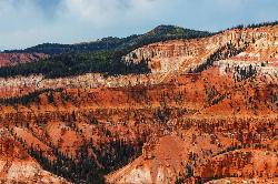
Dixie National Forest
Cedar City, Utah
45.2 miles NEOver 2 million acres of red rock canyons, forests, Duck Creek, and a ski resort span Dixie National Forest — with elevations from 2,800 to 11,322 feet and year-round recreation including skiing, snowmobiling, and hiking.
Backpack, Camp, Hike


