


45 Hiking Trails near Crystal Crag
first prev 1 2 3 next lastShowing Hiking Trails within 50 miles Distance miles of Crystal Crag near Mammoth Lakes, California City, Zip, or Address
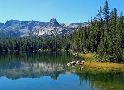
Crystal Lake
Mammoth Lakes, California
0.0 miles NA 3.2-mile roundtrip Sierra day hike past Lake George, Lake Marie, and Lake Mamie, ending at Crystal Lake beneath the monolith Crystal Crag — shaded trail with room to swim, fish, or picnic lakeside.
Camp, Hike

Crowley Lake
Mammoth Lakes, California
15.0 miles EA reservoir famed for ancient volcanic columns rising from the lakebed, along with trout fishing, and stunning Eastern Sierra scenery near Mammoth Lakes.
Hike, Swim 0.4 mi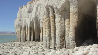
Crowley Lake Stone Columns
Mammoth Lakes, California
16.0 miles EOtherworldly 20-foot tufa columns rising from the Eastern Sierra lakebed at Crowley Lake — a geological wonder formed over 600,000 years of calcium carbonate buildup.
Hike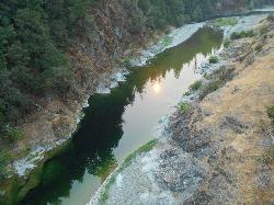
Standish Hickey Area
Lakeshore, California
19.2 miles SA two-mile stretch of the south fork of the Eel River inside a redwood canyon 180 miles from San Francisco — swim, kayak, fish, or hike, then camp near the 1,200-year-old Captain Miles Standish Tree.
Backpack, Camp, Hike, Kayak, Swim 3.6 mi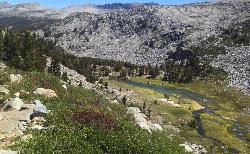
Lyell Canyon
Wawona, California
24.0 miles NWAn 8-mile, nearly flat hike through Yosemite's Tuolumne Meadows along the Lyell Fork river, with creek crossings, Kuna Creek cascades, and backcountry quiet far from the crowds.
Hike 4.0 mi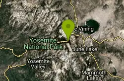
Mono Pass
Yosemite Valley, CA
24.1 miles NWAn 8-mile high-Sierra hike at 10,600 feet crossing meadows and several lakes, climbing through Bloody Canyon to sweeping views of Mono Valley and Mono Lake.
Hike, Swim 1.8 mi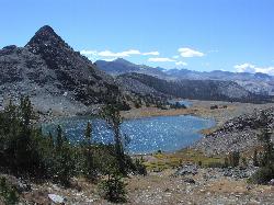
Gaylor Lakes
Yosemite Valley, CA
25.6 miles NWA 2-mile Yosemite hike with views the entire way — Dana Meadows, mountain peaks, and a high valley holding five separate lakes, with a mostly flat valley to wander once you top the pass.
Hike, Swim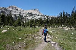
Elizabeth Lake
Wawona, California
25.8 miles NWA 4.8-mile hike with a 1,000-foot gain to a quiet alpine lake tucked between Cockscomb, Unicorn Peak, and Johnson's Peak in Yosemite's Tuolumne Meadows backcountry.
Hike, Swim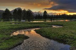
Tuolumne Meadows
Tuolumne County, California
26.3 miles NWA stunning alpine meadow in the high Sierra with granite domes and mountain views, the meandering Tuolumne River, and access to Yosemite backcountry — open summer only when the park road is clear.
Camp, Hike 0.8-4.1 mi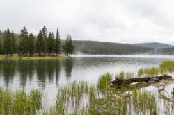
Dog Lake and Lembert Dome
Yosemite Valley, CA
26.8 miles NWA 4-mile round-trip hike through Tuolumne Meadows wildflowers to a serene evergreen lake and a granite dome with sweeping views — doable in 1.5 to 3 hours.
Hike, Swim 0.9-3.2 mi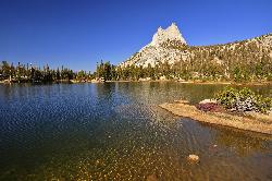
Cathedral Lakes
Wawona, California
28.1 miles NWA gorgeous 7-mile High Sierra hike along the John Muir Trail to twin lakes at 10,000 feet, framed by Cathedral, Echo, and Tressider Peaks with sweeping views of Tenaya Lake from a rock shelf.
Hike, Swim 4.0 mi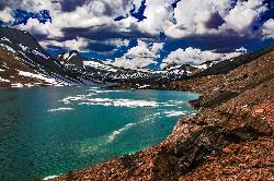
Saddlebag Lake
Lee Vining, California
28.8 miles NWAt 10,008 ft, this Eastern Sierra alpine lake offers exceptional trout fishing, a scenic four-mile loop, and a water taxi into the heart of the Twenty Lakes Basin.
Camp, Canoe, Hike 1.9 mi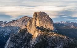
Half Dome
Yosemite Valley, Yosemite National Park
29.1 miles WA grueling 14-mile round-trip hike with 4,800 feet of gain to the summit of Half Dome, including a cable section in the final 400 feet — a permit is required and a sunrise start is essential.
Hike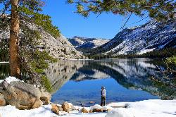
Tenaya Lake
Yosemite Valley, Yosemite National Park
29.4 miles NWTenaya Lake's glacier-carved granite shoreline offers a spacious east-beach for swimming, canoeing, and kayaking with stunning Yosemite dome views all around.
Canoe, Hike, Kayak, Swim 5.5 mi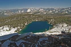
Ostrander Lake
Wawona, California
29.5 miles WAn 11.4-mile Yosemite hike to a semi-secluded swim lake surrounded by granite mountains — wildflowers, streams, and meadows in summer; open for cross-country skiing in winter via Ostrander Lodge.
Hike, Swim 6.1 mi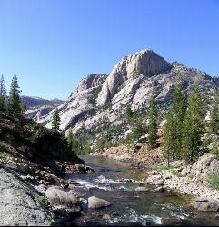
Glen Aulin
Wawona, California
30.7 miles NWAn 11-mile hike along the Tuolumne River to Glen Aulin with 800 feet of gain, passing Tuolumne Falls, Soda Springs, wildflower meadows, and the stunning White Cascade.
Backpack, Camp, Hike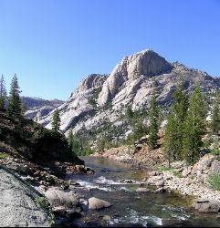
Glen Aulin
Glen Aulin, California
30.7 miles NWA popular introductory Yosemite High Country backcountry hike following the Tuolumne River to a High Sierra Camp beside the White Cascade waterfall, with further options to Waterwheel Falls.
Backpack, Camp, Hike, Swim 2.1 mi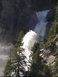
Snow Creek Falls
Yosemite Valley, Yosemite National Park
30.7 miles WA 2,140-foot, seven-drop cascade tucked deep in Tenaya Canyon — best spotted from the Mirror Lake Loop, where you can also take a swim before hunting for the falls from the Snow Creek Trail junction.
Backpack, Hike 0.4-2.1 mi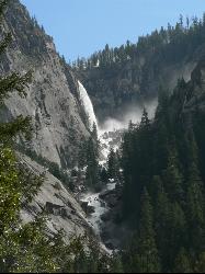
Illilouette Falls
Yosemite West, Yosemite National Park
31.0 miles WA 4-mile hike starting downhill from Glacier Point to a footbridge view of Illilouette Falls — with a side trip on the quieter Panorama Trail adding Half Dome and Nevada Falls views.
Hike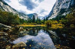
Mirror Lake
Yosemite Valley, Yosemite National Park
31.1 miles WA paved, car-free trail winds to this seasonal lake at the base of Half Dome, offering a still mirror reflection and a popular summer swimming hole.
Backpack, Hike, Swim


