


67 Hiking Trails near Teewinot Mountain
first prev 1 2 3 4 next lastShowing Hiking Trails within 50 miles Distance miles of 662 Lupine Meadows Rd, Alta, WY 83414, USA City, Zip, or Address

Yellowstone Branch Line Trail
Ashton, Idaho
38.8 miles NWYellowstone branch line trail runs from Warm River to the Montana border totaling 39 miles. There are a few places to jump on and off the trail as well as a few smaller trails that branch off of this...
Backpack, Cross-country Ski, Hike, Horseback, Mountain Bike 17.5 mi
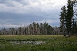
Tear Drop Lake
Ashton, Idaho
38.8 miles NWNestled in the Targhee National Forest just off of Ashton's Fish Creek Road, this tear drop shaped lake is a family adventure waiting to happen. The lake isn't very big but it is teeming with...
Camp, Canoe, Hike, Kayak, Mountain Bike, Swim 0.3-0.6 mi
Bear Gulch
Ashton, Idaho
39.4 miles NWBear Gulch is an abandoned ski hill out of operation since 1969. While the vegetation is beginning to take over, there's still some great sledding to be had. It's just far enough into the...
Camp, Cross-country Ski, Hike, Sled 13.2-13.5 mi
Bear Creek Hot Springs
Irwin, Idaho
40.2 miles SWBear Creek Hot Springs is a 15 mile out and back trail with a hot spring at the end. The trail is not well marked and is only recommended for very experienced outdoorsmen and primarily used for...
Backpack, Camp, Hike, Horseback, Hot Springs, Mountain Bike 6.9 mi
Heart Lake Trail
Grant Village, Yellowstone National Park
40.8 miles NThe trail is very clear and leads to a moderate eight mile hike to Heart Lake. This hike has many possibilities. Day hikers need to push their time to make sure they are on the trail early to allow...
Backpack, Camp, Hike, Hot Springs 2.1-11.5 mi
Lewis River Channel / Dogshead Loop
Grant Village, Yellowstone National Park
41.0 miles NAnyone who doesn't want to backpack through Yellowstone but is looking to experience the real beauty of Yellowstone will truly love this hike. Walking along the Lewis Channel is one of the...
Canoe, Hike, Kayak 0.6-2.2 mi
Fish Creek Area
Ririe, Idaho
41.5 miles WFish Creek is a network of mountain bike trails up in the Big Hole Mountains. The trails are easily accessed from either the Ririe or Rexburg side of the range. The trail system is set up much...
Hike, Mountain Bike
Mesa Falls
Ashton, Idaho
42.7 miles NWUpper Mesa Falls, aka Big Falls, is an absolutely awesome waterfall on the Henrys Fork of the Snake River. The falls drop 114 ft. and measure 300 ft. across. To get to the falls from the parking lot...
Cross-country Ski, Hike, Kayak 0.5-3.5 mi
Webster's Dam
Ririe, Idaho
42.9 miles WAlso known as Manmade Falls or the Woodmansee Dam, Webster Dam is an abandoned dam located deep in Moody Creek canyon, the dam was abandoned when sediment built up behind the dam which then...
Camp, Hike, Mountain Bike 1.1 mi
Hidden Vista / Pine Loop
Ririe, Idaho
43.2 miles WYou'll find the Hidden Vista trailhead on the South End of the Buckskin Morgan parking lot about a mile past Y Junction. This is a short trail with a little up and a little down for just under a...
Hike, Mountain Bike 1.7 mi
Buckskin Morgan Ridge
Ririe, Idaho
43.2 miles WGoing up is a little tough because of the rocks, but once you clear the top it is a twisty down hill portion [until] you get to a fenced road. From there you can turn around or keep going strait...
Hike, Mountain Bike
Poison Flats
Ririe, Idaho
43.3 miles WHike near Ririe, Idaho
Hike 4.8 mi
Riddle Lake Hike
Grant Village, Yellowstone National Park
43.8 miles NRiddle Lake hike is a 5 mile roundtrip hike. Riddle Lake is an alluring body of water with a sandy beach. The hiker gets the best of both worlds on this hike. Impressive pine and mountain views,...
Hike 3.8 mi
Kelly Mountain Trail
Ririe, Idaho
43.9 miles WKelly Canyon Trail is a moderate, uphill trail that can be used by hikers, mountain bikers, and ATV riders. The trail features views of hills, mountains, trees, wildflowers, and some wildlife. Dogs...
Cross-country Ski, Hike, Mountain Bike, Snowshoe
Sheep Falls on Henry's Fork
Island Park, Idaho
45.8 miles NWSheep Falls cascades approximately 25' through a narrow basalt chute on the North Fork of the Snake River near Island Park, Idaho. Compared to nearby Lower and Upper Mesa Falls, that height may...
Hike
Herbert Idaho Ghost Town
Ririe, Idaho
45.9 miles WCLOSED. Private property marked NO TRESPASSING. Herbert is a small ghost town that was operated until the 40s, but with the invention of the automobile, it was much more convenient to live in Rexburg...
Hike 3.8 mi
Stinking Springs
Ririe, Idaho
46.2 miles WStinking Springs is a great early to late season trail. Being at the edge of the Big Hole range, it gets spring earlier and winter later than other trails in the range. It's closed from December...
Hike, Mountain Bike 2.6 mi
Lone Star Geyser Trail
Old Faithful, Yellowstone National Park
47.3 miles NLone Geyser Star Trail is a hiking and mountain biking trail that leads through the forest to the colorful Lone Star Geyser. The Geyser here has beautiful white, yellow and orange colors in the...
Hike, Mountain Bike
Murphy Lakes
Bedford, Wyoming
47.4 miles SCanoe, Hike, and Swim near Bedford, Wyoming
Canoe, Hike, Swim 1.4 mi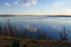
Yellowstone Lake Overlook Trail
Grant Village, Yellowstone National Park
47.7 miles NYellowstone Lake Overlook Trail is a 1.7 mile loop trail that is easy and great for beginner hikers. The trail begins near the West Thumb Geyser Basin Parking Lot and is open in the summer and fall.
Hike


