


Map of 64 Hiking Trails near Herriman, UT 84096
first prev 1 2 3 4 next lastShowing Hiking Trails within 50 miles Distance miles of Herriman, UT 84096, USA City, Zip, or Address

Pete's Rock
Salt Lake City, Utah
15.3 miles NEA large rock next to the Mount Olympus trailhead known locally as Pete's Rock and is a popular place for casual rock climbing. Mount Olympus is a prominent 9,026 feet peak on the east side of the...
Hike, Rock Climb 0.7 mi
Great White Icicle
Sandy, Utah
15.7 miles EThe Great White Icicle is located in Little Cottonwood Canyon just outside of Salt Lake City, Utah. It is a climbing area that is a frozen waterfall in the winter and a cascading waterfall...
Hike, Rock Climb
Lisa Falls
Sandy, Utah
16.6 miles ELisa Falls is a great place to climb Spring through Fall, any time of day. The base is well shaded by trees and offers many flat places to belay, or just hang out and relax. The roaring waterfall...
Hike, Rock Climb
Storm Mountain
Salt Lake City, Utah
17.0 miles NEStorm Mountain is on of the smaller peaks included in the Wasatch Range. Storm Mountain is located in Cottonwood Canyon. Storm Mountain Day Use Area is just 3 miles up Big Cottonwood Canyon,...
Hike, Mountain Bike, Rock Climb 1.5 mi
Timpanogas Cave
Provo, Utah
17.9 miles EKnown for it's colorful cave decorations, the Timpanogas cave attracts numerous visitors per year, is steep but it's paved so that visitors can access the cave. To access the cave, visitors...
Backpack, Cave, Hike
Hidden Falls
Salt Lake City, Utah
18.2 miles NEHidden Falls is a popular road side attraction for anyone cruising Big Cottonwood Canyon on a sunny afternoon. The falls are within strolling distance of the parking lot and only require about 15...
Hike
White Pine Lake
Sandy, Utah
18.7 miles EWhite Pine Canyon has long been the subject of intense controversy between advocates of wilderness and ski resort owners. The original boundaries of Lone Peak Wilderness Area, created in 1977, were...
Hike, Mountain Bike
Lake Blanche
Salt Lake City, Utah
18.9 miles ELake Blanche is a fun and popular hike. Lake Blanche, Lake Florence and Lake Lillian are all located next to each other in the upper reaches of the South Fork of Mill B. The trail to Lake Blanche...
Hike
Pfeiferhorn Peak
Provo, Utah
19.0 miles EThe Pfeifferhorn is a majestic peak, which is located east of Salt Lake City, Utah in the Wasatch mountain range. It's easy access, proximity to alpine lakes and short trail make it a popular...
Backpack, Hike 2.6 mi
Salt Lake Valley Scenic Overlook
Salt Lake City, Utah
19.1 miles NEThe Salt Lake Valley Scenic overlook starts on the Desolation trail in Millcreek Canyon near Salt Lake City, Utah and offers hikers a wide variety of destinations to stop at along the trail,...
Hike
Grove Creek Trail
Pleasant Grove, Utah
19.5 miles SEThe Grove Creek Trail falls from the upper shoulder of Mount Timpanogos down Grove Creek Canyon to Pleasant Grove. It's usually ridden as a shuttled downhill -- because the climb up this...
Hike, Mountain Bike
Grandeur Peak
Salt Lake City, Utah
19.6 miles NEGrandeur Peak is the most easily accessible of the major peaks that form the Salt Lake City skyline. For many valley residents Grandeur Peak was there first major summit. The peak offers great...
Hike
American Fork Twin Peaks
Provo, Utah
19.9 miles EAmerican Fork Twin Peaks is the highest mountain on the Little Cottonwood Canyon ridge. The summit is the prominent peak overlooking the Snowbird ski resort. A short approach hike...
Hike
G Mountain Trail
Pleasant Grove, Utah
20.4 miles SEThe trail starts at Kiwanis Park which is south of the 'G' at the end of Battle Creek Road. The trail starts out a little steep for about .25 mile and the very last bit is a...
Hike 1.2 mi
Battle Creek Falls
Pleasant Grove, Utah
20.4 miles SEBattle Creek Falls, located near Pleasant Grove, Utah, is a scenic waterfall that also has a rappelling and rock climbing area nearby. Hikers are allowed to see the falls from two view points, below...
Canyoneer, Hike 4.7 mi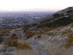
Bonneville Shoreline Trail
Salt Lake City, Utah
20.7 miles NEBonneville Shoreline Trail is a great place for hiking, biking, and trail running. It stretches from North Salt Lake to Parley's Canyon. The trail follows the shoreline of ancient Lake...
Hike, Mountain Bike 1.6-14.1 mi
Mount Timpanogas
Provo, Utah
21.5 miles EMt. Timp, as the locals call it, is the 2nd highest mountain in the Wasatch range (only Mt. Nebo is higher). What sets "Timp" apart is its location. It towers over the Provo, Orem, Pleasant...
Camp, Hike, Horseback, Swim

Sugarloaf Peak
Alta, Utah
21.7 miles ESugarloaf Peak is an easily reached 11,000 ft. summit which overlooks Albion Basin, Secret Lake, and much of Utah's Alta ski resort. The easy terrain and relatively high trailhead elevation...
Hike
Cecret (Secret) Lake
Alta, Utah
21.9 miles ECecret (pronounced "Secret") Lake is a beautiful lake located among alpine meadows in Little Cottonwood Canyons Albion Basin. Some folks spell Secret Lake as Cecret Lake, but the USGS...
Hike
Donut Falls
Salt Lake City, Utah
22.2 miles NEVery popular beginning hike in the Salt Lake City area. Many take this as a good intro hike into the outdoors, while others go for a trip out with friends to escape the rush of daily life. The...
Hike, Swim


