


25 Hiking Trails near Mackay, ID 83251
first prev 1 2 next lastShowing Hiking Trails within 50 miles Distance miles of Mackay, ID 83251, USA City, Zip, or Address
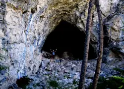
Hidden Mouth Cave
Moore, Idaho
9.2 miles EA surprisingly large lava cave with three chambers and a secret back exit — reached by quad or a quarter-mile steep hike above Moore, Idaho.
Cave, Hike 7.9 mi
Borah Peak
Mackay, Idaho
18.6 miles NWIdaho's highest peak at 12,662 feet offers a Class 3-4 summit route along 'Chicken-out' Ridge — complete with a snow knife-edge, talus, and the kind of exposure that separates the committed from the casual.
Hike
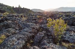
North Crater Flow
Arco, Idaho
31.7 miles SThe North Crater Flow Trail is one of the best first stops at Craters of the Moon National Monument, a short, paved, accessible loop that carries visitors out across a genuine river of hardened lava...
Hike 0.5 mi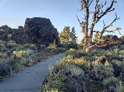
Devil's Orchard Trail
Visitors Center, Craters of the Moon National Monument
32.2 miles SA paved, wheelchair-accessible trail through cinder beds and ancient North Crater wall fragments, with exhibits on protecting this fragile volcanic environment.
Hike 1.0-1.3 mi
Caves Trail
Visitors Center, Craters of the Moon National Monument
32.6 miles SThe Caves Trail at Craters of the Moon National Monument leads into one of the most otherworldly landscapes in Idaho: a field of lava tubes formed by ancient volcanic eruptions on the high sagebrush...
Cave, Hike 0.4 mi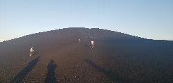
Inferno Cone
Visitors Center, Craters of the Moon National Monument
32.7 miles SA steep climb up Inferno Cone at Craters of the Moon, rewarded with panoramic views of the Great Rift, Snake River Plain, and Pioneer Mountains — and on clear days, the Tetons 100 miles away.
Hike 1.8 mi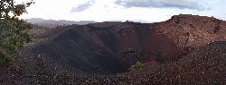
North Crater Trail
Visitors Center, Craters of the Moon National Monument
32.8 miles SA one-way trail through North Crater and Big Craters at Craters of the Moon — dropping into a volcanic crater mouth and ending at Spatter Cones, with fragile lava formations off-limits to protect.
Hike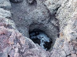
Snow Cone
Visitors Center, Craters of the Moon National Monument
32.8 miles SThe Snow Cone is one of the more surprising little features at Craters of the Moon National Monument, a small, narrow, deep spatter cone on the volcanic Snake River Plain of central Idaho that holds...
Hike 0.1 mi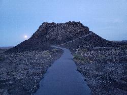
Spatter Cones
Visitors Center, Craters of the Moon National Monument
32.8 miles SMiniature volcanoes formed by lobbed molten lava blobs at Craters of the Moon — a must-see feature that symbolizes this unique national monument; stay on trails to protect the delicate spatter cones.
Hike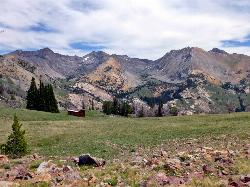
Pioneer Cabin Trail
Sun Valley
33.2 miles WA steep, switchbacking trail from the Corral Creek trailhead east of Sun Valley to Pioneer Cabin, a 1937 Union Pacific ski hut with close views of the Pioneer Mountains.
Hike, Mountain Bike 1.7 mi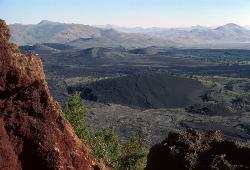
Broken Top Loop Trail
Visitors Center, Craters of the Moon National Monument
33.8 miles SA hike over, under, and around a 2,000-year-old cinder cone and lava flows in Craters of the Moon, with access to Buffalo Cave — bring a flashlight and free permit.
Cave, Hike 1.9 mi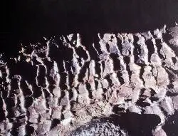
Tree Molds Trail
Visitors Center, Craters of the Moon National Monument
33.8 miles SA paved trail winding through Craters of the Moon Wilderness to a lava flow that captured the shapes of fallen and standing trees in cooling rock — look for wooden posts marking the molds.
Hike 8.8 mi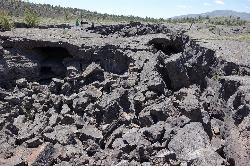
Wilderness Trail
Visitors Center, Craters of the Moon National Monument
33.8 miles SA solitary wilderness hike through young lava flows and cinder cones at Craters of the Moon, passing lava trees and ending near Echo Crater — a great backcountry camping spot.
Cave, Hike 0.3 mi
Birch Creek Charcoal Kilns
Leadore, Idaho
34.7 miles NESixteen remarkably intact 20-foot beehive brick kilns stand in remote Idaho as relics of an 1880s silver-mining operation that employed 200 workers for barely three years.
Hike 1.1-4.1 mi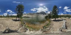
Meadow Lake
Leadore, Idaho
38.7 miles NA remote alpine lake in the Sawtooth Wilderness, tucked in the Sawtooth Mountains with no maintained trails and accessible only with a wilderness permit — $10–$20 per night to camp nearby.
Camp, Canoe, Hike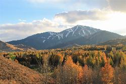
White Cloud Loop
Sun Valley, Idaho
40.1 miles WA 4.2-mile dirt loop around the White Clouds golf course in Sun Valley, maintained by Sun Valley Company and open to hikers, runners, riders and leashed dogs. It dries out early in spring and looks across at Bald Mountain and the Boulder Mountains.
Hike, Mountain Bike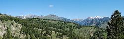
Fox Creek Loop
Ketchum, Idaho
40.8 miles WA 6-mile singletrack loop north of Ketchum that climbs through the 2007 Castle Rock burn, drops through aspen and finishes along the Big Wood River. Bikes ride it one way, counter-clockwise.
Hike, Mountain Bike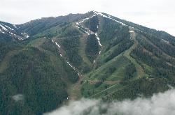
Bald Mountain Trail
Ketchum, Idaho
41.3 miles SWThe main hiking and uphill-only biking route up Bald Mountain, climbing about 5.2 miles and 3,200 feet from River Run Plaza in Ketchum. Many hikers stop at the Roundhouse about 4 miles up.
Hike, Mountain Bike
Adams Gulch Loop
Ketchum, Idaho
41.4 miles WKetchum's busiest trail network, with easy loops on Shadyside and Sunnyside, the Griffin Butte intermediate loop and the one-way, bike-only Forbidden Fruit flow trail. The trailhead is less than two miles north of town.
Hike, Mountain Bike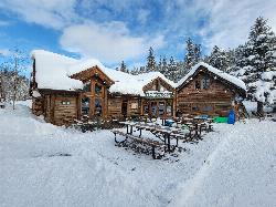
Harriman Trail
Ketchum
41.4 miles WAn 18-mile gravel path from the Sawtooth National Recreation Area headquarters north of Ketchum to Galena Lodge. It is open to bikes, hikers and horses in summer and groomed by BCRD for Nordic skiing in winter.
Cross-country Ski, Cycle, Hike, Mountain Bike


