


Homestead Crater
Midway, Utah
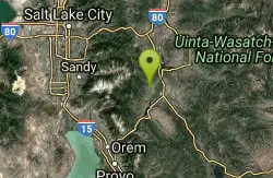
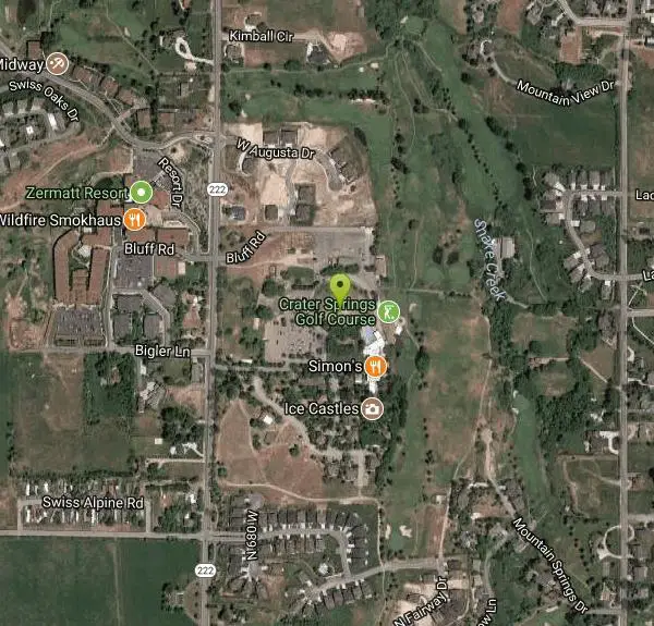
| Address: | 700 North Homestead Drive, Midway, UT 84049 |
| GPS: |
40°31'25.7"N 111°29'6.4"W Maps | Directions |
| State: | Utah |
Hot Springs and Swim
The Homestead Caldera, known locally as "The Crater" is a natural hot spring surrounded by a rock dome. It is located in Midway, Utah. It is a commercial location open year round to scuba divers and swimmers. Originally, it was accessed from a large natural opening at the top of the dome, but has since had a tunnel blasted through horizontally for easy access. The Crater began forming 10,000 years ago, and is made of minerals deposited by the rising, heated spring water.
More Information
Be careful. Pay attention to posted signs and always test the waters before you get in. Some hot springs can get up to boiling temperatures. Be sure to drink plenty of water to combat the dehydrating effect of the spring.
Be respectful of other soakers and the hot spring. Don't hog the pool. Camp at least 200 yards away and keep fires in designated areas. Keep your pets out of the water and never pee in thermal feature. Glass bottles should never go near a hot spring.

- Plan Ahead and Prepare
- Travel & camp on durable surfaces
- Dispose of waste properly
- Leave what you find
- Minimize campfire impacts
- Respect wildlife
- Be considerate of other visitors
Directions
From Midway, Utah
- Head west on W Main St toward N 200 W (0.1 mi)
- Turn right at the 1st cross street onto N 200 W (0.2 mi)
- Turn left at the 2nd cross street onto W 200 N (0.8 mi)
- Continue onto Homestead Dr (0.3 mi)
- Turn right (446 ft)
- Turn right (190 ft)
- Turn leftDestination will be on the right(190 ft)
From Salt Lake City/Ogden: Take Interstate 80 east up Parley's Canyon. Exit at U.S. 40/U.S. 189 and go south past the Jordanelle Reservoir. Just after descending from the dam, turn right towards Midway/Wasatch Mountain State Park. After a few miles, you'll arrive in Midway. Turn right at the stop sign. Follow the signs to the Homestead Resort.
Other Swimming Holes and Hot Springs Nearby

Mount Timpanogas
Provo, Utah
10.3 miles SWUtah's most-climbed mountain towers 7,000 feet above the Provo valley, stretching seven miles north to south with multiple peaks over 11,000 feet — a Wasatch landmark.
Camp, Hike, Horseback, Swim 
Donut Falls
Salt Lake City, Utah
12.2 miles NWA waterfall that pours through a hole in a cave ceiling — earning the 'donut' name — on a family-friendly 3-mile round-trip hike through Big Cottonwood Canyon.
Hike, Swim 
Alpine Rock Water Slide
Alpine, Utah
15.4 miles WCLOSED. The land has been sold and the new owner has closed off the waterslide to the public. The Alpine Waterslide has been permanently closed to the public after the land was sold — new hiking trails now connect the area to the city trail system and National Forest.
Swim 
Saratoga Hot Springs
Saratoga Springs, Utah
24.8 miles SWThree naturally heated pools around 100°F year-round, a muddy beautiful setting, and an easy walk to nearby Utah Lake for wildlife watching between soaks.
Hike, Hot Springs 4.7 mi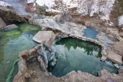
Fifth Water Hot Springs
Provo, Utah
31.1 miles SA scenic 2.5-mile riverside hike to the famous Diamond Fork rock pools and waterfall, with soaks up to 108°.
Backpack, Camp, Hike, Hot Springs, Mountain Bike, Swim 
Mirror Lake
Salt Lake City, Utah
33.6 miles EA mirror-calm alpine lake reflecting its forest and mountain surroundings, open to swimming, kayaking, canoeing, and fishing year-round — with easy shoreline trails and tougher mountain paths nearby.
Backpack, Hike, Mountain Bike, Swim 
Salem Pond
Salem, Utah
34.2 miles SA community gem with kayaking, paddleboarding, fishing, a trail around the whole pond, a bridge for summer jumping, and Christmas lights in winter — Salem Pond does it all.
Canoe, Kayak, Skateboard, SwimNearby Campsites
Mount Timpanogas
Provo, Utah
10.3 miles SWUtah's most-climbed mountain towers 7,000 feet above the Provo valley, stretching seven miles north to south with multiple peaks over 11,000 feet — a Wasatch landmark.
Camp, Hike, Horseback, Swim 
Spruces Campground
Salt Lake City, Utah
11.4 miles NWA fee campground in Big Cottonwood Canyon near Salt Lake City — check USDA.gov for current rates and seasonal availability.
Camp, Sled 
Mill Creek Canyon
Salt Lake City, Utah
17.1 miles NWAn out-and-back canyon trail with over 1,000 feet of elevation gain — the lower ski trail sees heavy traffic while the upper section above Elbow Fork stays quiet, with a reservable Yurt at the top December through April.
Camp, Cross-country Ski, Snowshoe 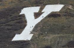
Y-Mountain Summit Trail
Provo, Utah
20.3 miles SA 1.2-mile climb east of BYU leads to a massive block Y on the hillside and sweeping panoramas over Provo, Orem, Utah Valley, and Utah Lake below.
Camp, Hike 
Holbrook Trailhead
Bountiful, Utah
31.0 miles NWThe Holbrook Trailhead is a popular access point for the Bonneville Shoreline Trail and Holbrook Canyon above Bountiful, Utah, on the western face of the Wasatch. Perched on the bench right at the...
Airsoft, Backpack, Camp, Paintball, Snowshoe 4.7 mi
Fifth Water Hot Springs
Provo, Utah
31.1 miles SA scenic 2.5-mile riverside hike to the famous Diamond Fork rock pools and waterfall, with soaks up to 108°.
Backpack, Camp, Hike, Hot Springs, Mountain Bike, Swim 
Hell Hole Lake
Evanston, Utah
38.1 miles NEA challenging wash hike in Evanston's Dry Wash, navigating sand and boulders for 1.8 miles to Hellhole Canyon at the edge of the Red Mountain Wilderness.
Camp, Hike, Horseback


