


Lake Wilderness Park Swim Beach
Maple Valley, Washington

| GPS: |
47°22'34.1"N 122°2'25.7"W Maps | Directions |
| State: | Washington |
Canoe, Hike, Kayak, and Swim
Lake Wilderness Park is Maple Valley's 117-acre city park on the north shore of Lake Wilderness, and its swim beach is one of the few in south King County that still has lifeguards. The beach is a curve of sand below the lawn with a big L-shaped dock wrapping around the roped swim area, a bathhouse and a concession stand beside it, and the city's Lake Wilderness Lodge on the rise above. Lifeguards are on duty daily from late June to late August, noon to 7 p.m., with a couple of bonus weekend days at the end of the season; outside those hours the beach is open but unguarded, and the city can close it for weather or water quality. During guard season the same stand rents canoes, paddleboards and pedal boats.
The park is free and open year round from 7 a.m. to dusk. There is no motor traffic on the water: internal-combustion engines are banned on the lake, so the launch at the park is for electric motors, paddle craft and rowboats. The lake is stocked with trout, and the annual fishing derby on opening day in late April fills the dock. King County posts bacteria and temperature readings for the beach on its swim beach page.
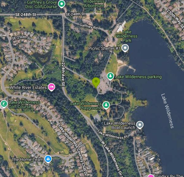
The rest of the park is set up for a full day. A large playground rebuilt in 2018 has a rope climbing structure, slides, a merry-go-round and an accessible swing; there are three covered shelters and five picnic sites that reserve May through September, tennis and pickleball courts, Patrick's Field for softball, and dozens of picnic tables across the lawn. Dogs are allowed on leash. Alcohol is prohibited. The Green to Cedar Rivers Trail runs through the park and connects to the Cedar River Trail, so it is reachable by bike from Renton without touching a highway.
The 40-acre Lake Wilderness Arboretum, run by a volunteer foundation since 1965, is on the west side of the park and holds one of the world's largest collections of western azalea along with native plant gardens and forest trails. The lodge, a 1950s resort building the city rents for weddings, looks over the lake from all three floors.
The park was a King County park until Maple Valley incorporated and took it over in 2003. Maple Valley Days in June, the Fourth of July fireworks and summer concerts all happen here, and the parking lot becomes a carnival midway for the June festival. The entrance is at 22500 SE 248th Street, off Witte Road, about 30 miles southeast of Seattle.
More Information
Be courteous, informed, and prepared. Read trailhead guidelines, stay on the trail, and don't feed the wildlife.
Read More
- Plan Ahead and Prepare
- Travel & camp on durable surfaces
- Dispose of waste properly
- Leave what you find
- Minimize campfire impacts
- Respect wildlife
- Be considerate of other visitors
Directions
From Maple Valley, Washington
- Head west on Witte Rd SE toward Witte Rd SE (0.8 mi)
- At the traffic circle, take the 3rd exit onto SE 248th St (0.3 mi)
- Turn right onto 224th Ave SE/
Lake Wilderness Park Continue to follow 224th Ave SE(0.2 mi) - Turn leftDestination will be on the right(0.1 mi)
 The swim beach and lake at Lake Wilderness Park courtesy of Steven Pavlov↗ (CC BY-SA 4.0↗)

 Sunrise over the lake from the beach building courtesy of Steven Pavlov↗ (CC BY-SA 4.0↗)

 Lake Wilderness and the docks courtesy of Steven Pavlov↗ (CC BY-SA 4.0↗)

 Winter reflections on Lake Wilderness courtesy of Steven Pavlov↗ (CC BY-SA 4.0↗)

 The playground courtesy of Steven Pavlov↗ (CC BY-SA 4.0↗)
 Picnic shelter in the park courtesy of Steven Pavlov↗ (CC BY-SA 4.0↗)
 The park lawn in autumn courtesy of Roc0ast3r↗ (CC0↗)

Other Swimming Holes, Hiking Trails, Canoeing Areas, and Kayaking Areas Nearby

Lake Sammamish State Park Beaches
Issaquah, Washington
12.6 miles NSunset Beach and Tibbetts Beach at the south end of Lake Sammamish, a 512-acre state park off I-90 in Issaquah with paddle rentals, playgrounds, trails and a boat launch.
Hike, Kayak, Mountain Bike, Swim 
Seattle Area Beaches
Leavenworth, Washington
14.8 miles NWSwim near Leavenworth, Washington
Swim 
Snoqualmie River Area
Leavenworth, Washington
15.5 miles NEScenic Snoqualmie River swimming areas are best visited in late summer when currents slow — strong currents have caused drownings at other times of year.
Swim 1.5 mi
Twin Falls Trail
North Bend, Washington
16.7 miles EA peaceful 3-mile river hike near North Bend that arrives at a beautiful waterfall viewpoint bridge at the halfway point, open rain or shine with easy access for all ages.
Hike 
Dash Point Beach
Federal Way, Washington
17.6 miles WDash Point State Park beach catches afternoon sun and relatively warm Puget Sound water, with restrooms, an outdoor shower, and camping just steps away.
Swim 
Blake Island
Port Orchard, Washington
23.9 miles NWBlake Island State Park near Port Orchard is a 476-acre island paradise for kayaking, bird watching, year-round camping, and Tillicum Village cultural tours.
Camp, Hike 
island lake
North Bend, Washington
25.1 miles EA quieter alternative to the crowded Snoqualmie Pass hikes — shed the weekend throngs who turn back at Talapus or Olallie Lake and discover Island Lake in western Washington.
Camp, Hike, Swim 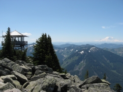
Granite Mountain
North Bend, Washington
25.8 miles EA steep, rewarding hike up Granite Mountain gaining about 1,000 feet per mile, with panoramic summit views of Mount Rainier, Mount Stewart, and the Teanaway — best tackled after the snow melts.
Backpack, Hike 5.4 mi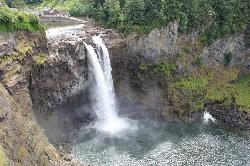
Middle Fork Snoqualmie Trail
North Bend, Washington
26.3 miles NECLOSED. Closed due to landslide activity.
Hike, Mountain Bike 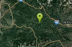
Green River Area
Ronald, Washington
28.7 miles SESeveral informal swimming spots in the Upper Green River east of Seattle and North Bend — a casual and scenic escape with clothing sometimes optional.
Swim 7.0 mi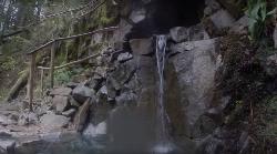
Goldmyer Hot Springs Trail
North Bend, Washington
31.3 miles EA strenuous 4.5-mile-each-way hike through lush forest to the remote Goldmyer Hot Springs — camping and soaking available by reservation and fee at the springs.
Hike, Hot Springs 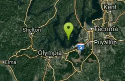
Lowell Johnson Park
Anderson Island, Washington
33.7 miles SWSwim near Anderson Island, Washington
Swim 
Skyscraper Mountain Trail
Ashford, Washington
35.0 miles SEA gorgeous day hike to 7,078-foot Skyscraper Mountain in Mount Rainier NP, with unobstructed Cascade Range views, Moraine Peak vistas, and Mystic Lake sightings from the summit.
Hike 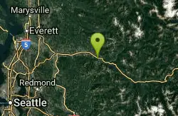
Skykomish Area
Leavenworth, Washington
36.5 miles NESwim near Leavenworth, Washington
Swim 
Eatonville Area
Palisades, Washington
37.2 miles SSwim near Palisades, Washington
Swim 
Mount Rainer
Ashford, Washington
38.3 miles SThe most glaciated peak in the contiguous U.S. at 14,410 feet — an active volcano with six major rivers, subalpine wildflower meadows, ancient forest, and abundant wildlife.
Camp, Hike, Mountain Bike 
French Cabin Creek
Ronald, Washington
43.5 miles ETwo cold, clear swimming spots in a National Forest creek on either side of a bridge near Ronald, Washington — clothing may be optional.
Swim 
Jade Lake
Skykomish, Washington
45.7 miles NEA 26-mile overnight backpacking route through the Snoqualmie region past wildflower meadows, Marmot Lake, and a steep talus scramble to a remote alpine lake for swimming.
Backpack, Camp, Swim 
Rainier East Area
Naches, Washington
48.3 miles SESwim near Naches, Washington
SwimNearby Campsites
Blake Island
Port Orchard, Washington
23.9 miles NWBlake Island State Park near Port Orchard is a 476-acre island paradise for kayaking, bird watching, year-round camping, and Tillicum Village cultural tours.
Camp, Hike
island lake
North Bend, Washington
25.1 miles EA quieter alternative to the crowded Snoqualmie Pass hikes — shed the weekend throngs who turn back at Talapus or Olallie Lake and discover Island Lake in western Washington.
Camp, Hike, Swim
Mount Rainer
Ashford, Washington
38.3 miles SThe most glaciated peak in the contiguous U.S. at 14,410 feet — an active volcano with six major rivers, subalpine wildflower meadows, ancient forest, and abundant wildlife.
Camp, Hike, Mountain Bike
Jade Lake
Skykomish, Washington
45.7 miles NEA 26-mile overnight backpacking route through the Snoqualmie region past wildflower meadows, Marmot Lake, and a steep talus scramble to a remote alpine lake for swimming.
Backpack, Camp, Swim


