


Mount Rainer
Ashford, Washington
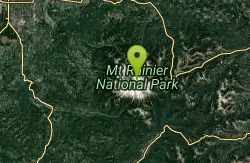
| GPS: |
46°51'50.2"N 121°43'42.7"W Maps | Directions |
| State: | Washington |
Camp, Hike, and Mountain Bike
Ascending to 14,410 feet above sea level, Mount Rainier stands as an icon in the Washington landscape. An active volcano, Mount Rainier is the most glaciated peak in the contiguous U.S.A., spawning six major rivers. Subalpine wildflower meadows ring the icy volcano while ancient forest cloaks Mount Rainier’s lower slopes. Wildlife abounds in the park’s ecosystems. A lifetime of discovery awaits.
More Information
Mount Rainier National Park Itinerary
This Mount Rainier National Park Itinerary will help you get started as you plan your vacation to Mount Rainier National Park.
https://www.justgotravelstudios.com/collections/national-park-itineraries/products/mount-rainier-national-park-itinerary?ref=9zpxis0diinMount Rainier National Park (U.S. National Park Service)
Ascending to 14,410 feet above sea level, Mount Rainier stands as an icon in the Washington landscape. An active volcano, Mount Rainier is the most glaciated peak in the contiguous U.S.A., spawning five major rivers. Subalpine wildflower meadows ring the icy volcano while ancient forest cloaks Mount Rainier’s lower slopes. Wildlife abounds in the park’s ecosystems. A lifetime of discovery awaits.
https://www.nps.gov/mora/index.htmNever modify trail features. Ride trails when they're dry enough that you won't leave ruts. Speak up when you see others on the trail and always yield to hikers, horses, and others coming uphill. Always ride on the established trail.
Read MoreBe courteous, informed, and prepared. Read trailhead guidelines, stay on the trail, and don't feed the wildlife.
Read More
- Plan Ahead and Prepare
- Travel & camp on durable surfaces
- Dispose of waste properly
- Leave what you find
- Minimize campfire impacts
- Respect wildlife
- Be considerate of other visitors
Directions
- Get directions on Google Maps
From Seattle
South on I-5 to SR 512 (exit 127). East on SR 512 to SR 7. South on SR 7 to SR 706 in Elbe. East on SR 706 through Ashford to the Nisqually Entrance.

Other Mountain Bike Trails and Hiking Trails Nearby

Skyscraper Mountain Trail
Ashford, Washington
4.6 miles NA gorgeous day hike to 7,078-foot Skyscraper Mountain in Mount Rainier NP, with unobstructed Cascade Range views, Moraine Peak vistas, and Mystic Lake sightings from the summit.
Hike
Lake Wilderness Park Swim Beach
Maple Valley, Washington
38.3 miles NFree city park beach on Lake Wilderness in Maple Valley with summer lifeguards, canoe and paddleboard rentals, a concession stand, a big playground and a 40-acre arboretum.
Canoe, Hike, Kayak, Swim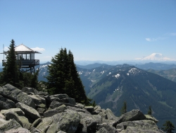
Granite Mountain
North Bend, Washington
38.6 miles NA steep, rewarding hike up Granite Mountain gaining about 1,000 feet per mile, with panoramic summit views of Mount Rainier, Mount Stewart, and the Teanaway — best tackled after the snow melts.
Backpack, Hike 1.5 mi
Twin Falls Trail
North Bend, Washington
40.2 miles NA peaceful 3-mile river hike near North Bend that arrives at a beautiful waterfall viewpoint bridge at the halfway point, open rain or shine with easy access for all ages.
Hike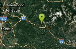
island lake
North Bend, Washington
40.9 miles NA quieter alternative to the crowded Snoqualmie Pass hikes — shed the weekend throngs who turn back at Talapus or Olallie Lake and discover Island Lake in western Washington.
Camp, Hike, Swim 7.0 mi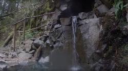
Goldmyer Hot Springs Trail
North Bend, Washington
45.9 miles NA strenuous 4.5-mile-each-way hike through lush forest to the remote Goldmyer Hot Springs — camping and soaking available by reservation and fee at the springs.
Hike, Hot Springs 5.4 mi
Middle Fork Snoqualmie Trail
North Bend, Washington
48.1 miles NCLOSED. Closed due to landslide activity.
Hike, Mountain Bike


