


Mono Hot Springs
Lakeshore, California
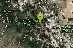
| GPS: |
37°19'33.6"N 119°1'4.8"W Maps | Directions |
| State: | California |
Hot Springs and Swim
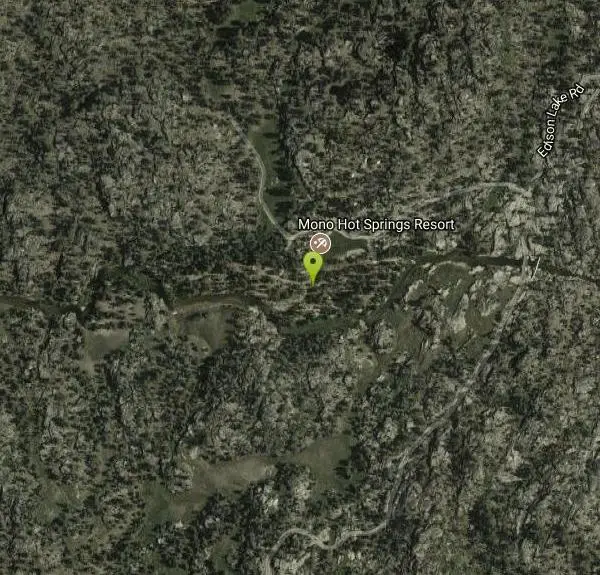
Mono Hot Springs is a magical high-Sierra retreat in California's Sierra National Forest, where natural hot springs bubble up along the South Fork of the San Joaquin River deep in the mountains east of Fresno. A cluster of roughly ten natural springs, a rustic seasonal resort, and a Forest Service campground come together in a stunning alpine setting above 6,500 feet — a beloved soaking destination for those willing to make the drive.
The natural springs are the draw. Scattered along and across the river from the historic Mono Hot Springs Resort, the primitive pools range in temperature (the hottest, Old Pedro, runs around 107 degrees), and the springs across the river are open to day visitors during daylight hours. Soaking in warm mineral water with the cold San Joaquin rushing by and granite peaks all around is a quintessential Sierra experience.
There's plenty more to do: the resort offers cabins and developed mineral baths, the campground sits right on the river, and the surrounding high country is laced with trails for hiking, fishing, and mountain biking, with the Ansel Adams and John Muir Wilderness areas close at hand.
Plan around the season and the road. Mono Hot Springs is only reachable in the warmer months — the resort and the narrow, winding Kaiser Pass Road typically open around Memorial Day and close in late October, with the road shut by snow in winter. The drive in is long, slow, and steep, so allow plenty of time and check conditions. Bring a swimsuit, water, and a sense of adventure, tread lightly on the fragile pools, and pack out everything. For a remote, scenic Sierra soak, Mono Hot Springs is hard to top.
More Information
Be careful. Pay attention to posted signs and always test the waters before you get in. Some hot springs can get up to boiling temperatures. Be sure to drink plenty of water to combat the dehydrating effect of the spring.
Be respectful of other soakers and the hot spring. Don't hog the pool. Camp at least 200 yards away and keep fires in designated areas. Keep your pets out of the water and never pee in thermal feature. Glass bottles should never go near a hot spring.

- Plan Ahead and Prepare
- Travel & camp on durable surfaces
- Dispose of waste properly
- Leave what you find
- Minimize campfire impacts
- Respect wildlife
- Be considerate of other visitors
Directions
From Lakeshore, California
- Head southeast on Big Creek Rd/Huntington Lake Rd toward Lower Deer Creek Ln (0.8 mi)
- Turn left onto Kaiser Pass Rd (3.1 mi)
- Continue onto Kaiser Pass Rd (13.6 mi)
- Turn left onto Edison Lake Rd (1.7 mi)
- Slight left at Edison Lake Rd (0.2 mi)
- Turn rightDestination will be on the left(0.1 mi)
Other Swimming Holes and Hot Springs Nearby

The Rock Tub Hot Springs
Whitmore Hot Springs, California
25.0 miles NERustic rock-walled geothermal tubs of varying size nestled in the Eastern Sierra near Mammoth Lakes — a rejuvenating mineral soak surrounded by pine trees and snow-capped mountains.
Hot Springs
Crowley Lake
Mammoth Lakes, California
25.3 miles NEA reservoir famed for ancient volcanic columns rising from the lakebed, along with trout fishing, and stunning Eastern Sierra scenery near Mammoth Lakes.
Hike, Swim
Wild Willy's Hot Spring
Mammoth Lakes, California
26.7 miles NEA soaking hot spring in Long Valley's open sagebrush plain — pools range from 95°F to 105°F, with a larger deeper pool and smaller, hotter pools, reached by a 0.2-mile wooden boardwalk from the parking area.
Camp, Hot Springs
Hot Creek
Mammoth Lakes, California
27.0 miles NCLOSED. Entering the water is now prohibited at this location. A striking hot-spring creek where cold water meets hydrothermal vents — a geological spectacle worth photographing from shore, but fenced off for swimming due to dangerous temperature swings and past fatalities.
Swim
Bass Lake Recreation Area
Oakhurst, California
30.5 miles WWarm Sierra reservoir at 3,400 feet with Forest Service beaches and campgrounds, a waterfall trail at the north end, and Yosemite's south gate twenty miles up the road.
Camp, Canoe, Hike, Kayak, Swim 5.5 mi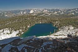
Ostrander Lake
Wawona, California
35.7 miles NWAn 11.4-mile Yosemite hike to a semi-secluded swim lake surrounded by granite mountains — wildflowers, streams, and meadows in summer; open for cross-country skiing in winter via Ostrander Lodge.
Hike, Swim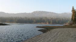
Hume Lake Sandy Cove Beach
Hume, California
37.7 miles SAn 87 acre lake at 5,250 feet in the Sequoia National Forest, held back by the first multiple arch dam ever built, with swimming off sandy coves and no motorboats.
Camp, Canoe, Hike, Kayak, Swim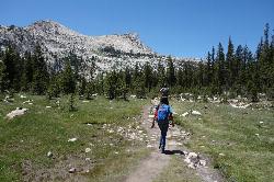
Elizabeth Lake
Wawona, California
40.7 miles NWA 4.8-mile hike with a 1,000-foot gain to a quiet alpine lake tucked between Cockscomb, Unicorn Peak, and Johnson's Peak in Yosemite's Tuolumne Meadows backcountry.
Hike, Swim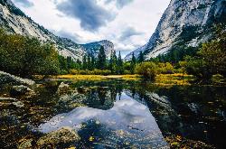
Mirror Lake
Yosemite Valley, Yosemite National Park
41.1 miles NWA paved, car-free trail winds to this seasonal lake at the base of Half Dome, offering a still mirror reflection and a popular summer swimming hole.
Backpack, Hike, Swim 4.0 mi
Mono Pass
Yosemite Valley, CA
41.3 miles NAn 8-mile high-Sierra hike at 10,600 feet crossing meadows and several lakes, climbing through Bloody Canyon to sweeping views of Mono Valley and Mono Lake.
Hike, Swim
Devil's Bathtub
Yosemite Valley, California
42.0 miles NWA warm, off-the-beaten-path pool fed by the Royal Arches Cascade just above Yosemite's Ahwanhee Hotel — great for families or a picnic near world-class climbing walls.
Swim 0.9-3.2 mi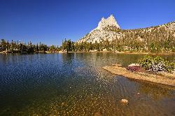
Cathedral Lakes
Wawona, California
42.2 miles NWA gorgeous 7-mile High Sierra hike along the John Muir Trail to twin lakes at 10,000 feet, framed by Cathedral, Echo, and Tressider Peaks with sweeping views of Tenaya Lake from a rock shelf.
Hike, Swim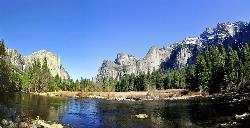
Merced River
Yosemite Valley, Yosemite National Park
42.2 miles NWThe Merced River circles Yosemite Valley with whitewater, swimming holes, gold-panning spots, and unbeatable views of Yosemite Falls and Glacier Point at every bend.
Camp, Swim, Whitewater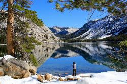
Tenaya Lake
Yosemite Valley, Yosemite National Park
42.7 miles NWTenaya Lake's glacier-carved granite shoreline offers a spacious east-beach for swimming, canoeing, and kayaking with stunning Yosemite dome views all around.
Canoe, Hike, Kayak, Swim 1.8 mi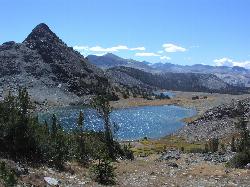
Gaylor Lakes
Yosemite Valley, CA
42.8 miles NA 2-mile Yosemite hike with views the entire way — Dana Meadows, mountain peaks, and a high valley holding five separate lakes, with a mostly flat valley to wander once you top the pass.
Hike, Swim 0.8-4.1 mi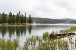
Dog Lake and Lembert Dome
Yosemite Valley, CA
42.8 miles NWA 4-mile round-trip hike through Tuolumne Meadows wildflowers to a serene evergreen lake and a granite dome with sweeping views — doable in 1.5 to 3 hours.
Hike, Swim 1.3-1.6 mi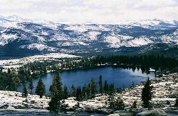
May Lake
Yosemite Valley, Yosemite National Park
44.4 miles NWA 2.5-mile roundtrip hike to a scenic 9,270-foot lake at the base of Mt. Hoffmann — with views of Clouds Rest, Half Dome, and Teyana Lake, plus the option to summit the peak for even grander panoramas.
Hike, Swim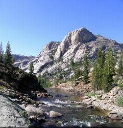
Glen Aulin
Glen Aulin, California
45.9 miles NWA popular introductory Yosemite High Country backcountry hike following the Tuolumne River to a High Sierra Camp beside the White Cascade waterfall, with further options to Waterwheel Falls.
Backpack, Camp, Hike, Swim 0.7 mi
Lukens Lake
Tuolumne Meadows, Yosemite National Park
48.7 miles NWA short 1.6-mile forest walk to a secluded lake famous for the luminescent shooting stars visible while you swim, plus a wildflower meadow that peaks in July.
Hike, SwimNearby Campsites
Crystal Lake
Mammoth Lakes, California
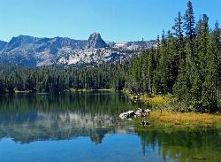
19.2 miles NA 3.2-mile roundtrip Sierra day hike past Lake George, Lake Marie, and Lake Mamie, ending at Crystal Lake beneath the monolith Crystal Crag — shaded trail with room to swim, fish, or picnic lakeside.
Camp, Hike
Crowley Lake Campground
Crowley Lake, California
21.9 miles NENestled in the stunning Eastern Sierra near Crowley Lake, this BLM campground offers first-come, first-served sites for tents, RVs, and trailers with breathtaking high-desert views.
Camp
Wild Willy's Hot Spring
Mammoth Lakes, California
26.7 miles NEA soaking hot spring in Long Valley's open sagebrush plain — pools range from 95°F to 105°F, with a larger deeper pool and smaller, hotter pools, reached by a 0.2-mile wooden boardwalk from the parking area.
Camp, Hot Springs
Bass Lake Recreation Area
Oakhurst, California
30.5 miles WWarm Sierra reservoir at 3,400 feet with Forest Service beaches and campgrounds, a waterfall trail at the north end, and Yosemite's south gate twenty miles up the road.
Camp, Canoe, Hike, Kayak, Swim
Hume Lake Sandy Cove Beach
Hume, California
37.7 miles SAn 87 acre lake at 5,250 feet in the Sequoia National Forest, held back by the first multiple arch dam ever built, with swimming off sandy coves and no motorboats.
Camp, Canoe, Hike, Kayak, Swim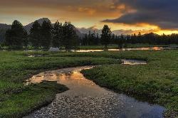
Tuolumne Meadows
Tuolumne County, California
42.1 miles NWA stunning alpine meadow in the high Sierra with granite domes and mountain views, the meandering Tuolumne River, and access to Yosemite backcountry — open summer only when the park road is clear.
Camp, Hike
Merced River
Yosemite Valley, Yosemite National Park
42.2 miles NWThe Merced River circles Yosemite Valley with whitewater, swimming holes, gold-panning spots, and unbeatable views of Yosemite Falls and Glacier Point at every bend.
Camp, Swim, Whitewater 6.1 mi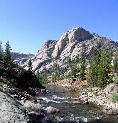
Glen Aulin
Wawona, California
45.9 miles NWAn 11-mile hike along the Tuolumne River to Glen Aulin with 800 feet of gain, passing Tuolumne Falls, Soda Springs, wildflower meadows, and the stunning White Cascade.
Backpack, Camp, Hike
Glen Aulin
Glen Aulin, California
45.9 miles NWA popular introductory Yosemite High Country backcountry hike following the Tuolumne River to a High Sierra Camp beside the White Cascade waterfall, with further options to Waterwheel Falls.
Backpack, Camp, Hike, Swim 4.0 mi
Saddlebag Lake
Lee Vining, California
46.3 miles NAt 10,008 ft, this Eastern Sierra alpine lake offers exceptional trout fishing, a scenic four-mile loop, and a water taxi into the heart of the Twenty Lakes Basin.
Camp, Canoe, Hike 5.7 mi
Ten Lakes
Tuolumne Meadows, Yosemite National Park
48.3 miles NWA 6.4-mile hike from Yosemite Creek to three of the Ten Lakes Basin's seven lakes, through wildflower meadows, forests, and past the Grand Canyon of the Tuolumne, gaining 2,200 feet.
Backpack, Camp, Hike


