


8 Free Swimming Holes near Auburn, CA
first prev 1 next lastShowing Swimming Holes within 50 miles Distance miles of Auburn, CA, USA City, Zip, or Address

American River Confluence
Auburn, California
2.5 miles NEThe Confluence — where the North and Middle Forks of the American River meet below Foresthill Bridge — is Auburn's favorite swimming and rafting hub.
Hike, Horseback, Kayak, Rock Climb, Swim, Whitewater 1.2-2.7 mi
Lake Clementine Trail Loop
Auburn, California
2.6 miles NEFour connected trails loop around Lake Clementine on the North Fork American River — wheelchair accessible, pet friendly, and great for fishing, camping, and family summer outings.
Camp, Canoe, Hike, Kayak, Mountain Bike, Swim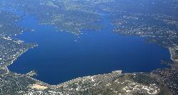
Granite Bay Main Beach
Granite Bay, California
10.3 miles SThe largest sand beach on Folsom Lake, guarded in summer, twenty five minutes from downtown Sacramento at the end of Douglas Boulevard.
Canoe, Hike, Kayak, Swim 0.1 mi
Edwards Crossing
Nevada City, California
30.4 miles NDeep blue water, rock cliffs, and a sandy beach on the Yuba River — with a half-mile walk from the parking lot and cliff jumping spots up to 20 feet deep.
Hike, Swim
North Fork Falls
Colfax, California
32.9 miles NEClear water, cliff-jumping pools, and waterfalls at Sierra Nevada's North Fork Falls — a summer hike to two deep pools with 10-to-25-foot cliffs ready for leaping.
Camp, Hike, Swim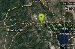
Heath Falls Overlook Trail
Truckee, California
44.3 miles NEHike and Swim near Truckee, California
Hike, Swim
Palisades Creek Trail
Truckee, California
44.3 miles NEA difficult Sierra Nevada trail past Palisade Falls — one of the tallest on the American River — with views of Devils Peak, alpine lakes, and 2,000 feet of elevation gain.
Hike, Swim 4.1 mi
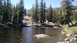
Shirley Lake Canyon Trail
Olympic Valley, California
49.4 miles NEA 2.5-mile hike from Squaw Valley Village past streams and waterfalls to a pure Sierra lake — rocky near the top, with a free gondola ride back down from High Camp as a reward.
Hike, Swim


