


Tallulah Falls Lake Beach (Terrora Day Use Area)
Tallulah Falls, Georgia

| GPS: |
34°44'19.6"N 83°23'55.5"W Maps | Directions |
| State: | Georgia |
Camp, Hike, Kayak, Mountain Bike, and Swim
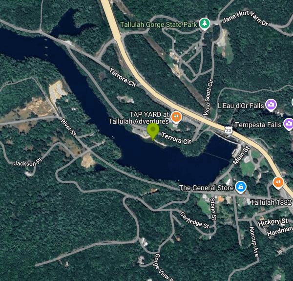
Tallulah Gorge State Park is famous for its two-mile, thousand-foot-deep gorge, but on a July afternoon most of the locals are at the other end of the park: the sand beach on Tallulah Falls Lake, in the Terrora Day Use Area off US 441 in the village of Tallulah Falls. The lake is the smallest of the six Georgia Power reservoirs on the Tallulah River, 63 acres backed up behind a 126-foot dam finished in 1914, and the beach sits on the calm arm of it just above the dam. The water is flat, cool and mountain-clear, with a roped swim area, a grassy bank for towels and picnic tables and grills under the trees behind it.
Swimming is free with parking; Georgia's ParkPass day-use fee (or an annual pass) covers the car. The park is open 8 a.m. to dark, and there is no lifeguard on the beach. Restrooms and changing space are at the Terrora area, and the campground with its 52 tent and RV sites is a short walk up the hill, so campers can drift down to the lake in the morning before the day crowd arrives. Kayaks and canoes launch from the same shoreline; the lake is small enough to paddle end to end in an hour, with the dam and the old railroad trestle as the backdrop.
One caution for 2026: Georgia State Parks announced the beach and swim area will be closed for construction during the summer season while a new ADA-accessible kayak launch and an upgraded swim area are built. Check the park's page before driving in for a swim. The rest of the park stays open.
When the beach is closed, or once you've dried off, the gorge is the reason to be here. The Jane Hurt Yarn Interpretive Center anchors more than 20 miles of trails, including the rim loops with their numbered overlooks, the 310-step staircase to the 80-foot suspension bridge, and Hurricane Falls below it. Gorge-floor permits are free but limited to 100 a day and are gone early on weekends; the floor route crosses the river on slick rock to Bridal Veil Falls, a natural slide the park allows swimming below when flows permit. Mountain bikers get a dedicated 10-mile loop on the Stoneplace Trail, and there is a second, smaller suspension bridge on the Shortline Trail, a paved rail-trail along the lake that connects the day-use area to the village.
Tallulah Falls is about 95 miles northeast of Atlanta and 20 minutes south of Clayton. Georgia Power releases water into the gorge on scheduled spring and fall weekends for kayakers and sightseers, and those release days are the busiest of the year; on any other summer weekend the beach lot fills by early afternoon.
More Information
Never modify trail features. Ride trails when they're dry enough that you won't leave ruts. Speak up when you see others on the trail and always yield to hikers, horses, and others coming uphill. Always ride on the established trail.
Read MoreBe courteous, informed, and prepared. Read trailhead guidelines, stay on the trail, and don't feed the wildlife.
Read More
- Plan Ahead and Prepare
- Travel & camp on durable surfaces
- Dispose of waste properly
- Leave what you find
- Minimize campfire impacts
- Respect wildlife
- Be considerate of other visitors
Directions
From Tallulah Falls, Georgia
- Head northeast on Main St toward Hwy 441 (52 ft)
- Turn left onto Hwy 441 (0.3 mi)
- Turn left onto Terrora CirDestination will be on the left(0.2 mi)
 Tallulah Falls Lake, the 1914 dam and the US 441 bridge above the beach courtesy of Fredlyfish4↗ (CC BY-SA 4.0↗)

 Tallulah Falls Lake shoreline near the Terrora Day Use Area courtesy of anonymouse1↗ (CC BY-SA 3.0↗)

 Tallulah Gorge from a rim overlook courtesy of Thomson200↗ (CC0↗)

 The suspension bridge over the gorge floor courtesy of ChattOconeeNF↗ (CC BY 2.0↗)

 Rim trail view into Tallulah Gorge courtesy of David Dugan↗ (CC BY-SA 3.0↗)
 Hawthorne Pool on the gorge floor courtesy of Thomsonmg2000↗ (CC0↗)

Other Mountain Bike Trails, Swimming Holes, Hiking Trails, and Kayaking Areas Nearby
War Woman Dell Wildlife Management Area
Clayton, Georgia
10.3 miles NA short 0.8-mile out-and-back hike near Clayton, Georgia through a nature trail to a waterfall — good for all skill levels and accessible year-round.
Camp, Hike, Horseback 
Boone Area
Otto, North Carolina
20.6 miles NSwim near Otto, North Carolina
Swim 
Big Laurel Falls
Otto, North Carolina
20.6 miles NSwim near Otto, North Carolina
Swim 
High Point
Hayesville, North Carolina
27.4 miles NWThe highest point in the Tsali trail system with the biggest climb and most technical terrain — rewarded by phenomenal views of the lake and surrounding mountains from the top.
Mountain Bike 
Yotee's Run
Hayesville, North Carolina
27.4 miles NWPart of the Jack Rabbit trail system, Yotee's Run is a fast, flowy singletrack that captures everything great about the singletrack in this area.
Mountain Bike 
Jack Rabbit Trails
Hayesville, North Carolina
27.4 miles NWA beginner-friendly machine-built trail network near Hayesville with a fast, twisty main loop and easy-to-navigate branches — a total blast for any level rider.
Mountain Bike 
Sneaking Creek
Hayesville, North Carolina
27.5 miles NWThe king of flow at Jack Rabbit — Sneaking Creek lets you carry serious momentum up hills and through turns, with big whoops and surprises mixed in.
Mountain Bike 
Burnt Tree Peninsula
Hayesville, North Carolina
27.8 miles NWOne of the easiest trails in the Jack Rabbit system — still an absolute blast to ride in Hayesville, NC.
Mountain Bike 
Cashiers Area
Woodleaf, North Carolina
28.5 miles NESwim near Woodleaf, North Carolina
Swim 
Vogle State Park
Blairsville, Georgia
29.7 miles WA 233-acre park at the base of Blood Mountain in the Chattahoochee National Forest — one of Georgia's first state parks, founded in 1931.
Camp, Canoe, Swim 
Todd Creek Falls
Central, South Carolina
33.1 miles EA short hike leads to Todd Creek Falls and a deep, gradually entered pool at the base — a relaxed clothing-optional spot in the South Carolina upstate woods.
Swim 1.0 mi
Hidden Falls
Lake Toxaway, North Carolina
34.6 miles NEJust a few steps off the Horsepasture River trail, Hidden Falls drops less than ten feet into an idyllic boulder-rimmed pool — a serene and easy family swimming hole.
Hike, Swim 1.4 mi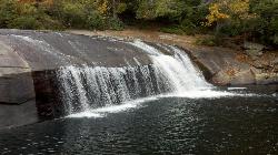
Turtleback Falls
Lake Toxaway, North Carolina
34.6 miles NETurtleback Falls' dome-shaped slide drops riders 10 feet into the Chug Hole pool, but wait for calm currents — strong flows have swept swimmers downriver over 125-foot Rainbow Falls.
Backpack, Hike, Swim 1.3 mi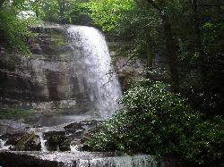
Rainbow Falls
Lake Toxaway, North Carolina
34.7 miles NEA 150-foot spectacular cascade on the Horsepasture River can be admired from front, side, bottom, and top — one showstopper in a 2-mile series of incredible falls.
Hike, Swim 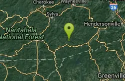
Blackrock #447
Glenville, North Carolina
35.8 miles NEA steep challenging climb over a miniature mountain in Panthertown Valley, rewarded by a bomber descent down the backside — one of the better efforts-to-payoff ratios in the area.
Mountain Bike 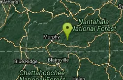
Fires Creek Area
Wake Forest, North Carolina
35.9 miles NWSwim near Wake Forest, North Carolina
Swim 
Panthertown Valley
Glenville, North Carolina
35.9 miles NEA 35-mile trail network in Panthertown Valley near Glenville with 19 miles of mountain biking, granite cliff vistas, mixed terrain from fire roads to tight singletrack, and rock climbing on the cliffs.
Mountain Bike 
Devils Elbow #448
Lake Toxaway, North Carolina
36.7 miles NEA mountain bike trail connecting to Panthertown Valley's main thoroughfare, with sections of old forest road and narrow singletrack climbing to Devils Elbow Knob.
Mountain Bike 
Moonshine Falls Area
Bishopville, South Carolina
37.7 miles NESwim near Bishopville, South Carolina
Swim 
Chattahoochee National Park
Cave Spring, Georgia
39.7 miles WSwim near Cave Spring, Georgia
SwimNearby Campsites
War Woman Dell Wildlife Management Area
Clayton, Georgia
10.3 miles NA short 0.8-mile out-and-back hike near Clayton, Georgia through a nature trail to a waterfall — good for all skill levels and accessible year-round.
Camp, Hike, Horseback
Vogle State Park
Blairsville, Georgia
29.7 miles WA 233-acre park at the base of Blood Mountain in the Chattahoochee National Forest — one of Georgia's first state parks, founded in 1931.
Camp, Canoe, Swim 
Mt. LeConte Lodge
Sylva, North Carolina
45.8 miles NThe highest guest lodge in the eastern United States at 6,400 feet, with spectacular Smokies views from an open glade just below the Mt. LeConte summit in Great Smoky Mountains NP.
Camp, Hike, Horseback, Rock Climb


