


Lake Rabun Beach Recreation Area
Lakemont

Camp, Hike, Kayak, and Swim
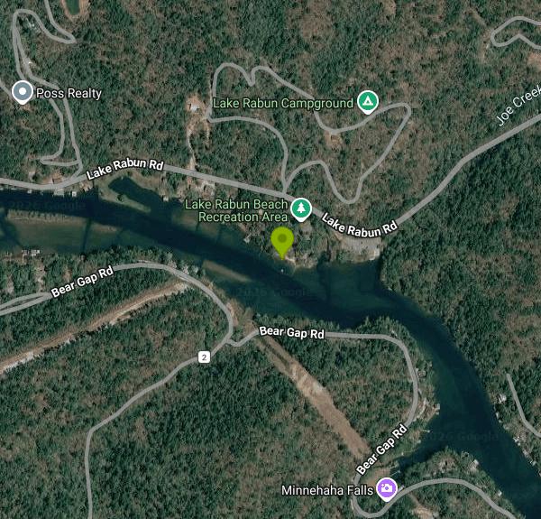
Lake Rabun Beach Recreation Area is a developed U.S. Forest Service day-use site on Lake Rabun, run by the Chattooga River Ranger District of the Chattahoochee-Oconee National Forest. Lake Rabun is an 835-acre Georgia Power reservoir on the Tallulah River, held back by Mathis Dam (finished in 1915) and third in the chain of six lakes that steps down the river toward Tallulah Falls. The lake twists through about 25 miles of wooded shoreline, and this beach is the Forest Service's public swim site on it, open to anyone who pays the day-use fee.
The beach sits at 5315 Lake Rabun Road, about 4 miles west of Lakemont. From Clayton, the Forest Service route is U.S. 441/23 south for 5.4 miles, a right on Wiley Connector, a left on Georgia 15 (Historic 441) for 1.4 miles, then a right on Lake Rabun Road for 5 miles. Drivers pulling a boat trailer are told to come in from the other side instead, by way of Hwy 76, Charlie Mountain Road, Bridge Creek Road and Burton Dam Road. The day-use parking lot is on the lake side of the road next to the boat ramp, and a short sidewalk leads from the kiosk down to the sand.
The swim area is a small sandy beach with a roped-off section of water for swimmers, two picnic tables and a restroom building close by. The Forest Service does not publish depth, bottom or water temperature details, and no lifeguard is listed, so plan on swimming at your own risk and keep an eye on children at the rope line. The boat launch and a fishing pier are only a short walk away, and waterskiing and motorboating are allowed on the lake, so stay inside the ropes. The Forest Service page says potable water is not available at the beach, so bring your own drinking water.
Day use is not free, but the fee is a Forest Service charge: $5 per person for everyone 16 and older, $5 per vehicle plus $2 per person for buses and vans, and $5 to launch a boat and trailer. Pay at the fee tubes at the kiosk by the top of the boat ramp or at the kiosk next to the sidewalk to the beach. Interagency Senior and Access Passes (and the older Golden Age and Golden Access Passports) are accepted. The beach and boat launch are open year-round from sunrise to sundown, and overnight parking is not allowed.
Georgia Power lowers Lake Rabun on a three-year cycle so owners can repair docks and seawalls. Every few years Georgia Power draws the lake down roughly 10 feet from late October to late December before refilling it. Drawdowns fall after swim season, but during one the water pulls well back from the sand. The Forest Service lists a Waterfall Dangers caution for the nearby Angel Falls trail and that trailhead has had temporary closures, so check the district office at 706-754-6221 before planning a hike.
Across Lake Rabun Road is the Forest Service's 80-site Rabun Beach Campground, with hot showers, 21 electric sites and reservations through Recreation.gov. It closes for the winter, usually from late October to April 1. From Loop 2 of the campground, a 1.7-mile trail climbs past Panther Falls to an observation deck at Angel Falls. Anglers fish the lake for bass, bream, perch, trout and catfish with a Georgia fishing license.
More Information
A Glistening Man-Made Lake Hidden In Georgia's Blue Ridge Mountains Is A Recreation And Camping Have
A man-made lake in Georgia offers some of the most fishing diversity in the South. It was once a getaway for wealthy Atlantans, now a destination for all.
https://www.islands.com/1872082/lake-rabun-georgia-blue-ridge-mountains-recreation-camping/Chattahoochee-Oconee National Forest | Angel Falls Trailhead | Forest Service
The Angel Fall Trailhead has 2 locations. The first is located in Loop 2, area 2 of the Rabun Beach Campground that is not available during the Winter season. This is mostly an easy trail with a couple of short, steep runs. The payoff is reaching the observation deck where you can enjoy Angel Falls.The second Trailhead location is on Lake Rabun Road just west of the entrance to Loop 2. It is a no fee area with no amenities available year-round.
https://www.fs.usda.gov/r08/chattahoochee-oconee/recreation/angel-falls-trailheadChattahoochee-Oconee National Forest | Lake Rabun Beach Recreation Area | Forest Service
Cradled in the hills of the North Georgia Mountains overlooking beautiful Lake Rabun, this developed recreation area offers hiking, all sorts of water activities like swimming, boating, and fishing, and an opportunity to absorb the peaceful lake scenery. The 80-site campground located across the highway is closed in the winter months. This area is open year-round.
https://www.fs.usda.gov/r08/chattahoochee-oconee/recreation/lake-rabun-beach-recreation-areaLake Rabun Beach Recreation Area, Chattahoochee-Oconee National Forest - Recreation.gov
Explore Lake Rabun Beach Recreation Area in Chattahoochee-Oconee National Forest, Georgia with Recreation.gov. Cradled in the hills of the North Georgia Mountains overlooking beautiful Lake Rabun, this developed recreation area offers camping and hiking. Across the road
https://www.recreation.gov/camping/campgrounds/273352Lake Rabun Beach Recreation Area, Georgia boat ramp and access | How's Your River
Public boat ramp and water access at Lake Rabun Beach Recreation Area on Tallulah River - Lake Rabun in Georgia. Map, directions, nearby USGS conditions, and amenities.
https://www.howsyourriver.com/access_sites/lake-rabun-beach-recreation-areaRabun Beach Recreation Area, Lakemont | Campendium
Rabun Beach Recreation Area is a Campground in Lakemont. Plan your road trip to Rabun Beach Recreation Area in GA with Roadtrippers.
https://maps.campendium.com/us/lakemont-ga/nature/rabun-beach-recreation-areaBe courteous, informed, and prepared. Read trailhead guidelines, stay on the trail, and don't feed the wildlife.
Read More
- Plan Ahead and Prepare
- Travel & camp on durable surfaces
- Dispose of waste properly
- Leave what you find
- Minimize campfire impacts
- Respect wildlife
- Be considerate of other visitors
Directions
From Lakemont
- Head northeast on Hwy 90 Alt E/
Jackson St toward S 3rd St Continue to follow Hwy 90 Alt E(4.6 mi) - Keep left to stay on Hwy 90 Alt E (2.6 mi)
- Turn right onto Texas 6 Access Rd (0.1 mi)
- Slight left to merge onto Hwy 6 S (1.9 mi)
- Turn left onto U.S. 59 Frontage Rd (0.5 mi)
- Slight left to merge onto I-69 (20.7 mi)
- Take exit 132 to merge onto I-10 E toward Beaumont (58.7 mi)
- Keep left to stay on I-10 E (24.5 mi)
- Keep left to continue on I-10 E/
US-90, follow signs for Lake Charles (22.9 mi) - Keep left to continue on I-10 EEntering Louisiana(164 mi)
- Keep left to continue on I-12 E, follow signs for Hammond (85.2 mi)
- Take the exit onto I-10 E toward Bay St LouisPassing through MississippiEntering Alabama(104 mi)
- Take exit 20 on the left for I-65 N toward Montgomery (0.6 mi)
- Continue onto I-65 N (170 mi)
- Take exit 171 for I-85 N toward Atlanta (0.3 mi)
- Continue onto I-85 N (60.6 mi)
- Keep left to stay on I-85 NEntering Georgia(87.3 mi)
- Keep left to stay on I-85 N (8.1 mi)
- Keep left to stay on I-85 N (1.0 mi)
- I-85 N turns slightly right and becomes I-75 N (7.4 mi)
- Take exit 251B on the left for I-85 N toward GA-400/
Greenville (0.4 mi) - Continue onto I-85 N (23.6 mi)
- Continue straight to stay on I-85 N (4.2 mi)
- Slight left onto I-985 N (24.4 mi)
- Continue onto US-23 N (24.6 mi)
- Take the GA-197 N exit toward Mt. Airy/
Clarkesville (0.2 mi) - Turn left onto GA-197 N (1.2 mi)
- Slight right onto Blacksnake Rd (2.3 mi)
- Turn left onto GA-17 N (0.9 mi)
- Turn right onto Hills Crossing Rd (0.8 mi)
- Hills Crossing Rd turns slightly right and becomes New Liberty Rd (7.0 mi)
- Turn right onto Low Gap Rd (0.6 mi)
- Low Gap Rd turns slightly left and becomes Gap Rd (4.5 mi)
- Turn left onto Bear Gap Rd/
Low Gap Rd (0.1 mi) - Turn right onto Lake Rabun Rd (1.1 mi)


Other Swimming Holes, Hiking Trails, and Kayaking Areas Nearby

Tallulah Falls Lake Beach (Terrora Day Use Area)
Tallulah Falls, Georgia
4.8 miles ESand swim beach on 63-acre Tallulah Falls Lake at Tallulah Gorge State Park's Terrora Day Use Area, with the gorge rim trails, suspension bridge and campground next door.
Camp, Hike, Kayak, Mountain Bike, Swim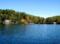
Timpson Cove Beach
Clayton
7.1 miles NA Georgia Power swim beach on the east shore of Lake Burton, with a buoyed swim area, picnic tables and restrooms about nine miles out of Clayton. No posted fee, no lifeguard, and a winter drawdown that decides how much sand there is.
Swim
War Woman Dell Wildlife Management Area
Clayton, Georgia
11.5 miles NEA short 0.8-mile out-and-back hike near Clayton, Georgia through a nature trail to a waterfall — good for all skill levels and accessible year-round.
Camp, Hike, Horseback
Lake Russell Recreation Area
Mt Airy
18.1 miles SA grass swim beach on 100-acre Lake Russell in the Chattahoochee-Oconee National Forest near Mt. Airy, with a $5 per vehicle Forest Service day-use fee and no gas motors on the lake.
Camp, Canoe, Hike, Kayak, Swim
Boone Area
Otto, North Carolina
18.9 miles NSwim near Otto, North Carolina
Swim
Big Laurel Falls
Otto, North Carolina
18.9 miles NSwim near Otto, North Carolina
Swim
Vogle State Park
Blairsville, Georgia
24.9 miles WA 233-acre park at the base of Blood Mountain in the Chattahoochee National Forest — one of Georgia's first state parks, founded in 1931.
Camp, Canoe, Swim
Cashiers Area
Woodleaf, North Carolina
30.6 miles NESwim near Woodleaf, North Carolina
Swim
Fires Creek Area
Wake Forest, North Carolina
31.9 miles NWSwim near Wake Forest, North Carolina
Swim
Chattahoochee National Park
Cave Spring, Georgia
35.0 miles WSwim near Cave Spring, Georgia
Swim 1.4 mi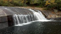
Turtleback Falls
Lake Toxaway, North Carolina
37.3 miles NETurtleback Falls' dome-shaped slide drops riders 10 feet into the Chug Hole pool, but wait for calm currents — strong flows have swept swimmers downriver over 125-foot Rainbow Falls.
Backpack, Hike, Swim 1.0 mi
Hidden Falls
Lake Toxaway, North Carolina
37.4 miles NEJust a few steps off the Horsepasture River trail, Hidden Falls drops less than ten feet into an idyllic boulder-rimmed pool — a serene and easy family swimming hole.
Hike, Swim
Queens Creek Lake
Nantahala, North Carolina
37.4 miles NA secluded reservoir in the Nantahala mountains with mountain reflections on still water, quality trout fishing, swimming on warm days, and a scenic drive up Winding Stairs Road.
Swim 1.3 mi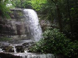
Rainbow Falls
Lake Toxaway, North Carolina
37.5 miles NEA 150-foot spectacular cascade on the Horsepasture River can be admired from front, side, bottom, and top — one showstopper in a 2-mile series of incredible falls.
Hike, Swim
Todd Creek Falls
Central, South Carolina
37.8 miles EA short hike leads to Todd Creek Falls and a deep, gradually entered pool at the base — a relaxed clothing-optional spot in the South Carolina upstate woods.
Swim
Bolding Mill Park
Gainesville
39.2 miles SWA Corps of Engineers park on Lake Lanier's Chestatee arm near Gainesville with a designated swim beach built on a gentle concrete slope, plus shelters, a boat ramp and a campground. Corps day-use fee applies.
Camp, Kayak, Swim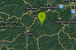
Big Creek
Waynesville, North Carolina
41.0 miles NEBig Creek is a crystalline mountain stream tumbling through the quiet northeastern corner of Great Smoky Mountains National Park, and it may be the single best swimming creek in the Smokies. Cold,...
Swim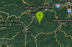
Midnight Hole
Waynesville, North Carolina
41.0 miles NEMidnight Hole is the most beloved swimming hole in Great Smoky Mountains National Park, an emerald-green pool of startling clarity sitting at the base of a six-foot waterfall, ringed by house-sized...
Swim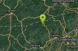
Moonshine Falls Area
Bishopville, South Carolina
41.3 miles NESwim near Bishopville, South Carolina
Swim
Fingerlake
Almond, North Carolina
42.6 miles NAn offshoot of Fontana Lake open April through October, Fingerlake offers gravel-edged swimming, kayaking, canoeing, and fishing surrounded by lush forest — with restrooms and picnic tables on site.
Canoe, Kayak, SwimNearby Campsites
Tallulah Falls Lake Beach (Terrora Day Use Area)
Tallulah Falls, Georgia
4.8 miles ESand swim beach on 63-acre Tallulah Falls Lake at Tallulah Gorge State Park's Terrora Day Use Area, with the gorge rim trails, suspension bridge and campground next door.
Camp, Hike, Kayak, Mountain Bike, Swim
War Woman Dell Wildlife Management Area
Clayton, Georgia
11.5 miles NEA short 0.8-mile out-and-back hike near Clayton, Georgia through a nature trail to a waterfall — good for all skill levels and accessible year-round.
Camp, Hike, Horseback
Lake Russell Recreation Area
Mt Airy
18.1 miles SA grass swim beach on 100-acre Lake Russell in the Chattahoochee-Oconee National Forest near Mt. Airy, with a $5 per vehicle Forest Service day-use fee and no gas motors on the lake.
Camp, Canoe, Hike, Kayak, Swim
Vogle State Park
Blairsville, Georgia
24.9 miles WA 233-acre park at the base of Blood Mountain in the Chattahoochee National Forest — one of Georgia's first state parks, founded in 1931.
Camp, Canoe, Swim
Bolding Mill Park
Gainesville
39.2 miles SWA Corps of Engineers park on Lake Lanier's Chestatee arm near Gainesville with a designated swim beach built on a gentle concrete slope, plus shelters, a boat ramp and a campground. Corps day-use fee applies.
Camp, Kayak, Swim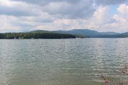
Morganton Point Recreation Area
Morganton, Georgia
44.4 miles WForest Service swim beach, campground and boat ramp on a wooded point jutting into Lake Blue Ridge, two miles from the town of Morganton.
Camp, Canoe, Hike, Kayak, Swim
Mt. LeConte Lodge
Sylva, North Carolina
45.7 miles NThe highest guest lodge in the eastern United States at 6,400 feet, with spectacular Smokies views from an open glade just below the Mt. LeConte summit in Great Smoky Mountains NP.
Camp, Hike, Horseback, Rock Climb
Cheoah Point Beach
Robbinsville
47.9 miles NWForest Service swim beach with a roped swim area on Santeetlah Lake, 6 miles north of Robbinsville, NC. Open April 15 to October 31 with a $5 per vehicle day-use fee.
Camp, Canoe, Hike, Kayak, Swim


