


The Cliffs at Beaver Lake
Larue, Arkansas

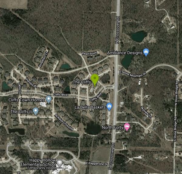
| Address: | 83X8+GX Larue, AR, USA |
| GPS: |
36°20'55.9"N 93°55'57.1"W Maps | Directions |
| State: | Arkansas |
Swim
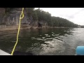
The Cliffs at Beaver Lake are a popular destination for swimmers and cliff jumpers in Arkansas. This colorful section of cliffs provide stunning contrast to the blue green water of Beaver Lake. The lake is surrounded by towering ceder trees that bring a beautiful lush green to the space. The water is clear, cool and deep here. Jumpers can enjoy the thrill of adventure in this uniquely beautiful location. Swimmers and divers should check safety and have experiences before diving. Diving is done at your own risk.
These unique formations can also be views and explored underneath using kayaks and canoes. The lake has wide open areas that are great for exploring and getting a good work out. Kayaking along the entire bluff is five miles round trip. The whole multi hour adventure provides a view of small waterfalls and many tree topped cliffs and rock formations. Beaver lake is the perfect place for anyone hoping for a scenic, easy access adventure.
More Information
Cliff Diving in Arkansas - Popular Locations, Cliffs, Quarries
Thirst for Adrenaline has the most complete list of popular locations for cliff diving in Arkansas. Cliff diving (cliff jumping) is a very popular sport.
https://thirstforadrenaline.com/adventures/cliff-diving/cliff-diving-in-arkansas/Tour de bluffs: Crags, cliffs part of Beaver Lake’s scenic canvas | Northwest Arkansas Democrat-Gaze
Beaver Lake is a kayaker’s paradise with its clear water, gravel shorelines and sheer rock cliffs, which rise high above rippled waves.
https://www.nwaonline.com/news/2021/nov/02/tour-de-bluffs/
- Plan Ahead and Prepare
- Travel & camp on durable surfaces
- Dispose of waste properly
- Leave what you find
- Minimize campfire impacts
- Respect wildlife
- Be considerate of other visitors
Directions
From Larue, Arkansas
- Head east on Collier Ln toward Larue Rd (69 ft)
- Turn right onto Larue Rd (1.3 mi)
- Turn left onto Rocky Branch Rd (0.5 mi)
- Turn left to stay on Rocky Branch Rd (0.7 mi)
- Turn left onto Park Rd (0.5 mi)
- Turn right onto Rocky Branch Marina Rd (0.6 mi)
- Continue onto Park Rd (0.1 mi)

Other Swimming Holes Nearby

Hogscald Hollow
Eureka Springs, Arkansas
6.6 miles SEAn adventurous Beaver Lake swimming hole near Eureka Springs with cliff jumps, from gentle 10-footers to a 50-foot Lover's Leap.
Canoe, Kayak, Swim
Eureka Springs Area
Heber Springs, Arkansas
6.8 miles EThe Beaver Lake and King River area near Eureka Springs hides several laid-back swimming holes in northwest Arkansas, some with very optional dress codes.
Swim
Trigger Gap
Eureka Springs, Arkansas
15.1 miles EA mild river kayaking stretch on Kings River with calm current, cool clear water, and rental canoes, kayaks, and paddleboards from $30–$80 at Trigger Gap Outfitters — great for beginners.
Canoe, Kayak, Swim
Tanyard Creek Falls
Mammoth Spring, Arkansas
20.2 miles NWA two-mile forested loop to a mossy, multi-tiered waterfall in Bella Vista — perfect wading pools await at the base, with cool, clean water on an easy trail for all levels.
Swim
Riverside Park
West Fork, Arkansas
32.3 miles SWA low concrete dam creates an impressive rushing waterfall above colorful cliffs in West Fork, with deep swimming water, fishing, sunbathing, a pavilion, and short walking trails.
Swim
Kings River Falls
Sheridan, Arkansas
36.9 miles SEA unique waterfall dropping from a wide red rock shelf into a pool — sometimes roaring wall-to-wall, sometimes trickling — on an easy two-mile round-trip hike.
Hike, Swim
Ponca Bridge
Ponca, Arkansas
38.9 miles SEBright blue water teeming with fish, a concrete bridge jump, rocky shallows for wading, and elk sightings nearby — Ponca Bridge is an easy-access swimming hole in Arkansas.
Hike, Swim
Moon Shine Beach
Branson, Missouri
39.0 miles NEA spacious sandy beach on Table Rock Lake with easy sloped water access, volleyball, a playground, and beautiful sunrises and sunsets over the large clear lake and surrounding hickory forest.
Swim
Ponca Area
Morrilton, Arkansas
39.6 miles SESwim near Morrilton, Arkansas
Swim
Cedar Flats
Banyard, Arkansas
44.4 miles SWSpring-fed Cedar Flats stays cool and clear all year, with large rock shelves for lounging near Devils Den State Park — an old rope swing is on site, so swim and swing at your own risk.
Swim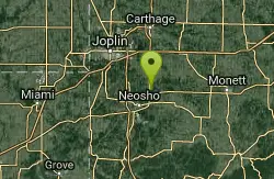
Cherry Corner Access
Neosho, Missouri
45.3 miles NWA 4.2-acre public creek access near Neosho with a gravel bar for kayak launch, a rope swing, and swimming — swimwear is customary, with more private spots upstream.
Canoe, Kayak, Swim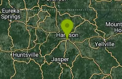
Harrison, AR, USA
Harrison, Arkansas
46.7 miles ECamp, Cave, Hike, and Swim near Harrison, Arkansas
Camp, Cave, Hike, Swim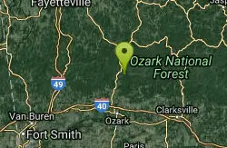
Mulberry River Area
Umpire, Arkansas
46.8 miles SSwim near Umpire, Arkansas
Swim
Bradley Park
Jasper, Arkansas
47.7 miles SEThe Little Buffalo River flows through this wooded Jasper park, with walking paths, fishing, picnic tables, calm deep swimming water, and easy kayak and canoe access.
Swim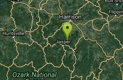
Jasper Area
New Blaine, Arkansas
48.6 miles SESwim near New Blaine, Arkansas
Swim
Pruitt
Pruitt, Arkansas
48.7 miles SESandy-beached Pruitt Landing and cliff-shaded Pruitt Bluff both offer deep-water swimming on the Buffalo River — with restrooms, picnic tables, and a playground just steps away.
Canoe, Kayak, Swim
Lee Creek Access
Chester, Arkansas
49.9 miles SWA smooth, deep, wide stretch of Lee Creek with a sandy beach, a kayak and canoe launch, camping spots with fire circles, and peaceful surroundings for a summer swim.
Camp, Canoe, Kayak, SwimNearby Campsites
Harrison, AR, USA
Harrison, Arkansas
46.7 miles ECamp, Cave, Hike, and Swim near Harrison, Arkansas
Camp, Cave, Hike, Swim
Lee Creek Access
Chester, Arkansas
49.9 miles SWA smooth, deep, wide stretch of Lee Creek with a sandy beach, a kayak and canoe launch, camping spots with fire circles, and peaceful surroundings for a summer swim.
Camp, Canoe, Kayak, Swim


