


27 Things to do in Glacier National Park, Montana
first prev 1 2 next lastShowing results in Glacier National Park, Montana, USA City, Zip, or Address
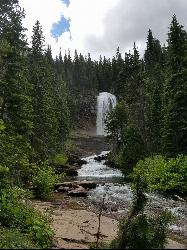
St Mary and Virginia Falls
Rising Sun, Glacier National Park
4.4 miles W of Rising Sun, Glacier National ParkA scenic 3.7-mile roundtrip hike past St. Mary Falls' 50-foot two-tiered drop to the upper and lower tiers of Virginia Falls, best in early season when snowmelt is rushing.
Hike 0.9 mi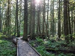
Trail of the Cedars
Apgar Village, Glacier National Park
13.2 miles NE of Apgar Village, Glacier National ParkAn easy wheelchair-accessible loop through towering 500-year-old cedars up to 100 feet tall in Glacier National Park, with gorge views of glacial Avalanche Creek and a footbridge over the water.
Hike 4.5 mi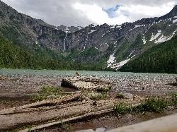
Avalanche Lake
Apgar Village, Glacier National Park
13.1 miles NE of Apgar Village, Glacier National ParkHike near Apgar Village, Glacier National Park
Hike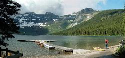
Cameron Lake
Waterton, Glacier National Park
7.8 miles SW of Waterton, Glacier National ParkA picturesque Canadian glacial lake in Waterton Lakes National Park surrounded by mountain scenery, avalanche-sculpted shores, kayaking, fishing, and Herbst Glacier views.
Backpack, Camp, Hike 5.0 mi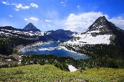
Hidden Lake
Glacier National Park
5.4 miles SE of Glacier National ParkA 6.6-mile round-trip hike from Logan Pass through alpine meadows, dense forest, and rocky terrain to the crystal-clear waters of Hidden Lake, with bighorn sheep and mountain goats along the way.
Hike 0.6 mi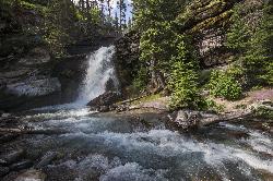
Baring Falls
Glacier National Park
10.4 miles SE of Glacier National ParkA moderate trail hike in Glacier National Park to 30-foot Baring Falls dropping into crystal-clear water — with scenic mountain overlooks, wildlife, and an optional gorge viewpoint 1.5 miles beyond.
Hike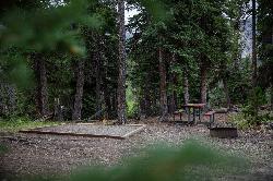
Cut Bank Campground
Glacier National Park
21.4 miles SE of Glacier National ParkA peaceful forested campground along Cut Bank Creek in Glacier National Park with 48 first-come sites, nearby hiking trails, and access to fishing at St. Mary Lake.
Camp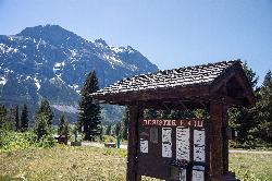
Rising Sun Campground
Glacier National Park
12.9 miles E of Glacier National ParkMore than 150 sites in eastern Glacier National Park close to Going-to-the-Sun Road, St. Mary's Falls and Red Rock Falls trails, and frequent bear, elk, and bighorn sightings.
Camp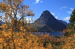
Two Medicine Campground
Glacier National Park
26.7 miles SE of Glacier National ParkTwo Medicine Campground lies in the quiet, dramatic southeast corner of Glacier National Park, on the shore of Two Medicine Lake beneath the sharp pyramid of Sinopah Mountain. About 13 miles up the...
Camp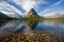
Many Glacier Campground
Many Glacier, Glacier National Park
0.9 miles W of Many Glacier, Glacier National ParkMany Glacier Campground sits in what many visitors consider the most spectacular corner of Glacier National Park: the Many Glacier valley on the park's northeast side, cradled among towering peaks...
Camp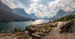
St. Mary Campground
Glacier National Park
15.6 miles E of Glacier National ParkOver 200 campsites on the edge of Glacier National Park with flush toilets, showers, and quick access to Going-to-the-Sun Road, the Highline Trail, and St. Mary Lake.
Camp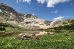
Siyeh Pass Trail
Logan Pass, Glacier National Park
2.3 miles E of Logan Pass, Glacier National ParkA top-of-the-world point-to-point hike through Glacier's Preston Park meadows to a high pass with glacier views, mountain goats, and bighorn sheep.
Backpack, Hike 11.8 mi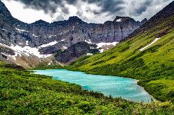
Cracker Lake Trail
Many Glacier, Glacier National Park
0.1 miles SE of Many Glacier, Glacier National ParkA 12.5-mile hike through forests and meadows to a surreal turquoise lake in the Many Glacier area — plan for two days to fully enjoy this bear-country gem.
Backpack, Camp, Hike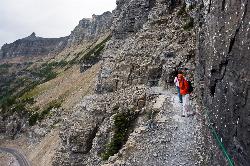
Highline Trail
Logan Pass, Glacier National Park
0.1 miles SE of Logan Pass, Glacier National ParkOne of Glacier National Park's most celebrated hikes — the Highline Trail spans alpine meadows, the Continental Divide, and the Garden Wall with mountain goats, wildflowers, and views to rival anything in the park.
Backpack, Hike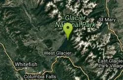
Glacier National Park
West Glacier, Montana
10.0 miles NE of West Glacier, MontanaSwim near West Glacier, Montana
Swim 10.5 mi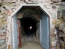
Ptarmigan Tunnel
Many Glacier, Glacier National Park
0.9 miles W of Many Glacier, Glacier National ParkA long hike to a hand-carved 240-foot tunnel through the Ptarmigan Wall at Glacier National Park, opening to views of Seaward Mountain and Elizabeth Lake — open mid-July through early October.
Backpack, Hike 9.7 mi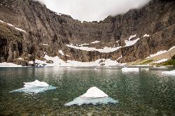
Iceberg Lake
Many Glacier, Glacier National Park
0.9 miles W of Many Glacier, Glacier National ParkNine miles of alpine trail deliver sweeping views of Ptarmigan Wall, Mount Grinnell, and Mount Wilbur before arriving at an iceberg-dotted cirque lake in Glacier NP.
Backpack, Camp, Hike
Clements Mountain Trail
Logan Pass, Glacier National Park
0.1 miles SE of Logan Pass, Glacier National ParkA four-mile round-trip climb of Clements Mountain in Glacier National Park, with several routes of varying difficulty and significant elevation gain — often confused with nearby Reynolds Mountain.
Backpack, Camp, Hike, Rock Climb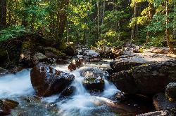
Avalanche Campground
Glacier National Park
5.8 miles S of Glacier National ParkNestled on Glacier National Park's west side, Avalanche Campground puts 128 sites, flush toilets, and bear-proof storage right next to the Trail of the Cedars and the stunning Avalanche Lake hike.
Camp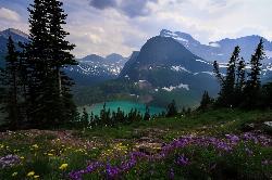
Grinnell Lake
Many Glacier, Glacier National Park
2.9 miles SW of Many Glacier, Glacier National ParkA 7.5-mile round-trip hike along glacier-fed subalpine lakes to a turquoise glacial lake in Glacier National Park — with a waterfall along the way and an optional ferry across Lake Josephine.
Hike, Swim


