


239 Things to do near Fish Creek Area
first prev 1 2 3 4 5 6 7 8 9 10 next lastShowing results within 50 miles Distance miles of MC6P+F3 Herbert, ID, USA City, Zip, or Address
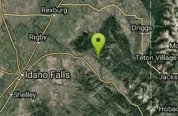
South Fork Rim Trail
Ririe, Idaho
7.4 miles SEMotorcycle trail. source: fs.usda.gov Courtesy of Singletracks.com
Mountain Bike 0.3-0.6 mi
Cress Creek Nature Trail
Rexburg, Idaho
7.7 miles WMeandering along the scenic South Fork of the Snake River, the beautiful 1¼ mile Cress Creek Nature Trail will lead you on a journey through sagebrush-grass communities, over juniper covered...
Hike
Twin Bridges Park
Rexburg, Idaho
10.1 miles WTwin Bridges is a campground 12 miles South East of Rexburg on S. 600 E. It is maintained by Madison County Parks Department. It is a 27 acre park of pristine land rich with wildlife on the Snake...
Camp, Canoe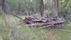
Ririe River Island (AKA Twin Bridges)
Rexburg, Idaho
10.1 miles WGo into the campground WHERE PAINTBALLING IS NOT ALLOWED. Park there and cross the creek on the North side of the park. You'll have to cross the river using the rocks that are there so not too...
Airsoft, Paintball
Blacktail Day Use Area
Ririe, Idaho
10.4 miles SWOn the North end of Ririe Reservoir there is a great little park with cliff jumping and even rock climbing. There is a trail from the south end of the parking lot down along the cliffs. There are...
Dive, Rock Climb, Swim
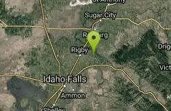
Rigby Wave-45th Wave
Rigby, Idaho
12.0 miles WKayak near Rigby, Idaho
Kayak
South Fork Snake River Trail
Ririe, Idaho
12.2 miles SEGo left at the trail head. It heads down about a mile and a half on double track. Then you'll come to a creek crossing. After the crossing the trail heads across a gate. Head left...
Mountain Bike
Wright Creek Trail
Tetonia, Idaho
12.5 miles NEOpen to MTB, horseback riding, snowshoeing, and hiking. source: fs.usda.gov
Mountain Bike
North Mahogany Trail #220
Tetonia, Idaho
13.6 miles Ehe N. Mahogany Trail is open to Motorbikes, Mountain bikes, Horses, and Hikers. Motorbikes and Horseback riders are the most common visitors, but the trail is becoming increasingly...
Mountain Bike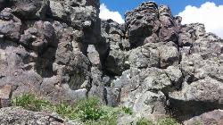
Basalt Bluff / Steve's Rock
Teton, Idaho
13.6 miles NDon't go anywhere marked No Trespassing and Beware of the Attack Bees at the top of the cliffs and the Stinging Nettle at the bottom. About a mile north of Loon Lake/Wentworth Springs Road...
Rock Climb 0.6 mi
Packsaddle Lake
Tetonia, Idaho
13.7 miles NEPacksaddle is one of the less well known lakes/trails in the area. If you've got a good offroad vehicle, you can probably make it all the way to the end of the road, otherwise, it's just an...
Dive, Hike, Mountain Bike, Snowshoe, Swim
Probation And Burg Bumper
Tetonia, Idaho
13.9 miles NEThe Probation part of the trail is the steepest downhill in the area. Has multiple bridges and log jumps in the short mile down. The Burg portion of the trail is uphill with some...
Mountain Bike 0.1 mi
Founder's Square Hill (Under the Water Tower)
Rexburg, Idaho
14.3 miles NWThis is a great sledding hill. It's about the perfect steepness and really wide. It's also big enough to make it worth a little run on a snowboard or an inner tube. While this is a pretty...
Sled
Horseshoe Canyon
Tetonia, Idaho
14.3 miles EHorseshoe Canyon is one of the closest trail systems to the town of Driggs, Idaho. This network doesn't have a ton of climbing or descending, but the smooth, swooping singletrack with a...
Mountain Bike
Bovine
Driggs, Idaho
14.3 miles EBovine trail is part of a larger system. You can use it to access more trails or make it your end destination from other trailheads. It is a steep climb but returns the favor with a fast downhill....
Mountain Bike
Horseshoe Trails
Driggs, Idaho
14.3 miles EMountain Bike near Driggs, Idaho
Mountain Bike
Blacktail Lake / Ririe Reservoir
Idaho Falls, Idaho
14.7 miles SWCanoe and Swim near Idaho Falls, Idaho
Canoe, Swim
Channel Lock
Driggs, Idaho
14.9 miles ETrail is a little over 1 mile uphill. Recommended route up to access the larger Horseshoe canyon trail system. Makes a nice downhill with twists. Gets its name from the deep ruts made from cows....
Mountain Bike
Southbound
Driggs, Idaho
15.0 miles ETrail starts by going up the Channel lock trail. At the top of Channel Lock go right onto the Southbound trail. Trail will loop back to Channel lock which you take back to your car. Trail is...
Mountain Bike
Sharks Belly
Driggs, Idaho
15.0 miles ETrail system can start from Channel lock or Bovine. Channel Lock is an easier climb than Bovine. This description and mileage starts at the Channel Lock trail, forest service boundary marker. Take...
Mountain Bike


