


135 Things to do near Grand Prismatic Spring
first prev 1 2 3 4 5 6 7 next lastShowing results within 50 miles Distance miles of US-287, Yellowstone National Park, WY 82190, USA City, Zip, or Address

Chittenden Road - Mount Washburn Trail
Canyon Village, Yellowstone National Park
27.2 miles NEHiking Mount Washburn via Chittenden Road is the shortest and easiest route to the top. The trail was once a service road and is now a clear well packed trail with a steady, gradual incline. The...
Hike

Flat Canyon Trail
Island Park, Idaho
27.4 miles SWNon-motorized use. souce: fs.usda.gov
Mountain Bike 1.9 mi
Terraced Falls
Grant Village, Yellowstone National Park
27.6 miles S3.6 mile easy out and back trail. 430 ft Elevation gain. The trailhead is off Ashton-Flagg Ranch Road along Yellowstone's South border. Ashton-Flagg Ranch Road is closed during the winter.
Hike
Cave Falls of Yellowstone
Ashton, Idaho
27.9 miles SThis campgrond is situated on the banks of Fall River in Wyoming along the south border of Yellowstone National Park. Cave Falls Campground has 23 single site units and a terrific area for...
Camp, Hike 2.8 mi
Mount Washburn Bike Trail
Devils Den, Wyoming
28.0 miles NEMount Washburn Bike Trail follows Chittenden Service Road for 2.5 miles to the top of Mount Washburn. This steep climb up the mountain provides a challenging elevation gain of 1500 feet. Mount...
Mountain Bike 14.8-30.2 mi
Mr. Bubbles Hot Spring
Old Faithful, Yellowstone National Park
28.2 miles SMr. Bubbles is one of the few places you can actually soak in the thermal waters of Yellowstone National Park. The Bechler area of Yellowstone is one of the best kept secrets of the otherwise densely...
Hike, Hot Springs 8.4 mi
Bunsen Peak Loop Bike Trail
Yellowstone National Park, Wyoming
28.4 miles NBunsen Peak Loop Bike Trail is a challenging trail that follows several service roads around Bunsen Peak. This 10 mile loop has a total elevation change of 1,120 feet, with several miles of the trail...
Mountain Bike 7.8 mi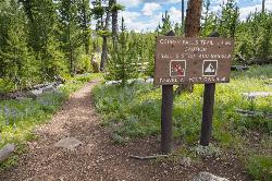
Osprey Falls Trail
Mammoth Hot Springs, Yellowstone National Park
28.4 miles NOsprey Falls Trail is an 8 mile out and back trail near Mammoth Hot Springs that provides hikers with a variety of stunning views, including ravines and a waterfall. Hikers begin this hike...
Hike 4.0 mi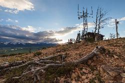
Bunsen Peak Trail
Mammoth Hot Springs, Yellowstone National Park
28.4 miles NBunsen Peak Trail is a 4.6 mile hike to the peak of Mount Bunsen. This is an out and back trail and is considered moderately difficult because of the 1,300 foot climb in elevation. ...
Hike 15.9-16.6 mi
Union Falls & Ouzel Pool
Grant Village, Yellowstone National Park
28.5 miles SBackpack, Hike, Hot Springs, and Swim near Grant Village, Yellowstone National Park
Backpack, Hike, Hot Springs, Swim 1.1 mi
Fish Lake
Ashton, Idaho
28.5 miles SHike near Ashton, Idaho
Hike 5.8 mi
Box Canyon Trail
Island Park, Idaho
28.5 miles WVarious species of tress and wildflowers can be seen on the trail, as well as songbirds, waterfowl and occasional wildlife. The trail is open for the following uses: Motorcycle Trail Riding, Off...
Hike, Mountain Bike
Horseshoe Lake
Ashton, Idaho
28.6 miles SWHorseshoe Lake is hidden back in the Targhee National Forest. It's a beautiful lake with plenty of lily pads. The road to get there is well maintained and there are many options for pull-outs...
Camp, Canoe, Dive, Swim
Box Canyon Island Park
Island Park, Idaho
28.6 miles WThe Box Canyon Campground is situated on the canyon rim above the Henry's Fork of the Snake River. There are 16 single and 2 double units, each having tent and camper pads, fire rings, grills...
Canoe
Loon Lake
Ashton, Idaho
29.3 miles SCamp, Kayak, and Swim near Ashton, Idaho
Camp, Kayak, Swim
Sawtell Peak Trail
Island Park, Idaho
30.0 miles WThis trail offers great views of the valley floor, mountain peaks and wildlife. source: fs.usda.gov
Mountain Bike 7.6 mi
Mount Jefferson
Island Park, Idaho
30.0 miles WMount Jefferson, at 10, 203 feet is the highest point in the Centennial Mountains, a small, local range on the border of Idaho and Montana a little west of Yellowstone. These mountains consist of a...
Hike 4.2 mi
Lake Marie
Island Park, Idaho
30.0 miles WLake Marie sits on the North slope of Mount Jefferson in Fremont County, Idaho. The trail to get there cuts back and forth across the Idaho Montana border 4 times. Much of the trail is fairly flat...
Backpack, Hike 2.0 mi
Snow Pass Trail
Yellowstone National Park Wyoming
30.4 miles NSnow Pass Trail is a beautiful day hike for visitors to Yellowstone looking to escape the crowds. Located a half mile south of the Mammoth Hot Springs Upper Terraces. Parking is available at a...
Backpack, Hike 0.8 mi
Wraith Falls Trail
Mammoth Hot Springs, Yellowstone National Park
30.4 miles NWraith Falls Trail is a less than 1 mile there and back hike that can be taken in under an hour. This is a wonderful family friendly hike that is easy for hikers of all levels. The hike leads...
Hike


