


139 Things to do near Kings Wave
first prev 1 2 3 4 5 6 7 next lastShowing results within 50 miles Distance miles of US-26, Jackson, WY 83001, USA City, Zip, or Address

Sharks Belly
Driggs, Idaho
39.3 miles NWTrail system can start from Channel lock or Bovine. Channel Lock is an easier climb than Bovine. This description and mileage starts at the Channel Lock trail, forest service boundary marker. Take...
Mountain Bike
Bovine
Driggs, Idaho
39.4 miles NWBovine trail is part of a larger system. You can use it to access more trails or make it your end destination from other trailheads. It is a steep climb but returns the favor with a fast downhill....
Mountain Bike
Horseshoe Trails
Driggs, Idaho
39.4 miles NWMountain Bike near Driggs, Idaho
Mountain Bike
Horseshoe Canyon
Tetonia, Idaho
39.6 miles NWHorseshoe Canyon is one of the closest trail systems to the town of Driggs, Idaho. This network doesn't have a ton of climbing or descending, but the smooth, swooping singletrack with a...
Mountain Bike
North Mahogany Trail #220
Tetonia, Idaho
39.8 miles NWhe N. Mahogany Trail is open to Motorbikes, Mountain bikes, Horses, and Hikers. Motorbikes and Horseback riders are the most common visitors, but the trail is becoming increasingly...
Mountain Bike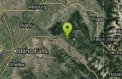
South Fork Rim Trail
Ririe, Idaho
40.5 miles NWMotorcycle trail. source: fs.usda.gov Courtesy of Singletracks.com
Mountain Bike
Blacks Canyon Trail
Ririe, Idaho
40.5 miles NWThe Blacks Canyon trail begins at Black Can Road and ends at Junction Fleming Canyon Trail. The trail is open for the following uses: Motorcycle Trail Riding, Off Highway Vehicles (OHV)...
Mountain Bike
Probation And Burg Bumper
Tetonia, Idaho
41.1 miles NWThe Probation part of the trail is the steepest downhill in the area. Has multiple bridges and log jumps in the short mile down. The Burg portion of the trail is uphill with some...
Mountain Bike
Burns Canyon
Ririe, Idaho
41.6 miles NWHike and Mountain Bike near Ririe, Idaho
Hike, Mountain Bike 0.6-5.5 mi
Old Ranger
Ririe, Idaho
41.7 miles NWOn the South end of the Big Hole mountains just above the Snake River is a grueling yet diverse section of single-track on Forest Service Trail 287 called Old Ranger. Because of the...
Mountain Bike
Thousand Springs Trail
Driggs, Idaho
42.1 miles NWThe Thousand Springs trail begins at Moody Swamp trailhead and ends at Jct Prospect Peak Trail. source: fs.usda.gov Courtesy of Singletracks.com
Mountain Bike
Badger Creek
Tetonia, Idaho
43.2 miles NWBadger Creek is a stream located just 13.6 miles from Ashton, in Teton County, in the state of Idaho, United States, near France, ID. Whether you’re spinning, baitcasting or fly fishing your...
Camp, Cross-country Ski, Hike, Mountain Bike, Rock Climb
The Arcane
Ririe, Idaho
43.6 miles NWRock Climb near Ririe, Idaho
Rock Climb 0.6 mi
Packsaddle Lake
Tetonia, Idaho
43.7 miles NWPacksaddle is one of the less well known lakes/trails in the area. If you've got a good offroad vehicle, you can probably make it all the way to the end of the road, otherwise, it's just an...
Dive, Hike, Mountain Bike, Snowshoe, Swim

Moody Meadows
Driggs, Idaho
44.2 miles NWGood place for kids, they can ride bikes in the meadow, play in the stream, and camping is off of the road. Hiking, motorbiking, and horseback riding trails are abundant in the area.
Camp
Wolverine Creek Trail
Ririe, Idaho
45.0 miles NWThe Wolverine Creek Trail is a doubletrack trail in Ririe, Idaho. It begins at South Fork Road and ends at Wolverine trailhead. It is commonly used by dirt bikes and four wheelers. This trail is...
Mountain Bike
Wright Creek Trail
Tetonia, Idaho
45.9 miles NWOpen to MTB, horseback riding, snowshoeing, and hiking. source: fs.usda.gov
Mountain Bike 4.3 mi
Leaning Fir #169
Ririe, Idaho
46.7 miles NWMountain Bike near Ririe, Idaho
Mountain Bike 0.6-2.2 mi
Fish Creek Area
Ririe, Idaho
47.7 miles NWFish Creek is a network of mountain bike trails up in the Big Hole Mountains. The trails are easily accessed from either the Ririe or Rexburg side of the range. The trail system is set up much...
Hike, Mountain Bike
Table Rock Campground
Ririe, Idaho
47.7 miles NWTable Rock / Poison Flat Campground is located at the Caribou-Targhee National Forest which occupies over 3 million acres and stretches across southeastern Idaho, from the Montana, Utah, and Wyoming...
Camp


