


Add Location
Refine Search
- skateboard 37
- hike 29
- mountain bike 18
- camp 10
- swim 8
- rock climb 8
- canoe 5
- cave 5
- horseback 5
- backpack 5
- kayak 4
- disc golf 3
- whitewater 1
- street hockey 1
- sled 1
- snowshoe 1
- canyoneer 1
73 locations
Add Location
 Full Listing
Show more
Skateboard
Full Listing
Show more
Skateboard
 Full Listing
Show more
Skateboard
Full Listing
Show more
Skateboard
 Full Listing
Show more
Skateboard
Full Listing
Show more
Skateboard
 Full Listing
Show more
Hike, Mountain Bike, Rock Climb
Full Listing
Show more
Hike, Mountain Bike, Rock Climb
 Full Listing
Show more
Skateboard
Full Listing
Show more
Skateboard
 Full Listing
Show more
Skateboard
Full Listing
Show more
Skateboard
 Full Listing
Show more
Hike, Rock Climb
Full Listing
Show more
Hike, Rock Climb
 Full Listing
Show more
Cave, Hike
Full Listing
Show more
Cave, Hike
 Full Listing
Show more
Cave
Full Listing
Show more
Cave
Cañon City Skate Park
Cañon City, Colorado
1.3 miles NE of Cañon City, ColoradoThe Cañon City Skatepark is a fun public concrete skatepark in Cañon City, Colorado, the historic Arkansas River town at the mouth of the Royal Gorge in the Rockies' Front Range foothills. Set within Mountain View Park, it's a quality Team Pain-built park with a great flow and a scenic mountain setting.
The park's standout feature is a large bowl right in the middle, varying from about six to nine feet deep and ringed almost entirely with coping except for one rounded peninsula that provides a steep roll-in from either direction — a real treat for bowl skaters who love speed and carving. Great flowing terrain, separated by a “camel hump” that lets you build speed between sections, connects the bowl to street-style features including rails, stairs, and ledges, so there's something for every style and skill level.
As part of the larger Mountain View Park — which also has a playground, a pavilion, restrooms, and soccer fields — it's an easy spot for a family outing, and it's free to skate. As always, gear up with a helmet and pads (especially younger skaters), be courteous and take turns, bring water (and remember Colorado's elevation and strong sun), and check for any posted hours or rules. With its flowing bowl and quality build, the Cañon City Skatepark is a great stop in the Royal Gorge region.
Stirling Skate Park
Dunedin, Florida
0.8 miles W of Dunedin, FloridaThe Stirling Skate Park is a fun, well-designed public concrete skatepark in Dunedin, Florida, on the Gulf Coast just north of Clearwater. Part of the city's MLK Jr. Recreation Center, this lighted 10,000-square-foot park was designed by the renowned Team Pain and is a popular spot for skateboarders and trick-scooter riders alike.
Built as a flowing concrete course, the park centers on two bowls — a tight kidney-shaped pool with stairs in the shallow end, and a nice flow bowl ranging from about four to nine feet deep — paired with a street plaza and snake zone. Street skaters will find a step-up, a rail, and hubbas (including a banked hubba) to work, making it enjoyable for a wide range of styles and skill levels. Lights let you skate into the evening.
Note that this park charges a small admission fee to skate and requires a helmet, so bring your gear and check current hours and pricing before you go. As always, wear your pads, be courteous and take turns, bring water for the Florida heat, and follow the posted rules. Quality Team Pain design, fun bowls, and a convenient location make Stirling a great place to skate on Florida's Gulf Coast.
Oyster Creek Skate Park
Englewood, Florida
3.6 miles SE of Englewood, FloridaThe Oyster Creek Skate Park is a large, fun public concrete skatepark in Englewood, Florida, on the Gulf Coast in Charlotte County. At around 18,000 square feet, it's one of the bigger parks in the area and a well-loved spot for skaters up and down the southwest Florida coast, tucked into the Oyster Creek recreational complex alongside the town's sports fields.
Built by the renowned Team Pain, the park offers a great variety of terrain for all abilities, including China banks, concrete bowls, and a mix of beginner, street, and transition features. That range makes it welcoming for newcomers finding their feet while still giving experienced skaters bowls to carve and lines to session. It's an enjoyable, well-designed park with something for everyone.
The skatepark is free to enjoy, though a few scheduling quirks are worth knowing: bikes are only allowed on Tuesdays, the park is closed on Wednesdays, and hours shift depending on whether school is in session or on summer break — so check the current schedule before you go. As always, gear up with a helmet and pads (especially younger skaters), be courteous and take turns, bring water for the Florida heat, and follow any posted rules. Big, varied, and free, Oyster Creek is a standout stop on the Gulf Coast.
Ferguson Canyon
Cottonwood Heights, Utah
1.6 miles E of Cottonwood Heights, UtahFerguson Canyon is a hidden gem of the Wasatch Front — a small, forested canyon tucked between Big and Little Cottonwood Canyons in Cottonwood Heights, just southeast of Salt Lake City. Known for its impressive granite cliffs, shady creekside trail, and big mountain views, it's a local favorite for both hikers and rock climbers, all within minutes of the city.
The canyon itself is the destination. A trail climbs up through pine and scrub-oak forest alongside a creek, with the towering granite walls that have made Ferguson a popular climbing spot rising on either side. You can do a shorter hike of about 1.6 miles to a scenic overlook with views out over the Salt Lake Valley, or push on toward the upper meadow for a more challenging outing of around 5 miles round trip. Climbers come for the quality granite crags right along the route.
A nice bonus: because Ferguson Canyon sits just outside the Salt Lake City watershed (unlike the neighboring Cottonwood canyons), dogs are allowed here — making it a favorite for local hikers with four-legged friends.
A practical heads-up: the trail starts from a residential neighborhood, so parking is limited and fills fast, especially on weekends when both hikers and climbers pack the canyon. Go early in the morning or on a weekday for a quieter experience, and park considerately. Spring through fall is ideal; bring water and sturdy shoes for the rocky, sometimes steep trail, watch your footing near the cliffs, and pack out everything. Close to the city yet genuinely wild, Ferguson Canyon is a perfect quick Wasatch escape.
Deltona Skate Park
Deltona, Florida
5.5 miles SE of Deltona, FloridaDeltona Skate Park is a fun public skate spot in Deltona, Florida, in the lakes-and-pines country of Volusia County between Orlando and Daytona Beach. A welcoming neighborhood park for skateboarders, BMX riders, and scooter kids, it's a solid place for the local crew to session and for travelers to squeeze in a roll while passing through central Florida.
The park offers a good mix of concrete features for a range of skill levels — ramps, ledges, rails, and transitions that reward everything from first drop-ins to more advanced lines. It's an easygoing community spot, great for learning new tricks or just enjoying an afternoon on wheels.
As a public city facility, it's a friendly, accessible place to skate. As always at skateparks, gear up with a helmet and pads (especially younger riders), be courteous and take turns, bring plenty of water for the Florida heat and humidity, and check for any posted hours or rules before you go.
Tucked into a quiet corner of Volusia County, Deltona Skate Park is a reliable home base for the area's skate community and an easy stop for anyone exploring central Florida on wheels.
Fleischmann Edge Skate Park
Naples, Florida
1.8 miles N of Naples, FloridaThe Edge Skate Park at Fleischmann Park is a standout skating destination in Naples, Florida — a sprawling, well-built park of more than 40,000 square feet right beside the Fleischmann Park community center. With a mix of wood and concrete features for every style and skill level, it's a hub for the Southwest Florida skate, BMX, and scooter scene.
The park packs in serious variety: a street plaza and a smaller mini plaza loaded with ledges and rails, plus a flowing transition side with a concrete snake run, a bowl, and a pool for those who like to carve and catch air. Whether you're a first-timer learning to drop in or an experienced skater stringing together lines, there's plenty to session.
A few things to know before you roll up: this is a managed city facility, so a helmet and a signed waiver are required, and there's a fee to skate (the city offers session passes). The park closes during inclement weather — entering when it's closed is treated as trespassing — so check current hours and conditions with the City of Naples before you go.
Gear up with a helmet and pads, be courteous and take turns with other skaters, bring water for the Florida heat, and look out for one another. Well-maintained and packed with features, the Edge at Fleischmann Park is one of the best places to skate on Florida's Gulf Coast.
Pete's Rock
Salt Lake City, Utah
8.7 miles SE of Salt Lake City, UtahPete's Rock is a beloved local climbing landmark on the east bench of the Salt Lake Valley — a prominent rock outcrop right at the Mount Olympus trailhead off Wasatch Boulevard, where generations of Salt Lake climbers have learned the ropes. Easy to reach and steeped in history, it's a go-to spot for casual top-roping, bouldering practice, and a quick climbing session with a big mountain backdrop.
The rock takes its name from O'Dell “Pete” Petersen, who, with his wife Edith, taught climbing lessons here for years. Today it remains a popular toproping outcrop thanks to its super-convenient access and long climbing tradition — a friendly place to practice technique, set up anchors, and enjoy the views out over the valley, even if the rock quality is more practical than perfect.
Because it sits right at the trailhead, Pete's Rock pairs naturally with the strenuous Mount Olympus hike, a classic Wasatch summit climb topping out above 9,000 feet — climbers often warm up (or wind down) on the rock before or after the trail. The signed parking area is on the east side of Wasatch Boulevard, a ways south of 4500 South.
As with any climbing, come prepared and climb smart: bring proper gear and helmets, climb with a knowledgeable partner, check your anchors and the rock carefully, and be courteous sharing the popular outcrop. Spring and fall offer the most comfortable temperatures (summer afternoons get hot and exposed on the rock). Whether you're squeezing in a quick session or starting up Mount Olympus, Pete's Rock is a quintessential piece of Salt Lake's climbing culture.
Mallory Cave
Boulder, Colorado
3.0 miles S of Boulder, ColoradoMallory Cave is a historic and scenic hiking destination in the Flatirons above Boulder, Colorado, set high on the slopes of Dinosaur Mountain within the city's Open Space and Mountain Parks. First explored by a University of Colorado student in 1932, the cave and the rugged trail that climbs to it have been a beloved Boulder adventure for generations — a rewarding scramble through classic Front Range terrain with big views along the way.
One crucial thing to know: you can no longer go inside the cave. Mallory Cave is home to a colony of sensitive Townsend's big-eared bats, and to protect them from white-nose syndrome — a devastating disease spread in part by humans — the cave entrance was gated in 2011 and is permanently closed to entry. On top of that, the final approach to the cave is closed seasonally from April 1 to October 1 each year to protect the roosting bats, so the upper trail is only open in late fall and winter. Please respect the gate, the signs, and the closures — the bats depend on it.
Even without entering the cave, the hike is well worth it. Starting from the NCAR Trailhead (off Table Mesa Drive at the National Center for Atmospheric Research), the route heads west and climbs through forest and rock, with a short, hands-on scramble near the top, and it connects to Boulder's vast Mesa Trail network if you want to extend your outing.
Plan a fall or winter visit if you want to reach the cave area, wear sturdy shoes for the rocky final pitch, carry water, and leave no trace. A piece of Boulder history wrapped in a great little hike, Mallory Cave is a rewarding trek — just admire the cave from outside, and let the bats be.
Palmer Lake Ice Cave
Palmer Lake, Colorado
1.0 miles W of Palmer Lake, ColoradoThe Palmer Lake Ice Cave is an offbeat little adventure tucked into the foothills above the town of Palmer Lake, Colorado, between Denver and Colorado Springs. Not a typical hollow cavern, it's a maze of passages — at least 500 feet of mostly crawlways — formed in the dark spaces beneath a monstrous jumble of boulders on the hillside. For curious explorers who don't mind getting low and dirty, it's a fun, quirky destination paired with a pretty foothills hike.
Reaching it is half the outing. From the Reservoir Trailhead on the edge of town, a pleasant trail climbs west to a small reservoir; from there, a narrow boulder field and ravine lead a few hundred yards up to the cave entrances. The walk up through the pines and rock is scenic in its own right, and the boulder pile that hides the cave is a fun puzzle to explore.
This is a tight, technical boulder cave, so go prepared and use caution. The passages are mostly crawlways and squeezes through and beneath house-sized rocks — not for the claustrophobic. Bring a helmet and multiple light sources, wear clothes you can scrape around in, and never go alone. Conditions change with the season: in winter, ice can block the entrance entirely, and in spring and early summer, snowmelt and flowing water can make the cave wet, slick, and difficult or unsafe to enter. Late summer and fall are generally the best and driest time to visit.
Note that the Old Carriage Road / Reservoir trailhead parking now requires a small paid permit (around $5–6) from a kiosk, and the lot fills quickly on weekends, so arrive early. Pack water, watch your footing in the boulders, and the Palmer Lake Ice Cave will reward you with a genuinely unique little underground adventure in the Colorado foothills.
0.2 mi
 Full Listing
Show more
Canyoneer, Hike, Rock Climb
Full Listing
Show more
Canyoneer, Hike, Rock Climb
Rocky Mouth Trail/Waterfalls
Sandy, Utah
2.1 miles SE of Sandy, UtahThis adventure begins with a very scenic hike to a beautiful waterfall and ends with a magnificent rappel through a short slot canyon and down the waterfall. The hike to the waterfall is a great trip for all family members. Bring the family for a picnic at the bottom of the waterfall and they can marvel at your skills as you descend from above.
The hike to the waterfall is about as quick and easy as it comes and ends at the beautiful Rocky Canyon Waterfall. The trailhead starts in suburbia and goes at an easy ascent up a small path through the neighborhood and up into the canyon. Once in the canyon, you'll enter a whole new ecosystem with lush plantlife and fun rock formations.
Rock climbers can continue up the slot canyon beyond the waterfall for a popular rappel.
The first rappel is 60' from a tree located at the lip of the waterfall. Rappel down two short drops to the large platform located at the top of the last section of waterfall. The second rappel is 70' down the center of the waterfall. The anchor is a sling located under the giant chokestone located in the center of the stream flow.Courtesy of climb-utah.com
Distance to falls: 0.2 miles
0.6 mi
 Full Listing
Show more
Hike, Mountain Bike
Full Listing
Show more
Hike, Mountain Bike
Potato Hill Trail
Draper, Utah
2.7 miles S of Draper, UtahLocated in Draper, UT, Potato Hill Trail start at the trailhead on Transverse Mountain Road. and goes down to the (BST) or Bonneville Shoreline Trail west of Coyote Hollow. There are some trails that intersect Potato Hill Trail like the Red Potato Trail; it extends from the Potato Hill Trail to the west 0.7 miles downhill to the BST just east of Red Rock and the Lexie and Ethan trail; it's 0.6 west past Red Rock to join the BST near Mike Weir Drive. The parking has been paved and cleaned due to demand and there are 30 parking places in the paved lot. There are also restrooms close to the trailhead in case you want to go before you begin. The trail is a short trail but combined with the trails surrounding the Potato Hill Trail can easily be a 3 mile long venture (most hikers combine potato trail, the red potato trail and the BST to make a loop. After the entry through the log fence, you turn right to begin the potato hill trail and after a mile, the trail will fork (stay left onto Potato trail). It's a great trail for climbing with a smooth slope with nothing too bump or tough.
1.1-4.7 mi
 Full Listing
Show more
Backpack, Hike, Mountain Bike, Snowshoe
Full Listing
Show more
Backpack, Hike, Mountain Bike, Snowshoe
Bells Canyon
Sandy, Utah
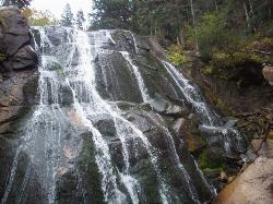
1.9 miles E of Sandy, UtahBells Canyon is a moderate, 4.5 mile hike that begins in a residential area and ends at a waterfall in the enter of the canyon's forest. The first 1/2 mile of the hike is relatively easy and leads straight to the reservoir, which is one of the best views of the hike. There are several places for people to stop and have a snack surrounding the reservoir, although some choose to turn around before the trail gets too difficult.
Once you reach the sign that directs you to the waterfall, the hike gets considerably more difficult. It's about 1.2 miles of climbing over large rocks at a serious incline, but the views are incredible. Bells Canyon has gorgeous fall foliage in the autumn months, and once spring comes around, everything is beautiful and green. There is a creek that flows along the trail, several open areas of meadow and wildflowers, and spectacular views of the canyon and the Salt Lake Valley. It's a hike that pays off as you climb it.
The waterfall is in the center of a grove of trees. There is a steep hill downward that will take you to the base of the fall, but it can be treacherous to reach, so tread carefully.
Bells Canyon does not see much Mountain Bike traffic, and for good reason! It starts out very steep and with a loose gravel trail base, it makes for a tough climb on a bike. There are steps that are all but impossible to ride up (or down). After reaching the very scenic Lower Bells Canyon Reservoir the trail is much better! It turns to a fun single track through the trees. After crossing the stream above the Reservoir the trail becomes snarled with large granite boulders and is tough for even a hiker to negotiate. Courtesy of Singletracks.com
1.6 mi
 Full Listing
Show more
Backpack, Hike, Mountain Bike
Full Listing
Show more
Backpack, Hike, Mountain Bike
Corner Canyon Trail
Draper, Utah
1.6 miles SE of Draper, UtahCorner Canyon is the "Go To" riding area in South Salt Lake and for many riders it is worth the drive (or ride) from Utah County. It is a good mix of everything from beginner training trails in Little Valley to big table tops and wall rides in Maple Hollow.Courtesy of trailforks.com
For trail maps and trails specific information, visit trailforks.com.
0.6 mi
 Full Listing
Show more
Hike, Mountain Bike
Full Listing
Show more
Hike, Mountain Bike
Bst To Equestrian Center Loop
Draper, Utah
1.6 miles SE of Draper, UtahAn intermediate trail with a length of 10 miles that's located in Draper, UT. It's a single track look trail that has an elevation of 417 ft. Start at the Equestrian Center and follow the Lower Canyon Corner road until the trail splits. Going the Bonneville Shoreline Trail (BST) way is the easiest access the get to the Loop. Follow the directions; if you make a certain turn, the you will end up where hikers and mountain bikers park as another parking spot. Follow the trail and it will lead you to a crossing; the right turn will take you to the (BST).
0.4-0.7 mi
 Full Listing
Show more
Mountain Bike, Sled
Full Listing
Show more
Mountain Bike, Sled
Rexburg Bike Park
Rexburg, Idaho
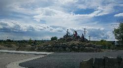
0.8 miles NE of Rexburg, IdahoIt's a small but great bike park for all ages; if you are a beginner, then this is the bike park to go to. The mounts are a decent size and approximately 4-6 mounts in different sizes for the kids. Want to spend time with friends and/or family while doing something awesome? Do your kids have nothing to do? Come to the Rexburg bike park!
Located in the back of the water park Rexburg Rapids, the Rexburg bike park is a fun place for people of all ages to ride their bikes during the open season.
There are mounts of many different sizes (small, medium and a few large ones.) Being bored is not cool! Bring your family and friends, have a cookout and ride mounts with your bike! Always wear protective equipment before riding.
By the way, do you love sledding in the winter? Also, in the winter time, the mounts are covered with snow; which makes for great sledding with family and friends. Come and have fun!
0.2-1.8 mi
 Full Listing
Show more
Hike, Mountain Bike, Rock Climb
Full Listing
Show more
Hike, Mountain Bike, Rock Climb
Lone Peak
Draper, Utah
3.2 miles SE of Draper, UtahEstablished in 1978 and located southeast of Salt Lake, Lone Peak is one of the taller peaks in the Wasatch range along the Wasatch Front. It has 5 main trailheads: Jacobs Ladder via Corner Canyon Road (access road from Orson Smith trailhead) and Jacobs Ladder Trailhead, the Cherry Canyon Logging Trail via Orson Smith trailhead at the Corner Canyon Gate 2000 E and 12600 S, from the town of Alpine and the Schoolhouse Springs trailhead, Big Willow Canyon via Hidden Valley Park trailhead at 11500 S Wasatch Blvd, and the Bells Canyon trailhead at 10200 S Wasatch Blvd.
The summit of Lone peak is over 11,000 ft. with a starting elevation of 5,200 ft. The average distance covering the peak is 9 miles for a round-trip and this trail would take approximately 5-7 hours to completion. The mountain is a beautiful and big mountain and can be easily seen from Salt Lake City but the terrains are rugged, narrow canyon and alpine cirque is dominated by the peak of the mountain. Taking pre-cautions and reading signs will help along the way in dealing with this peak; it's been known as one of the most difficult summits of the 18 Wasatch mountain peaks but if you're an experienced hiker/biker and want to be challenged, then this is one of the best peaks to fulfill your appetite.
1.5 mi
 Full Listing
Show more
Backpack, Cave, Hike
Full Listing
Show more
Backpack, Cave, Hike
Timpanogas Cave
Provo, Utah
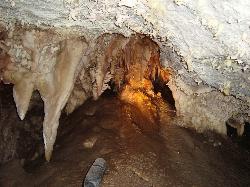
14.7 miles N of Provo, UtahKnown for it's colorful cave decorations, the Timpanogas cave attracts numerous visitors per year, is steep but it's paved so that visitors can access the cave. To access the cave, visitors take a 1.5 mile on a trail, leading to the cave. The trails to the cave is only open for tours May through September depending on funding and weather conditions. There are many colorful cave features (rocks) including cave bacons, cave columns, flowstone, cave drapery and many others. These features are formed when water travels through a tube, evaporates and leaves mineral deposits at the end.
The cave was founded by two rock climbers, James W. Gough and Frank Johnson in 1913. In addition, other caves were found by hikers (middle cave and the Hansen cave-found prior to the Timpanogas cave.) The caves were known and venturers occasionally vandalized the Hansen cave; as a result the US Forest Service were called to protect and preserve the caves. The National Park Service maintained the caves after the US Forest Service and the WPA (Workers Progress Administration) built a number of park structures to showcase the caves.
0.1-0.3 mi
Full Listing
Show more
Disc Golf
Rexburg Nature Park
Rexburg, Idaho
0.8 miles NW of Rexburg, IdahoRexburg Nature Park:
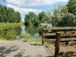
Life can be stressful, annoying, or just not good. Sometimes, it takes a moment to simply get away from the non-sense of this world; to gather yourself and seek peace and tranquility. That option is around the corner; you drive and see a trail, so you park and walk on the trail. As you walk, there's trees and sunlight shining on the leaves. You walk further and see a pond with ducks (both green and brown) and families sitting on the green grass with their kids; they watch, feed the ducks and take pictures with a smile on their face.
You go back to your vehicle and reminisce what you saw. Close to the south fork of the Teton River, is a nature park that isn't crowded with college students or infested with incoming traffic but a 15 acre park that was made so you can take your family or acquaintances for a picnic or a social gathering and enjoy; you also have the option to ride your bike or to jog on the trails.
The park is next to the Claire Boyle skate park, a beautiful golf course next to the fairgrounds and a 9 hole Frisbee golf course.
Features:
-Playground for the kids
-Fishing ponds ( A valid fishing license is required); fishing ponds for children as well.
-Wildlife and wildflowers
For more information and questions:
| Phone | 208-359-3020 Ext. 0 |
|
customerservices@rexburg.org |
0.1-0.9 mi
 Full Listing
Show more
Canoe, Hike, Kayak, Mountain Bike, Swim, Whitewater
Full Listing
Show more
Canoe, Hike, Kayak, Mountain Bike, Swim, Whitewater
Clear Creek Whitewater Park
Golden, Colorado
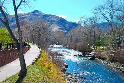
0.3 miles W of Golden, ColoradoDedicated in 1998 and located in Golden, Colorado, Clear Creek Park is one of the most unique parks in Colorado filled with water activities such as kayaking and canoeing. It reaches a quarter mile of water activities filled with good water currents and a chance for visitors to enjoy a summer vacation.
Known to some as Golden Play Park, this water recreational experience comes with different levels of drops and pools. It's meant for all experience levels so that the park can cater to all people, big or small. There are kayaking and canoeing training instructions, depending on your experience level and different courses, on how to handle the high currents of the waters. There are also facilities that have pools to learn the paddle motions and other basic but important aspects of going downstream. There are 6 additional drop structures for white water access and 7 city blocks of white water activity on clear creek.
This park has hosted water events such as The Open Canoe Championships, The Junior Olympic Championships, The Clear Creek Whitewater Festival and a few others. You have the option to either compete or to watch great water action! Either way, this is a great summer activity.
0.5-1.5 mi
 Full Listing
Show more
Hike, Horseback, Mountain Bike
Full Listing
Show more
Hike, Horseback, Mountain Bike
Palmer Park
Colorado Springs, Colorado
4.2 miles NE of Colorado Springs, ColoradoA popular park, Palmer Park is located in Colorado Springs and has over 25 trails for hiking, horseback riding or mountain biking. These trails are generally singletrack but there are also double-tracks and dirt roads along the way. The park has unique rock formations and wildlife with rabbits, coyotes, foxes and occasionally bears at the park. At the trail, there's a bird-watching park with hawks, ravens, towhees and chickadees.
The park has two baseball/softball fields, a dog park to walk animals (make sure to have a leash and to clean up the mess), a community playground for kids, horse stables for horse back riding, several picnic grounds for couples and large groups, a football/soccer field and three volleyball courts.
Once owned by Matt France in the 1800s, he sold the land in 1873 to Henry Austin; he changed the name to Austin Bluffs and raised sheep. Then in 1902, William Jackson Palmer (the founder of Colorado Springs) donated the 692 acres to Colorado Springs for the park. With it, he improved the roads leading to the park (Paseo Dr. and Palmer Park Blvd.) Eventually, activities were added for attraction later in the century. Overall, Palmer Park is an adventurous and beautiful place for all visitors to explore the outdoors while enjoying the views of the wildlife.
×


