


Teton Canyon Campground
Alta, Wyoming

| Address: | Teton Canyon Rd, Alta, WY 83414, USA |
| GPS: |
43°45'22.7"N 110°55'7.8"W Maps | Directions |
| State: | Wyoming |
Restrooms Picnic Tables
Camp
Teton Canyon is the start of several great adventures, including the Alaska Basin Trail, Table Rock, Devil's Stairs, and the Teton Crest. The campground offers a perfect basecamp to get an early start. Each campsite has a picnic table, grill, fire ring, and bear box for storing food. There are also 2 sites specifically for those with horses. Drinking water is available and firewood can be bought from the camp hosts.
Check fsda website for rates
More Information
Recreation.gov - Camping, Cabins, RVs, Permits, Passes & More
We’re here to help you dream up your next trip, figure out the details, and reserve experiences at over 3,600 facilities and 103,000 individual sites across the country.
https://www.recreation.gov/Teton Canyon, Grand Teton National Park
Your Complete Travel Guide For Grand Teton National Park. Check Out: Trails > Teton Canyon
https://www.jacksonholewy.net/trails/teton_canyon.php- Plan Ahead and Prepare
- Travel & camp on durable surfaces
- Dispose of waste properly
- Leave what you find
- Minimize campfire impacts
- Respect wildlife
- Be considerate of other visitors
Directions
From Alta, Wyoming
- Head north on Alta School Rd (98 ft)
- Turn right onto 2239/Alta School Rd (315 ft)
- Merge onto W Alta Ski Hill Rd (2.0 mi)
- Turn right onto Teton Canyon Rd (4.2 mi)
- Turn right to stay on Teton Canyon Rd (197 ft)
- Turn left to stay on Teton Canyon Rd (289 ft)
- Turn right to stay on Teton Canyon RdDestination will be on the right(266 ft)


Other Arenas Nearby

Table Rock / Table Mountain
Driggs, Idaho
0.1 miles EA big climb to 11,300 feet for arguably the finest view of the Grand Tetons — pick the steep Face or the gradual Huckleberry trail.
Camp, Hike 15.0-18.4 mi
Alaska Basin
Driggs, Idaho
0.2 miles EA stunning trail through the Jedediah Wilderness into Wyoming near Grand Teton National Park, with wildflowers, rushing rivers, the Teton Range, and the serene Alaska Basin — intermediate to advanced.
Backpack, Hike, Horseback 7.9 mi
Devil's Stairs
Driggs, Idaho
0.2 miles EAn 8-mile round-trip trail that starts from the Teton Canyon Trailhead, climbs 1,000 feet in switchbacks, and arrives at a stunning high meadow filled with wildflowers and framed by a towering cliff.
Backpack, Hike
Reunion Flat Campground
Alta, Wyoming
1.6 miles WCamp near Alta, Wyoming
Camp 4.0 mi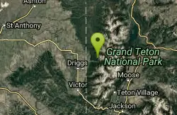
Quakie Ridge
Moose, Wyoming
2.9 miles NWSingletrack that winds through wildflower meadows with a rewarding downhill on the Quakie ridge section — trail maps available at the Grand Targhee Resort base area.
Mountain Bike 2.1 mi
Buffalo Soldier
Moose, Wyoming
3.0 miles NWA lollipop singletrack loop near Grand Targhee with fast, smooth riding and one rocky section near the top, offering some of the best Teton views on any trail out of the resort.
Mountain Bike 1.9 mi
Perm-a-grin
Moose, Wyoming
3.0 miles NWSwooping, flowing, smooth singletrack descending the hillside above Rick's Basin — Perma Grin puts a permanent smile on your face.
Mountain Bike 1.1 mi
More Cowbell
Moose, Wyoming
3.0 miles NWA singletrack trail winding through aspens, high alpine meadows, and old-growth conifers near Moose, Wyoming — a serene and scenic mountain bike ride.
Mountain Bike 0.6-4.0 mi
Grand Targhee XC Park
Moose, Wyoming
3.0 miles NWGrand Targhee's free Rick's Basin cross-country trails offer flowy, family-friendly riding on the quiet west side of the Tetons.
Mountain Bike 1.7 mi
Rick's Basin
Driggs, Idaho
3.3 miles NWMountain Bike near Driggs, Idaho
Mountain Bike 4.5 mi
Sheep Bridge Trail
Driggs, Idaho
3.4 miles WAn easy 2.25-mile trail through summer wildflowers and kaleidoscopes of butterflies along Teton Creek — cross a bridge, meander east, and dip down to the creek at a midway rest spot.
Hike, Mountain Bike 7.1 mi
Mill Creek Trail
Moose, Wyoming
3.5 miles WA cross-country downhill mountain bike ride at 7,000–10,000 ft elevation, linking Targhee resort via Lightning Ridge and Colter's Escape down Mill Creek into Teton Canyon — best shuttled for the descent.
Cross-country Ski, Mountain Bike, Snowshoe
Cold Springs
Moose, Wyoming
4.1 miles WA winding loop through Teton-area forest via jeep road and singletrack — starts up Ski Hill Road, drops through trees on the Cold Springs trail, and finishes back on Mill Creek.
Mountain Bike
Grand Targhee Resort
Moose, Wyoming
4.1 miles WA spectacular Teton mountain disc golf course at 8,000 feet elevation at Grand Targhee Resort — discs available at the Activity Center, open June through October when snow clears.
Disc Golf 6.2 mi
Darby Wind Cave
Driggs, Idaho
5.4 miles SWWaterfalls, wildflowers, creek crossings, and a wind cave high on the canyon wall — Darby's switchback trail rewards hikers with views found nowhere else in the Tetons.
Backpack, Cave, Hike, Rock Climb
Alta Nordic Trail
Alta, Wyoming
5.9 miles WA 6.2-mile free public cross-country ski and snowshoe loop around Teton Springs Golf Course, with minimal elevation change and frequent elk, moose, and waterfowl sightings.
Cross-country Ski, Snowshoe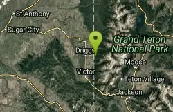
Spring Creek Trail
Alta, Wyoming
6.3 miles WOld doubletrack follows Rapid Creek past historic ranger station ruins before climbing a ridge with spectacular central Teton and Darby Canyon panoramas.
Mountain Bike 4.5 mi
Aspen Trail
Alta, Wyoming
6.3 miles SWFlowing singletrack along a 6,800-ft ridgeline contour connects to Darby Canyon on a mix of smooth and rocky terrain — a satisfying intermediate out-and-back or loop.
Hike, Mountain Bike 4.9 mi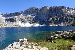
Amphitheater Lake
Alta, Wyoming
7.1 miles EAmphitheater Lake is one of Grand Teton National Park's most rewarding alpine destinations — a sparkling cirque lake cradled in granite high above the treeline, beneath the soaring peaks of...
Backpack, Hike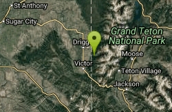
Darby Canyon Cliffs
Alta, Wyoming
7.5 miles SWA popular west-slope hike near Alta, Wyoming to an ancient Wind Cave snaking through 350-million-year-old dolomite, with waterfalls and wildflowers cascading down the canyon rim along the way.
Rock Climb
Nearby Campsites
Table Rock / Table Mountain
Driggs, Idaho
0.1 miles EA big climb to 11,300 feet for arguably the finest view of the Grand Tetons — pick the steep Face or the gradual Huckleberry trail.
Camp, Hike
Reunion Flat Campground
Alta, Wyoming
1.6 miles WCamp near Alta, Wyoming
Camp
Darby Canyon Camping
Alta, Wyoming
7.6 miles SWDispersed campsites with fire lays in scenic Darby Canyon — no official campground, just established spots in Wyoming wilderness. Leave No Trace and use existing rings only.
Camp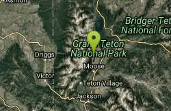
Jenny Lake Campground
Jackson Hole, WY
9.8 miles ETucked right at the base of the Tetons, this tent-only campground fills before 8 AM in summer for good reason — alpine beauty, quiet sites, and unbeatable Teton proximity.
Camp 1.3-4.3 mi
Phelps Lake
Jackson, Wyoming
11.5 miles SEA 5.5-mile loop around beautiful Phelps Lake with mountain scenery, majestic blue water, several Teton waterfalls, and lakeside campsites — plus a popular cliff jumping rock along the trail.
Backpack, Camp, Dive, Hike, Swim
Mike Harris Campground
Victor, Idaho
15.7 miles SWA scenic mountain campground at 6,200 feet along Teton Pass just 5 miles from Victor, Idaho — a peaceful base for fishing, trail exploring, and sightseeing in the Teton region.
Camp
Pine Creek Campground
Victor, Idaho
19.2 miles SWThe Pine Creek Campground has 10 single units and has restrooms.
Camp
Sheep Falls on Fall River
Ashton, Idaho
24.0 miles NA local gem off Cave Falls Road where the river splits into multiple falls tumbling over each other — primitive campsites and beautiful views make it a great picnic stop.
Camp
Loon Lake
Ashton, Idaho
24.7 miles NCamp, Kayak, and Swim near Ashton, Idaho
Camp, Kayak, Swim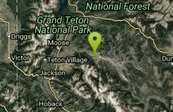
Crystal Creek Campground
Jackson, Wyoming
26.4 miles EA small, peaceful campground along two Wild and Scenic Rivers — the Gros Ventre and Crystal Creek — with nearby options for hiking, biking, and OHV riding.
Camp
Cave Falls of Yellowstone
Ashton, Idaho
27.0 miles NA campground right on the Fall River along Yellowstone's south boundary puts you steps from legendary fishing, with fire rings and bear-proof boxes at each site.
Camp, Hike
Porcupine Creek
Ashton, Idaho
27.3 miles NWA backcountry hunting, fishing, camping, and swimming spot in Targhee National Forest, surrounded by forests, meadows, a creek, and unmarked trails — bear country, so pack and store food carefully.
Camp, Swim
Moody Meadows
Driggs, Idaho
27.8 miles WGood place for kids, they can ride bikes in the meadow, play in the stream, and camping is off of the road. Hiking, motorbiking, and horseback riding trails are abundant in the area.
Camp 2.8-4.1 mi
Palisades Creek Trail / Lakes and Waterfall Canyon
Irwin, Idaho
28.8 miles SWSpectacular mountain views, two landslide-formed alpine lakes, and mountain goat sightings — all within a 4-to-6-mile hike in the Swan Valley wilderness.
Backpack, Camp, Hike, Horseback, Mountain Bike
Horseshoe Lake
Ashton, Idaho
29.4 miles NA lily-pad-dotted lake hidden in the Targhee National Forest with a gradual beach entry perfect for wading, a floating dock for jumping, and no motorized boats.
Camp, Canoe, Dive, Swim
Falls Campground
Victor, Idaho
31.6 miles SWA Snake River campground near Swan Valley with cottonwood shade, abundant wildlife — eagles, osprey, moose, and deer — and Fall Creek Falls just a quarter mile away; Palisades Reservoir is 20 miles out.
Camp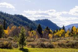
Big Elk Campground
Irwin, Idaho
31.6 miles SA versatile campground near Palisade Reservoir with fishing, hiking, horseback riding, and kayaking — plus a small secluded lake on the drive in that's perfect for a quiet afternoon.
Camp 6.9 mi
Big Elk Creek
Irwin, Idaho
31.6 miles SA versatile campground on a small dammed lake with fishing, kayaking, hiking and backpacking into the Caribou-Targhee National Forest, and stunning fall Aspen and Douglas-Fir colors on the Big Elk Creek Trail.
Backpack, Camp, Canoe, Hike, Horseback, Kayak
Fall Creek Falls
Swan Valley, Idaho
31.7 miles SWA shaded Snake River campground near Swan Valley with abundant wildlife, great trout fishing, and Fall Creek Falls a quarter-mile away.
Camp, Cave, Hike, Kayak, Swim
Warm River Campground
Ashton, Idaho
31.8 miles NWSlow-moving warm water and willow-lined banks make this campground a perfect spot for tubing, trout fishing, and peaceful mountain biking at 5,200 ft elevation.
Camp


