


Guadalupe River State Park
Spring Branch, Texas
| Address: | Guadalupe River State Park, 3350 Park Rd 31, Spring Branch, TX 78070, USA |
| GPS: |
29°52'5.6"N 98°29'23.0"W Maps | Directions |
| State: | Texas |
| Trails/Routes: | 0.2-2.0 mi |
Restrooms Picnic Tables Rivers Pet Friendly Bicycles Fishing State Park
Canoe, Hike, Horseback, Kayak, Mountain Bike, and Swim
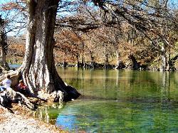
Guadalupe River State Park is a wonderful place to enjoy the beautiful Guadalupe River and the land around it.
The park has over 4 miles of river front where visitors can enjoy swimming, fishing, wading in the water, sitting on the shore, kayaking, and canoeing. The river varies in depth allowing for these different activities. People of all ages will enjoy the variety available on the river.
Floating on tubes over the calmer parts of the river is an activity that is enjoyed by many. Don’t own a tube? Rentals are available at the park.
Guadalupe River State Park also features over 13 miles of trails available to hikers and mountain bikers. A few of these trails also allow for horseback rider access, including the Painted Bunting and River Overlook Trails.
There are 85 campsites at the park available for reservation. These campsites have water and electricity available for RV and tent campers. Nine additional primitive campsites are available for walk-ins on a first come first served basis. These primitive campsites do not have water or electricity, allowing campers to enjoy being more connected to nature.
The entrance fee to the Guadalupe River State Park is 7 dollars per person. Children 12 years old and younger can enter the park for free.
Guadalupe River State Park is a wonderful place for the citizens of Austin, Dallas and other surrounding cities to escape and enjoy the great outdoors many times over.
More Information
Guadalupe River State Park — Texas Parks & Wildlife Department
We're sorry, some parts of the TPWD website don't work properly without JavaScript enabled.
https://tpwd.texas.gov/state-parks/guadalupe-riverNever modify trail features. Ride trails when they're dry enough that you won't leave ruts. Speak up when you see others on the trail and always yield to hikers, horses, and others coming uphill. Always ride on the established trail.
Read MoreBe courteous, informed, and prepared. Read trailhead guidelines, stay on the trail, and don't feed the wildlife.
Read More
- Plan Ahead and Prepare
- Travel & camp on durable surfaces
- Dispose of waste properly
- Leave what you find
- Minimize campfire impacts
- Respect wildlife
- Be considerate of other visitors
Directions
From Spring Branch, Texas
- Head south on US-281 S (2.9 mi)
- Take the TX-46 ramp to Boerne/New Braunfels (0.1 mi)
- Keep right, follow signs for Texas 46 (417 ft)
- Keep right at the fork, follow signs for TX-46 W and merge onto TX-46 W (7.3 mi)
- Turn right onto St Park Rd P31 (0.5 mi)
- Continue straight onto Park Rd 31 (0.2 mi)
- Continue onto St Park Rd P31 (2.3 mi)
- Continue onto Guadalupe River State Park Rd (0.2 mi)
- Guadalupe River State Park Rd turns slightly right and becomes St Park Rd P31 (1.3 mi)
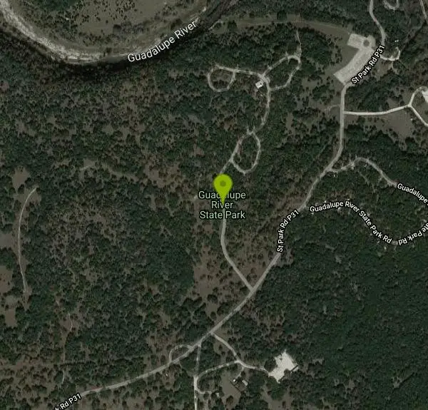
- Turn left onto Guadalupe River State Park RdDestination will be on the left(0.2 mi)


Added by tasiawhicker
Other Mountain Bike Trails, Swimming Holes, Hiking Trails, Canoeing Areas, Horseback Trails, and Kayaking Areas Nearby
Nichol's Landing
New Braunfels, Texas
3.3 miles EA scenic cypress-lined stretch of the Upper Guadalupe River with a sandbar and a rope swing — the easiest put-in or take-out for canoes, kayaks, and tubes in the area.
Canoe, Kayak, Swim
Boerne
Boerne, Texas
15.1 miles WSwim near Boerne, Texas
Swim
Blanco State Park
Blanco, Texas
15.8 miles NA spring-fed park on the Blanco River with a multi-level dam creating beautiful waterfall views — ideal for swimming, kayaking, canoeing, fishing, and camping on a mile of riverfront.
Camp, Canoe, Hike, Kayak, Swim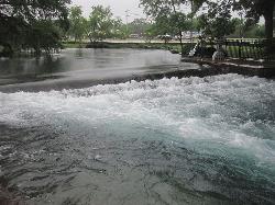
Landa Park
New Braunfels, Texas
23.7 miles SEThree spring-fed pools at 72°F year-round, a fishing pier, paddleboat rentals, and paved trails around Comal Springs — Landa Park is New Braunfels' all-day family oasis.
Hike, Swim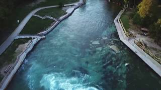
Prince Solms Park
New Braunfels, Texas
24.7 miles SEStrikingly blue Comal River water and the City Tube Chute — the largest dam-carved water slide of its kind — make Prince Solms a New Braunfels standout.
Disc Golf, Swim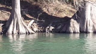
Cypress Bend Park
New Braunfels, Texas
25.4 miles SEFifteen tree-lined acres on the Guadalupe River with a playground, horseshoe pits, and a river that swings from a calm swim to a pleasant wading spot depending on the day's flow.
Swim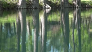
Blue Hole at Wimberley
Wimberley, Texas
25.8 miles EClear blue water under spectacular cypress trees, with beginner and advanced rope swings, 4.5 miles of free shaded hiking trails, and a sand volleyball court — reservations required at $12 for adults.
Hike, Swim
San Marcus City Park
San Marcos, Texas
33.3 miles EAn 18-acre city park on the clear San Marcos River with walking trails, river access for kayaks and tubes, swimming in deep clear water, basketball courts, and a playground for all ages.
Canoe, Hike, Kayak, Mountain Bike, Swim
Sewell Park
San Marcos, Texas
33.3 miles EA 72-degree, crystal-clear San Marcos River running through a Texas State University campus park, with tube and kayak rentals, volleyball, and open lawns — free and open to all.
Canoe, Disc Golf, Kayak, Swim
San Marcos Area
Del Rio, Texas
33.3 miles ESwim near Del Rio, Texas
Swim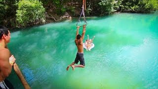
John Stokes Rope Swing
San Marcos, Texas
33.4 miles EA tall, well-built rope swing over the San Marcos River off Thompson Island — climb the plank ladder and whip out over the water.
Dive, Swim
Pedernales Falls
Johnson City, Texas
35.2 miles NELimestone waterfalls and downstream pools of varying depth make Pedernales Falls a classic Texas swimming hole — wade, swim, hike, and camp all in one state park visit.
Camp, Hike, Horseback, Mountain Bike, Swim
Pedernales Area
Perryton, Texas
35.4 miles NESwim near Perryton, Texas
Swim
Kerrville Area
Lampasas, Texas
41.0 miles WSwim near Lampasas, Texas
Swim
Krause Springs
Spicewood, Texas
46.7 miles NECamp and Swim near Spicewood, Texas
Camp, Swim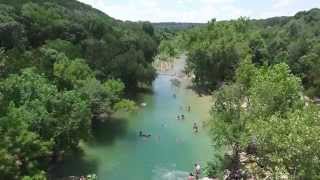
Twin Falls
Austin, Texas
48.2 miles NETwin Falls is one of the best waterfall-and-swimming-hole hikes in Texas, a scenic stretch of Austin's beloved Barton Creek Greenbelt where the creek pours over limestone ledges into clear, cool...
Hike, Swim 1.2 mi
Barton Creek Greenbelt
Austin, Texas
48.2 miles NEUp to 7.9 miles of biking, hiking, and trail running along Austin's Barton Creek, with multiple swimming access points including the famous Campbell's Hole and the beautiful Sculpture Falls.
Hike
Sculpture Falls
Austin, Texas
48.2 miles NESculpture Falls is a beloved Barton Creek Greenbelt swimming hole in Austin, where the creek carves clear pools into sculpted limestone ledges.
Hike, Swim
Hill Of Life
Austin, Texas
48.6 miles NEThe Hill of Life is the steepest, most notorious stretch of Austin's Barton Creek Greenbelt, a rugged climb (or descent) at the western end of the Greenbelt near the Scottish Woods trailhead that...
Hike, SwimNearby Campsites
Blanco State Park
Blanco, Texas
15.8 miles NA spring-fed park on the Blanco River with a multi-level dam creating beautiful waterfall views — ideal for swimming, kayaking, canoeing, fishing, and camping on a mile of riverfront.
Camp, Canoe, Hike, Kayak, Swim
Pedernales Falls
Johnson City, Texas
35.2 miles NELimestone waterfalls and downstream pools of varying depth make Pedernales Falls a classic Texas swimming hole — wade, swim, hike, and camp all in one state park visit.
Camp, Hike, Horseback, Mountain Bike, Swim
Krause Springs
Spicewood, Texas
46.7 miles NECamp and Swim near Spicewood, Texas
Camp, Swim


