


Barton Creek Greenbelt
Austin, Texas

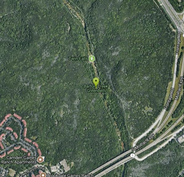
| Address: | Barton Creek Greenbelt, 3755 S Capital of Texas Hwy B, Austin, TX 78704, USA |
| GPS: |
30°14'49.8"N 97°48'45.7"W Maps | Directions |
| State: | Texas |
| Trails/Routes: | 1.2 mi |
Rivers Trails Rocks Wildflowers Bicycles
Hike
This hike can be up to 7.9 miles long and starts up near Zilker Park. You can choose the length of your hike, walk, or run. The easiest access to the Greenbelt, though, is through the Loop 360 Entrance. This location is filled with biking, hiking and running trails. There are great locations to have picnics.
On the trail there are a couple of great swimming locations. When the water levels are right these are the access points to go to to find the best swimming locations:
- Spyglass Access (1601 Spyglass Dr.): There is usually easy-access street parking at this location. Once you head down the hill at the trail access, take a left and you’ll find your way to the Flats & the Campbell’s Hole swimming spot.
- Gus Fruh Access (2642 Barton Hills Dr.): You could get to Gus Fruh from the Spyglass entrance and just simply keep going, but you can take a more direct route and park in this residential neighborhood. The water in this location is beautiful and the swimmning is perfect.
- Trail End/Sculpture Falls Access (1710 Camp Craft Road): Here you will find the trails end, the famous Hill of Life and the Sculpture Falls swimming area. Be warned, however, that you’ll need to be ready for a half-mile uphill hike to get to the falls. The falls are small and beautiful and is a great location for family-friendly fun.
This trail is open year-round and have great activities for families. The best times to go are earlier in the day before it gets too hot and right before the sun sets.
More Information
Barton Creek Greenbelt
The Barton Creek Greenbelt is Austin's prime spot for hiking, mountain biking, and rock climbing. Spanning nearly 12 miles of trails along lush greenery and limestone bluffs, this urban oasis offers an escape into nature just minutes from Downtown Austin. Check out the Austin Insider Blog to learn more about exploring the Barton Creek Greenbelt.
https://www.austintexas.org/listings/barton-creek-greenbelt/2852/Safeguarding Your Website — BigScoots
Safeguarding Your Website — BigScoots
https://austinot.com/austin-greenbelt-guideThings To Do In Texas | Texas Outside
This is your home to discover fun things to do in Texas. From hiking to biking, surfing, fishing, getaways, activities & more, find it here!
https://texasoutside.com/Be courteous, informed, and prepared. Read trailhead guidelines, stay on the trail, and don't feed the wildlife.
Read More
- Plan Ahead and Prepare
- Travel & camp on durable surfaces
- Dispose of waste properly
- Leave what you find
- Minimize campfire impacts
- Respect wildlife
- Be considerate of other visitors
Directions
From Austin, Texas
- Head south on Congress Ave toward W 5th St (0.3 mi)
- Turn right onto W Cesar Chavez StPass by the lake (on the left in 0.3 mi)(1.5 mi)
- Keep left at the fork, follow signs for TX-1 Loop S and merge onto TX-1 Loop S (2.8 mi)
- Take the exit toward Texas 360 Loop N/Capital of Tx Hwy (0.1 mi)
- Merge onto Frontage Rd (0.9 mi)
- Keep right (0.1 mi)
Zilker Access - From I-35 exit on Riverside and head west. Drive 1.5 miles to Barton Creek Rd and turn left (west). Drive one mile past the Lamar intersection and the Zilker Park entrance will be on your left. The Zilker trail access will be west of the Zilker Pool. Use this entrance if you are planning on riding a bike or if you need to lose a few more pounds.
Spyglass Access - From Mopac/Loop 1 exit on Barton Skyway and head east. Barton Skyway will dead end in less than half a mile. The trail begins where the road ends. Use this access to reach the New Wall/Great Wall. This access can be used to access Gus Fruh
Gus Fruh Access - From I-35 exit on Riverside and head west. Drive 1.5 miles to Barton Creek Rd and turn left (west). Drive about one mile past the Lamar intersection and turn left on Robert E Lee Rd. Take the first right on Barton Hills Dr. Continue down Barton Hills for exactly 2 miles. The access is in the middle of residential neighborhood on the right near the intersection of Barton Hills Dr. and Horseshoe Bend Cove. Use this access to climb at Gus Fruh and Urban Assault
Loop 360 Access - From I-35 head west on Ben White Blvd. Ben White Blvd will become 360 (a.k.a. Capitol of Texas Highway). After Ben White Blvd becomes 360 the road will head down a steep hill. This will be approximately 1/4 mile from Mopac/Loop 1. Turn right at the light on the steep hill and turn into the bank parking lot. The trail access will be located at west side of the bank parking lot. Use this access to climb at Seismic Wall and Bee Hive Wall.Courtesy of texasoutside.com


Other Hiking Trails Nearby

Sculpture Falls
Austin, Texas
1.2 miles NWSculpture Falls is a beloved Barton Creek Greenbelt swimming hole in Austin, where the creek carves clear pools into sculpted limestone ledges.
Hike, Swim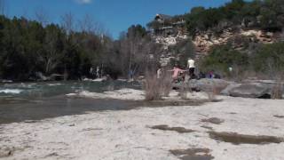
Campbell's Hole, Austin, TX, USA
Austin, Texas
1.9 miles NECampbell's Hole is one of Austin's best-loved swimming holes, a deep, cold, spring-fed pool on Barton Creek in the heart of the Barton Creek Greenbelt. Sitting about half a mile up the creek from the...
Hike, Swim
Hill Of Life
Austin, Texas
2.0 miles NThe Hill of Life is the steepest, most notorious stretch of Austin's Barton Creek Greenbelt, a rugged climb (or descent) at the western end of the Greenbelt near the Scottish Woods trailhead that...
Hike, Swim
Zilker Park
Austin, Texas
2.7 miles NEZilker Metropolitan Park is the green heart of Austin, Texas, a sprawling 358-acre expanse along the Colorado River and Barton Creek that holds one of the city's true crown jewels: Barton Springs...
Hike, Swim 0.4-0.9 mi
Wild Basin Wilderness Preserve
Austin, Texas
4.4 miles NA peaceful nature preserve with guided and self-guided hiking loops in Austin, including a stroller-friendly easy access path and plenty of wildlife and scenery.
Hike 0.3 mi
Mayfield Nature Preserve
Austin, Texas
5.2 miles NEA 21-22 acre nature preserve in Austin with walking trails, a historic cottage, colorful cottage gardens, large palms, resident peacocks, and water lily ponds — no pets, open weekdays only.
Hike
Upper McKinney Falls Swimming Hole
Austin, Texas
6.8 miles SESwimming below the Upper Falls of Onion Creek at McKinney Falls State Park, a limestone swimming hole 13 miles from the Texas Capitol in southeast Austin.
Camp, Hike, Mountain Bike, Swim
Blue Hole at Wimberley
Wimberley, Texas
23.6 miles SWClear blue water under spectacular cypress trees, with beginner and advanced rope swings, 4.5 miles of free shaded hiking trails, and a sand volleyball court — reservations required at $12 for adults.
Hike, Swim
San Marcus City Park
San Marcos, Texas
26.0 miles SAn 18-acre city park on the clear San Marcos River with walking trails, river access for kayaks and tubes, swimming in deep clear water, basketball courts, and a playground for all ages.
Canoe, Hike, Kayak, Mountain Bike, Swim
Pedernales Falls
Johnson City, Texas
26.9 miles WLimestone waterfalls and downstream pools of varying depth make Pedernales Falls a classic Texas swimming hole — wade, swim, hike, and camp all in one state park visit.
Camp, Hike, Horseback, Mountain Bike, Swim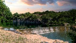
Blue Hole Park
Georgetown
28.4 miles NA free city swimming hole in downtown Georgetown, where the South San Gabriel River pools green and deep under limestone bluffs above a low stepped dam. No lifeguards, no fee, and no water quality monitoring.
Hike, Swim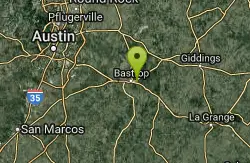
Bastrop State Park
Bastrop, Texas
32.9 miles EBastrop State Park packs in backpacking, camping, canoeing, swimming, golf, and a 12-mile scenic bike ride through the Lost Pines of east Central Texas.
Camp, Hike, Mountain Bike
Blanco State Park
Blanco, Texas
38.2 miles WA spring-fed park on the Blanco River with a multi-level dam creating beautiful waterfall views — ideal for swimming, kayaking, canoeing, fishing, and camping on a mile of riverfront.
Camp, Canoe, Hike, Kayak, Swim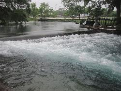
Landa Park
New Braunfels, Texas
41.6 miles SWThree spring-fed pools at 72°F year-round, a fishing pier, paddleboat rentals, and paved trails around Comal Springs — Landa Park is New Braunfels' all-day family oasis.
Hike, Swim 0.1 mi
Devils Water Hole
Burnet, Texas
47.3 miles NWA canyon swimming hole tucked inside Inks Lake State Park, surrounded by beautiful rock formations with diving spots and calm, deep water — reserve ahead, as the nearest parking fills fast.
Hike, Swim 0.2-2.0 mi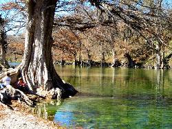
Guadalupe River State Park
Spring Branch, Texas
48.3 miles SWOver 4 miles of Guadalupe River frontage for swimming, fishing, wading, tubing, kayaking, and canoeing — plus 13 miles of trails and 85 campsites in a scenic Texas Hill Country state park.
Canoe, Hike, Horseback, Kayak, Mountain Bike, SwimNearby Campsites
Upper McKinney Falls Swimming Hole
Austin, Texas
6.8 miles SESwimming below the Upper Falls of Onion Creek at McKinney Falls State Park, a limestone swimming hole 13 miles from the Texas Capitol in southeast Austin.
Camp, Hike, Mountain Bike, Swim
Krause Springs
Spicewood, Texas
25.7 miles NWCamp and Swim near Spicewood, Texas
Camp, Swim
Pedernales Falls
Johnson City, Texas
26.9 miles WLimestone waterfalls and downstream pools of varying depth make Pedernales Falls a classic Texas swimming hole — wade, swim, hike, and camp all in one state park visit.
Camp, Hike, Horseback, Mountain Bike, Swim
Bastrop State Park
Bastrop, Texas
32.9 miles EBastrop State Park packs in backpacking, camping, canoeing, swimming, golf, and a 12-mile scenic bike ride through the Lost Pines of east Central Texas.
Camp, Hike, Mountain Bike
Blanco State Park
Blanco, Texas
38.2 miles WA spring-fed park on the Blanco River with a multi-level dam creating beautiful waterfall views — ideal for swimming, kayaking, canoeing, fishing, and camping on a mile of riverfront.
Camp, Canoe, Hike, Kayak, Swim


