


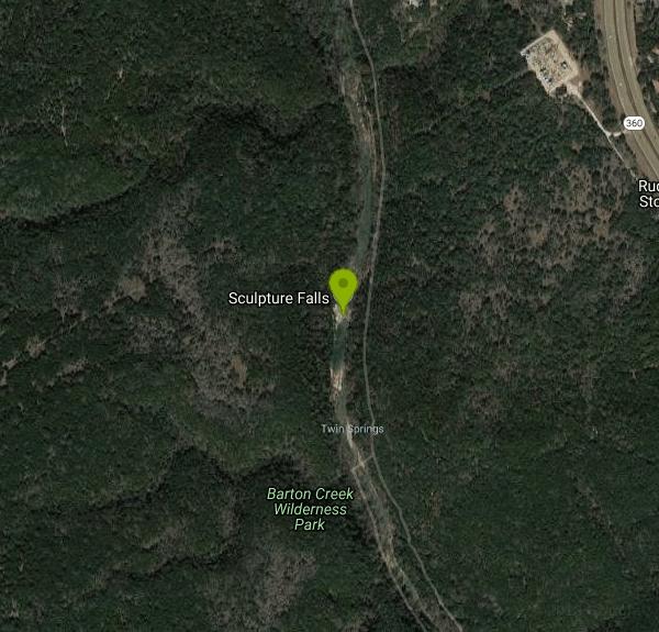
Sculpture Falls
Austin, Texas

| Address: | Barton Creek Greenbelt Trail, Austin, TX 78746, USA |
| GPS: |
30°15'42.7"N 97°49'24.7"W Maps | Directions |
| State: | Texas |
Hike and Swim
Sculpture Falls is one of Austin's most beloved natural swimming holes, hidden along Barton Creek in the beautiful Barton Creek Greenbelt — a nearly eight-mile ribbon of wild limestone canyon that threads right through the heart of the city, a genuine slice of the Texas Hill Country just minutes from downtown. Here the creek spills over a broad shelf of sculpted ledges into a series of clear, cool green pools; over thousands of years the water has carved the soft Edwards limestone into the smooth, artful shapes and channels that give the falls their name.
Reaching it takes a little effort, which helps keep it a touch quieter than the busier greenbelt spots nearer downtown. Many hikers come in from the upstream end at the Trail's End access, home of the infamous “Hill of Life” — a steep, rocky descent that drops roughly 300 feet in half a mile and is the greenbelt's toughest pitch, beloved by trail runners and mountain bikers — then follow the creek a bit over a mile downstream, passing the popular Twin Falls along the way. You can also come from other trailheads like Gus Fruh or the Barton Springs end, though those make for a longer walk. At Sculpture Falls you'll find pools deep enough for swimming, flat ledges for lounging and sunbathing, and refreshing water around 70°F on a scorching Texas afternoon. It's dog-friendly, too, and the tall limestone cliffs that line the greenbelt draw rock climbers to routes nearby.
One crucial caveat: Barton Creek is spring- and rain-fed and runs seasonally, so it can drop low or dry up entirely during summer heat and Central Texas droughts. The falls are only worth the trek when the creek is actually flowing — the sweet spot is generally two to four days after a good rain, before the water turns murky or vanishes — so check recent conditions and rainfall before you go.
The greenbelt is ecologically special as well as scenic. Barton Creek recharges the Edwards Aquifer and feeds the famous Barton Springs downstream, home to the endangered Barton Springs salamander, so it's a place to tread lightly: use the trash cans, keep sunscreen, soap, and glass out of the pools, don't build rock dams, and stay on established paths to protect the fragile creek. On hot weekends it can get genuinely crowded, so an early start helps with both parking and solitude.
Practical notes: wear sturdy shoes with grip for the rocky, sometimes-slick trail and creek bed, and carry plenty of water for the hike, because there is none along the trail and the exposed stretches bake in summer. Watch depth before jumping from the ledges, keep a close eye on kids near the drop-offs, and be ready for a real workout on the climb back up the Hill of Life if you came in that way. Spring and early summer, in the days after rain, are absolutely prime — and if you time it right, Sculpture Falls is about as good as a wild city swimming hole gets anywhere in Texas.
More Information
Guide to Austin’s Barton Creek Greenbelt | Greenbelt Trails & Hiking | Visit Austin, TX
The Barton Creek Greenbelt travels through South Austin, Texas and is the go-to destination for hiking, biking, rock-climbing, bouldering, swimming and even hammocking or sunbathing. Here are the best access points and trail heads to visit.
https://www.austintexas.org/austin-insider-blog/blog/post/your-guide-to-navigating-austins-barton-creek-greenbelt/Be courteous, informed, and prepared. Read trailhead guidelines, stay on the trail, and don't feed the wildlife.
Read More
- Plan Ahead and Prepare
- Travel & camp on durable surfaces
- Dispose of waste properly
- Leave what you find
- Minimize campfire impacts
- Respect wildlife
- Be considerate of other visitors
Directions
From Austin, Texas
- Head south on Congress Ave toward W 5th St (0.3 mi)
- Turn right onto W Cesar Chavez StPass by the lake (on the left in 0.3 mi)(1.5 mi)
- Keep left at the fork, follow signs for TX-1 Loop S and merge onto TX-1 Loop S (2.8 mi)
- Take the exit toward Texas 360 Loop N/Capital of Tx Hwy (0.1 mi)
- Merge onto Frontage Rd (0.4 mi)
- Turn right onto TX-360 Loop N (1.6 mi)
- Make a U-turn at Parkstone Heights Dr (0.5 mi)

![[GUIDE] Hiking to Sculpture Falls from the Barton by Geek Adventures](https://i.ytimg.com/vi/K1WcNp4-ctU/default.jpg?width=120&height=90)
Other Swimming Holes and Hiking Trails Nearby

Hill Of Life
Austin, Texas
0.9 miles NThe Hill of Life is the steepest, most notorious stretch of Austin's Barton Creek Greenbelt, a rugged climb (or descent) at the western end of the Greenbelt near the Scottish Woods trailhead that...
Hike, Swim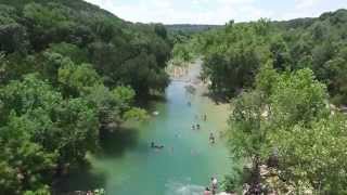
Twin Falls
Austin, Texas
1.2 miles SETwin Falls is one of the best waterfall-and-swimming-hole hikes in Texas, a scenic stretch of Austin's beloved Barton Creek Greenbelt where the creek pours over limestone ledges into clear, cool...
Hike, Swim 1.2 mi
Barton Creek Greenbelt
Austin, Texas
1.2 miles SEUp to 7.9 miles of biking, hiking, and trail running along Austin's Barton Creek, with multiple swimming access points including the famous Campbell's Hole and the beautiful Sculpture Falls.
Hike
Campbell's Hole, Austin, TX, USA
Austin, Texas
2.3 miles ECampbell's Hole is one of Austin's best-loved swimming holes, a deep, cold, spring-fed pool on Barton Creek in the heart of the Barton Creek Greenbelt. Sitting about half a mile up the creek from the...
Hike, Swim
Zilker Park
Austin, Texas
3.0 miles EZilker Metropolitan Park is the green heart of Austin, Texas, a sprawling 358-acre expanse along the Colorado River and Barton Creek that holds one of the city's true crown jewels: Barton Springs...
Hike, Swim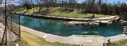
Barton Springs Pool
Austin, Texas
3.2 miles EA legendary 3-acre spring-fed pool in Zilker Park at a constant 70°F — Austin's beloved year-round swimming destination with deep roots in Texas history, adjacent to the greenbelt.
Swim 0.4-0.9 mi
Wild Basin Wilderness Preserve
Austin, Texas
3.4 miles NA peaceful nature preserve with guided and self-guided hiking loops in Austin, including a stroller-friendly easy access path and plenty of wildlife and scenery.
Hike 0.3 mi
Mayfield Nature Preserve
Austin, Texas
4.7 miles NEA 21-22 acre nature preserve in Austin with walking trails, a historic cottage, colorful cottage gardens, large palms, resident peacocks, and water lily ponds — no pets, open weekdays only.
Hike
Upper McKinney Falls Swimming Hole
Austin, Texas
7.9 miles SESwimming below the Upper Falls of Onion Creek at McKinney Falls State Park, a limestone swimming hole 13 miles from the Texas Capitol in southeast Austin.
Camp, Hike, Mountain Bike, Swim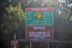
Hippie Hollow Park
Austin, Texas
11.1 miles NA clothing-optional park on 109 peaceful acres nestled in the natural Hill Country beauty of Lake Travis, just 20 minutes from Austin — a quiet nudist retreat away from city bustle.
Swim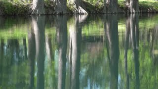
Blue Hole at Wimberley
Wimberley, Texas
23.9 miles SWClear blue water under spectacular cypress trees, with beginner and advanced rope swings, 4.5 miles of free shaded hiking trails, and a sand volleyball court — reservations required at $12 for adults.
Hike, Swim
Krause Springs
Spicewood, Texas
24.6 miles NWCamp and Swim near Spicewood, Texas
Camp, Swim
Pedernales Falls
Johnson City, Texas
26.1 miles WLimestone waterfalls and downstream pools of varying depth make Pedernales Falls a classic Texas swimming hole — wade, swim, hike, and camp all in one state park visit.
Camp, Hike, Horseback, Mountain Bike, Swim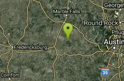
Pedernales Area
Perryton, Texas
26.4 miles WSwim near Perryton, Texas
Swim
Sewell Park
San Marcos, Texas
26.7 miles SA 72-degree, crystal-clear San Marcos River running through a Texas State University campus park, with tube and kayak rentals, volleyball, and open lawns — free and open to all.
Canoe, Disc Golf, Kayak, Swim
San Marcus City Park
San Marcos, Texas
26.8 miles SAn 18-acre city park on the clear San Marcos River with walking trails, river access for kayaks and tubes, swimming in deep clear water, basketball courts, and a playground for all ages.
Canoe, Hike, Kayak, Mountain Bike, Swim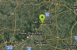
San Marcos Area
Del Rio, Texas
27.3 miles SSwim near Del Rio, Texas
Swim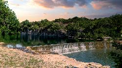
Blue Hole Park
Georgetown
27.7 miles NA free city swimming hole in downtown Georgetown, where the South San Gabriel River pools green and deep under limestone bluffs above a low stepped dam. No lifeguards, no fee, and no water quality monitoring.
Hike, Swim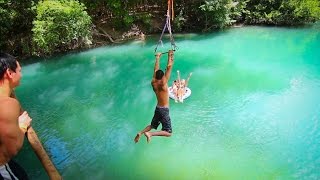
John Stokes Rope Swing
San Marcos, Texas
27.7 miles SA tall, well-built rope swing over the San Marcos River off Thompson Island — climb the plank ladder and whip out over the water.
Dive, Swim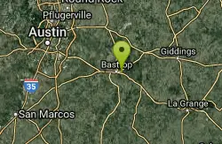
Bastrop State Park
Bastrop, Texas
33.8 miles EBastrop State Park packs in backpacking, camping, canoeing, swimming, golf, and a 12-mile scenic bike ride through the Lost Pines of east Central Texas.
Camp, Hike, Mountain BikeNearby Campsites
Upper McKinney Falls Swimming Hole
Austin, Texas
7.9 miles SESwimming below the Upper Falls of Onion Creek at McKinney Falls State Park, a limestone swimming hole 13 miles from the Texas Capitol in southeast Austin.
Camp, Hike, Mountain Bike, Swim
Krause Springs
Spicewood, Texas
24.6 miles NWCamp and Swim near Spicewood, Texas
Camp, Swim
Pedernales Falls
Johnson City, Texas
26.1 miles WLimestone waterfalls and downstream pools of varying depth make Pedernales Falls a classic Texas swimming hole — wade, swim, hike, and camp all in one state park visit.
Camp, Hike, Horseback, Mountain Bike, Swim
Bastrop State Park
Bastrop, Texas
33.8 miles EBastrop State Park packs in backpacking, camping, canoeing, swimming, golf, and a 12-mile scenic bike ride through the Lost Pines of east Central Texas.
Camp, Hike, Mountain Bike
Blanco State Park
Blanco, Texas
37.8 miles WA spring-fed park on the Blanco River with a multi-level dam creating beautiful waterfall views — ideal for swimming, kayaking, canoeing, fishing, and camping on a mile of riverfront.
Camp, Canoe, Hike, Kayak, Swim


