


56 Hiking Trails near Little Wapiti
first prev 1 2 3 next lastShowing Hiking Trails within 50 miles Distance miles of Fs 2522, Gallatin Gateway, MT 59730, USA City, Zip, or Address
Daly Creek
Gallatin Gateway, Montana
6.9 miles EDaly Creek Trail is a 5.2 mile out and back trail located near Gallatin Gateway, Montana and is good for all skill levels. The trail is primarily used for hiking and is accessible from May until...
Hike 10.1 mi
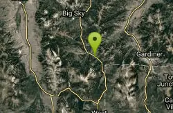
Sky Rim Trail to Sheep Mountain
Big Sky, Montana
8.2 miles ESky Rim Trail to Sheep Mountain is a challenging hike with stunning and famous views. This 10 mile out-and-back trail starts at Dailey Creek Trailhead (WK1). The trail follows Dailey Creek over...
Backpack, Hike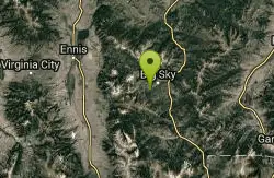
Ousel Falls
Gallatin Gateway, Montana
14.1 miles NOusel Falls Park Trail is a 1.7 mile out and back trail located near Big Sky, Montana that features a waterfall. The trail is primarily used for hiking and is accessible from May until October.
Hike, Rock Climb, Swim 7.8 mi
Osprey Falls Trail
Mammoth Hot Springs, Yellowstone National Park
28.1 miles EOsprey Falls Trail is an 8 mile out and back trail near Mammoth Hot Springs that provides hikers with a variety of stunning views, including ravines and a waterfall. Hikers begin this hike...
Hike 4.0 mi
Bunsen Peak Trail
Mammoth Hot Springs, Yellowstone National Park
28.1 miles EBunsen Peak Trail is a 4.6 mile hike to the peak of Mount Bunsen. This is an out and back trail and is considered moderately difficult because of the 1,300 foot climb in elevation. ...
Hike 2.0 mi
Snow Pass Trail
Yellowstone National Park Wyoming
28.4 miles ESnow Pass Trail is a beautiful day hike for visitors to Yellowstone looking to escape the crowds. Located a half mile south of the Mammoth Hot Springs Upper Terraces. Parking is available at a...
Backpack, Hike 8.1 mi
Sepulcher Mountain Trail
Mammoth Hot Springs, Yellowstone National Park
28.6 miles ESepulcher Mountain Trail is an 11 mile loop trail from Mammoth Hot Springs to the peak of Sepulcher Mountain. This is a challenging hike with a 3,500 foot ascent to the 9,652 foot peak. The...
Hike 5.3 mi
Beaver Ponds Trail
Mammoth, Yellowstone National Park
28.6 miles EBeaver Ponds Trail is a wonderful short hike accessible from Mammoth Hot Springs. The trail forms a loop between the two trailheads available at Mammoth Hot Springs. The loop is just over 5 miles...
Hike 0.1-5.2 mi
Mammoth Hot Springs
Mammoth, Yellowstone National Park
28.6 miles EMammoth Hot Springs is a unique sight in Yellowstone National Park. The soft limestone in this area allowed the water to form colorful terraces. The extremely hot running water is clear and smooth,...
Camp, Hike
Mammoth/Gardiner Back Road
Mammoth Hot Springs, Yellowstone National Park
28.7 miles EThe only road open in Yellowstone National Park is Highway 89 at Gardiner, Montana to park Headquarters at Mammoth Hot Springs and from Mammoth Hot Springs to Silver Gate and Cooke City, Montana.
Hike, Mountain Bike 7.9 mi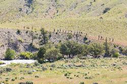
Rescue Creek Trail
Mammoth Hot Springs, Yellowstone National Park
28.8 miles ERescue Creek Trail is an 8 mile hike that crosses the Montana/Wyoming boarder. This double trail makes for a leisurely hike through beautiful hills and colorful yellow green grasslands. This trail,...
Hike 4.0 mi
Lava Creek Trail
Mammoth Hot Springs, Yellowstone National Park
29.1 miles ELava Creek Trail is a 4.2 mile hike where hikers can enjoy walking along the scenic Lava Creek. The trail passes Undine Falls and the Gardner River. Undine Falls is a beautiful 60 foot...
Hike
Hyalite Creek Trail
Gallatin Gateway, Montana
30.2 miles NESummer activities are on a timeshare basis, with specific days and activities listed at the trailhead. The entire trail is 11 miles, with eleven waterfalls along the trail! Bear...
Hike, Horseback, Mountain Bike 0.8 mi

Wraith Falls Trail
Mammoth Hot Springs, Yellowstone National Park
32.9 miles EWraith Falls Trail is a less than 1 mile there and back hike that can be taken in under an hour. This is a wonderful family friendly hike that is easy for hikers of all levels. The hike leads...
Hike 0.8 mi
Harlequin Lake Trail
Madison, Yellowstone National Park
33.7 miles SEHarlequin Lake Trail is a beautiful short hike that can be taken in under an hour. This scenic hike is easy and family friendly, making it the perfect activity to add to any Yellowstone visit....
Hike 7.4 mi
Blacktail Deer Creek to Yellowstone River Trail
Mammoth Hot Springs, Yellowstone National Park
34.1 miles EBlacktail Deer Creek Trail is a 7 mile out and back trail that leads to the Yellowstone River. Hikers on this trail will enjoy seeing green open fields, boulder formations and waterfalls at the...
Hike 6.1 mi
Purple Mountain Trail
Madison, Yellowstone National Park
34.3 miles SEPurple Mountain Trail is a 6 mile out and back trail to the peak of purple mountain. This is a beautifully forested trail with little foot traffic is a quiet respite from the crowds of...
Hike 4.2 mi
Lake Marie
Island Park, Idaho
34.6 miles SLake Marie sits on the North slope of Mount Jefferson in Fremont County, Idaho. The trail to get there cuts back and forth across the Idaho Montana border 4 times. Much of the trail is fairly flat...
Backpack, Hike 7.6 mi
Mount Jefferson
Island Park, Idaho
34.6 miles SMount Jefferson, at 10, 203 feet is the highest point in the Centennial Mountains, a small, local range on the border of Idaho and Montana a little west of Yellowstone. These mountains consist of a...
Hike
Forces of the Northern Range
Mammoth, Yellowstone National Park
35.4 miles EThis short 1/2 mile boardwalk located on the Blacktail Deer Plateau between Mammoth Village and Tower Junction will open your eyes and educate you about forces of nature that have sculpted the land...
Hike


