


Map of 125 Hiking Trails near Black Canyon City, AZ 85324
first prev 1 2 3 4 5 6 7 next lastShowing Hiking Trails within 50 miles Distance miles of Black Canyon City, AZ 85324, USA City, Zip, or Address
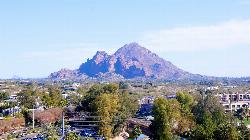
Camelback Mountain
Phoenix, Arizona
39.3 miles SHiking After Camelback became a park in 1968, TripAdvisor advertised the hikes as one of the top 10 things to do when in Phoenix. Located right in the middle of Phoenix, Scottsdale and...
Hike, Rock Climb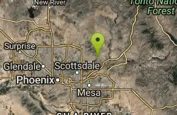
Sunrise Peak via Sunrise Trail
Scottsdale, Arizona
39.5 miles SEHike near Scottsdale, Arizona
Hike 23.0 mi
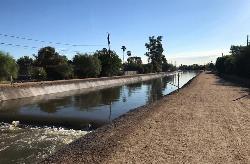
Grand Canal Trail
Phoenix, Arizona
40.2 miles SThe Grand Canal Trail is a 23-mile long system of paved and unpaved trails located in Glendale, Phoenix and Tempe that travels through...
Hike
Goat Camp Trail
Buckeye, Arizona
40.3 miles SWGoat Camp Trail is a well-liked mountain biking and hiking trail in White Tank Mountain Regional Park. This is a 16 mile out-and-back trail that is rated as advanced due to the length, as well as the...
Hike, Mountain Bike
South, Bajada, Mule Deer Loop Trail
Waddell, Arizona
40.4 miles SWSouth - Bajada - Mule Deer Loop is a 4.1 mile loop trail located near Waddell, Arizona that offers the chance to see wildlife. The trail is rated as moderate and is accessible from...
Hike, Horseback, Mountain Bike 2.2-6.1 mi
Fossil Creek Dam (Toilet Bowl)
Pine, Arizona
40.5 miles NEHidden within the vast Arizona desert is an oasis of a river that brings the surrounding banks to life around it. This is Fossil Creek--one of Arizona's two designated "Wild and...
Dive, Hike, Swim 0.1-3.8 mi
Fossil Springs Trail No. 18
Pine, Arizona
40.5 miles NELocated within the Fossil Springs Wilderness, this trail leads down a canyon to the springs for which it is named. At the trailhead, there are several hikes, some of which are available for...
Hike, Horseback, Swim
Fountain Park Trail
Fountain Hills, Arizona
40.8 miles SEFountain views, Four Peaks view, desert vegetation, close to coffee! The trail is well groomed and well marked. It parallels some house as you begin to go up the first hill. About 15...
Hike, Mountain Bike 16.9 mi
West Clear Creek Trail No. 17
Camp Verde, Arizona
41.1 miles NEWest Clear Creek Trail No. 17 is a great way to reach the running waters of West Clear Creek. By far the most accessible and popular, it starts from the Bull Pen Ranch parking lot and winds down the...
Backpack, Hike, Swim
Bullpen Day Use Area
Camp Verde, Arizona
41.1 miles NEBullpen has something for everyone. Whether you park here and use the trail head to start on one of several hikes that lead down West Clear Creek, or stay nearby to use the picnic areas and...
Backpack, Dive, Hike, Swim
Fountain Hills Park
Fountain Hills, Arizona
41.2 miles SEFountain Park is a 1.3 mile loop trail located near Phoenix, Arizona ( in Fountain Hills) and is good for all skill levels. The trail is primarily used for hiking and is accessible...
Hike 3.0 miBlodgett Basin Trail No. 31
Camp Verde, Arizona
41.2 miles NEBlodgett Basin Trail is one of a select few trails that shows off the riparian desert beauty unique to West Clear Creek Wilderness. The trail stretches from Bull Pen Trailhead through the canyon and...
Backpack, Hike, Swim 1.4 mi
Ballantine Trail
Rio Verde, Arizona
43.3 miles SEthis trail looks a lot better once it moves away from the highway. A somewhat strenuous climb reveals a landscape of knuckle-and-joint, mica-imbedded boulders, deep gorges and a battalion of regal...
Hike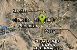
Papago to Tempe Town Lake
Phoenix, Arizona
43.4 miles SThere are many paths that interconnect within Papago park and the nearby Tempe Town Lake. Any of these in combination provide a good walk or bike riding experience with a variety of views. Papago...
Hike
Double Butte Loop Trail
Phoenix, Arizona
44.0 miles SDouble Butte Loop Trail is one of the trails within Papago Park in Phoenix, Arizona. The Double Butte Loop Trail is a natural trail that traverses the circumference of both the small butte...
Hike, Mountain Bike
Bearfoot Trail
Strawberry, Arizona
44.5 miles NEHike and Mountain Bike near Strawberry, Arizona
Hike, Mountain Bike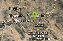
Crosscut Canal Trail
Tempe, Arizona
44.8 miles SCrosscut Canal Trail is a concrete, sidewalk multi-use trail for walking, biking, wheelchairs, scooters, and skateboards. This two mile long path follows a canal and links Tempe Town Lake to...
Hike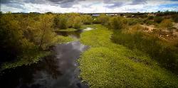
Rio Salado Habitat Restoration Area
Phoenix, Arizona
44.9 miles SHike near Phoenix, Arizona
Hike 4.8 mi
Lost Creek Petroglyph Trail
Buckeye, Arizona
45.4 miles SWStarting at Verrado's trailhead, the trail heads a short ways to a petroglyph site. While a little rocky at times, the trail is easy. To deter vandals, a very necessary fence with barbed-wire has...
Hike, Mountain Bike 4.9 mi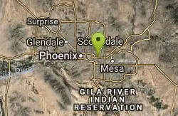
Tempe Town Lake Trail
Tempe, Arizona
45.5 miles SOn the lake's south side, the trail connects Arizona State University's main Tempe campus with Tempe Beach Park, as well as the Tempe Marketplace retail mecca. A newer extension on the...
Hike


