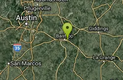
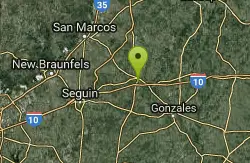
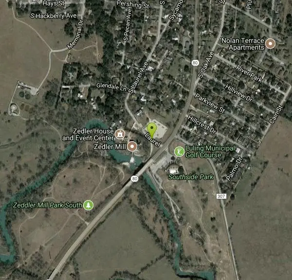
Luling Area
Perryton, Texas
Swim
More Information
- Plan Ahead and Prepare
- Travel & camp on durable surfaces
- Dispose of waste properly
- Leave what you find
- Minimize campfire impacts
- Respect wildlife
- Be considerate of other visitors
Directions
From Perryton, Texas
- Head northeast on TX-15 E/E Brillhart Ave toward S Ash StContinue to follow TX-15 E(1.2 mi)
- Turn right onto TX-143 Loop S/E Loop RdContinue to follow TX-143 Loop S(3.2 mi)
- Turn left onto US-83 S/S Main StContinue to follow US-83 S(42.2 mi)
- Turn right onto US-60 W/US-83 S (9.6 mi)
- Slight left onto US-83 S (62.3 mi)
- Continue onto US-83 S (127 mi)
- Turn left onto US-380 E/US-83 SContinue to follow US-83 S(37.9 mi)
- Continue straight onto US-277 S/US-83 S (1.4 mi)
- Turn right onto US-277 S/US-83 S/Commercial AveContinue to follow US-277 S/US-83 S(18.6 mi)
- Take the exit on the left toward Abilene/San Angelo S (0.5 mi)
- Continue onto Pine St (1.9 mi)
- Turn right to merge onto I-20 E (2.6 mi)
- Exit onto E Stamford St (1.5 mi)
- Turn right onto TX-322 Loop S (1.7 mi)
- Take the TX-36 exit toward Cross Plains/Airport/Expo Center (0.2 mi)
- Turn left onto TX-36 S/E South 11th St (signs for TX-322 Loop S/US-83/US-84)Continue to follow TX-36 S(40.4 mi)
- Turn right onto TX-206 S/S Main St (signs for TX-279)Continue to follow TX-206 S(1.1 mi)
- Continue straight onto TX-279 S (31.5 mi)
- Turn left onto W Commerce St (1.1 mi)
- Continue onto Early Blvd (1.7 mi)
- Turn right onto US-183 S/US-84 E (30.3 mi)
- Slight right toward US-183 S (0.2 mi)
- Continue straight onto US-183 S (36.8 mi)
- Turn right onto US-183 S/US-190 E/US-281 SContinue to follow US-183 S(42.1 mi)
- Continue straight onto TX-183A Toll Rd SPartial toll road(9.9 mi)
- Take the Texas 45 Toll E exitToll road(1.2 mi)
- Merge onto TX-45 E/TX-45 TollToll road(11.9 mi)
- Take the Texas 45 Toll S/Texas 130 Toll S exit toward AustinToll road(0.9 mi)
- Merge onto TX-130 S/Texas 45 TollContinue to follow TX-130 SPartial toll road(28.4 mi)
- Keep left at the fork to stay on TX-130 SToll road(12.6 mi)
- Exit onto US-183 S (17.1 mi)
- Continue onto S Magnolia Ave (1.0 mi)
- Turn right onto LaurelDestination will be on the left(200 ft)
Other Swimming Holes Nearby

John Stokes Rope Swing
San Marcos, Texas
22.0 miles NWThis is a great place to cool off in the San Marcos River and you can get in some showing off time while you're at it. Just off Thompson Island, there's an ideal tree for a rope swing....
Dive, Swim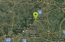
San Marcos Area
Del Rio, Texas
22.4 miles NWSwim near Del Rio, Texas
Swim
San Marcus City Park
San Marcos, Texas
22.8 miles NWSan Marcus City Park is a popular cool off spot on the San Marcus River. This beautiful clear river is surrounded by lush greenery, giving beautiful views to those who walk the trails of this 18 acre...
Canoe, Hike, Kayak, Mountain Bike, Swim
Sewell Park
San Marcos, Texas
22.8 miles NWSewell Park is the perfect place too cool off on a hot day. The park is located on Texas State University campus along the crystal clear San Marcos River. Visitors can enjoy the 72-degree...
Canoe, Disc Golf, Kayak, Swim
Cypress Bend Park
New Braunfels, Texas
27.5 miles WCypress Bend Park is one of the many charming public parks in the New Braunfels area. This park is a spacious 15 acres of play area. Cypress Bend is aptly named for the many cypress trees that line...
Swim
Prince Solms Park
New Braunfels, Texas
28.5 miles WPrince Solms Park is known for its strikingly blue, refreshing waters. Located on the Comal River this 19-acre park is the perfect spot for swimmers and tubers to enjoy for the day. Prince Solms...
Disc Golf, Swim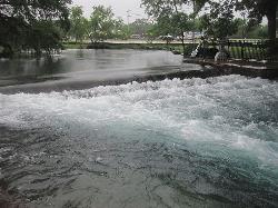
Landa Park
New Braunfels, Texas
29.3 miles WLanda Park is a 50-acer, beautiful respite for locals and visitors alike. With its many uniquely charming attractions, this park is a place you will want to visit and revisit many times...
Hike, Swim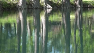
Blue Hole at Wimberley
Wimberley, Texas
35.0 miles NWBlue Hole Regional Park is a beautiful forested spot that has been preserved by the City of Wimberley and is a popular destination for locals. The clear blue water and spectacular cypress trees make...
Hike, Swim
Twin Falls
Austin, Texas
41.2 miles NHike and Swim near Austin, Texas
Hike, Swim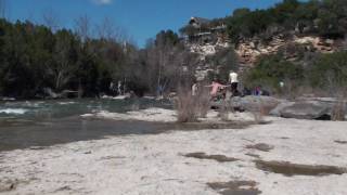
Campbell's Hole, Austin, TX, USA
Austin, Texas
41.7 miles NHike and Swim near Austin, Texas
Hike, Swim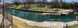
Barton Springs Pool
Austin, Texas
41.8 miles NWithin Zilker Park's 358 acres lies one of the crown jewels of Austin - Barton Springs Pool. The pool itself measures three acres in size, and is fed from underground springs with an average...
Swim
Zilker Park
Austin, Texas
42.1 miles NHike and Swim near Austin, Texas
Hike, Swim
Sculpture Falls
Austin, Texas
42.4 miles NHike and Swim near Austin, Texas
Hike, Swim
Hill Of Life
Austin, Texas
43.2 miles NHike and Swim near Austin, Texas
Hike, Swim
Nichol's Landing
New Braunfels, Texas
49.0 miles WNichol’s Landing is a unique spot on the Upper Guadalupe River. Nichol's Landing is the area where the Upper Guadalupe River can be accessed with the most ease. Unlike most other...
Canoe, Kayak, Swim