


Granite Mountain
North Bend, Washington
| Address: | Granite Mountain Trail #1016, North Bend, WA 98045, USA |
| GPS: |
47°23'53.8"N 121°29'20.4"W Maps | Directions |
| State: | Washington |
| Trail Length: | 8.60 miles |
| Trail Type: | Loop |
| Hike Difficulty: | Intermediate |
| Elevation Gain: | 3800 feet |
Streams Trails Rocks Pet Friendly
Backpack and Hike
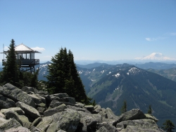
This hike up Granite Mountain comes with a steep price, so be prepared for a good climb to the top. Elevation gain is about 1,000 ft per mile, and should be done by those who are in good shape to handle the strain. Part of the reason people love going on this hike is the beautiful views available from the lookout point at the summit. Hikers will be able to see Mount Rainier in the distance as well as Mount Stewart and the Teanaway.
The trail begins off the highway at the Pratt Lake trailhead. Hikers will follow this trail for about 1.2 miles until they reach a trail junction. Pratt Lake continues on the left, while Granite Mountain takes off on the right. There are switchbacks along the trail, with one of the early switchbacks giving an excellent view of steep, debris filled avalanche chute. This hike is especially dangerous in the winter and early spring, and it is highly adviced that hikers wait until the snow melts before attempting this hike as the avalanche risk is very high.
Once past the trail junction, the Granite Mountain trail becomes narrower and rockier as hikers begin their way towards the summit. The trail is shaded, however because of the steep climb, most hikers will not feel cold but pretty warm. Switchbacks meander across the mountain, and about a mile after the junction, hikers will be at the top of the previously seen avalanche chute. There is a seasonal stream which can be used to refill water, just remember to filter. Continuing up along the trail, there will be some flatter spots through a few meadows and forests before reaching a talus slope. At this point the outlook will be in view, but there is still a difficult climb to the top.
Overall this trail is gruelling and steep, however the views are well worth the work it takes to get to the top. There is a ranger outlook which is sometimes open to the public at the top, and makes for a great rest spot. This trail tends to get crowded on the weekends, so it might be best to go during the week.
More Information
Granite Mountain
The astounding views from the summit of the Granite Mountain trail come at a price. A nearly-1000-feet-of-elevation-gain-per-mile price. But views of pointed Kaleetan Peak, deep blue Crystal Lake, the climber-dotted Tooth, and Mount Rainier dominating the skyline to the south make it all worth it.
https://www.wta.org/go-hiking/hikes/granite-mountainGranite Mountain Trail #1016 Hiking Trail, Riverbend, Washington
A beautiful hike with stunning views! Near Riverbend, Washington.
https://www.hikingproject.com/trail/7004544/granite-mountain-trail-1016Be courteous, informed, and prepared. Read trailhead guidelines, stay on the trail, and don't feed the wildlife.
Read More
- Plan Ahead and Prepare
- Travel & camp on durable surfaces
- Dispose of waste properly
- Leave what you find
- Minimize campfire impacts
- Respect wildlife
- Be considerate of other visitors
Directions
From North Bend, Washington
- Head southwest on N Bend Blvd N/Bendigo Blvd N toward W North Bend Way (0.7 mi)
- At the traffic circle, take the 2nd exit onto the I-90 E ramp to Spokane (0.3 mi)
- Merge onto I-90 E (16.7 mi)
- Take exit 47 toward Asahel Curtis/Denny Creek (0.5 mi)
- Turn left onto Asahel Curtis Rd/NF-55Continue to follow NF-55(0.1 mi)
- Turn left onto NF-9034Partial restricted usage road(0.5 mi)
- Keep leftRestricted usage roadDestination will be on the right(322 ft)


Other Hiking Trails and Backpacking Trails Nearby
island lake
North Bend, Washington
2.9 miles NA quieter alternative to the crowded Snoqualmie Pass hikes — shed the weekend throngs who turn back at Talapus or Olallie Lake and discover Island Lake in western Washington.
Camp, Hike, Swim 7.0 mi
Goldmyer Hot Springs Trail
North Bend, Washington
7.7 miles NEA strenuous 4.5-mile-each-way hike through lush forest to the remote Goldmyer Hot Springs — camping and soaking available by reservation and fee at the springs.
Hike, Hot Springs 1.5 mi
Twin Falls Trail
North Bend, Washington
10.2 miles WA peaceful 3-mile river hike near North Bend that arrives at a beautiful waterfall viewpoint bridge at the halfway point, open rain or shine with easy access for all ages.
Hike 5.4 mi
Middle Fork Snoqualmie Trail
North Bend, Washington
10.6 miles NCLOSED. Closed due to landslide activity.
Hike, Mountain Bike
Jade Lake
Skykomish, Washington
25.8 miles NEA 26-mile overnight backpacking route through the Snoqualmie region past wildflower meadows, Marmot Lake, and a steep talus scramble to a remote alpine lake for swimming.
Backpack, Camp, Swim
Lake Wilderness Park Swim Beach
Maple Valley, Washington
25.9 miles WFree city park beach on Lake Wilderness in Maple Valley with summer lifeguards, canoe and paddleboard rentals, a concession stand, a big playground and a 40-acre arboretum.
Canoe, Hike, Kayak, Swim
Lake Sammamish State Park Beaches
Issaquah, Washington
28.8 miles NWSunset Beach and Tibbetts Beach at the south end of Lake Sammamish, a 512-acre state park off I-90 in Issaquah with paddle rentals, playgrounds, trails and a boat launch.
Hike, Kayak, Mountain Bike, Swim
Skyscraper Mountain Trail
Ashford, Washington
34.0 miles SA gorgeous day hike to 7,078-foot Skyscraper Mountain in Mount Rainier NP, with unobstructed Cascade Range views, Moraine Peak vistas, and Mystic Lake sightings from the summit.
Hike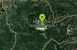
Mount Rainer
Ashford, Washington
38.6 miles SThe most glaciated peak in the contiguous U.S. at 14,410 feet — an active volcano with six major rivers, subalpine wildflower meadows, ancient forest, and abundant wildlife.
Camp, Hike, Mountain Bike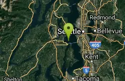
Blake Island
Port Orchard, Washington
47.8 miles WBlake Island State Park near Port Orchard is a 476-acre island paradise for kayaking, bird watching, year-round camping, and Tillicum Village cultural tours.
Camp, HikeNearby Campsites
island lake
North Bend, Washington
2.9 miles NA quieter alternative to the crowded Snoqualmie Pass hikes — shed the weekend throngs who turn back at Talapus or Olallie Lake and discover Island Lake in western Washington.
Camp, Hike, Swim
Jade Lake
Skykomish, Washington
25.8 miles NEA 26-mile overnight backpacking route through the Snoqualmie region past wildflower meadows, Marmot Lake, and a steep talus scramble to a remote alpine lake for swimming.
Backpack, Camp, Swim
Mount Rainer
Ashford, Washington
38.6 miles SThe most glaciated peak in the contiguous U.S. at 14,410 feet — an active volcano with six major rivers, subalpine wildflower meadows, ancient forest, and abundant wildlife.
Camp, Hike, Mountain Bike
Blake Island
Port Orchard, Washington
47.8 miles WBlake Island State Park near Port Orchard is a 476-acre island paradise for kayaking, bird watching, year-round camping, and Tillicum Village cultural tours.
Camp, Hike


