


Skyscraper Mountain Trail
Ashford, Washington

| Address: | Wonderland Trail, Ashford, WA 98304, USA |
| GPS: |
46°55'37.4"N 121°41'51.3"W Maps | Directions |
| State: | Washington |
| Trail Length: | 8.00 miles |
| Trail Type: | Out & Back |
| Hike Difficulty: | Advanced |
| Elevation Gain: | 1300 feet |
Streams Glaciers Trails Wildflowers National Park
Hike
Located in Mount Rainier National Park, Skyscraper Mountain measures at about 7,078 feet and towers over the valleys and streams below. The entire hike offers magnificent mountain views and only gets better as you go! The trail has a few ups and downs along the way but has a steady incline at about 3.4 miles. The ascent to the summit is the most difficult part of this hike and may require some scrambling. At 3.6 miles you get to the pass which is a popular place to rest and take in the unobstructed views of the Cascade Range. The summit itself is rocky, exposed, and fairly small. Looking southwest you will see incredible sights of Mount Rainier and to the west, you will enjoy amazing vistas of Moraine Peak and Mystic Lake!
You can turn around and scramble back down the mountain the way you came, or you can switch it up if you'd like and take a different trail back down to the base of Skyscraper Mountain.
This is a gorgeous day hike that anyone in the Mount Rainier area should experience.
NOTE: The network of trails around the Sunrise trail can be quite confusing, but you will also find peace and solace in this area no matter what trail you take.
More Information
Mount Rainier National Park Itinerary
This Mount Rainier National Park Itinerary will help you get started as you plan your vacation to Mount Rainier National Park.
https://www.justgotravelstudios.com/collections/national-park-itineraries/products/mount-rainier-national-park-itinerary?ref=9zpxis0diinSkyscraper Mountain : Climbing, Hiking & Mountaineering : SummitPost
Skyscraper Mountain : SummitPost.org : Climbing, hiking, mountaineering
https://www.summitpost.org/skyscraper-mountain/731737Skyscraper Pass
The trail to Skyscraper Pass makes an ideal dayhike to take you a little further from the popular visitor center at Sunrise, and the crowds that head to Dege Peak and the Burroughs. It’s a bit longer, so you’ll need to be ready for push. Particularly enthusiastic hikers can push onto Skyscraper Mountain via a bootpath.
https://www.wta.org/go-hiking/hikes/skyscraper-passBe courteous, informed, and prepared. Read trailhead guidelines, stay on the trail, and don't feed the wildlife.
Read More
- Plan Ahead and Prepare
- Travel & camp on durable surfaces
- Dispose of waste properly
- Leave what you find
- Minimize campfire impacts
- Respect wildlife
- Be considerate of other visitors
Directions
From Ashford, Washington
- Head east on WA-706 toward 305th Ave E (2.4 mi)
- Turn right onto Kernahan Rd E/NF-52Continue to follow NF-52Parts of this road may be closed at certain times or days(22.1 mi)
- Continue onto Skate Creek Rd S (0.8 mi)
- Turn left onto US-12 E (7.3 mi)
- Turn left onto WA-123 NParts of this road may be closed at certain times or days(16.3 mi)
- Merge onto WA-410 WMay be closed at certain times or days(3.6 mi)
- Turn left onto Sunrise Park Rd/White River RdContinue to follow Sunrise Park RdMay be closed at certain times or days(15.3 mi)
- Keep rightMay be closed at certain times or days(0.2 mi)


Other Hiking Trails Nearby
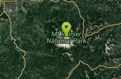
Mount Rainer
Ashford, Washington
4.6 miles SThe most glaciated peak in the contiguous U.S. at 14,410 feet — an active volcano with six major rivers, subalpine wildflower meadows, ancient forest, and abundant wildlife.
Camp, Hike, Mountain Bike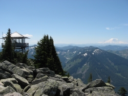
Granite Mountain
North Bend, Washington
34.0 miles NA steep, rewarding hike up Granite Mountain gaining about 1,000 feet per mile, with panoramic summit views of Mount Rainier, Mount Stewart, and the Teanaway — best tackled after the snow melts.
Backpack, Hike
Lake Wilderness Park Swim Beach
Maple Valley, Washington
34.9 miles NWFree city park beach on Lake Wilderness in Maple Valley with summer lifeguards, canoe and paddleboard rentals, a concession stand, a big playground and a 40-acre arboretum.
Canoe, Hike, Kayak, Swim 1.5 mi
Twin Falls Trail
North Bend, Washington
35.8 miles NA peaceful 3-mile river hike near North Bend that arrives at a beautiful waterfall viewpoint bridge at the halfway point, open rain or shine with easy access for all ages.
Hike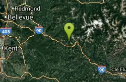
island lake
North Bend, Washington
36.3 miles NA quieter alternative to the crowded Snoqualmie Pass hikes — shed the weekend throngs who turn back at Talapus or Olallie Lake and discover Island Lake in western Washington.
Camp, Hike, Swim 7.0 mi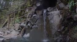
Goldmyer Hot Springs Trail
North Bend, Washington
41.3 miles NA strenuous 4.5-mile-each-way hike through lush forest to the remote Goldmyer Hot Springs — camping and soaking available by reservation and fee at the springs.
Hike, Hot Springs 5.4 mi
Middle Fork Snoqualmie Trail
North Bend, Washington
43.5 miles NCLOSED. Closed due to landslide activity.
Hike, Mountain Bike
Lake Sammamish State Park Beaches
Issaquah, Washington
46.8 miles NSunset Beach and Tibbetts Beach at the south end of Lake Sammamish, a 512-acre state park off I-90 in Issaquah with paddle rentals, playgrounds, trails and a boat launch.
Hike, Kayak, Mountain Bike, SwimNearby Campsites
Mount Rainer
Ashford, Washington
4.6 miles SThe most glaciated peak in the contiguous U.S. at 14,410 feet — an active volcano with six major rivers, subalpine wildflower meadows, ancient forest, and abundant wildlife.
Camp, Hike, Mountain Bike
island lake
North Bend, Washington
36.3 miles NA quieter alternative to the crowded Snoqualmie Pass hikes — shed the weekend throngs who turn back at Talapus or Olallie Lake and discover Island Lake in western Washington.
Camp, Hike, Swim


