


238 Things to do near Blacks Canyon Trail
first prev 1 2 3 4 5 6 7 8 9 10 next lastShowing results within 50 miles Distance miles of Forest Road 206, Ririe, ID 83443, USA City, Zip, or Address
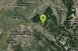
South Fork Rim Trail
Ririe, Idaho
0.0 miles SEMotorcycle trail. source: fs.usda.gov Courtesy of Singletracks.com
Mountain Bike 0.6-5.5 mi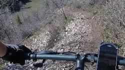
Old Ranger
Ririe, Idaho
1.3 miles NWOn the South end of the Big Hole mountains just above the Snake River is a grueling yet diverse section of single-track on Forest Service Trail 287 called Old Ranger. Because of the...
Mountain Bike
Burns Canyon
Ririe, Idaho
1.3 miles NWHike and Mountain Bike near Ririe, Idaho
Hike, Mountain Bike
The Arcane
Ririe, Idaho
3.1 miles NWRock Climb near Ririe, Idaho
Rock Climb
Wolverine Creek Trail
Ririe, Idaho
4.6 miles NWThe Wolverine Creek Trail is a doubletrack trail in Ririe, Idaho. It begins at South Fork Road and ends at Wolverine trailhead. It is commonly used by dirt bikes and four wheelers. This trail is...
Mountain Bike
South Fork Snake River Trail
Ririe, Idaho
5.0 miles SEGo left at the trail head. It heads down about a mile and a half on double track. Then you'll come to a creek crossing. After the crossing the trail heads across a gate. Head left...
Mountain Bike
Thousand Springs Trail
Driggs, Idaho
5.9 miles NThe Thousand Springs trail begins at Moody Swamp trailhead and ends at Jct Prospect Peak Trail. source: fs.usda.gov Courtesy of Singletracks.com
Mountain Bike 4.3 mi

Leaning Fir #169
Ririe, Idaho
6.4 miles WMountain Bike near Ririe, Idaho
Mountain Bike
Moody Meadows
Driggs, Idaho
6.4 miles NGood place for kids, they can ride bikes in the meadow, play in the stream, and camping is off of the road. Hiking, motorbiking, and horseback riding trails are abundant in the area.
Camp
Table Rock Campground
Ririe, Idaho
7.3 miles NWTable Rock / Poison Flat Campground is located at the Caribou-Targhee National Forest which occupies over 3 million acres and stretches across southeastern Idaho, from the Montana, Utah, and Wyoming...
Camp
Lower Hawley Gulch Trail
Ririe, Idaho
7.3 miles NWThis is a singletrack biking trail in Ririe, Idaho. The trail is mainly flat with a few gradual slopes. You may have to carry your bike over obstacles such as fallen trees, logs, and small ponds....
Mountain Bike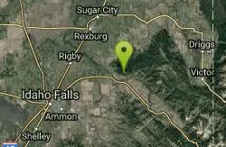
Kelly Canyon/Table Rock
Ririe, Idaho
7.3 miles NWThe initial climb is soft, so you might wash out a little. There are enough roots and rocks to add some challenge to the climb and some air to the descent. The trail forks at one point,...
Mountain Bike 0.6-2.2 mi
Fish Creek Area
Ririe, Idaho
7.4 miles NWCLOSED. This land is owned and managed by the US Forest Service and is not designated for use. As of July 2024, being caught mountain biking on this trail could recieve up to a $5000 fine and a...
Hike, Mountain Bike
Poison Flats
Ririe, Idaho
7.7 miles NWHike near Ririe, Idaho
Hike
Wolf Flats Recreation Area
Ririe, Idaho
7.8 miles WWolf Flats is a completely free, dispersed, undeveloped camping area with 25 locations to camp. Some areas are large enough to accommodate groups of 50 people.
Camp 1.1 mi
Hidden Vista / Pine Loop
Ririe, Idaho
8.0 miles NWCLOSED. This land is owned and managed by the US Forest Service and is not designated for use. As of July 2024, being caught mountain biking on this trail could recieve up to a $5000 fine and a...
Hike, Mountain Bike 5.7-8.1 mi
Space Cruz
Ririe, Idaho
8.0 miles NWCLOSED. This land is owned and managed by the US Forest Service and the upper portions of this route are not designated for use. As of July 2024, being caught mountain biking on PINE LOOP or THE...
Cross-country Ski, Mountain Bike 1.7 mi
Buckskin Morgan Ridge
Ririe, Idaho
8.0 miles NWCLOSED. This land is owned and managed by the US Forest Service and is not designated for use. As of July 2024, being caught mountain biking on this trail could recieve up to a $5000 fine and a...
Hike, Mountain Bike
West Pine Creek Trail
Ririe, Idaho
8.1 miles ENon-motorized use. source: fs.usda.gov
Mountain Bike
Trail Canyon Trail
Ririe, Idaho
8.1 miles EThe Trail Canyon trail begins at Trail Canyon Parklot, T8s R43e Sec28 and ends at Intersect Trail 5251,t8s R43e Sec28. source: fs.usda.gov
Mountain Bike


